For my October 2021 trip, I decided to visit another provincial park offering backcountry camping, close-ish to Toronto, Frontenac. Located just north of Kingston, it’s about three hours away from Toronto and perfect for a one-nighter. Apparently it’s a really great spot for winter camping and snowshoeing as well! I took this trip over the weekend on October 16-17.

Day 1
I packed everything the night before, and got up at 6am Saturday morning. Recently, it has been unbearably hot in my apartment (AC was recently switched off, and despite it being 15-18°C outside at the time, it’s 10 degrees hotter inside) so I was very glad to get away to a potentially colder environment! After getting the cat fed and watered, I took off at 6:30am. First order of business was getting gas, but for some odd reason the gas station near me was not dispensing gas whatsoever which was quite odd. No big deal – I stopped at the On Route in Port Hope. Smooth sailing the rest of the way, got quite a lot of rain but made it to the park office in Frontenac at around 9:30am. Got some good information about the trails (including a nice map) as well as my permits, and I was off on the trail just before 10am.
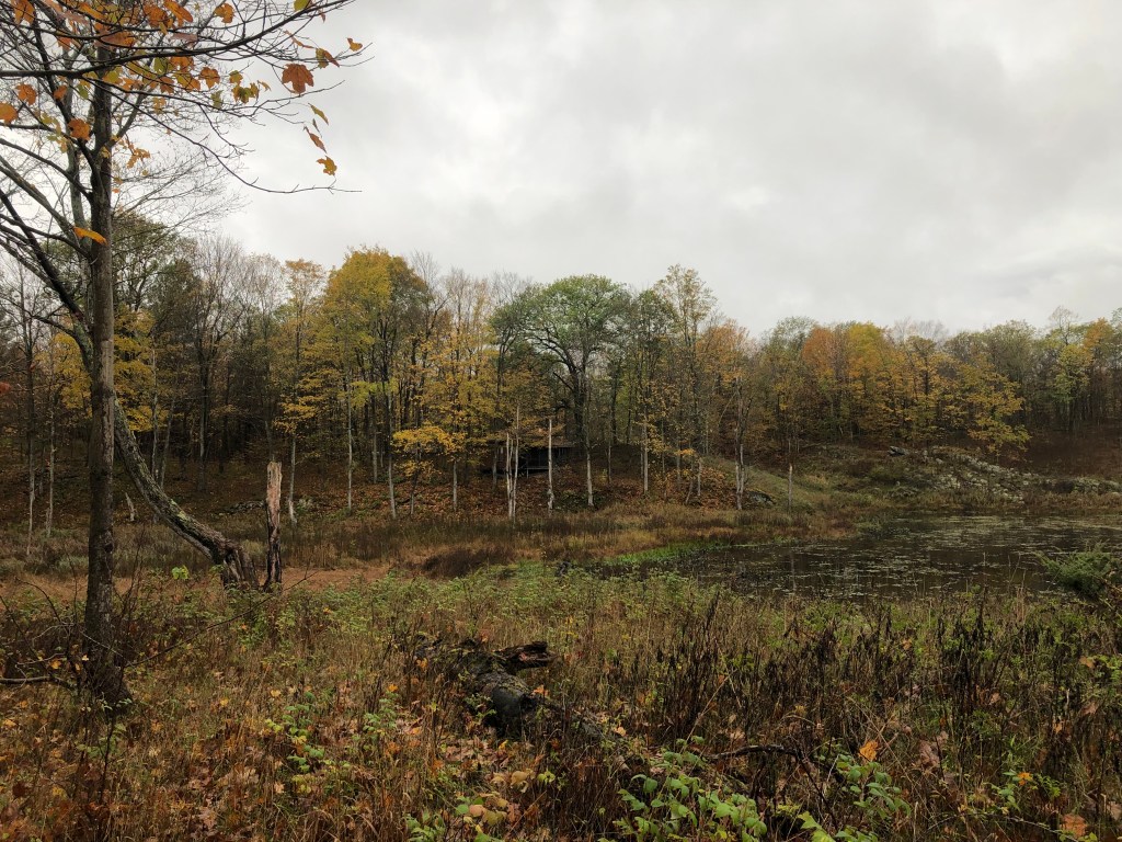
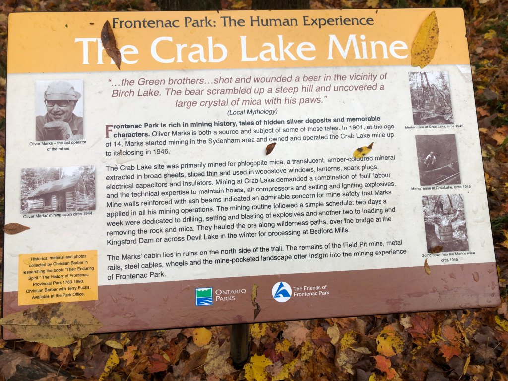
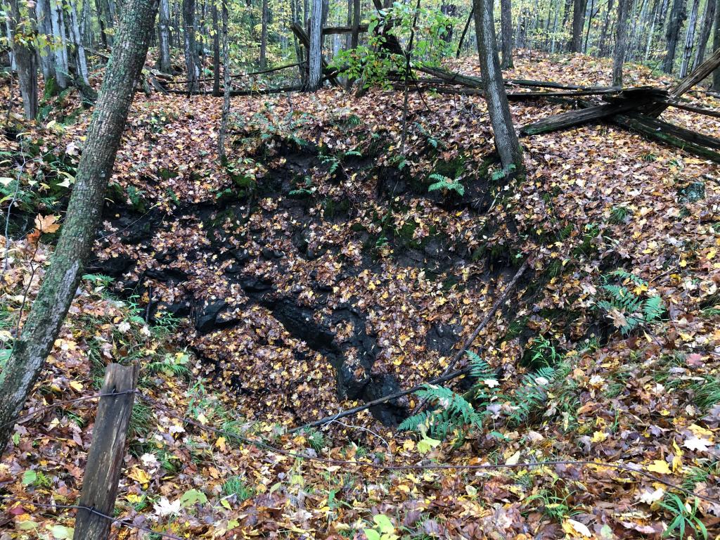
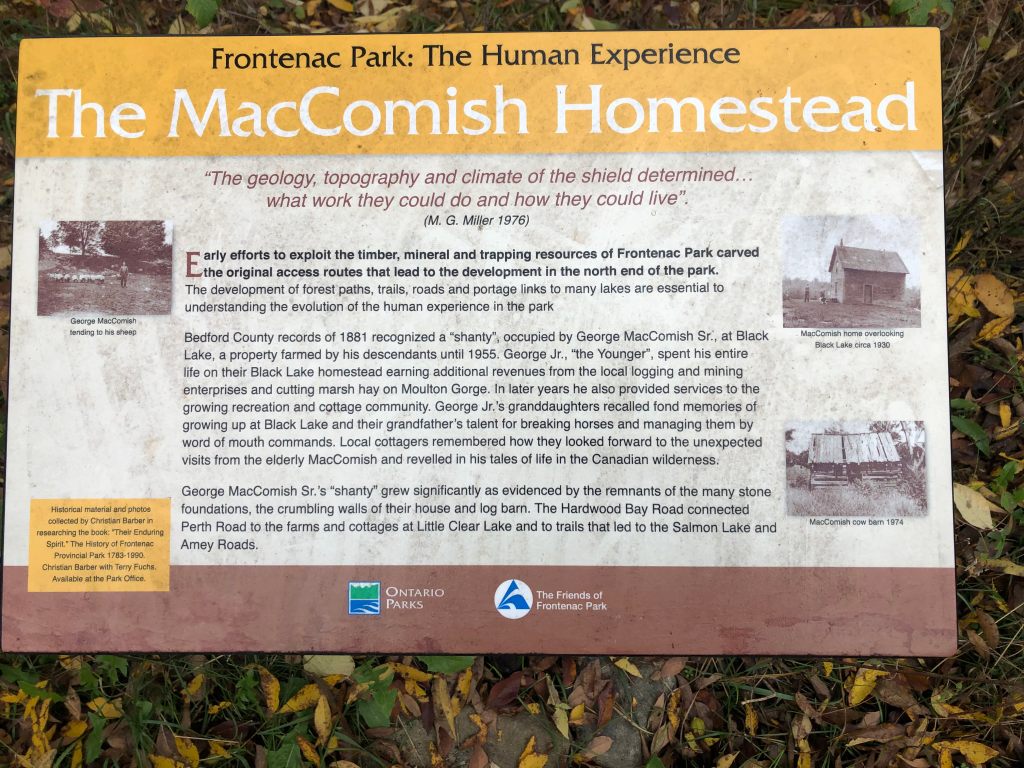
I planned on Day 1 to hike roughly 23km to my site, going counter-clockwise effectively around the outer perimeter of the park. I missed my turn and decided to do my planned Day 2 hike (~21km) in reverse on Saturday, followed by my planned Day 1 hike also in reverse on Sunday. Thus, on Day 1, I made my way north and east along the Arkon, Tetsmine, and Gibson Lake loops. My plan regarding breaks was to take a 10 min or so break every 5km. The trail was fairly easy to hike, so I was able to make good pace. The autumn colors were incredible, I love the wide range of yellow, red and orange, and the fallen leaves looked gorgeous in places. I did have to be a bit extra careful watching my step though, since the leaves obscured hazards like roots and rocks a bit more. There was also quite a few neat historical plaques that had been set up, pointing out some of the history of the area. This included The Page Homestead and The Crab Lake Mine.

I noticed there were a lot of trail markers along the way, which turned out to be related to the “Frontenac Challenge.” This involves completing all the trails in the park within the months of September and October (not necessarily all at the same time). Upon further research I found that the fastest time to run all the trails (nearly 200k) is just over 20 hours! Yikes! This definitely would be a great place to trail run (I saw one guy running the trail about 5km into my hike). It was raining to start with, but gradually it let up and I removed my rain gear, and was able to comfortably hike in a pair of tights and base layer top. The sun finally made an appearance at around 2pm.
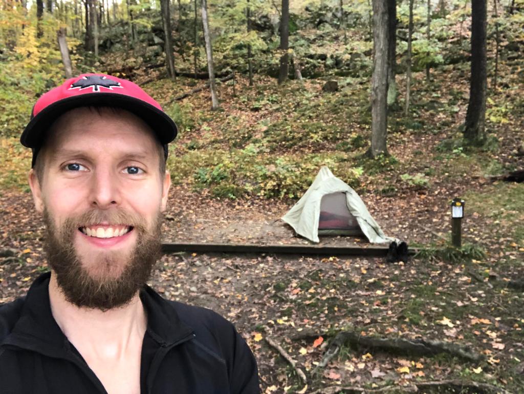
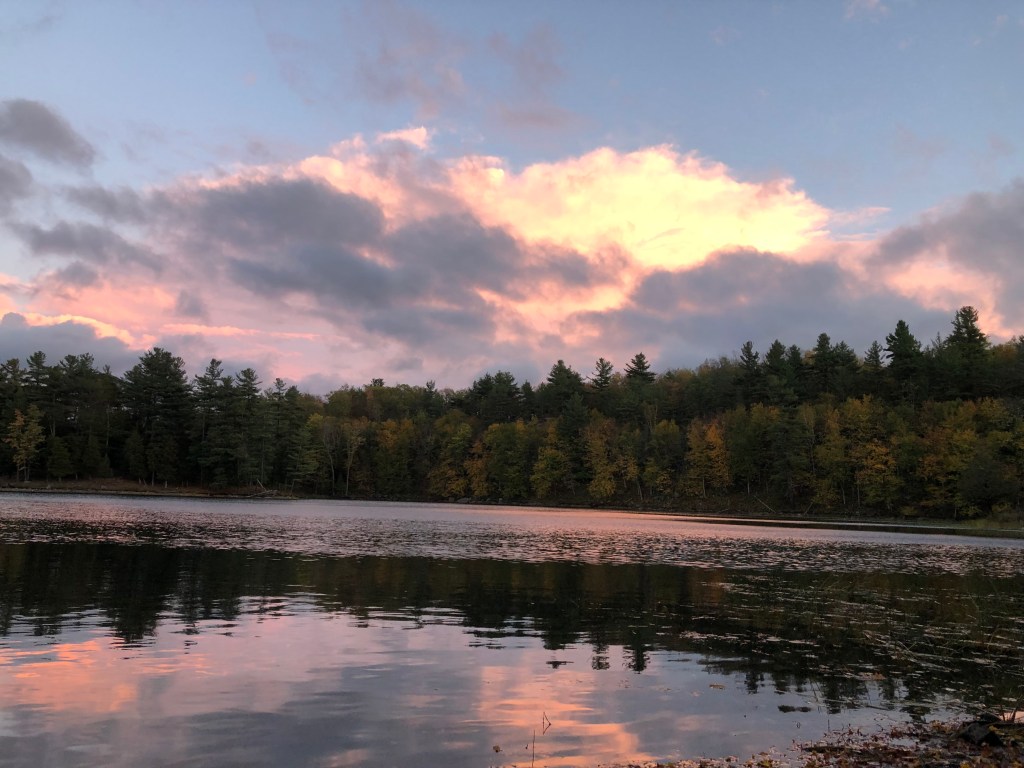
I made it to my campsite (10A) at around 4:30pm, pretty sweet little spot on Hardwood Bay, part of Devil Lake in the northeast corner of the park. I noticed just after arriving some pretty ominous clouds approaching, so without further ado I rapidly set up camp. Turns out it was a false alarm – the sun returned quickly. I only had about an hour before sunset (which was forecasted for just after 6pm) so I quickly made dinner and washed my dishes. Temperature for the evening was a chilly 7-8°C but had a lot of layers that were dry and warm, got into my tent at 7pm. Sleep was fairly inconsistent as per usual for me, I woke up at 10pm and it was super bright outside – I think it was a pretty cloudless night and it was almost a full moon. Still able to get a decent amount of sleep in though.
Day 2
I woke up at around 6am and as expected it was still dark – sunrise was around 7am – so I took my time getting up, finally emerging at around 6:45am and saw a pretty nice sunrise over the lake. I made breakfast which was my usual (oatmeal with nuts and seeds, I also threw in a banana) and started to pack up. No rain that night but the ground was a bit damp, so I let my tent + footprint dry a bit before packing them away. I left a bit later than planned at around 8:45am.

My feet were pretty beaten up from the previous day, so I had a backup shorter route planned just in case. My initial plan was to continue along the outer edge of the park, hitting the Small Slide Lake trail (the most rugged trail section in the park) before branching up and reconvening with the main Corridor Trail where I started on Saturday. The detour, which was roughly 4km shorter, would skip the Slide Lake section altogether and take the Big Salmon and Cedar Lake trails instead. I also planned to get more fluids in me throughout the day, something I did not do much of in Day 1 and also on my Algonquin trip – I wanted to avoid leg cramping as much as possible. About 2km in it was decision time whether to take the short or long path and I opted to suffer.

The hike started off really easy with not too much in the way of obstacles but after around 8km, as I approached Slide Lake, it started to get a lot more demanding, but still not as difficult as some of the other hikes I’ve done in the past. Lots of ups and downs, climbing up rock formations, and some really great views. The weather was very cooperative today, albeit a bit chilly. I opted to take more frequent breaks on Day 2, with 10 mins of “boots off” (to let my feet relax a bit) every 4km or so. It was during my breaks I realized that my Garmin Forerunner watch was tracking mileage while I was stationary, I estimated roughly 50m extra per 10 mins staying put. That explained why my daily travel distances were a fair amount higher than what FATMAP said.


The last 8km or so were pretty painful, my feet were not pleased and I also started rolling my ankles quite a bit (luckily I was able to avoid serious injury since I was using my trekking poles and was able to transfer a lot of my body weight). After about 6.5 hours of hiking almost 24 km, I finally made it back to my car, and it immediately started pouring rain. I quickly got changed and hit the road at around 3:30pm. The drive home was largely uneventful – after negotiating some typical GTA traffic, I got home at around 7:30pm.
Final Thoughts
Overall, I was pleasantly surprised by how good Frontenac was – it has a lot of great trails of varying difficulties, is very quiet and offers a lot of great options for camping. I also would be remiss not to mention that there are great canoe/portage options as well! In addition, they do a lot of work to make the trails accessible in the winter for snowshoeing, cross country skiing and general winter camping, so I will definitely have to give that a try at some point! I also want to check out some of the trails I missed (in the interior of the park) as well as a few of the other historical features – I love that kind of stuff. I’d highly recommend this park, super underrated in my opinion!

