I did not intend to split my intro to mountaineering course into two posts, but it was quickly evident as I started writing it that there was way too much that happened in six days to put in one post. Alas, here’s Part 2!
Day 4
Of course, being in the mountains it is extremely important to monitor the weather and plan accordingly in case conditions aren’t ideal. Richard had a number of nifty tools at his disposal which provided a detailed overview of conditions in our immediate area (including wind, pressure, precipitation, and of course temperature) which he was using to plan out our days on the glacier. Unfortunately the forecast looked suboptimal for Day 4, with the chance for Day 5 having a decent weather window, so the plan was to stay close to the hut and work on skills for Day 4, and re-evaluate the Day 5 conditions in the evening.
After breakfast we spent quite a bit of time discussing map & compass work and how it compares with using GPS. Clearly, GPS is great but it can cause a drain on phone battery. While this can be remedied by carrying a power bank, it is a great skill to be able to navigate using old school methods. It’s also very different in mountains/glaciers where there is often no marked trail, and you want to follow terrain which has the least amount of risk and is generally easier to traverse (for example you wouldn’t want to go down 100m just to ascend it and then some later, if you can take a slightly different path that minimizes the total descent/ascent). So keeping an eye on map contours, as well as their spacing, is important in order to plan routes!
We learned about how magnetic north (which a compass points to) differs from true north, and I never knew that the deviation (magnetic declination) differs not only based on where you are in the world, but also changes yearly! These details are often included on maps so one can orient themselves appropriately. For example, up on the Wapta Glacier, the mean declination was 14° 50′ E in 2017, with an annual change of minus 9.4′. This means in 2022, the declination is 14° 3′ E. In some places, true north and magnetic north can perfectly line up, such as Minneapolis in 2020. Here’s more details, it’s a pretty interesting topic!
We also learned a few navigating techniques such as handrails and dead reckoning. Handrails are features which are easy to follow (such as shoreline on a lake) compared to a compass bearing, and are known to lead you to a specific location. Dead reckoning is a method used when you’re on featureless terrain (nothing to aim for visually), but you want to hit a specific feature such as a trail or stream and confidently know which side of that feature you’re on. Generally when you follow a compass bearing there is some degree of error, but with dead reckoning you purposely aim very off of your intended target, in order to ensure you hit the feature (such as a trail or stream) on one specific side (for example, a fork in the trail or stream), in order to eliminate the other side.
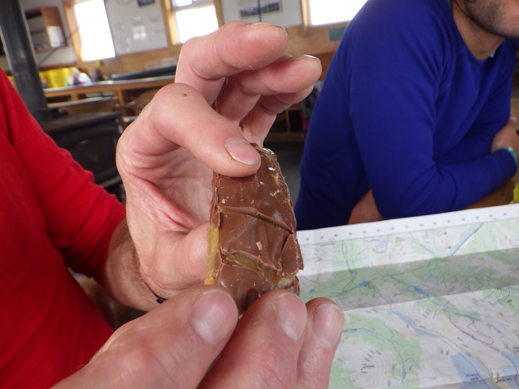
Richard also described how glaciers move and the effects on crevasse formation. A glacier is pretty much a very slow-moving river, and crevasses form when the glacier flows over bumps in topography. He demonstrated how this works using a simple Mars bar!
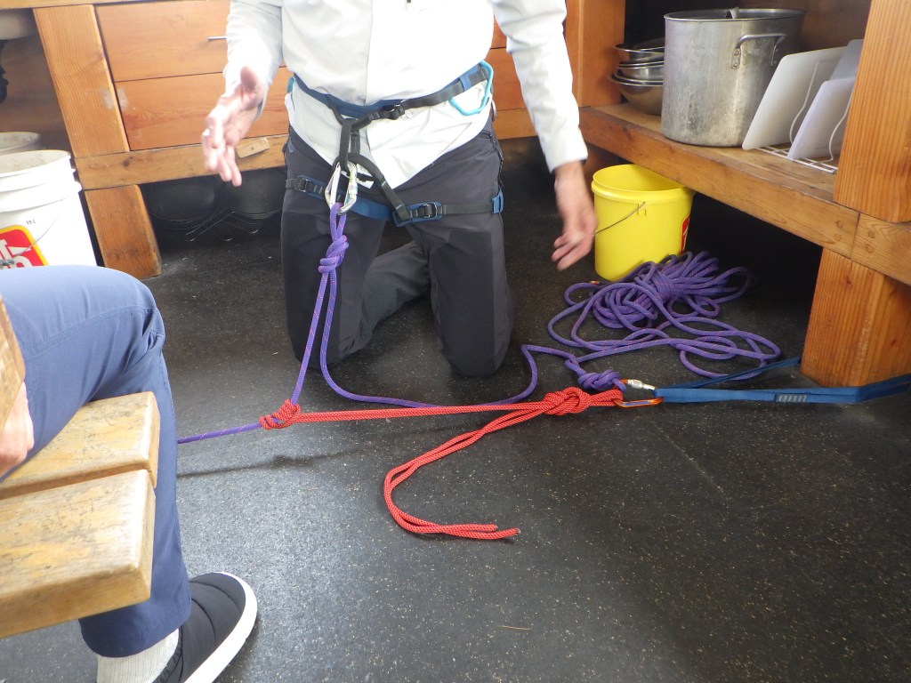
We spent a lot of time working on crevasse rescue techniques both in the hut as well as outside the hut (obviously, not a great idea to purposely fall into a crevasse!). The main points are that you want to keep a minimal amount of slack in the rope to ensure the fallen climber doesn’t fall far, and communicate with the fallen climber in order to gauge how far they’ve fallen, any injuries they may have sustained, and whether they are able to climb out on their own. Typically the first climber on the rope is the one who falls in, so the second climber creates an anchor to take on the load of the fallen climber, allowing the remaining climber (assuming a 3 person team) to make their way forward with rescue rope to assist the fallen climber. It’s obviously a lot more complex than this, but I don’t really want to inundate readers with too many details. Definitely a very technical method! We also learned how to tie various knots like prussik knots, and also how to bundle up the prussik ropes which are typically carried on the harness via caribiners.
We also went out later in the day to practice creating anchors. It was a pretty steep slope but it was nice to be outside after being indoors most of the day.
We also had a few folks join us in the Hut. Firstly we had three extremely poorly equipped day hikers from Saskatchewan trudge into the Hut soaking wet (it was snow/raining all day, and the snow was knee to waist high in places). They were wearing street shoes (!!!), had no poles, gaiters, or waterproof clothing. They said they were hiking to the Onion, but it was evident that they had not done their homework and checked the trail conditions. Richard sternly suggested that when they were ready to go, they turn around and go back to Bow Lake, and luckily, they saw reason and listened to his advice. I can’t understand why people don’t plan appropriately to be in the mountains. I’ve read too many tales of people dying in the mountains out west for very avoidable reasons. Please be smart, people!
We had another trekking group join us in the Hut for the rest of the week (they were also leaving on Friday), a very nice family of 4 from California (the mom is actually from Scarborough!) lead by another Yamnuska guide, Grant. For some reason they had way more food than us so a few of us ate some of their dinner (spaghetti) that night as an appetizer (haha) and they also kindly gave us some extra instant coffee for the last couple days as we blew through our stash. Was a bit different having another group in the Hut but there was still plenty of space and great having more people to interact with. Grant, like Richard, was very interesting to talk to, he had a lot of great stories and a wicked sense of humor. One particular story he told was when he was younger and climbing in Yosemite (I think?) and he and his buddy had setback after setback while climbing a wall, escaping serious injury over and over again. It was quite the riveting tale that seemed to never end!
Richard checked the weather forecast that evening and it appeared we had a solid weather window to be able to climb Mount Olive (just south of Mount St. Nicholas) the next day. It would require us to be up at 4am since the weather would turn towards late morning/noon. So, we went to bed quite early that night!
Quote(s) of the Day
“Useful as tits on a bull”
Richard – can’t recall what he was referring to but memorable nonetheless
“Your heads are going to explode, it’ll get a bit messy…”
Richard, on his reasoning to not bombard us with too much map & compass theory
Day 5
In typical summit fashion, we woke up bright (not really, still dark, even on nearly the longest day of the year!) and early at 4am, with the intent of departing the hut between 5 and 5:30 in order to take advantage of the excellent glacier conditions in the morning, and avoid the precipitation as much as possible so we could ascend Mount Olive. Funny enough, I woke up on my own just minutes before my alarm went off, so I didn’t have to worry about feeling guilty of having my blaring alarm wake up Grant and his group. After a great breakfast and packing our gear, we were off at 5:30am sharp, just as it was starting to get bright outside.
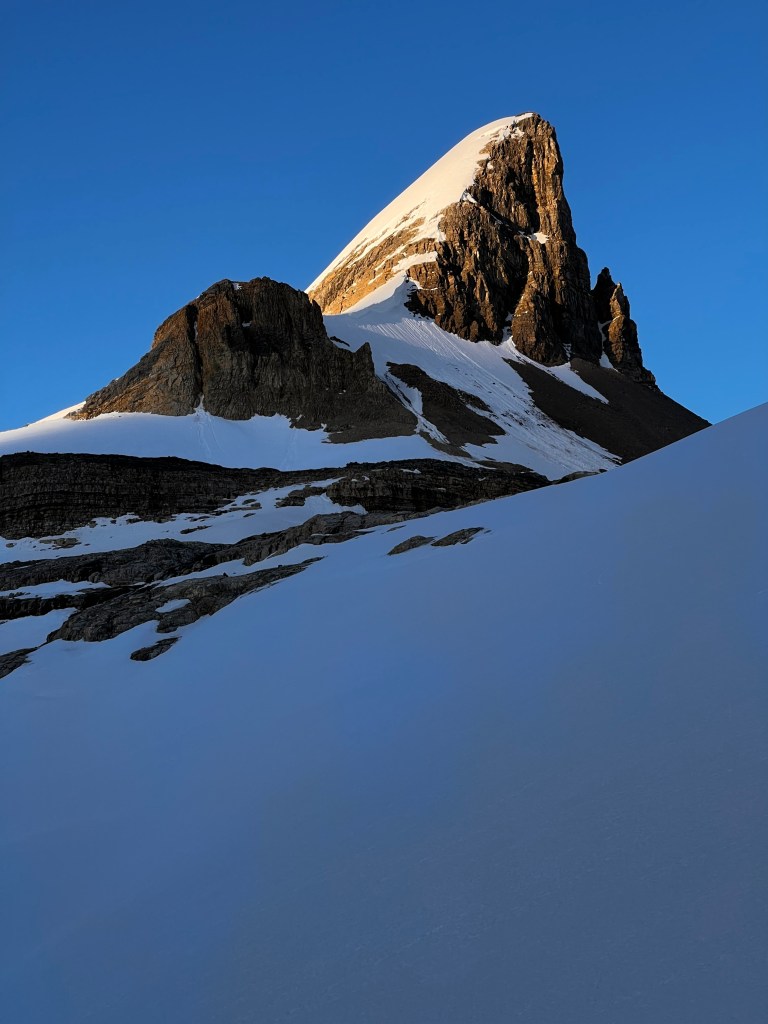
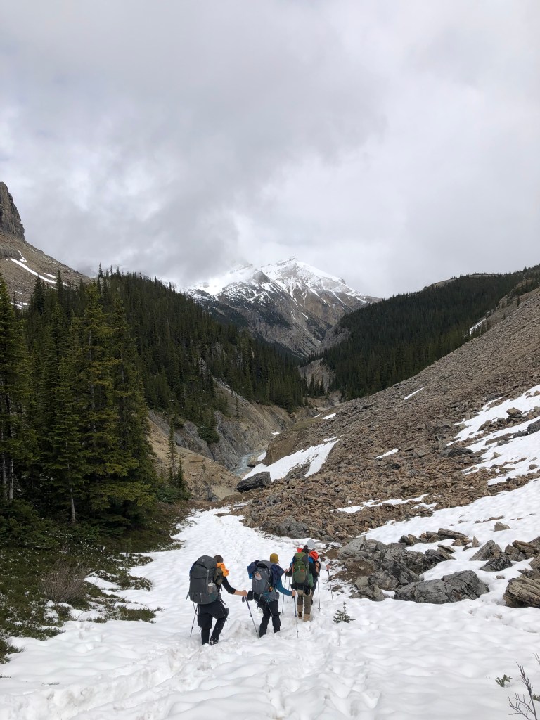
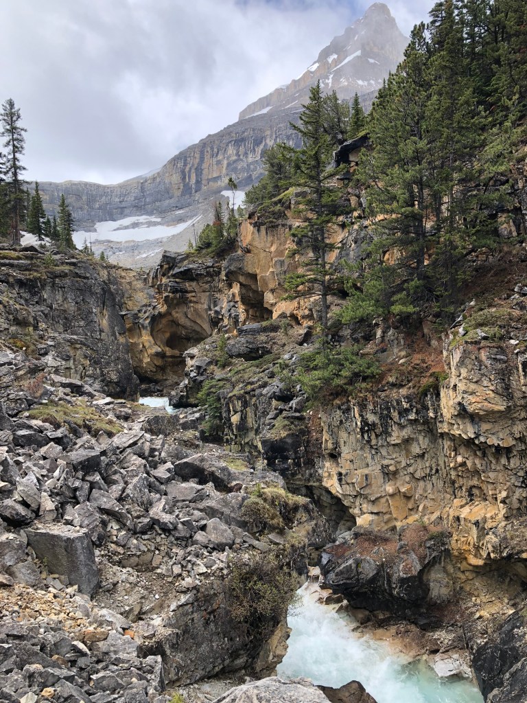
Today was the first (and only) day we used crampons, as there was a pretty good freeze overnight and the glacier was rock-solid. It was a fairly chilly morning but perfectly clear and the views were incredible. I cannot put into words how invigorating it was to be climbing/hiking with such a beautiful backdrop! We worked our way up the glacier and around St. Nicholas – it looked very different from the opposite side.
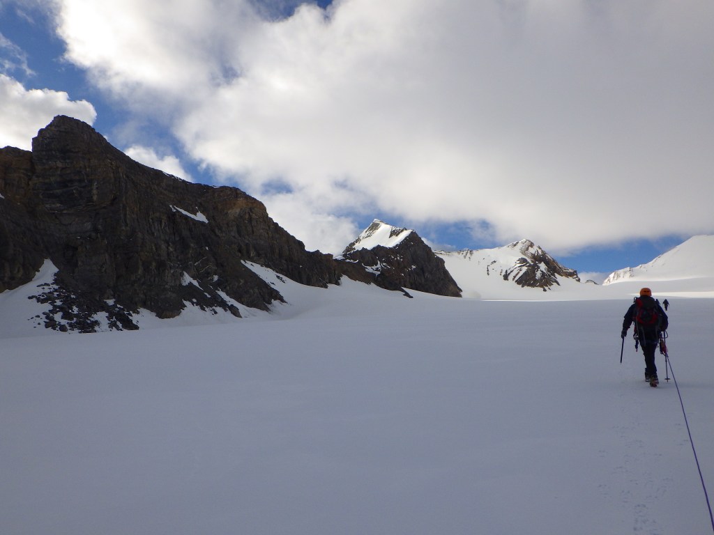
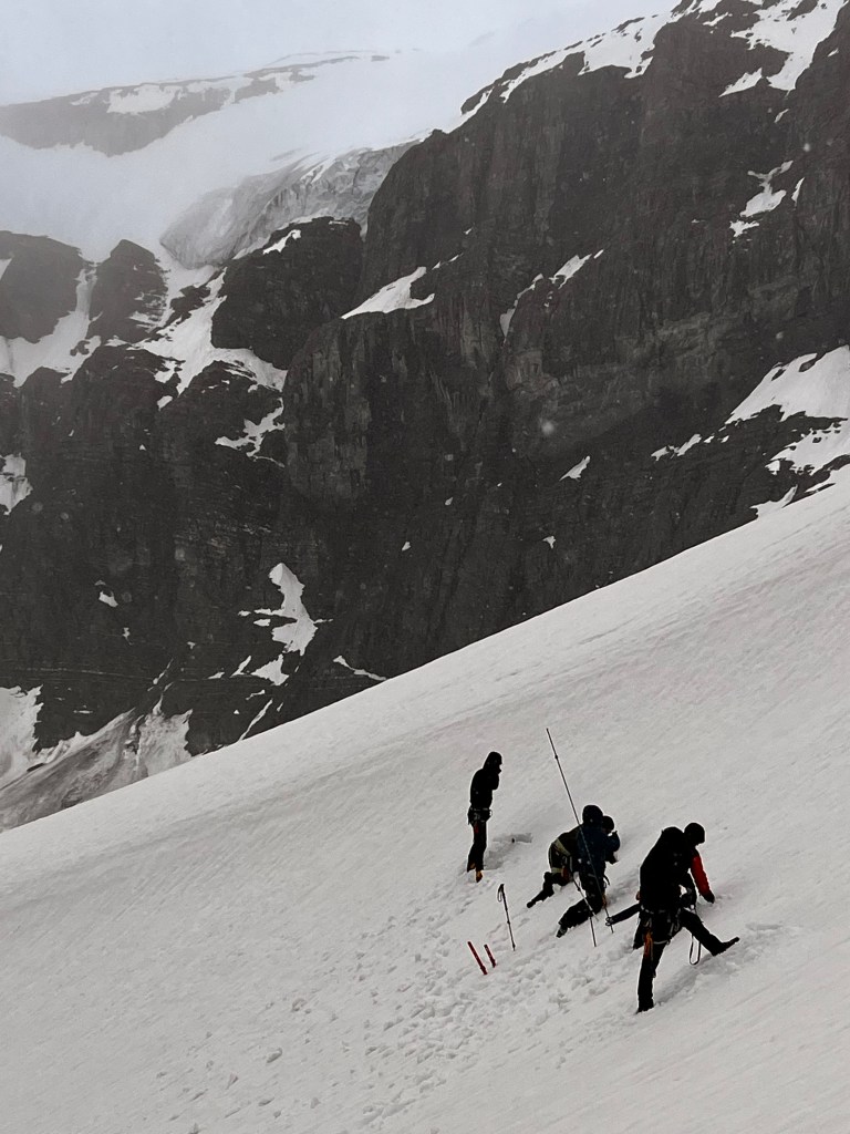
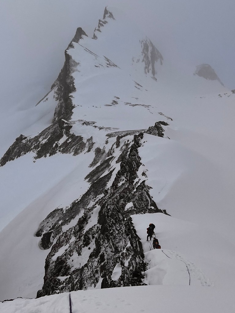
We eventually reached the snow slope leading up to the saddle/col and worked our way up. At the col, we rested for about 20 mins and enjoyed the views before carrying on up the ridge towards the north peak of Olive. It was here where we felt like we were truly experiencing mountaineering – the slope was very steep but the snow pack was really deep, so all we had to do was follow the trail that Richard (in the lead) was breaking. It was absolutely magnificent. We stopped to shorten the rope a little bit (a safety precaution as we were doing some significant inclines) and eventually reached the last part of the climb where there was very little snow collected, mostly shale. Thus we unroped and continued onwards, being careful to watch our steps on the loose rock. The snow started coming in around this point, and I got the feeling we would need to turn around in the near future.


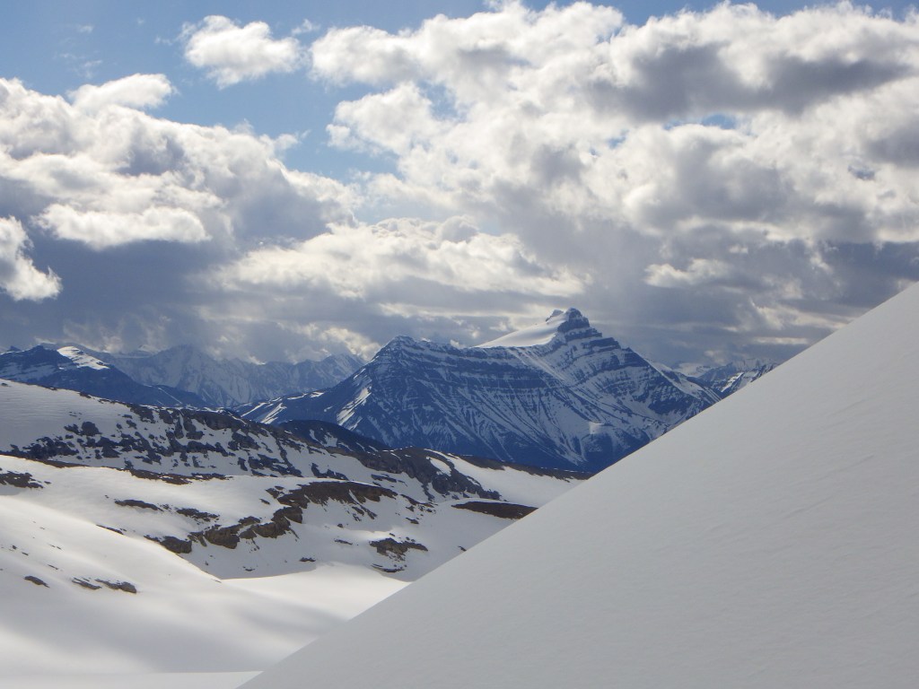
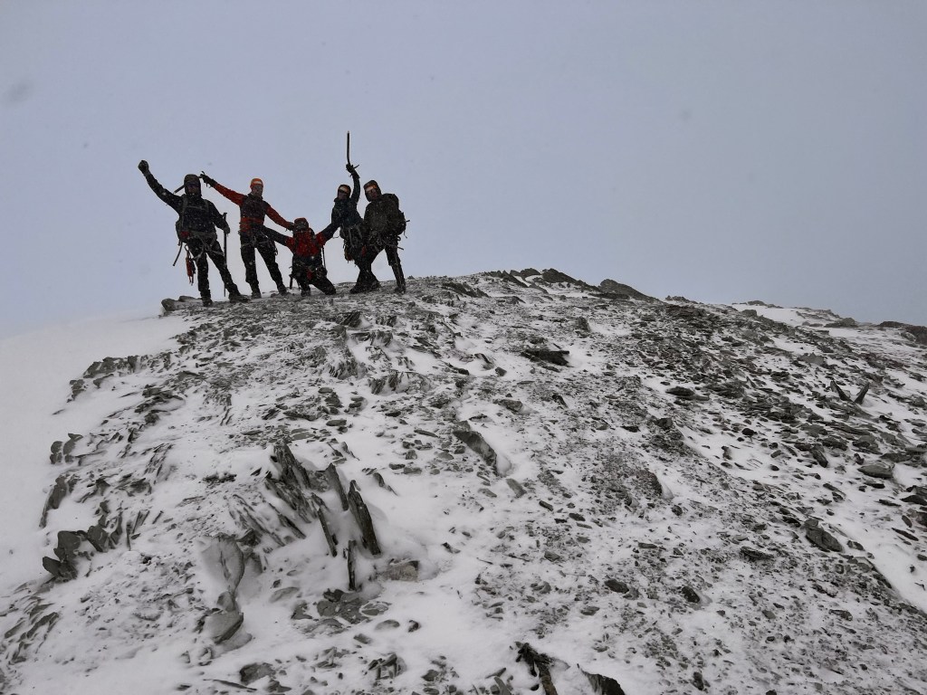
Finally, at around 10:30am, we arrived at the north summit of Mount Olive, situated at 3103m. The south summit, which is slightly higher at 3126m, was only about 500m away as the crow flies, but Richard decided that due to the failing weather, we would save that for another day. We stayed for about 10 mins at the summit, taking photos (views were non-existent at this point). Not quite an elevation PB for me (South Sister in Oregon was higher at 3157m) but it was the highest I had been in Canada to date, so that was something. Also, congrats to Luca for visiting BC on this climb (the rest of us had already been there) as we crossed over the border traversing around Mount St. Nicholas. The south summit of Olive actually sits entirely within BC.
The descent was quite interesting as we attached both 50m ropes together and Richard hung back while the rest of us descended the steep section. He got some pretty sweet photos of our group moving down the ridge during this section. After about 90 mins, we arrived at the saddle and had a quick lunch, as the snow was coming down fairly hard, before descending the initial slope back to the Wapta Glacier.
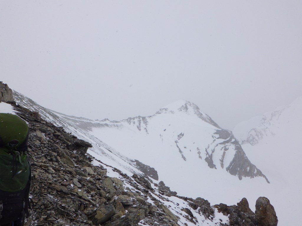
The trek back to the Hut was very interesting. The blowing snow was very fierce and pounded us on one side of our faces, which wasn’t the most comfortable thing in the world. It was also very difficult for Richard to navigate via compass bearing as he had little in terms of visual cues to work with. I was keeping track periodically with FATMAP and we all noticed that Richard was tending to veer away from the Onion. He later explained that this was a perfect example of disorientation – he thought he was following the bearing but got offline really quickly. We eventually reached a spot where the Onion was visible, and we were able to follow familiar terrain back to the Hut.
At this point snow began to ball up in our crampons, making walking difficult (the conditions were completely different than the morning!) so we would whack our boots with our ice axes every few steps to dislodge the snow. On our way back to the Hut we stopped briefly at an area we walked past several times in the prior days where Richard pointed out that it was the location of the original Bow Hut. You could tell where the “facilities” were based on the level of plant life.
We finally made it back to the Hut after 8 hours and 42 minutes of hiking/climbing, with the total travel 11.29km. Luckily my Garmin recorded this track, so you can see our path (including where Richard was off track) below. The rest of the day was, of course, very low key as we were all very exhausted from a hard day’s work! Richard and Janet took an afternoon nap, and I probably should have as well as I was completely spent.
I’m glad I didn’t take a nap as I would have missed perhaps the most memorable moment of the day (other than the trek of course!), when Grant told us a very funny story about an Italian woman he was guiding on Mount Athabasca. During the trek, she put down her gloves on the glacier and lost them (you NEVER place anything on the ground unless it is secured with an ice axe). She was handed a second pair of gloves belonging to Grant, and told not to put them on the ground. Of course, seconds later, she did put them down, and Grant’s gloves were quickly gone. She was then given a pair of socks, yes socks, to use as gloves for the rest of the trek. Weeks later, she sent Grant a pair of replacement gloves from Italy, but they were old, used, and ratty. What a story! Grant provided the quote of the day (see below) when describing this woman, and I don’t believe I have ever laughed harder when he said that. I suspected it was because I was very tired, turns out that could have been the reason!
We enjoyed a well-deserved dinner and turned in fairly early that night. No climbs planned for our last day other than the hike back to Bow Lake, however we wanted to spend some time in the morning reinforcing skills. What a fantastic day!
Garmin GPS Data – note my watch indicated we reached 3171m which is off by over 150m. My watch is notoriously bad at tracking elevation gain.
Quote(s) of the Day
“Dumber than a mud fence”
Grant, referring to the Italian woman in his Mount Athabasca story
“Do you want me to hold it for you?”
Richard, to Andrew when we were stopped on a break on our way to Olive. No further details needed.
Day 6
Sadly, Day 6 was our last day up in the mountains. No hikes/climbs planned other than the hike down to Bow Hut, so we had a bit of time in the morning to take it a bit easier and reinforce skills. My lips and nose had really taken a beating from our Olive summit – both super sunburned. My lips were very cracked and I also got a sun blister (think cold sore but way bigger) on my upper lip. Very uncomfortable, I really learned my lesson to use lip balm and appropriate spf sunscreen.
Over the course of the trip, we learned that Richard LOVES mayonnaise. He indicated earlier in the trip that he puts it in his oatmeal, and naturally, with our final breakfast being oatmeal, we asked him to add mayo to his bowl, which he obliged by adding two packets and eating it with a grin on his face. I gave it a try, didn’t really feel it but to each their own!

I also used mayonnaise for an unconventional purpose, much to the delight of my trip-mates. My lips were very dry, so I tried applying mayo to them in lieu of lip balm. It sort of worked in the immediate term, but definitely needed to be reapplied. I surprisingly did not lick my lips after applying!
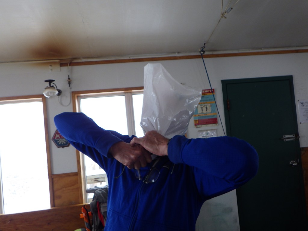
We did some final practice of crevasse rescue in the hut, and Richard demonstrated how to use pulleys to created sit-stand setup to hoist oneself out of a crevasse. We packed out our garbage from the trip to dispose of in the bins at Bow Lake. I took a large amount of the garbage as I had a lot of space in my pack. I double-bagged because I was worried about leaks, and Richard chose an unconventional method to determine there were no holes in the bag to ease my mind.
We had gotten over 5cm of snow the previous afternoon/night which was pretty wild considering it was June and back in Toronto it was 40 Celsius. This meant that we likely had a bit of a slower hike down due to the snow, however luckily Grant’s group left a couple hours before us, and they broke the trail, so it wasn’t too bad. The hike down was pretty good, much faster than on the way up and the views once again did not disappoint.
Randy met us about a kilometer before we reached the boulder over the river, and after making it down to the initial flat trail around Bow Lake, he surprised us with a box of 20 Timbits to pass around, before further surprising us by saying there was another box of FIFTY Timbits in the van. What a champ, thank you Randy!
We eventually made it back to the trailhead at Bow Lake in just over 3 hours and upon arrival, Andrew jumped in the lake for a polar dip. It looked very cold but refreshing! We packed everything up and enjoyed Timbits on the drive back to Canmore. After a quick debrief, we parted ways, but not before exchanging contact information. Looking forward to going on more adventures with these fine folks in the near future! 🙂
I enjoyed a delicious pizza at PZA Parlour in Canmore (Fireside) after checking into my AirBNB, and chatted with my waitress about hikes and climbs in the area (she was very familiar with Yamnuska, funny enough). I went to bed pretty early that night as I planned to be up very early to take on the final outdoor adventure of my trip – Middle Sister!
Quote of the Day
“Bear spray – the first time they told me it was AIR spray…that didn’t end well”
Richard – I sure hope this wasn’t a true story!
