Roughly a year after completing my most recent Canadian highpoint (Mount Carleton in New Brunswick), I was at last, able to continue working on my daunting quest to stand at the highpoints of all 10 Canadian provinces and 3 territories in September 2022 with my visit to the beautiful Maritimes on the east coast. This visit aimed to cover two more highpoints in Nova Scotia (White Hill) and Prince Edward Island (Queen’s County unnamed point) bringing my total to four. This trip was also pretty special in that I was visiting the city and province where I was born (Halifax, Nova Scotia), visiting my maternal grandmother who I have not seen in a long time, and also visiting PEI for the first time.
This trip morphed quite dramatically in the months leading up to it, as after my mountaineering course I got a craving to revisit Alberta and do more hiking with my Alberta friends (Andrew and Karly) who I met on the course. Thus I had to rejig a ton of my plans to be able to fit in a few days out west, which made for an action packed twelve day fall trip! Thus, I will have a separate post for the Alberta portion of this adventure, coming soon!
Day 1 – Parc Régional du Massif du Sud
I stayed overnight at my parents’ place the night before (once again they graciously helped with cat sitting) and was out the door at 5am. I changed things up a little bit after my previous Labour weekend trip – I split the drive into two days as I was super exhausted last year (do not recommend doing this drive alone in one day!). So my start time was a bit more reasonable and I got a decent night’s sleep. After 5 hours of driving, I stopped in Chateauguay for gas and lunch, and got a bit of work done at Tim Hortons. I was soon back on the road and arrived at my first stop on the trip – Parc Régional du Massif du Sud – for one night of “car camping.”
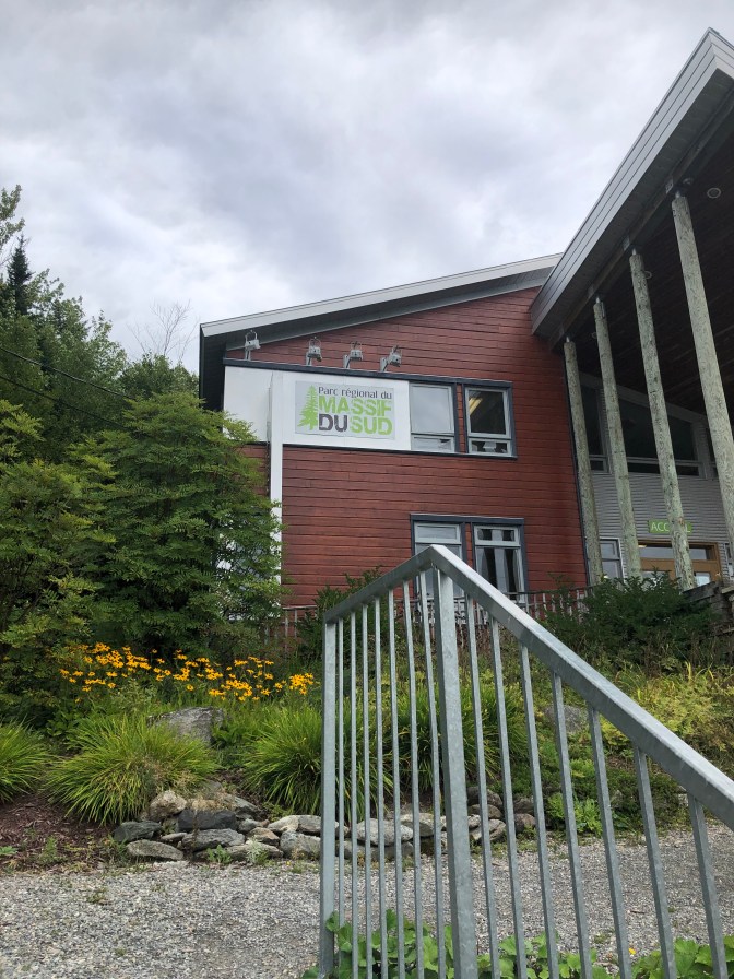
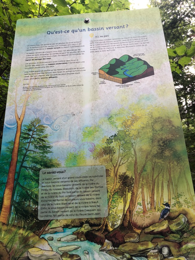
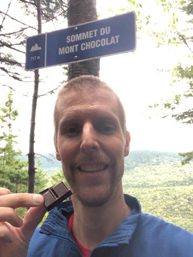
This park is just south of Montmagny in Québec, and is a great spot for hiking. I had mapped out a quick 2 hour hike on Mont Chocolat while in Chateauguay, so I quickly got my day pack together and hit the trail at 4:30pm. It was a quick ascent on just under an hour – the trail was a bit steep in places but really well marked and easy to follow – would make a great place to trail run! There were also some neat little plaques with information on the geology, flora and fauna along the way.
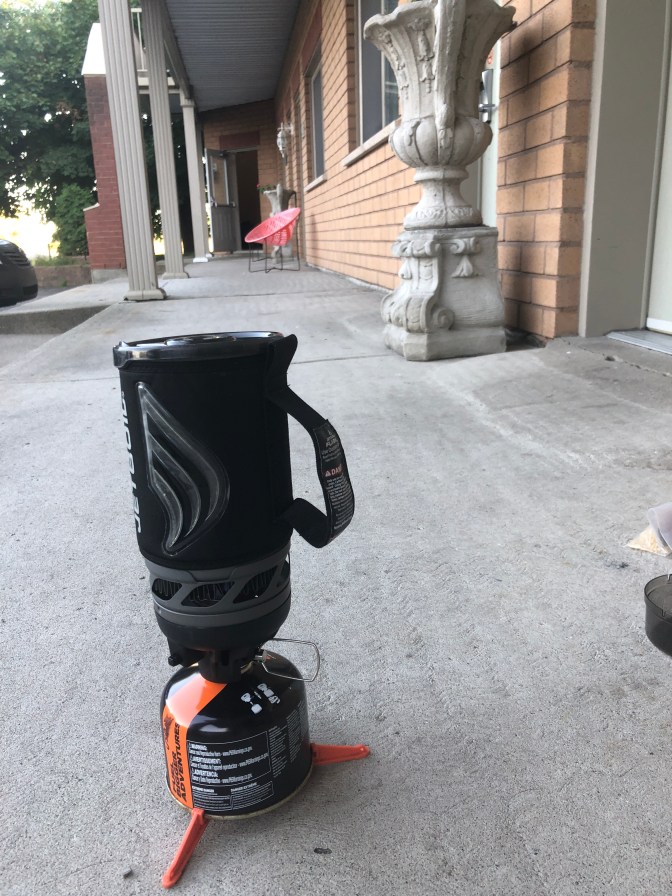
At the top (717 m) I cooked dinner on my JetBoil which I had brought with me and, naturally, snapped a selfie in front of the summit sign with a piece of chocolate! After about 20 mins at the top, I headed back down, set up camp, and took a shower in the exceptionally clean and tidy facilities. They were cleaner than the community Center I swim at in Mississauga! After checking emails regarding my next accommodations in Halifax as well as planning my route for day 2, it was off to bed at 8:30pm.
Day 2 – Halifax
Sleep was a bit uncomfortable – the campsite was gravel and I was using my closed cell foam pad, which is far less soft than my inflatable pad. Nevertheless with my MEC Talon 10C bag along with my synthetic liner, the temperature was just right! I think my inflatable pad is a 4 season pad, hence it’s often a very sticky sweaty night camping with it in the summer.
I was up at 5am once again and off at 5:30am, and arrived at the border with New Brunswick by 8am and had breakfast at Tim’s (coffee plus cream cheese bagel, a staple on this trip) as well as filling up. My next break for lunch was near Moncton, and then hit the road one last time, arriving at 5pm at my AirBNB in Halifax, the city I was born in!
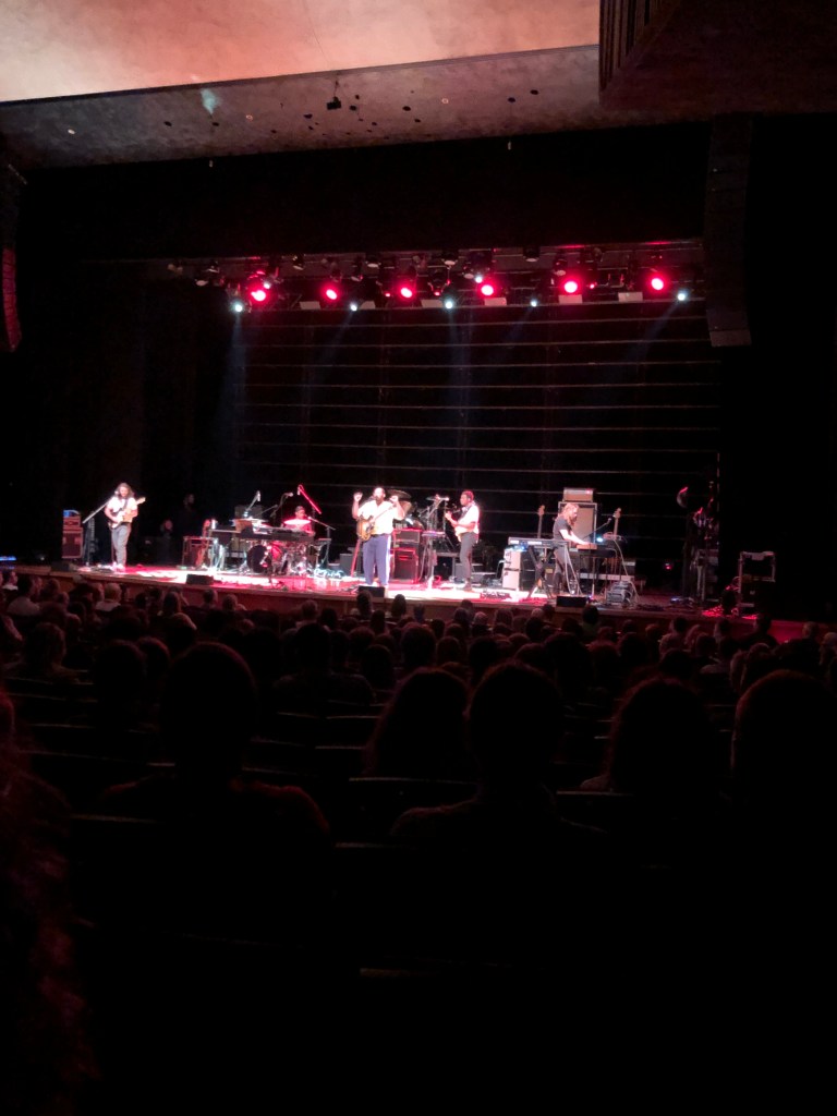
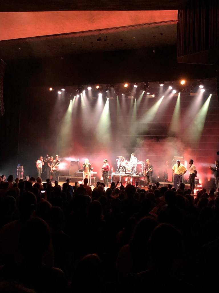
After checking in and doing a bit of pack organization (had an overnight hike planned for the following night) I was off to see the Metric gig at nearby Dalhousie University. I planned my trip around being able to see this concert (first live event since Feb 2020) as well as visit my grandmother the next day. After just missing out on Chinese food (they ran out right before I arrived) I settled on Charger Gourmet Burgers where I had a delicious mushroom burger with, of course, a plant based patty. Great meal but it took a long time to get my order. Luckily I had just enough time to inhale the burger and fries and walk briskly to the Rebecca Cohn auditorium at Dal for the show.
The show was really good! Opening was Bartees Strange, an artist who I had never heard of who, along with his band (guitarist, drummer, guitar/keys and bassist) expertly showcased an energetic set of songs which fused together rock, jazz and r&b. Then came the main event – Metric. The set was full of old and new songs alike – the sound was really great other than one song in the encore (“What Feels Like Eternity” – the guitar was way too loud and drowned out the vocals). The set also featured a number of tracks that they hadn’t played on this tour yet (oldies like “Dead Disco” and “Monster Hospital”) and also the band invited Bartees and his band out to sing a reprise of the chorus of the final song, “Breathing Underwater.” Great show by a great Canadian band (okay, the bassist and drummer are American…)!
After the show I walked back to my AirBNB and it was off to bed at 11pm.
Day 3 – Cape Breton Island & Pollett’s Cove
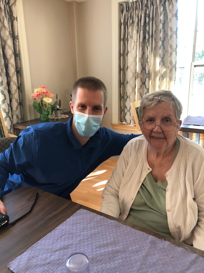
Day 3 was a fairly light day – the plan was to visit my grandma for a bit at her nursing home, before setting off northeast to Cape Breton Island and doing an overnight at Pollett’s Cove, located northwest of Cape Breton Highlands National Park, where the most rugged terrain in the province is located. It was great seeing my grandma – it had been far too long!
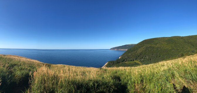
The drive up to Cape Breton Island was very scenic, especially as I made my way along the west coast, and through the National Park. Definitely want to come back at some point and do more exploring within the park! By 4pm I had arrived at the trailhead for Pollett’s Cove, which is a beach and hilly area located on private land. The owner apparently won the lottery some years back and bought the land, allowing hikers to access it for camping. I quickly packed everything I’d need for an overnight in the backcountry, and started hiking. The trail was not too challenging but was definitely a solid workout, taking me over several hills. The hike itself was not too scenic other than a couple spots where the trail emerged out of the forest, and there was a small stream about halfway through which was a great spot to top up on water.
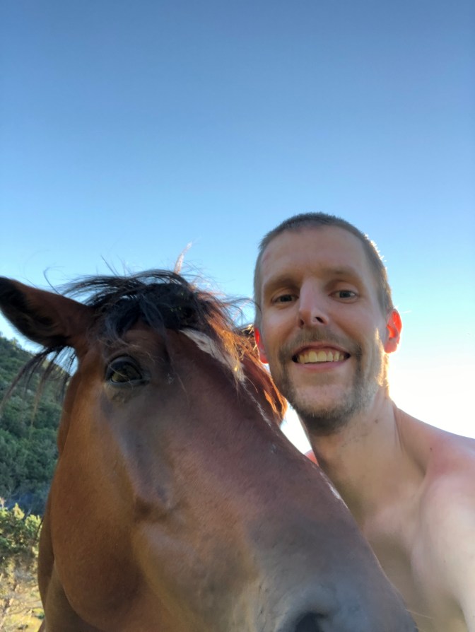
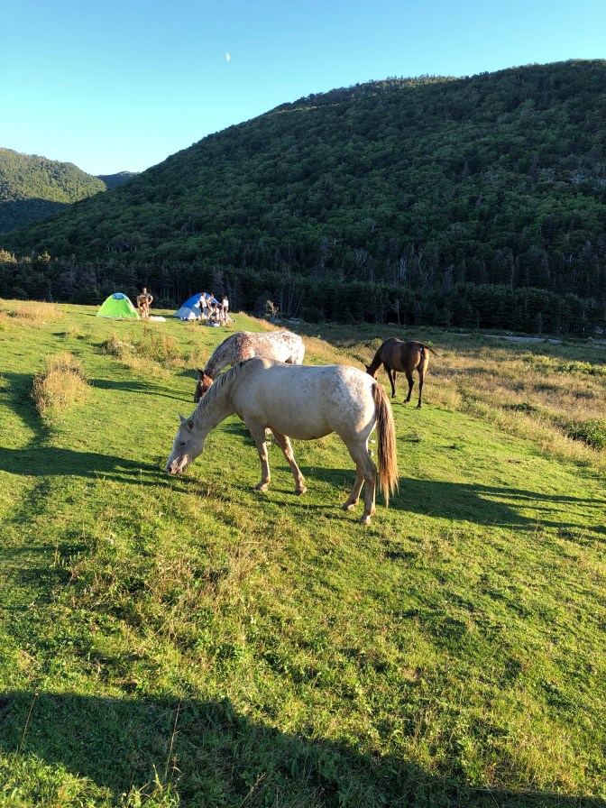
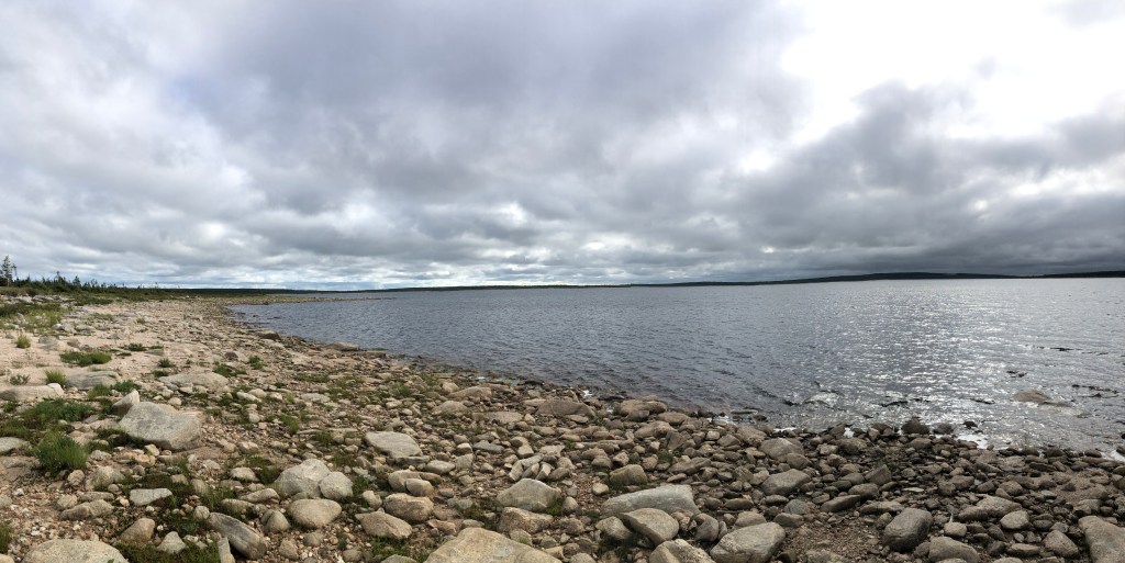
After a couple hours I finally arrived at Pollett’s Cove, what a view! It was at the bottom of a hill, with a large beach area bisected by a large stream of water, along with some grassy fields behind, with a herd of (domesticated) horses! It’s quite the beautiful spot, though there were a TON of people there – it was a long weekend so not surprised at all. I made my way across the cove and stream to the far side, and found a nice little spot up on the hill to set up camp. The horses came by and I was able to pet them and get some photos.
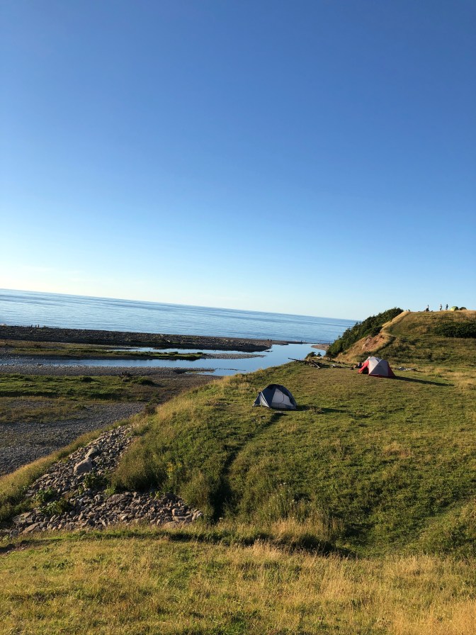
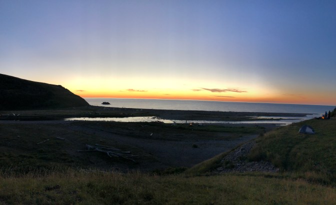
I did get in a bit late (close to 6:30pm) so I had a little bit of time to get some photos of the beautiful scenery as well as the sunset, as well as prepare dinner (soup). Despite most of the other campers staying up to have campfires, I set off to bed fairly early as I planned an early start in order to get settled in at my next destination.
Day 4 – Ingonish
I woke up at around 6am, and had a quick oatmeal breakfast before breaking camp and heading back to the car, starting around 7:15am. On the way back I met a guy from Calgary who was working in Dartmouth, and who also happened to be an engineer. We had a good conversation while trucking through the last half of the hike. After returning to the car, I quickly changed and it was on the road again, off to Ingonish, on the east coast of Cape Breton Island.
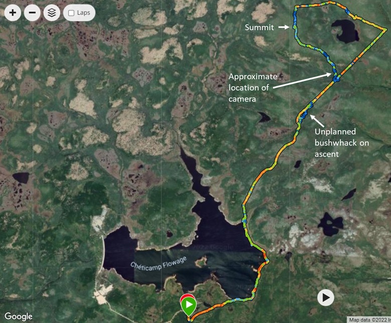
Ingonish is a nice little town, with a great view of the Atlantic Ocean, plenty of beaches, as well as access to several great trails in the National Park (including the Franey Mountain trail, which was my original plan for accessing White Hill, the Nova Scotia highpoint). I went over to the information center for the park and inquired about the best option for accessing White Hill. As expected, the park staff were dubious I could get to it in a single day (this is not a hike many people do), and recommended that if I were to try it, I should take the route from the south via Chéticamp Flowage, and NOT the Franey trail (it apparently is very difficult to find the trail that leads close to White Hill, and is also a much longer hike). This seems to be, based on my research, the best route to the summit and I had planned it as a backup.
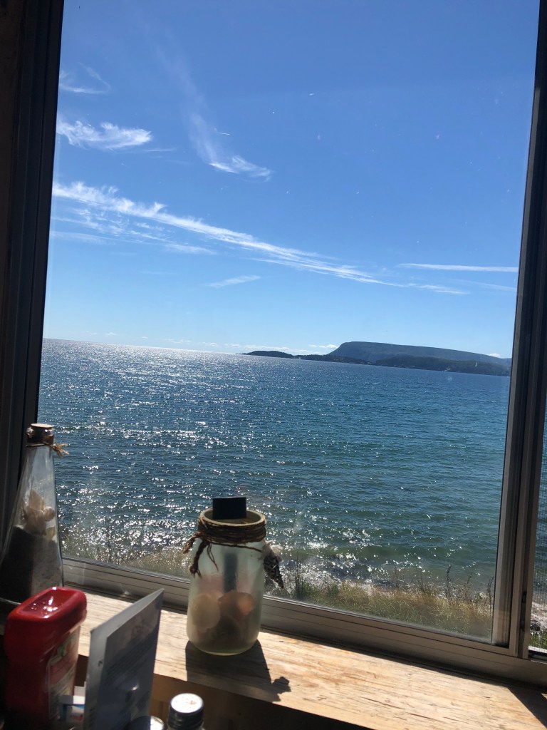
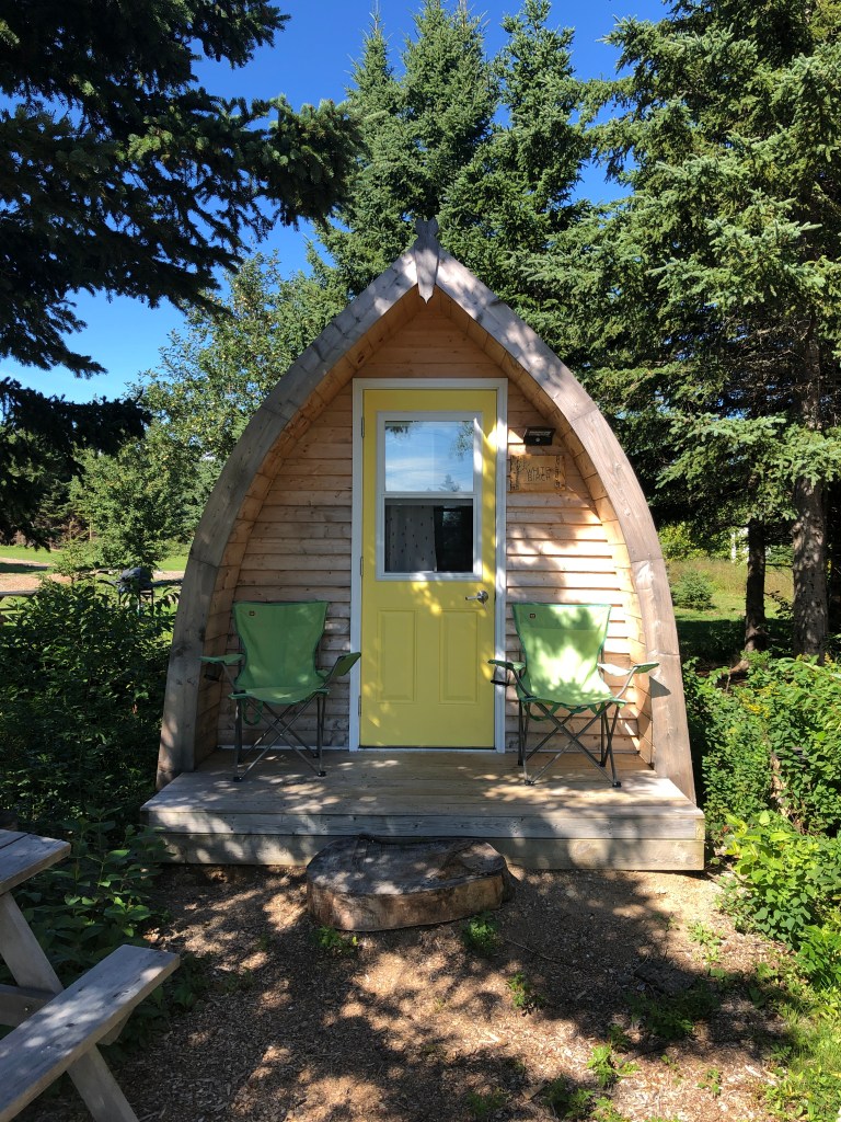
After getting my park pass for the next day to do the hike, I went for lunch at Seagull restaurant. Being in the Maritimes, I had to have a lobster club sandwich (sans bacon – seafood I will eat on the rare occasion!). After lunch I had a couple hours to burn, so I chilled out at a beach nearby, going for a quick dip first. I had forgotten my sunscreen at home so I did get quite a bit of sun in just a couple hours! I then drove over to my AirBNB at 3pm to check in – I stayed in a camping pod which was one of several on site, and advertised as “glamping” (glam + camping). A bit more lavish than my stay at Massif du Sud, but definitely not as outfitted as a hotel. Pretty nice spot!
Before dinner I headed down the road to a local outdoor shop and unfortunately they were out of sunscreen. However the owner was very friendly and helpful, and gave me some tips for White Hill. He also scared me a little bit, claiming it was about 50/50 I would blow one of the tires on my car on the drive in (on rough gravel/rocky roads). He said I should have tire plugs and that if something were to happen, I would likely be SOL as there was no service out there. I assured him I would be very careful, and he gave me his card just in case I needed anything in the morning, and was able to get service. I also bought another can of bear spray as I had lost the safety tab on my old can in the Adirondacks – he suggested I tie a piece of twine through the tab and to the can to secure it.
After dinner I turned in very early – I was planning to leave the AirBNB around 6am and spend the entire day on the trail, including 2+ hours of driving each way.
Day 5 – White Hill
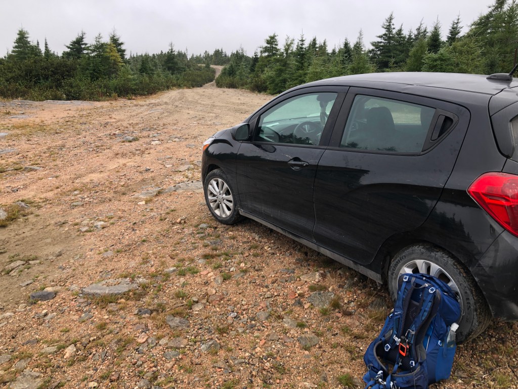
I woke up bright and early at 5:45am and was on the road just before sunrise at 6:10am. The drive was incredibly long as the vast majority was on unmaintained gravel roads, full of potholes, bumps, and large rocks. Google Maps said it would take 75 mins to drive to the starting point, but it actually took over an hour longer. Most of the drive I was going very slowly and carefully at 10-20km/h, but the car held up and I eventually arrived at the station at Chéticamp Flowage at 8:20am. After getting my pack ready and donning my trail shoes (I knew it would be a long hike and also very muddy and wet, so I opted to save my hiking boots for my Alberta trip) I was off at 8:50am.
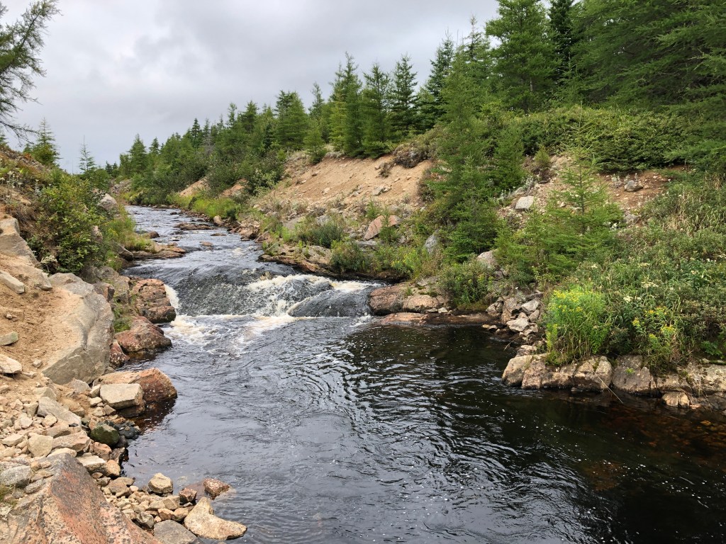
At the very beginning I needed to cross a steep-banked river flowing out of the flowage and through the station. Previous trip reports, including that by the Gilbertson brothers indicated that there was a tunnel at the sluice gate at the station. I quickly ascertained that it was no longer present, and the station itself was sealed tight with locks and fences, so climbing over was not an option either. Looking downstream, I saw that the river got a bit shallower and there were a number of rocks which looked like good stepping stones. So, I made my way down the river a ways and crossed safely with no issues.
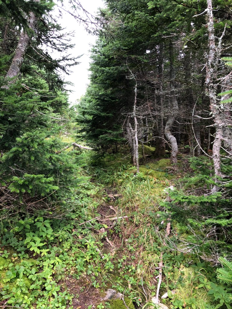
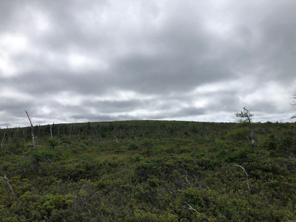
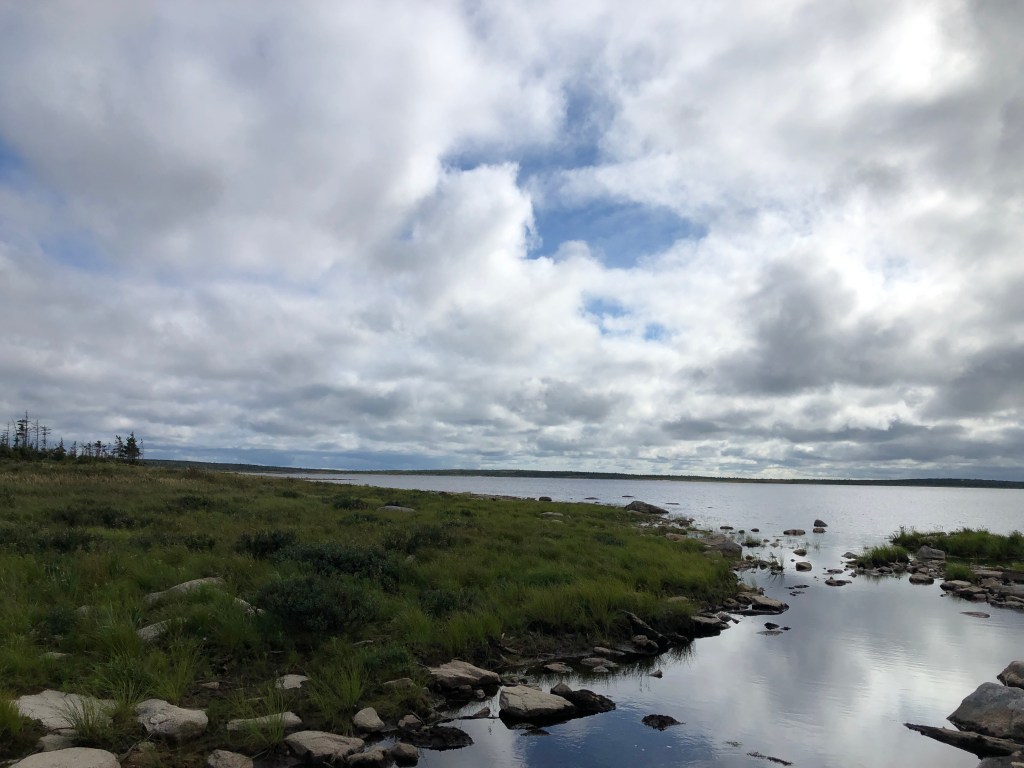
The next part of the hike was on an old logging road which led to the shores of Chéticamp Flowage. Upon reaching the lake, I began hiking along the shore of the lake around to the northeast side. This was probably the most enjoyable part of the hike – the views were great and the hiking easy (although I had to watch my steps around the larger rocks and driftwood). After about an hour of hiking, I reached the start of the long, faint logging road which headed directly north and past White Hill.
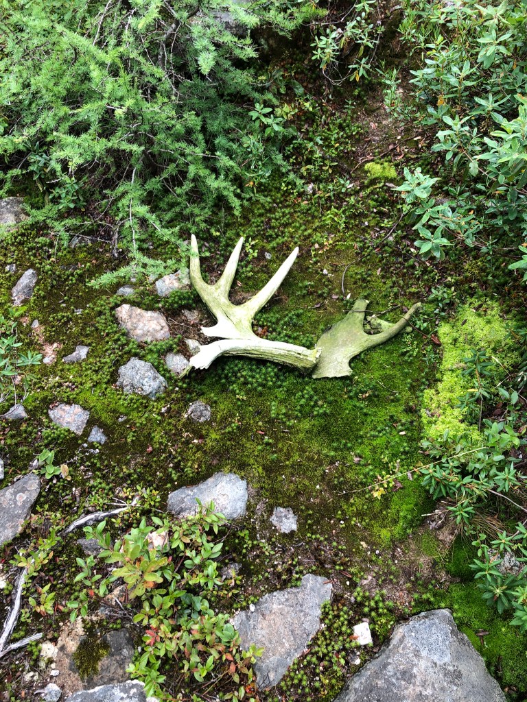
The hike up started off fairly brisk and easy – the path was faint but still farly easy to follow. I saw a moose partway up as well – I suspect that if not for our antlered friends, the path would be even more difficult to follow. At some point the trail became difficult to follow and I ended up off trail. What followed was nearly an hour of painstaking bushwhacking trying to find the trail again. Even with GPS it was a challenge! I ended up burning through quite a lot of my battery on my phone trying to get back on track – initially I wasn’t too worried since I had my power bank with me. I was also wearing shorts at this point, so my bare legs took quite the beating.
After finding the trail again (and donning a pair of long pants), I continued northward and eventually reached a junction where four trails intersected – heading right would take me to Franey Mountain, and left would lead me west, north of White Hill and its namesake lake, where a bushwhack would be required to reach the summit. The westbound trail also offered a number of false trails as well as some of the deepest muddy sections of the hike – I sunk up to my waist in one spot!
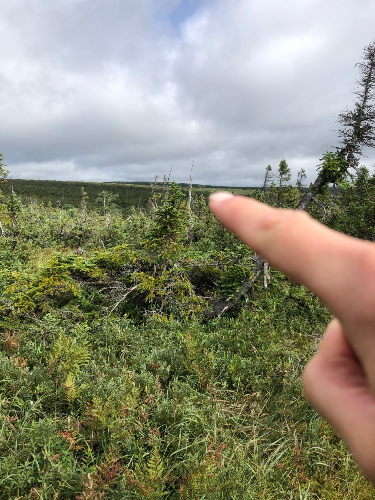
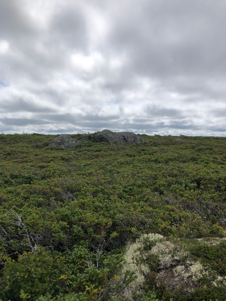
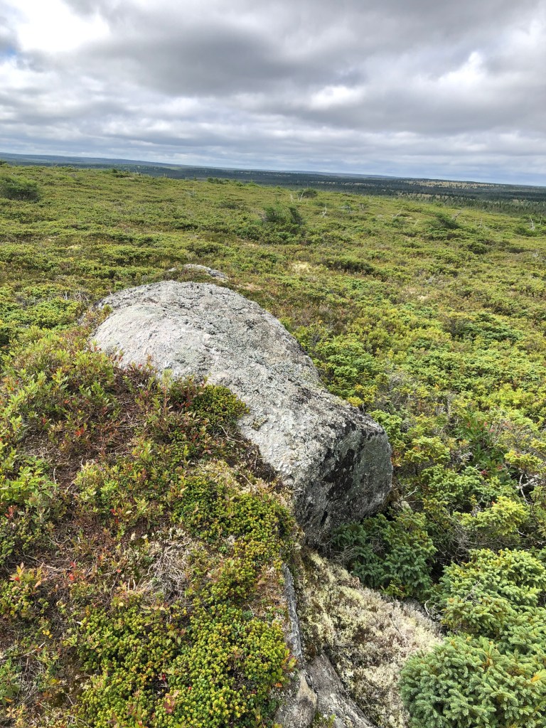
Eventually it was time to start the bushwhack up to the summit of White Hill. This bushwhack wasn’t too bad – I aimed to stay in the lower shrubbery and avoid the larger trees which caused problems for me earlier. Eventually, at about 1:30pm and around 4.5 hours of thrashing through the Cape Breton backcountry, I was at the summit “plateau.” It was quite difficult to make out where the exact summit was – my waypoint with coordinates of the summit turned up nothing, and of the two rocky formations in the area, neither had a summit register, pole or fallen antenna as seen in the mid to late 2000s. I suspected that they had been knocked loose and/or buried under the shrubbery at the top.
I spent about 45 mins at the top, having lunch and taking photos, before beginning my descent. It was here I also realized that although I brought my power bank with me, I did not bring the lightning cable for my iPhone (which I was using for GPS purposes). With around a third of my battery remaining, it was time to be very frugal with the use of my phone! I opted to bushwhack my way back to the faint trail leading to Chéticamp Flowage rather than backtrack to the east-west trail – this turned out to be a fateful decision.
The bushwhack started off fairly well as the vegetation was low-lying and easy to walk through. However as I approached the trail, the trees became taller and thicker, and it became very challenging to advance. I took a couple tumbles and spent what felt like forever within meters of the trail trying to punch through. Eventually after over an hour, I was back on the trail and started downward back to Chéticamp Flowage. All of a sudden, I realized that my camera, which had been in my pants pocket, was nowhere to be found. I had it on the summit, so I suspect it fell out when I took one of my several tumbles, and as I was quite frustrated with the trees and bushes thwarting my advance, I failed to realize that it fell out. I quickly weighed my options. It was almost 3:30pm, with about 3-3.5 hours of sunlight left. I had a 90 minute drive on gravel after finishing the hike, and I wanted to do that in daylight to be able to see the road hazards. I had at least two hours of hiking left, AND since I had lost my camera during a bushwhack in an area with no trail, it would have been damn near impossible to find the exact spot again. Thus, I made the very tough decision to forge on and leave the camera behind.
The return hike down to the lake was uneventful and luckily I stayed on the trail. Upon arrival at the lake, I took a break at the stream, where I removed my boots and socks and attempted to wash them (very little success), and also tried to filter water from the stream (it was brown, so nope). I then set off around the lake and in no time, was back at the car after over 28 kilometers and 8 hours 40 mins of hiking. I quickly got changed and began the slow drive back to the main road. Upon arriving back at my AirBNB, I whipped up a quick camp meal on my JetBoil, took a highly satisfying shower, and then it was off to bed.
FATMAP Route (saved .gpx from Peakbagger, courtesy Zackary Michek)
Garmin GPS Track
Day 6 – Prince Edward Island & Highpoint
I woke up at 6:30am, and after having a quick oatmeal breakfast and packing everything into the car, was on the road. First stop was just up the street at the local gas station to fill up (I would have filled up the night before to get an earlier start, but gas stations close early in Ingonish). Then, I was off down the east side of Cape Breton Island towards the bridge to the mainland. The drive was very scenic and I stayed entertained by alternating podcast episodes (I started listening to Materialism, which is all about materials science and engineering – yes I’m a nerd!) with albums on Spotify. I stopped at Auld’s Cove once again after crossing the bridge for a quick pick-me-up, then was off again.
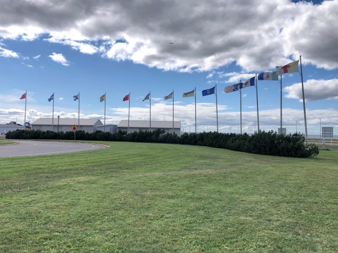
Google Maps indicated that the route I was on had tolls, so I opted for the toll-free route which included…gravel roads of course! Very odd that the best route to PEI not involving a toll involved being on an unpaved road. Before long I was on Confederation Bridge, which at 8 miles or almost 13 km in length, is the longest bridge in Canada and the longest in the world over a body of water that freezes. I found out later that there was a recent motion in the Prince Edward Island provincial government which unanimously passed (a rarity in politics nowadays!) which proposed renaming the bridge to the Epekwtik Crossing (where Epekwtik is the traditional First Nations name for Prince Edward Island). It’s all up to the federal government now to approve it. I like this new name a lot better. This bridge is also famous for the fact that it is free to enter PEI, but it costs $50.25 for a 2-axle vehicle to leave (presumably this encourages people to stay on the island longer, smart!)
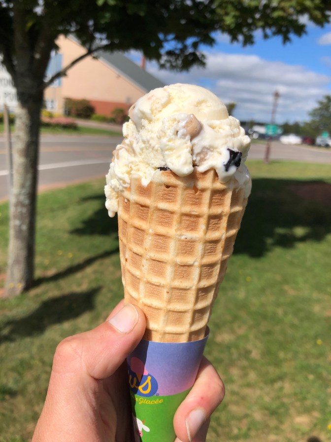
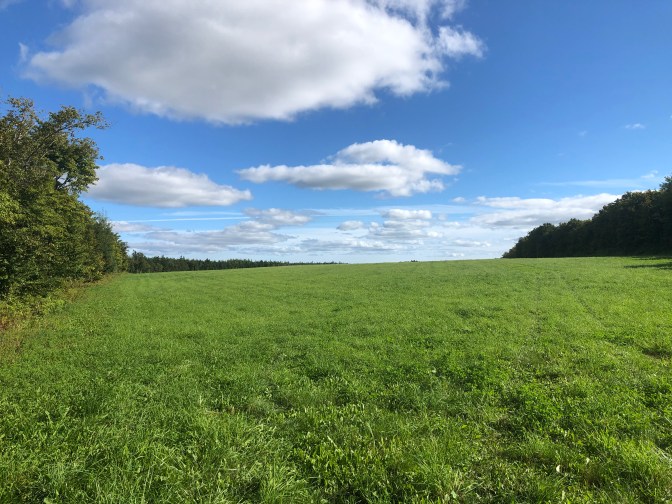
Upon setting foot in my eighth Canadian province visited (just Newoundland and Saskatchewan left, plus the territories!), I went to Subway for lunch and joined in a weekly work call, and had a delicious ice cream (I almost never consume dairy products but will have the odd 1-2 ice creams per year). I took some photos outside before getting back to the car and driving over to the provincial high point, located in Queen’s County, about 30 mins from Confederation Bridge.
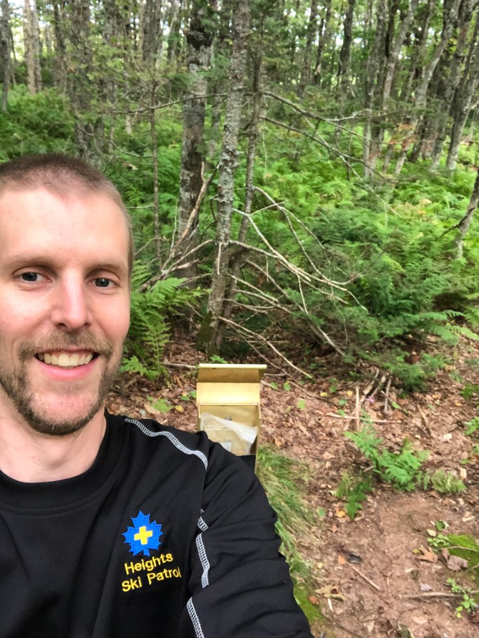
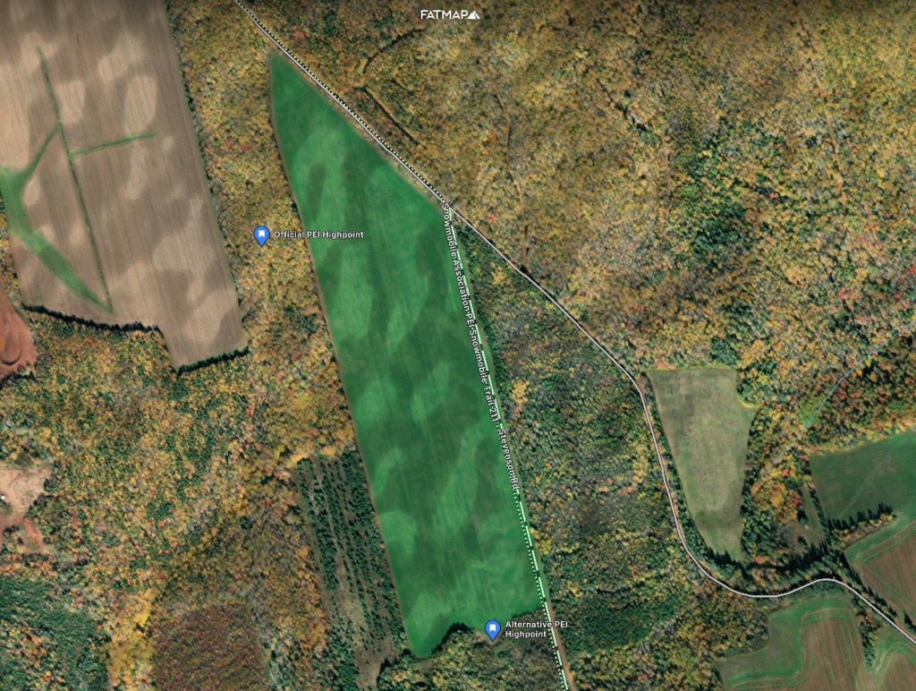
The approach was on a gravel road, and according to the GPS track I had uploaded to FATMAP from Peakbagger to plan my “route” started on the edge of a potato field and made its way into a strip of forest alongside. It was a “gruelling” 300 meter walk until I located the summit register, which no doubt marked the “official” high point of Prince Edward Island, at 142 meters above sea level. I signed my name in the notebook, took a few photos, then made my way out back to the car.
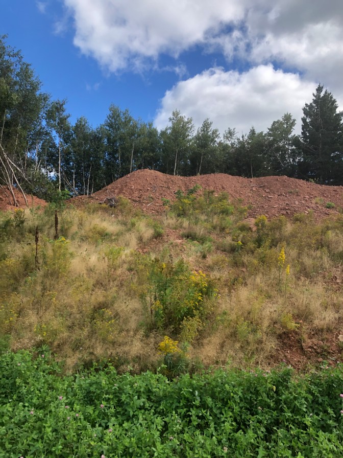
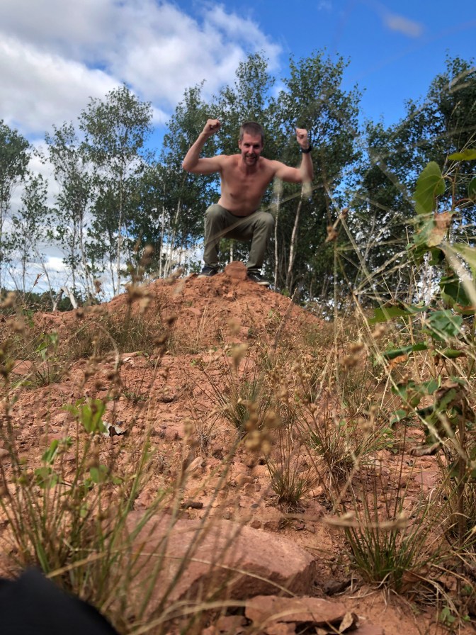
When I got back to the field, I noted a mound of red clay-based dirt at the far south of the field which looked like it was higher than the point located in the woods. This was the exact spot also noticed by Ronald Brisebois in 2008, as noted on Peakbagger. I walked back to the car, drove down the road as close to the mound as possible, then thrashed through the woods westward about 300 meters until I returned to the field. I climbed up and I believe it is definitely higher than the point of land where the summit register was (my sources say roughly 10 meters higher), though I suspect the dirt may have been piled there and is not a natural formation. Nevertheless, I took a few photos here as well, then departed. It would be neat if a professional survey were to be done to confirm the height at this spot. We’ll consider this a summit regardless and my fourth Canadian provincial highpoint! This also meant that I have summited the four lowest highpoints on the list. Only up from here.
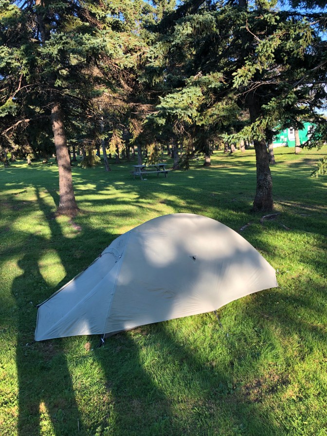
I hopped back in the car after making my way back through the woods and made my way to my camping accommodations for the night at Linkletter Provincial Park, located on the shores of the St. Lawrence. As soon as I got out of the car to get my permit I was immediately accosted by mosquitoes. Very surprised that 1. there were still mosquitoes out in September and 2. there were mosquitoes in PEI and none in backcountry Nova Scotia. As soon as I got to my site I donned my bug net for the first time on the trip, set up my tent, then went for a quick dip in the water. After showering and having dinner, I was off to bed at 8:30pm.
Day 7 & 8 – Back to Ontario
I woke up bright and early at 5am (not actually bright as sunrise is after 6am), quickly packed up and threw everything in my car. It was quite damp overnight so my tent fly was soaked, along with the towel I left outside to dry. I opted to not make oatmeal breakfast at camp, as the mosquitoes were exceptionally atrocious the night before. Therefore, I was out of my site by 5:20am, and after having a chat with one of the park employees at the entrance, was on the road at 5:30.
After a quick stop at Tim Hortons, I was across Confederation Bridge and on my way. The drive was largely uneventful, with a gas and bathroom stop in Hartford (not in CT, USA!), along with a lunch and work stop in Edmundston, after about 6 hours of driving. I had lobster poutine for lunch, which was a nice fusion of Québecois and Maritime cuisine. I spent some time doing some work, before hitting the road again just after 2pm to finish out the driving for the day. I had booked a motel in Drummondville, Québec, which is just over 4 hours from Edmundston, and less than an hour from Montréal. I checked in, cooked a “camp” meal outside in front of my room, spent some time drying out my damp tent, and struggled immensely trying to get my Garmin watch to sync to Connect. It was acting really buggy and turning off randomly, but was finally able after almost two hours to get the data transferred and luckily, everything (save a hike I had done on the Bruce Trail with my Toronto hiking group) transferred cleanly. It was off to bed at 11pm, a bit later than I would have liked.
I was up early once again the next day and departed the motel just after 5am (the aim was to avoid the Montréal rush hour traffic). I got through without any difficulty and had breakfast at an ON Route when I started to run low on gas. I made it back home around noon, immediately unpacked and ran a load of laundry, and began packing for the next phase of my fall trip – my return to the Rockies in Alberta! I’ll cover that in my next post, stay tuned!
Note (July 2025): It has recently been confirmed that White Hill is not the highest point in Nova Scotia, so I will need to make a return trip to Cape Breton Island to visit Western Barren, a much easier approach and situated southwest of White Hill.

3 thoughts on “Canada High Point #3 (Queen’s County, PEI) and White Hill (Nova Scotia)”