October 2022 found me on the road again back down to the Adirondacks to tackle a few more of the 46 High Peaks. I had previously been in August and caught the 46er bug after completing 4 peaks, so I immediately made plans to make two return visits in 2022, with more to come in 2023. These two trips would also mark the latest in the year I had ever done backcountry and tent camping, which was also helpful in preparing for winter camping.
First up was a solo trip to take on the Great Range, which consists of seven peaks, one of which I climbed in August. From tallest to shortest:
– Haystack (1512m) [Climbed in August]
– Basin (1471m)
– Gothics (1444m)
– Saddleback (1376m)
– Armstrong (1341m)
– Upper Wolfjaw (1276m)
– Lower Wolfjaw (1273m)
The plan was to climb the remaining six Great Range peaks, which form a nice loop and can all be reasonably (weather/trail conditions permitting) done in a single weekend or even day. For this trip I picked up a couple new pieces of gear – a 4-season tent (MSR Access 1-person) with footprint and a Bare Boxer lightweight bear barrel (this cost an arm and leg in shipping/customs from the USA). I also opted to bring my -9C bag, which I last used in the Cascades, microspikes (trails reported to be icy the previous weekend, especially on peaks) and also packed a lot of the colder weather attire I got for my mountaineering course. I also got a chance to test out my brand new GPS watch – Garmin Fenix 6 Sapphire (the expensive version, but it was a crazy good sale). A massive step up from my old Forerunner 910XT!
My initial plan was to camp at Sno-bird for night 1, but after learning Sno-bird is not in great shape, I changed things up. The new itinerary involved hiking in and making a base camp near the Howard Lean-to about 5 kilometers from the trailhead at the Garden parking lot on Day 1, taking a lighter pack and doing the loop trail counterclockwise (in order: Basin, Saddleback, Gothics, Armstrong, UWJ, LWJ) on Day 2, camping in the same spot, followed by a 5 kilometer return hike back to the car on Day 3. The loop can also be cut short if time is an issue, taking the Orebed Brook trail down, which would omit Armstrong and the two Wolfjaw peaks as well as possibly Gothics. Thanks to the Adirondack Trail Conditions Facebook group for the suggestions!
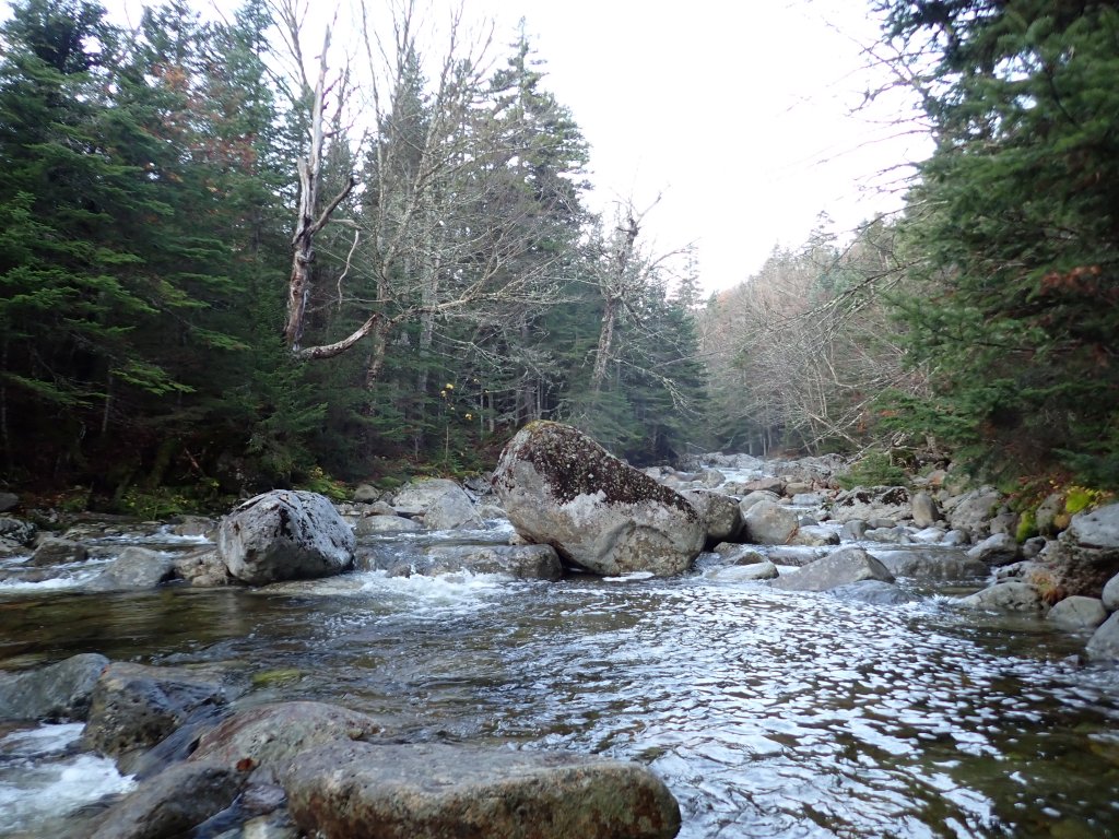
I departed Toronto just before noon on the Friday, and after a smooth drive down to the Adirondacks including the fastest border crossing I’ve ever experienced (only car at the checkpoint!) I made it to the Garden trailhead just after 5pm. After paying for parking (it’s $10 USD a day, which is super confusing as usually one would pay per night – I was only going to be parked for for about 40 hours across three calendar days, but still paid for three days) I was on the trail. A bit muddy but not too bad. Sunset was at around 6:30pm so I did the last half of the hike with my headlamp, but made it to the campsite area near Howard Lean-to safely, and managed to find an open spot to set up my tent. Very awkward setting up a new tent for the first time in the dark! It took a little while, but got everything set up and was off to bed at around 8pm.
I woke up the next day at around 6am and it was still dark (sunrise was at around 7am). My sleep was fairly decent – I was nice and toasty in my -9C bag + liner. The tent itself was pretty solid though – a bit more space than what I was used to, both in terms of floor area and height (a whopping 1m high!). After quickly gathering my things for the day (left my tent and sleeping stuff behind) I was off on the trail at 6:30am. The trail started off fairly flat but started to gain elevation quickly. I stopped near the river at around 7:45am to make breakfast – interestingly I had a hard time lighting my stove with matches but had no trouble with the sparker (which had previously given me trouble). On this trip I brought a smaller, more compact fuel canister which fits perfectly in the vessel.
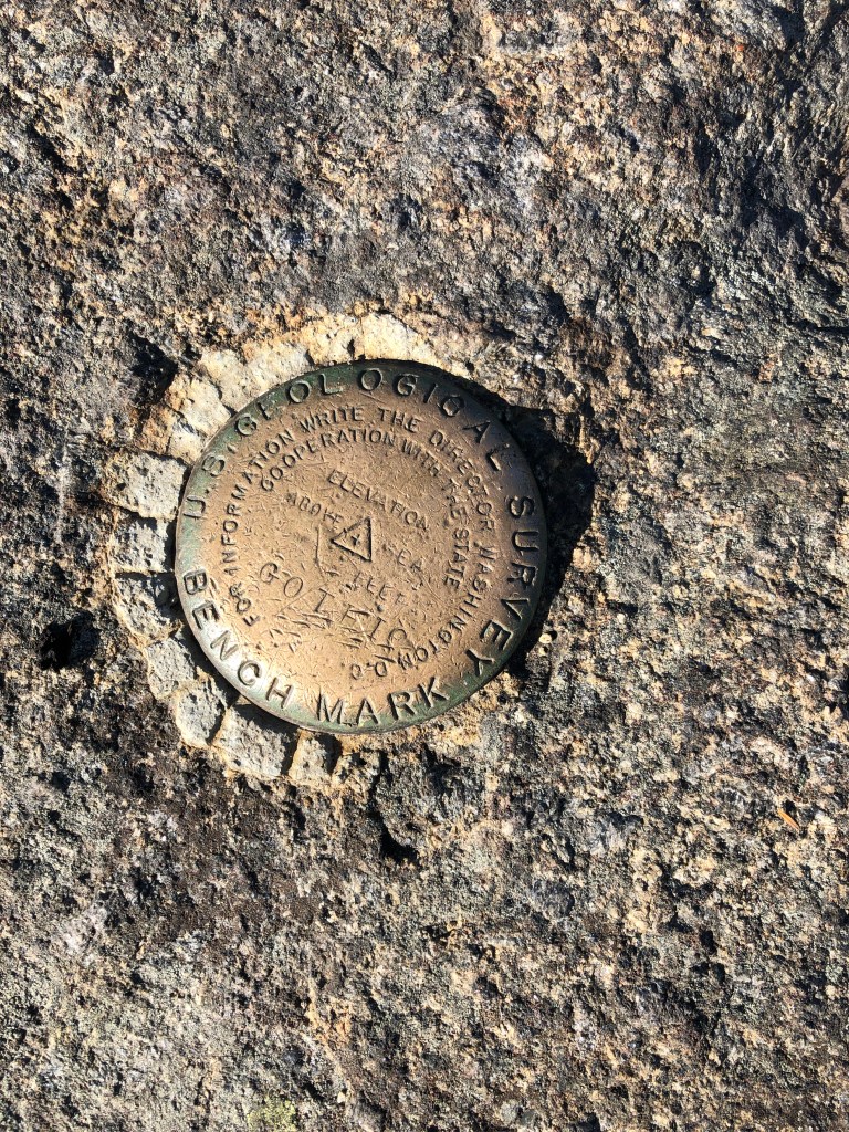
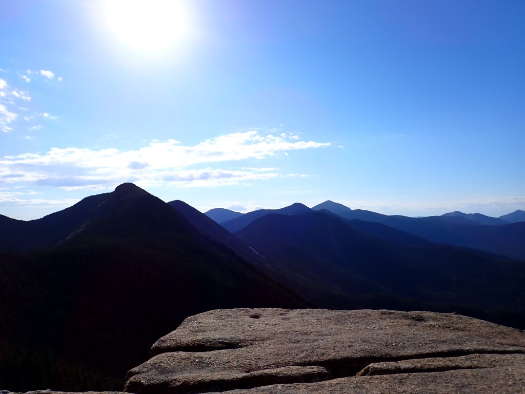
After gaining ascent through the Shorey Short Cut Trail, I met a gentleman and his son at the junction with the State Range trail. They had done Haystack and were on their way to Saddleback. I hiked just behind them for the next few hours and was very impressed with the son’s fitness and energy. The climb up Basin wasn’t too challenging and I made it to the summit at around 11:30am, after five hours of hiking. It was a beautiful day with great views of some familiar faces, including Haystack and Marcy.


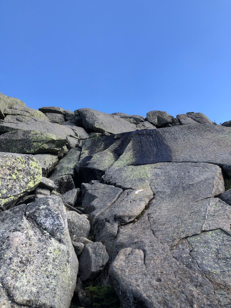
I spent a short time on the summit of Basin before pushing onwards to Saddleback. First up was the first of many descents on the day, followed by a very steep, somewhat technical climb up the Saddleback cliffs. Now I know why it was recommended to climb UP these cliffs! It was quite tricky in some places and I was very happy the peaks were ice-free and fairly dry on the more technical spots. At one point I dropped my pole down a shallow crevasse (I tossed them up so I could have both hands free) so I had to stick my leg partially into the crevasse to lift the pole with my foot so I could grab it with my hand. Pretty intense and for the next little while I opted to stow my poles in my pack. I arrived at the Saddleback summit at around 1:00pm and once again, great views! Also met a lot of friendly people at the top, including a couple of hikers who were doing a similar traverse to me, but the other direction! They were thankful for the heads up on the cliffs.
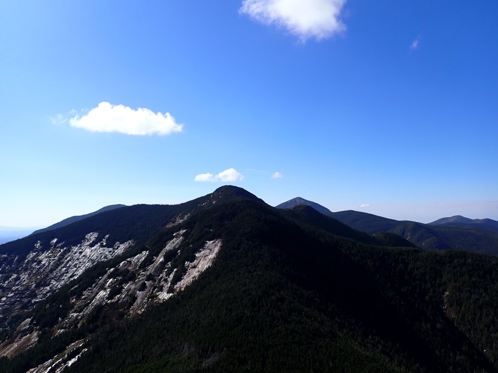
My next peak would be Gothics, which is named as such due to its rock formations somewhat resembling Gothic architecture. It’s also known for a cable that was installed on a particularly steep section to aid hikers, but it seemed like it wouldn’t be too bad since there was no ice that day, unlike the prior weekend. After a quick stop on Saddleback, it was onwards and downwards (then upwards!). Overall, fairly uneventful up to Gothics, though the climb up the cable section really got the heart racing! There was a bit of a false peak on the way which was a bit of a soul crusher, but it wasn’t too bad up to the true summit, my third peak of the day, arriving at 2:15pm.
It was here I decided that I would do an abbreviated version of my planned route. I had already passed the turnoff to Orebed Trail (located between Saddleback and Gothics) and going down Gothics the same way would have been slow going, so I opted to carry onwards and skip Lower Wolfjaw which was my planned sixth peak (and a bit of a side trip) before descending to the Southside trail at the base of the range. I hit Armstrong (peak 4) just after 3pm, followed by Upper Wolfjaw (peak 5) at around 4pm, with the views becoming increasingly less impressive. It was quite taxing at this point, having climbed up and down several times as I traversed the five peaks, so I was happy to spend a bit of extra time on Upper Wolfjaw summit and make myself a nice hot meal (I opted to eat there rather than at camp, as it would likely be dark when I returned).

Just before 5pm I set off, and with a bit of disappointment turned down the Wolfjaw trail, “orphaning” Lower Wolfjaw. Lower Wolfjaw summit was only half a mile away, but I knew it would be at least 40 mins up to the top – the elevation gain makes it take a lot longer than what you’d expect. The descent was fairly steep and I had to be mindful of my footing, but got down the tricky sections safely before getting onto a more even footpath. I forgot to mention that most of these trails had streams of water running directly over them, making for some very dicey spots where I had no choice but to tread on damp rock. Definitely paid to take my time and be methodical about my attack plan! I ended up using a lot of tree branches and roots for extra support, and also had to slide on my butt a few times. The poles got tossed down quite a bit as well when I needed both hands.
On my descent down the Wolfjaw trail, I encountered a group of three hikers who I had initially met on Upper Wolfjaw. Two of them were moving quite slowly, with the third a bit further down at a stream. While I was collecting water at the stream (a godsend as there were no good sources of water on the ridgeline) the other two hikers caught up and I learned that one of them had rolled their ankle. I expressed sympathy and wished them luck – it was getting dark and they were still four miles from the Garden. One of them ended up passing me further down the trail, making a beeline for the car. I sure hope they all got home safely – it was pitch black when I got back to my campsite, so they likely had a long slow walk in the dark. Sprained ankles are the worst!
As mentioned, it was very dark when I returned to my site just before 6:30pm and I had donned my headlamp with about 20 mins left in my hike. Definitely a good call to skip Lower Wolfjaw! I quickly got changed, stowed my barrel in the woods, and was off to bed at 7pm after a long, challenging day on the trail!
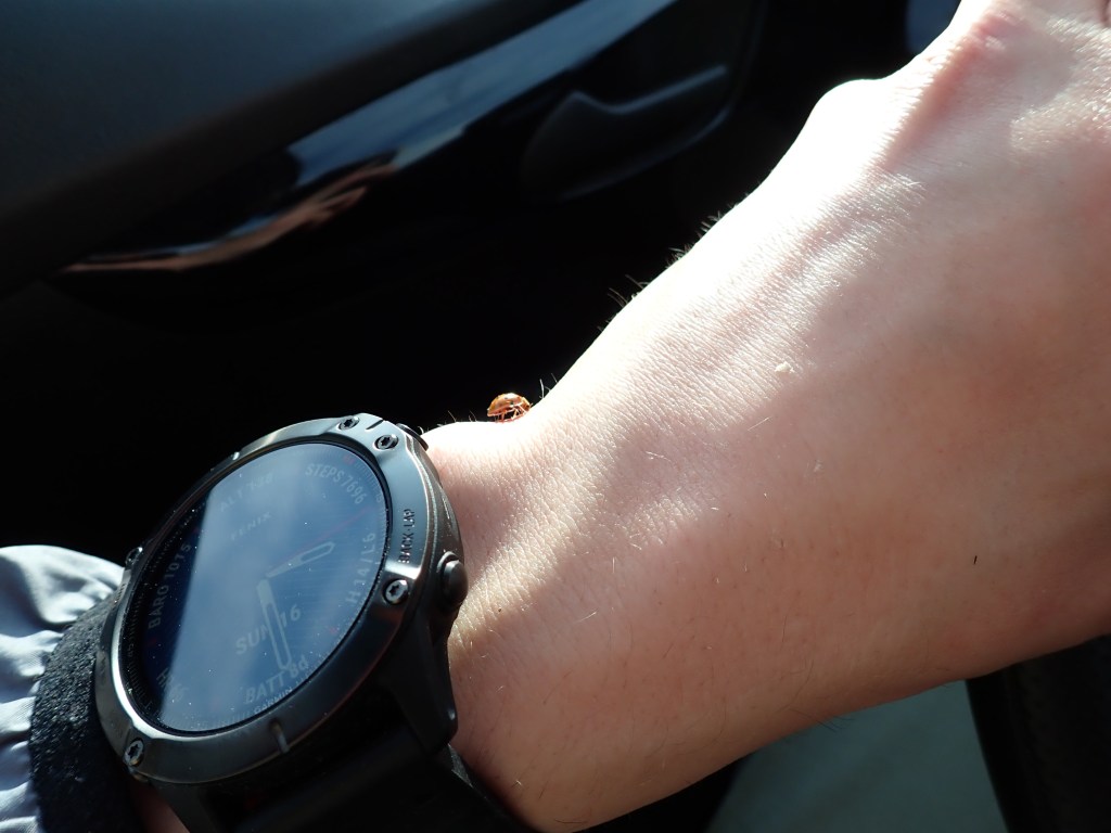
The next day was another early start – I wanted to be on the trail early to get home as soon as possible. I packed everything up by the light of my headlamp and was off just after sunrise. It was quick easy hike back to the car in a neat 75 mins including a short water break. I encountered a lot of outbound hikers on the way, including a pair of girls who were planning to do Basin, Saddleback, and Haystack, but in the opposite direction to what I did. They were very thankful when I recommended they go up the Saddleback cliffs rather than down! After returning to the parking lot, I moved my car so that a group of seniors from Vermont could park – the lot was completely full! I was soon on the road at around 8:45am – smooth sailing all the way home with a quick gas/food stop at the ON Route in Ingleside. No traffic until I got to Whitby which was a nice change – definitely will try and avoid long weekends in the future! Also was accompanied by a ladybug on the drive home, possibly immigrating north?
Overall, a really solid weekend! Got to tick off another 5 peaks from the 46, putting me just under 20% completed. Late fall camping was a good experience – I learned a lot for next time, as well as for future forays into winter camping. Glad I brought my -9C bag as well as a bunch of extra layers. Finally, was very happy with my itinerary – short-ish hikes in/out to a basecamp, with a long loop with a lighter pack in between. Having less to carry on the long day was definitely a nice bonus – wasn’t overly tired at the end of the day, or even back at home as I type out this post. A weekend well spent!
Garmin GPS tracks – Friday | Saturday | Sunday
Can’t wait to return to the Adirondacks in a couple weeks for some more late fall backcountry hiking and camping, as well as more peaks!

One thought on “Adirondacks – Great Range”