This trip was a bit of an impromptu adventure – I was planning to do the McIntyre Range with a couple friends and we had Nov 4-6 lined up. Then a possible work trip caused us to pencil in two weeks later (Nov 18-20), which then fell through but due to some minor injury issues one of my friends was having, we decided to keep our McIntyre Range trip to later in November. Therefore, I decided to head down anyway the first weekend in November to take advantage of the very mild weather (!!) and snag a few more peaks on my quest to become a 46er. Coincidentally, I got laid off from my job due to financial reasons the day before I left, making this trip double as a cathartic experience.
I had a few ideas for this trip, but settled on a set of fairly straightforward peaks with easy access, due to the reduced sunlight. The plan was as follows:
– Lower Wolfjaw (1273m) – initially planned for my October Great Range trip, I “orphaned” this one due to lack of time.
– Big Slide (1292m) – located fairly close to Lower Wolfjaw, this peak is not very difficult and can be combined with the former for a decent, albeit long day hike.
– Giant (1410m) – a short drive from the other two but fairly close by and easy to access (trail is right off the main road).
– Rocky Peak Ridge (1347m) – typically combined with Giant, so logical to do those two together as another day hike.
My plan changed quite a bit in terms of the order I would do the peaks, but I eventually settled on an early Friday start, getting to the trail in NY around noon, completing Giant and Rocky Peak Ridge first, before camping (either at the close-by Chapel Pond or at one of the sites early on on the Phelps trail after driving to the Garden). Day 2 I would complete Big Slide and Lower Wolfjaw, before camping a second night and leaving early Sunday for a mid-afternoon arrival in Toronto.
Day 1
I got up at 4:40am, having packed the night before. After a quick shower and feeding the cat, I was off at 5am. The weather looked incredibly good for November (20C in the local town on Friday) so I went with my usual summer packing list, with a few additional warm weather pieces of gear (puffy jacket, 0C bag) just to be safe.
The drive was very smooth, with one quick stop at an ONRoute for gas and coffee, and saw no traffic whatsoever. I made it to the trailhead for Giant Mountain, off of State Highway 73 at exactly noon, and set off at 12:15pm. I had packed a day pack in advance for this hike with my overnight pack ready to go afterwards.

This hike was only about 12km roundtrip with over 1300m of elevation gain, so I knew going in it would be steep, and the trail didn’t disappoint. This made for a much different experience than my previous ADK hikes, which featured long approaches on relatively flat trails. Despite the relentless ascent, I made it to the junction where the trail splits between the approach to RPR and the final couple hundred meters to the summit of Giant in about 1h 50 mins. I opted to go for Rocky Peak Ridge first, which featured a tenuous descent about 200m followed by about the same in ascent to the summit of RPR. Heading down the rocks were a bit slippery but overall not too bad. I got to the summit of Rocky Peak Ridge (my #10 ADK High Peak) after another hour, snapped some photos, and immediately began my descent (and ascent) back to Giant.

It took roughly an hour to get to the summit of Giant (my #11 ADK High Peak) from RPR, arriving at 4pm. My stay at the summit was very short, and I immediately began descending, noting that a lot of the people I met on the way up were nowhere to be found – it looked like they skipped RPR due to lack of time.

About halfway down, I ran into a bunch of ladies from Quebec – they had done Giant and had started towards RPR but bailed due to lack of time. I indicated that it would probably be best to budget 2.5 hours for Giant –> RPR and we all agreed it was a good call to turn around. They were impressed at my speed and fitness, with one of them joking about the “bananes on my stomach” (alluding to the fact that I had shed my shirt for the entire hike). I wished them luck getting down and took off, losing the trail briefly before I hit the forest before finding it again. Total hike time car to car was just under 5.5 hours and it was starting to get dark as I finished…just in time! I hopped back in my car and drove about 10 mins to the Garden trailhead, did some slight reorganization of my overnight pack, paid for parking (the lot was only about 1/4 full) before setting off with only the light of my headlamp and a near full moon at around 6:15pm.
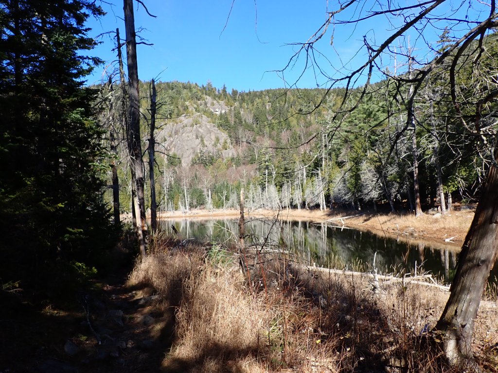
The hike to the second campsite along the Phelps trail (near Deer Brook Lean-To, about 1/3 of the way to Howard Lean-To, where I camped in October) was pretty quick and I made short work in setting up camp and cooking myself a nice hot meal in the dark. After cleaning up, I was in my tent at 8:15pm before another long day on Saturday.

FATMAP Route (Giant & RPR only)
Garmin GPS Data: Giant & RPR | Garden to Deer Brook
Day 2
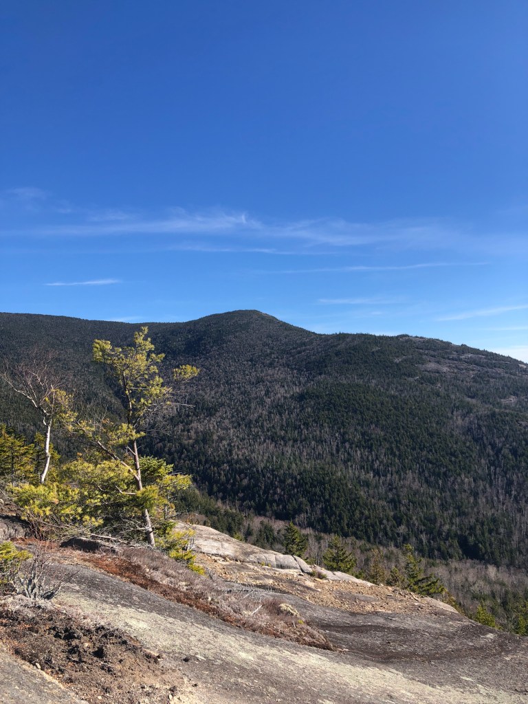
I woke up at 5:30am and was on the trail at 6am. The plan for this hike was to hike up Big Slide Mountain first, before descending and heading up Lower Wolfjaw. The trail to Big Slide followed the same initial path northwest as the one I took to get to Basin the month before, turning up the Slide Mountain Brook trail upon reaching Big Slide Brook. I got to the brook at 7am, refilled my water bottle, and the sun started to rise as I began working my way up. It took just under two hours to hike to the summit from Phelps trail. Close to the top, near the Brothers trail junction, I met another hiker, Chris, who was very friendly and we had a good conversation as we made our way to the top and relaxed at the summit (#12 ADK High Peak). It was quite windy but luckily there was quite a lot of sheltered spots to fire up the camp stove for an oatmeal breakfast.


After about 50 mins, I began heading down and got back to the Phelps trail after a further 90 minutes. I then began heading east on the Phelps trail before dipping onto the South Side trail which led to the Wolfjaw trailhead, where I had descended from Upper Wolfjaw a few weeks previously. The hike up was a bit slower than I had liked; all the hiking from the last 24 hours was really starting to catch up to me, but I kept one foot in front of the other, and gradually made my way up to where the trail split between Upper and Lower Wolfjaw. I ran into a few interesting people on the way up – most notably a couple of ladies, one of whom correctly guessed I was Canadian because of my “lumberjack” mustache (turns out she was asking everybody on the trail if they were Canadian, haha).
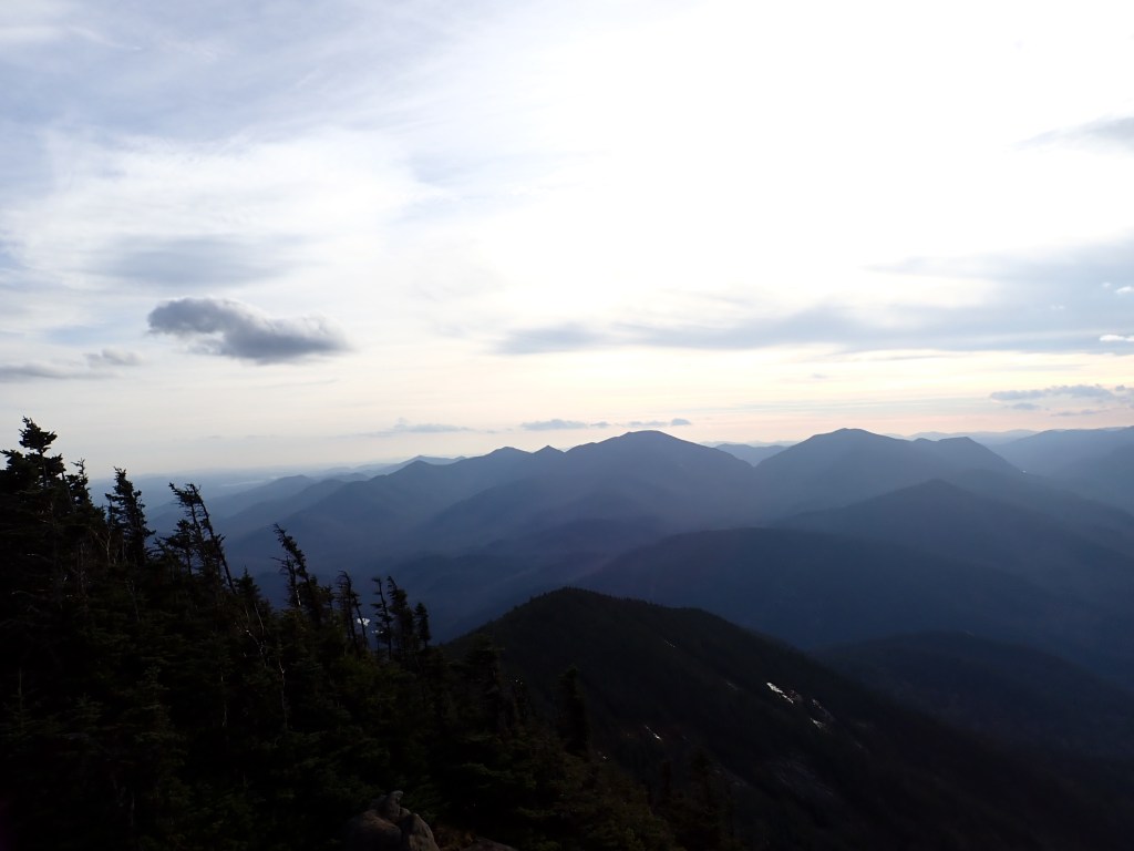
The trail up Lower Wolfjaw from the junction was only half a mile long, but oh boy was it a doozy. A decent amount of low exposure scrambling up the rocks, gaining a pretty sizable 200m of ascent. Was pretty fun but also quite tiring, it seemed to never end! Eventually I made it to the summit at 1:15pm (#13 ADK High Peak), where it was starting to spit rain. The views weren’t the greatest due to the cloud, but still was worth the tough climb. I quickly cooked up a nice hot meal on my stove, and was starting back down the trail after 30 minutes.

It took just under 75 minutes to reach the South Side Trail, and I was back at my campsite just after 4pm, after over 10 hours on the trail. Due to the weather starting to turn, and knowing that it would be a wet overnight, I had decided to head back to Toronto that night as I was heading up Lower Wolfjaw. I didn’t make as good time as I thought I would, but given that I could be home before 1am, I figured it was worthwhile. So, I packed up my camp in under 20 minutes and was back on the trail. The hike back to the car was very uncomfortable – my feet felt like they were being scraped on a cheese grater every step. But luckily it was only a 1.9km, flat-ish hike so it wasn’t too bad. After getting changed and packing everything into the car, I was on the road and got some great views of Whiteface Mountain on the drive out. Before long it was dark, but made really good time on the drive and got through the border with no issues. After a quick A&W stop as well as grabbing coffee and gas, I made quick work of the remaining drive, making sure to blast music and sing along to make sure I didn’t nod off. Got a bit of rain as I entered the GTA but overall things went smoothly and I got home earlier than planned (much to the delight of my cat) at 1am.
FATMAP Route
Garmin GPS Data: Big Slide & Lower Wolfjaw | Deer Brook to Garden
Overall, a pretty solid two-day trip! I don’t know if I would do an ADK trip in two days very often but it is nice to know I can pound out a lot of kms on the trail and still have the option to return home early if needed. With this trip I now have completed over a quarter of the ADK 46 High Peaks, not too shabby!
