The first weekend of April had me back in the Adirondacks for more winter-esque hiking (winter officially done on the 21st of March, so none of these peaks would count as winter summits). Still, a ton of snow up high, so I needed to approach these hikes like it was winter. More mileage in my snowshoes!
The weekend’s plans were to tackle the Santanoni range (Santanoni, Panther and Couchsachraga Peaks) on Saturday, followed by Mount Marshall (part of the MacIntyre range) on Sunday. The weather was to be mild and rainy on Saturday, before cooling down on Sunday. A bit of snow leading up to the weekend as well. Decided to try a bit of a different approach and drive to NY directly from work on Friday, meaning I could get a full day to tackle the Santas on Saturday and not have to take a day off work.
The Santanoni range is a bit more isolated from the rest of the High Peaks and is not visited often. Its trailhead is near Upper Works, in the southwest part of the High Peaks Wilderness Area. The Santas are often done as a loop, with small offshoot trails to each of the three peaks, with the Santanoni Express trail usually used to ascend and the Panther trail to descend (though the latter is very common as well). A lean-to is situated near Bradley Pond for camping, though I elected to stay at an AirBNB in nearby Newcomb for the weekend.
Marshall is the shortest and southernmost of the four MacIntyre High Peaks, and is a bit isolated from the other three, which are usually done together. It doesn’t have a marked trail but rather two fairly straightforward herd paths (Herbert Brook and Cold Brook) running in parallel, meeting near the summit. The northern (Cold Brook) trail also features a detour to allow the opportunity to see the remains of a plane crash which took place in 1969. Marshall can be approached from either the Upper Works trailhead or the Loj; it is approximately equidistant from either. Because I was staying in Newcomb, the Upper Works start point made the most sense.
Day 1
I got up early, having gotten most of my stuff ready the night before, and headed off to Oshawa, about 35 mins east of Toronto, for a swim at the community center before a full day in the office. Really productive day – while out shopping for some hardware at RONA for a project, I stopped by Sail to try and get some moleskin, as my stash of moleskin is really old and starting to fall apart. They didn’t have moleskin unfortunately, but they still had a 50% clearance sale on for winter gear, and I scooped a sweet pair of hard shell pants which were normally $600 for a really good price! These ended up being very useful for this trip!
I left the office at 3pm, and started further east to the Ogdensburg bridge to the USA. I stopped for food and gas and made really good time across the border. After about 40 mins in the USA, the weather quickly became snowy and the roads for the last couple hours were very icy and snow-covered, so I ended up taking a little longer than I’d like. Biggest scare was when a deer walked out in front of me when I was on an icy road – luckily it was far enough away that there were no concerns, but it got my heart rate up a bit!
Eventually, at around 9:30pm, I made it to my AirBNB in Newcomb, the Inn at Santanoni! This was a house with a shared kitchen, bathrooms and common area, with a bunch of private rooms. Really cute little place, and very easy to check in. Highly recommend! I was staying in the Belden Pond room, which was quite small but good enough for me. I got organized for my hike the next day, did a bit of work, and went to bed.

Day 2
Saturday was a significantly later start. Since I was staying at an AirBNB, and sunset was around 7:30pm, I decided to aim for a 9am start for the Santanoni Range, since I was expecting a roughly 10 hour day. So, I got up at around 7:30am, and was out the door at around 8:15am. The weather was forecasted to be rainy for the morning before clearing up in the afternoon, with balmy temperatures of around 10°C at the base (trailhead) for Santanoni (a bit cooler up high). There was also a decent amount of rain the night before, which meant a lot of the snow had washed out, so the drive to the trailhead was a bit easier. I strapped on my snowshoes and began my hike just before 9am.
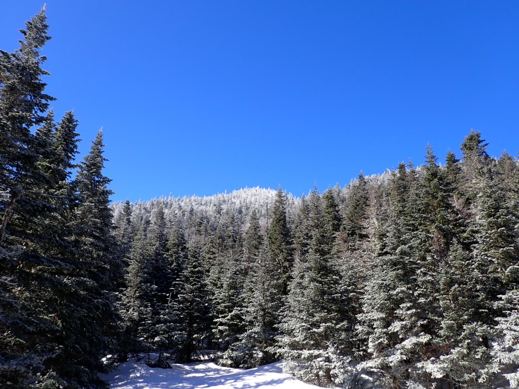
The Santanoni Range hike starts with a nice flat 2.8 km approach along Santanoni Road before another 3.2 km on the Bradley Pond trail. Initially I thought you could drive on this road all the way to the Bradley Pond trail, but you can pretty much only do this in an ATV I imagine. I covered this stretch in just under 1 hour 50 mins. Here, you can choose one of two paths up the mountains – continue along the Bradley Pond trail past the lean-to, before heading up the Panther trail, or take a path through the woods along the Santanoni Express. As you might imagine, the Express effectively takes you straight up Santanoni Peak, and you would then head north to the other two peaks, while the Panther trail gets you to Panther and Couch first. The Express is a bit steeper, so I elected to take that trail up the mountain and take the more gentle Panther trail down.


Unfortunately, it became clear very quickly that no one had been on the Express in a while, or a ton of that rainfall from the night before fell as snow on the trail (being at a higher elevation). There was a very faint trail that was manageable to follow, but the snow became very deep the further I climbed, and eventually I was bushwhacking up very steep terrain with snow up to mid-thigh. At one point I got stuck in a spruce trap, but luckily it was only up to my waist and I was able to get myself free. Spruce traps are very scary especially if solo, as you can fall quite deep and be unable to free yourself without help. I later learned the next day that there are a TON of spruce traps between Santanoni and Panther.

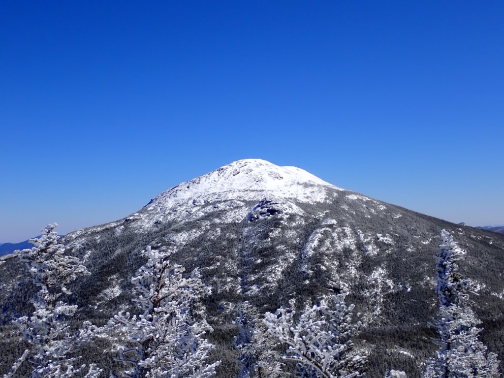
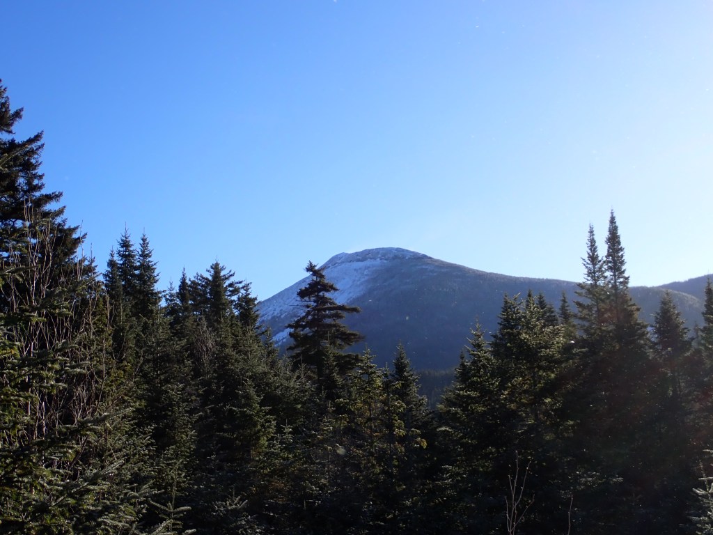
Eventually, after 1.7 km and over 3 hours on the Express, I got to a more flat section of the trail where I was greeted by the imposing Santanoni Mountain. At this point my heart sank – I could not believe that I still had so much further to go to the summit, and ahead was a completely open area of terrain with what were almost certainly buried trees and shrubs – prime spruce trap terrain! At this point I had been on the trail for 5 hours, and still had at least 2 hours of hiking to the summit of Santanoni. Based on the fact the terrain looked very dicey, and the amount of time I had spent so far, I decided to play it safe and turn around after a quick break. I probably could have gotten up Santanoni, but I would probably have had not enough time to get to Panther and Couch, which would mean I would have to return to bag the last two. If I had taken the Panther trail up, I likely would not have gotten Santanoni. Tough pill to swallow, but one of the most important things about being in the backcountry is to know when to turn around.

My descent was very quick as I now had a trail to follow! No difficulty getting back to the car – it took me exactly three hours from my turnaround point. The weather was absolutely gorgeous and mild for the back half of my hike – I removed most of my layers and it was very enjoyable. This trail is actually really nice in the winter, I look forward to coming back to get these three summits on a broken out trail!

I returned to the AirBNB and did a bit of homework on my plan for the next day – Mount Marshall. I was concerned I would run into the same issue as on the Santas as the Marshall trails are not marked, but I decided to at least give it a shot since I had no summits on Saturday. Thus, I got my pack ready, loaded most of my stuff into my car as I would check out early the next day, and was off to bed at 9pm.
Day 3
I got up at 4:20am, and was quickly out the door, after triple checking I didn’t leave anything behind. The weather overnight had dropped considerably in temperature, and it was roughly -10°C in the morning. In addition, it had snowed a little bit as well, with a couple inches of fresh powder.
The drive was smooth to the Upper Works trailhead, and I began my hike at roughly 5:45am. Much like the Santanoni hike the day before, it started off with a very flat, 7.5km section of trail which followed the Calamity Brook and went past Flowed Lands. This was the first ADK trail I had hiked on way back in July, so it was cool to see it in the winter. The trail was in excellent condition, though the snow was a bit soft under a crusty top layer which meant I sunk a little bit with each step. Eventually, after about 2.5 hours of hiking, I reached the Herbert Brook Trail, which was my path up to the summit of Marshall. I made a stop at the Herbert Brook Lean-To, which was very close by, and stashed one of my water bottles to cut a bit of weight. Then, I started up the trail.

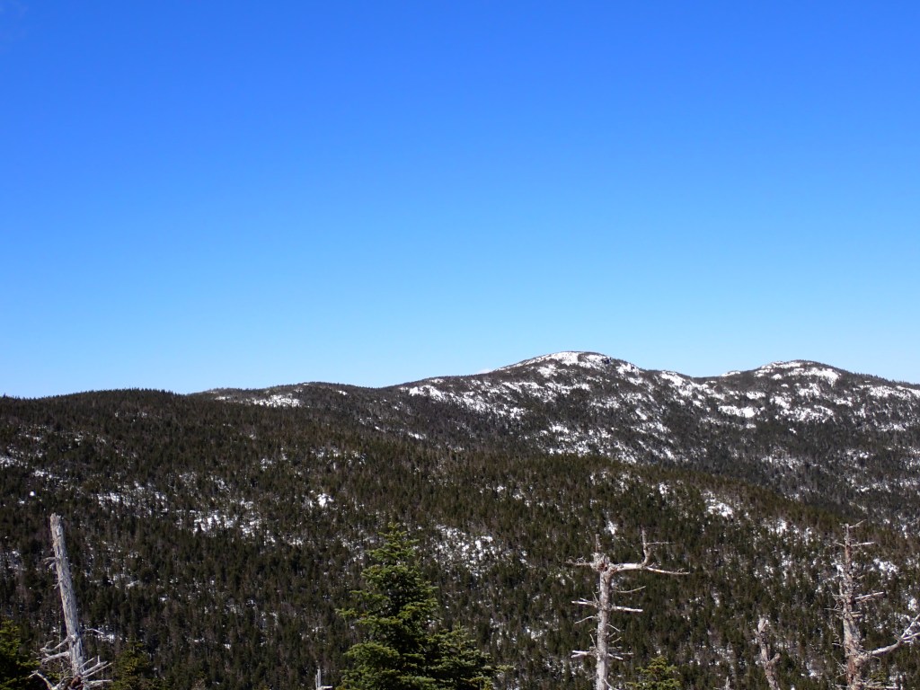
Thankfully, the Herbert Brook trail, which follows the brook it’s named after, was broken out by someone who appeared to have been up Marshall the day before. I was very pleased to have a trail to follow! Unfortunately, there were a few wrong turns leading to dead ends, but generally the trail was very easy to follow. It was a pretty fun trail, not too steep but still a solid workout, very pretty with the winter scenery. Eventually the forest thinned out as I approached the highest parts of the mountain, and I was greeted with some incredible views of nearby peaks, including Iroquois!
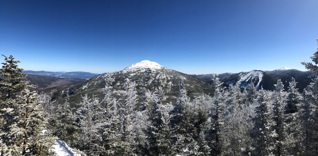
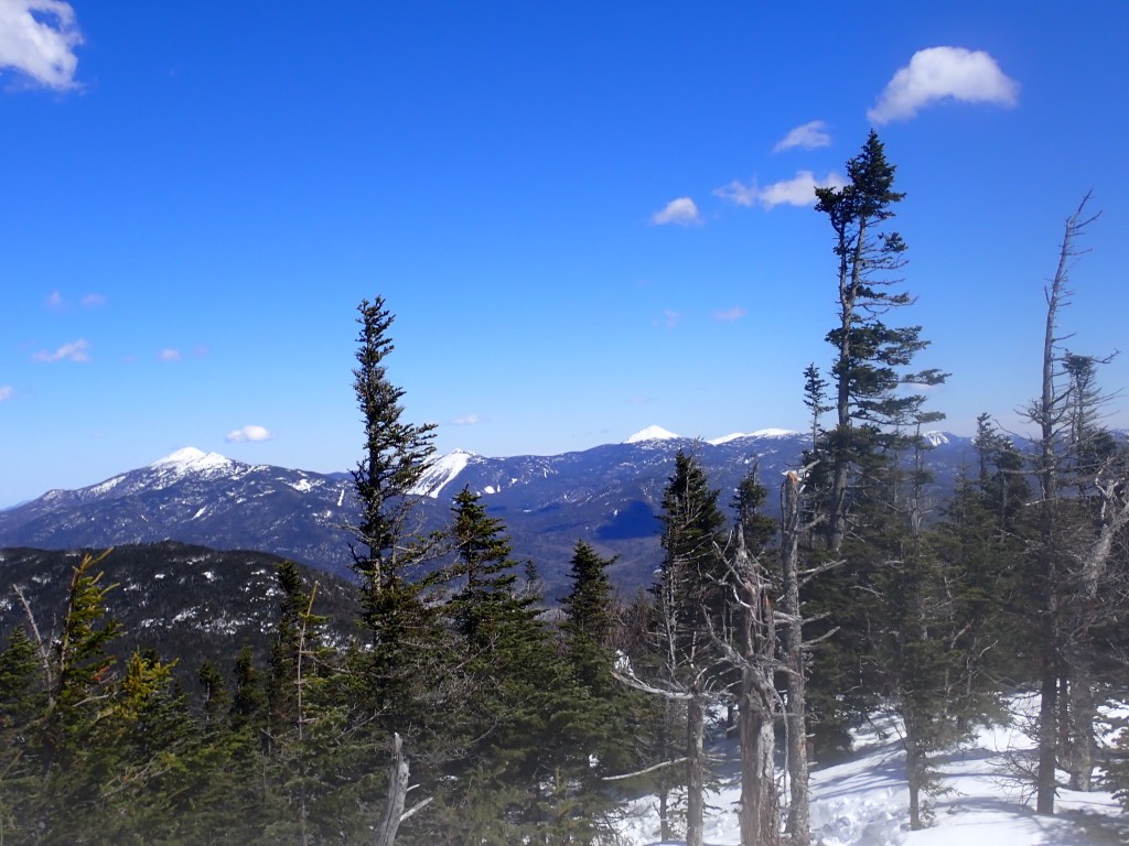
The trail disappeared a few hundred feet below the summit, and I spent a few minutes walking back and forth, until I spotted it resuming a little ways away. So I forged through the unbroken snow and was, rather sooner than expected, at the summit of Mount Marshall, my 23rd Adirondack High Peak, putting me at exactly half of the High Peaks completed. Very happy to get a summit after the previous day’s disappointment! I hung out at the summit for about 10 mins for a quick snack, and started back down, about 5 hours after starting my hike and before my planned turnaround time of 11:45am.

I got some great photos on the way down, and was happy to finally enjoy the descent after a long climb up. I love hiking down in the snow because the trail is really easy to follow – I guess if there was a lot of snowfall or wind tracks can get covered easily, but no such thing this time. I encountered a bunch of friendly folks on the way down, who had gotten off track on the way up Marshall and gotten stuck in very deep snow. They must have followed another false trail! Really good to see people – these were the first I had seen the whole trip so far! The descent to the lean-to was smooth, and I took a good long break here to catch my breath, refuel, rehydrate, and enjoy the view!

Met quite a few more people on the way back to Upper Works trailhead, including a few Canadians, as well as a few people who had recognized me from the Adirondacks Trail Conditions Facebook group (I had posted about my Santanoni misadventures the day before and inquired about Marshall). The hike back to the trailhead was really quick and I made great time, though unfortunately the moleskin I had applied to my heels slipped off partway, and I started getting blisters. It became quite painful towards the end of the hike! In addition, it had really warmed up in the afternoon and the snow was very soft and wet, causing me to sink a bit more than before. In addition, I was nearly rolling my ankles on the sides of the trail, which were not as compacted as the center, thus I had to be careful to tread directly in the center of the trail. Eventually, I stumbled into the parking lot after nearly nine hours of snowshoeing. I quickly got changed and hit the road. The drive was very smooth on the way back – I made a couple stops for gas, food, and coffee, and hit no major traffic spots. Even the Don Valley Parkway was kind!
Overall, a moderately successful weekend. A bit of disappointment on the Santanonis, but it was definitely a good learning experience, and I’m confident I made the correct decision to turn around, given the time and the fact I was alone. But overall, I liked that trail (super quiet and remote) and I look forward to returning to get my revenge! Marshall was a really long, but fun hike. I really like the Calamity Brook trail, it’s a nice smooth path in the winter, and the Marshall trail was really enjoyable as well, and the views were fantastic near the top. I think I have a couple more hikes here to round out the High Peaks in that area (Allen, Redfield, and Cliff, as well as the rest of the MacIntyres) so I’m excited to return! This will probably do it for winter(-esque) hiking for now. Unless there’s a decent cold spell or the trails manage to hold in April, I will probably be next back in the ADK in late June/early July to begin the last half of my 46!