June 2023 saw me resume my Canadian High Points mission with two more provincial high points in Manitoba and Saskatchewan. These two would mark the last two of the “easy” or lower elevation high points, as all the other high points at the top of the list require technical climbing and/or long, expensive trips.
I had also never been to Saskatchewan before, so I made sure to add on a few places around the province and spend most of my trip there. My main focus would be southwestern Saskatchewan – there are some great multi-day backpacking spots further north near Prince Albert that I unfortunately could not fit into my itinerary for this trip. My trip plan was to spend roughly half my nights camping and the other half in AirBNBs/motels, alternating between the two. I kind of enjoy changing places every day!
After I started writing this post, I decided it was best to split this trip into three shorter, more digestible posts as I ended up with an action packed trip! This first installment covers my arrival in Saskatchewan, my brief visit to Duck Mountain Provincial Park and the Manitoba High Point, and my stop in Saskatoon as I made my way west across the province.
You can check out Part 2 and Part 3 here.
Day 1
My first day got off to a bit of a rough start. Work was insanely busy the week leading up to my trip so I didn’t have much time to pack (or even make any bookings for accommodations!) until right before I left. As a result, and also thanks to some obnoxious traffic getting to the airport, I missed my flight which was originally scheduled for 2:20pm. Luckily, there was another Air Canada flight which was leaving at 6pm, and there were seats left, so I was able to hop on that flight.
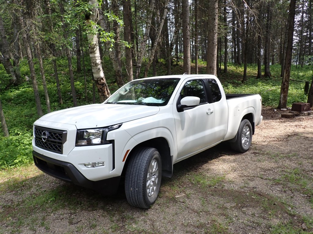
Flight was smooth and actually slept a bit on the plane as I was very exhausted from the previous week, and we landed at 7pm local (Mountain) time in Regina. This marked province number 9 for me visited, with only Newfoundland & Labrador left (next year?). I also unfortunately missed out on the smaller car I had reserved at the airport, and ended up in a Nissan Frontier, which is a small pickup truck. I always wind up driving massive rental cars! The truck was surprisingly easy to get used to (I drive a Chevrolet Spark which is pretty much half the size of the Frontier) and navigate the streets of Regina to my AirBNB. The Frontier gets about 850km on a tank of gas, but has slightly worse fuel economy than my Spark (understandably) but not bad for a truck! As I found out later, it turned out to be a good thing I ended up with the Frontier.
My first AirBNB was in the basement of a home, and the hosts were very helpful and accommodating. I made a stop for food (picked up a ton of snacks, stuff for wraps – for my first few meals, as well as some pasta and lentils for my camp stove meals) but unfortunately couldn’t get to the outfitter (Cabela’s) for stove fuel and Bulk Barn (for dried vegetables) since I arrived so late. I spent the evening planning out a few things for the next couple days and watching the Arnold series on Netflix. Was really good!
Day 2
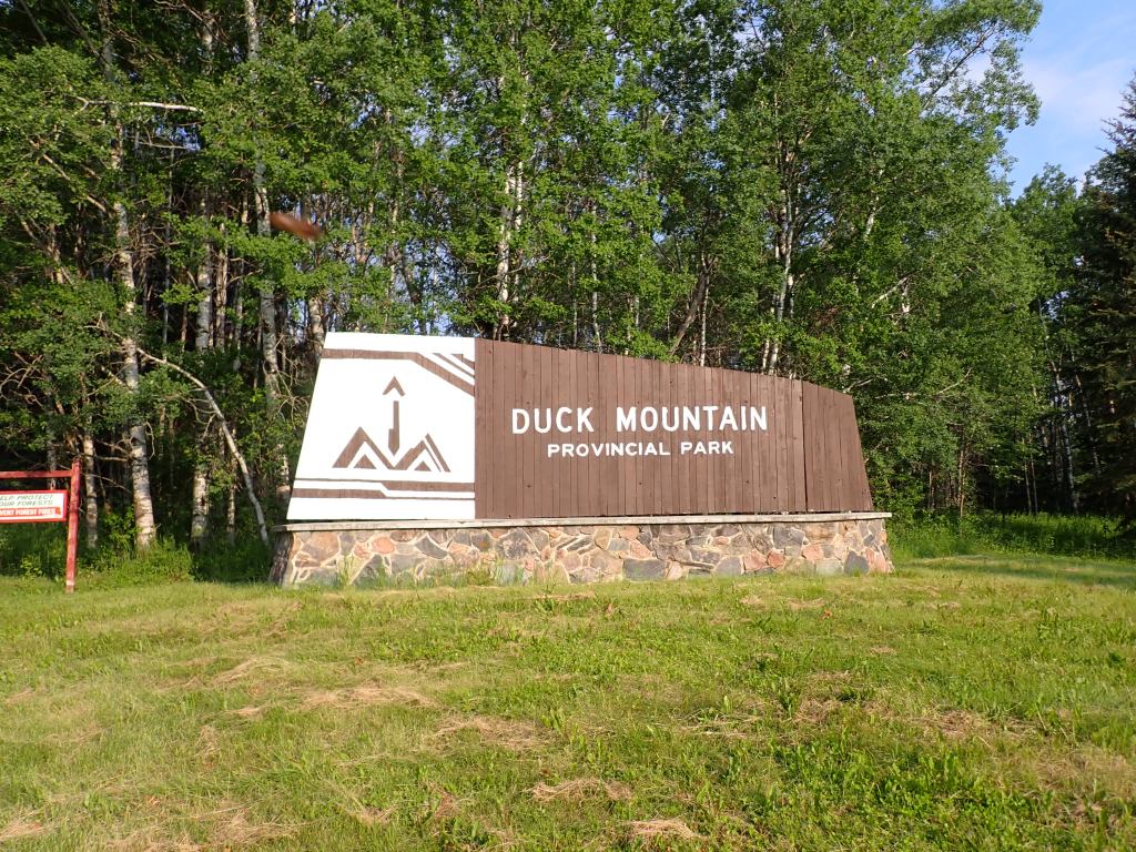
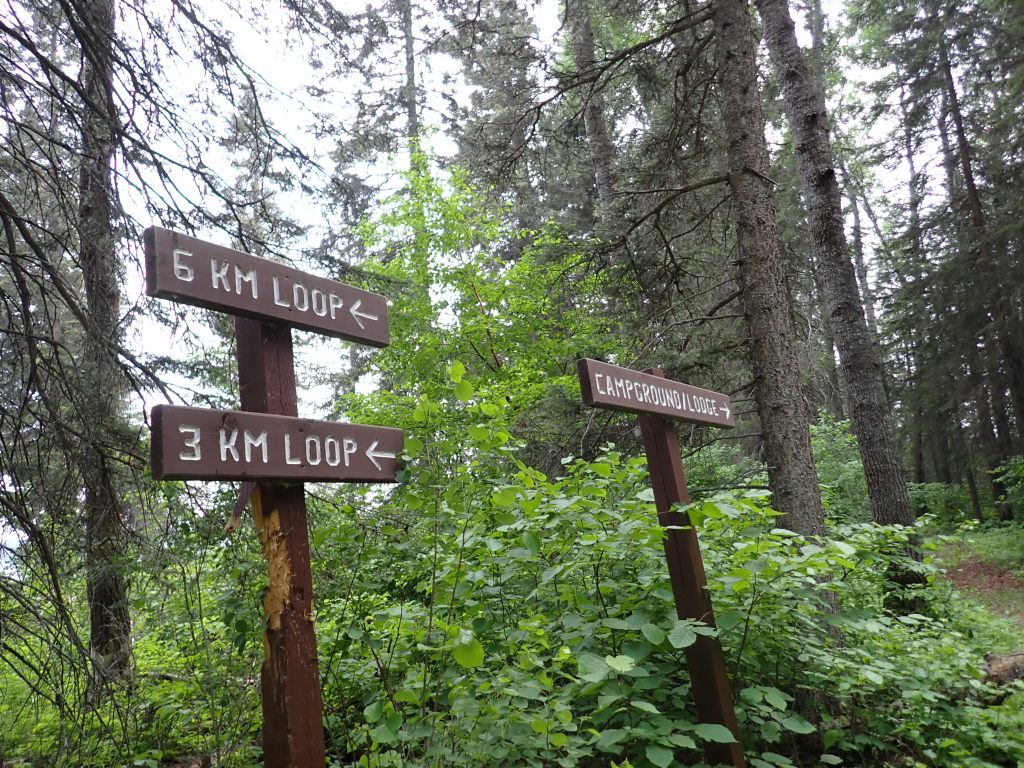
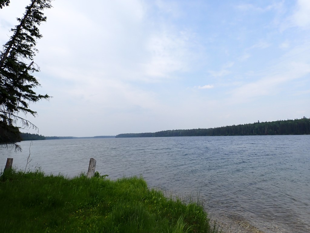
My first stop after Regina would be Duck Mountain Provincial Park, where Baldy Mountain (Manitoba high point) is located. The plan was to camp one night at Childs Lake, and do a few hikes in the afternoon/early evening as well as the following morning. After stopping by Cabela’s for a small canister of JetBoil fuel, the drive was pretty uneventful and I didn’t even notice when I crossed over into Manitoba. Probably my favorite spot was when I passed the Lake of the Prairies, which ended up being just after crossing the border.
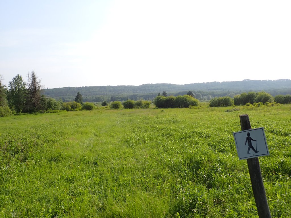
As soon as I arrived at the park, I noticed the truck being pelted by large insects which looked suspiciously like horseflies. I sprinted to the park office and signed in, and it was confirmed they were. They seemed to be more interested in the truck than me though. I found my site right near the swimming area on Childs Lake and got set up for a quick hike on the Childs Lake trail, which follows the northwest side of the lake as a loop. This trail is also quite popular in the winter for snowshoeing and skiing. I also realized that there were a TON of mosquitoes at the campground, so I donned my bug net for the hike and made sure to put bug spray on any exposed skin.
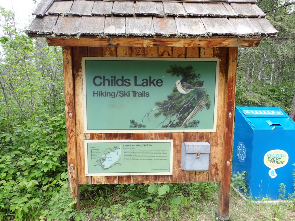
The trail, other than the bugs, was pretty fun! Fairly flat and wide, easy to follow, and not too much obstacles other than a few roots and downed trees.
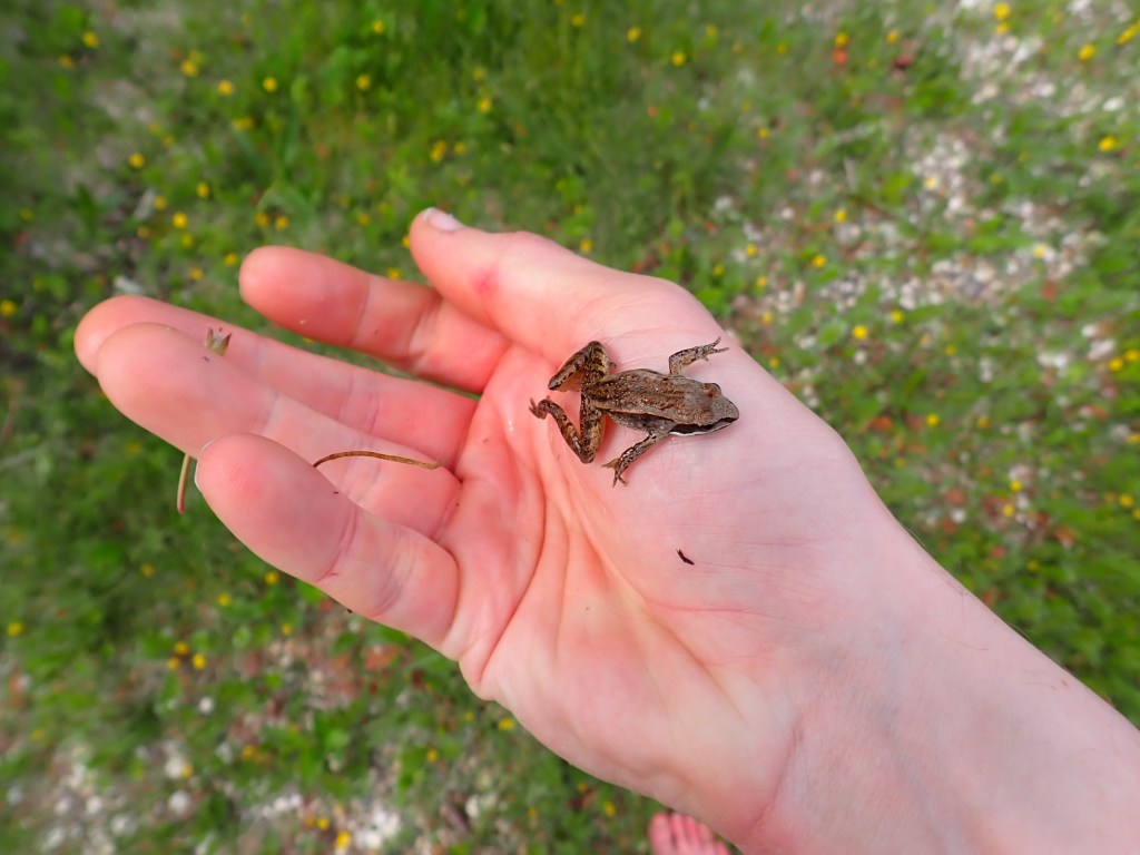
I made excellent time to the top of the loop in just under an hour and enjoyed some wraps by the lake. I even took off my trail shoes and socks and dipped my feet in the water. I also caught a small frog and released it after taking a picture (of course!).
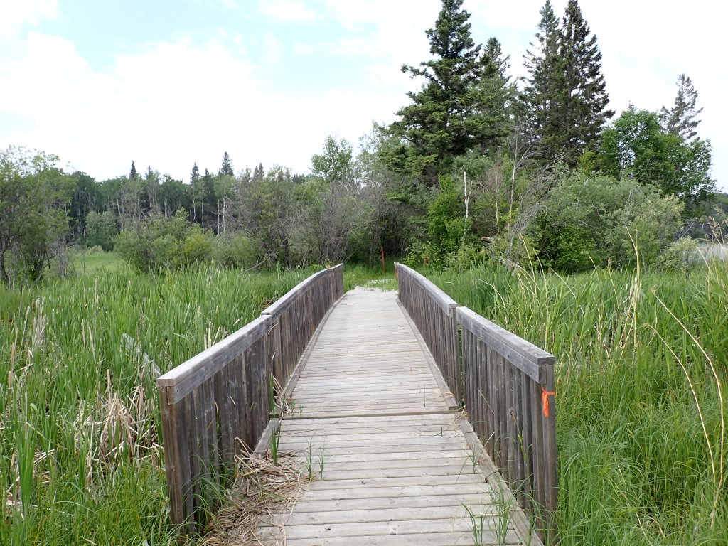
I took the western part of the trail for the return, which was a bit more overgrown but still made great time. I got back to the start and made my way back to the campsite, and immediately hopped in the truck for another hike – Shell River Valley – which was about 20 mins west down the main road. When I arrived, I was greeted by a horde of horseflies, and quickly realized, to my horror, that my camera was gone! I had recently bought a pouch to hold my camera and had attached it to my belt, and it appeared to have broken and fallen off at some point! I quickly turned around and went back to Childs Lake and retraced my steps along the Childs Lake trail, knowing I definitely had my camera with me after I took a break. I quickly found it about 500m from the trailhead, confirming that the strap did indeed break.
I then went back to Shell River Valley trailhead, and started my hike there. This trail was a bit more overgrown than Childs Lake, and it was a bit tricky to find the start of the trail. After a short climb to the viewpoint, I began descending, heading what I believed was in the counterclockwise direction. This trail is not visible in FATMAP and I do not have AllTrails Pro, so I was only relying on the paper map from the park office.
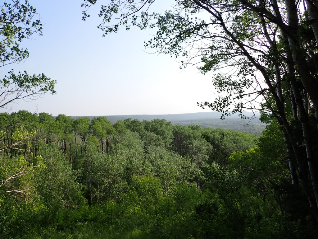
At one point the trail emerged from the forest into a meadow which ended up being a bog where my feet sunk ankle deep in mud. I decided to turn around and retrace my steps back to the trailhead at this point, since it was also hard to see the trail. Still, a decent hike!
I returned to the campsite, with the plan being to take a dip in the lake to cool off (was quite warm and sunny on the trail, so I was a bit sweaty!) and then jump back in the truck to catch the sunset at the summit of Baldy Mountain! The swim was quite refreshing and it took a while to get used to the cold water! I took off at about 8:15pm and it took 45 mins to get to Baldy Mountain, at the far southeast of the park.
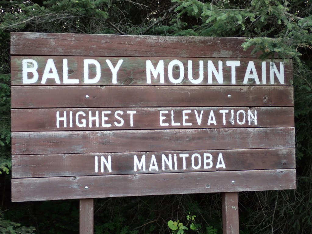
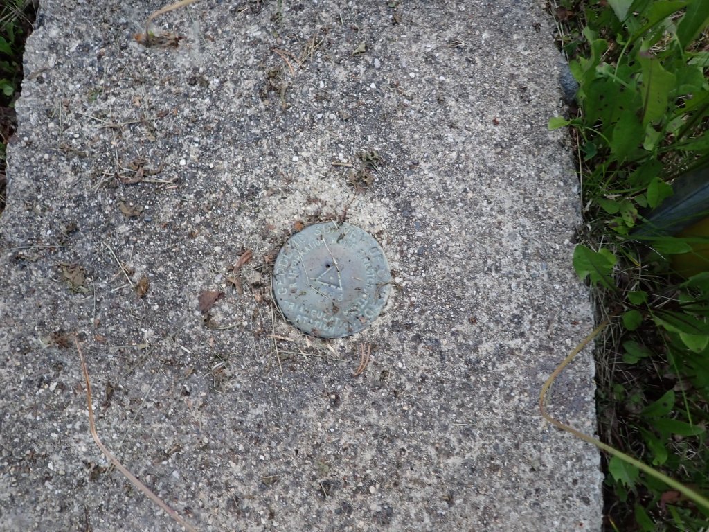
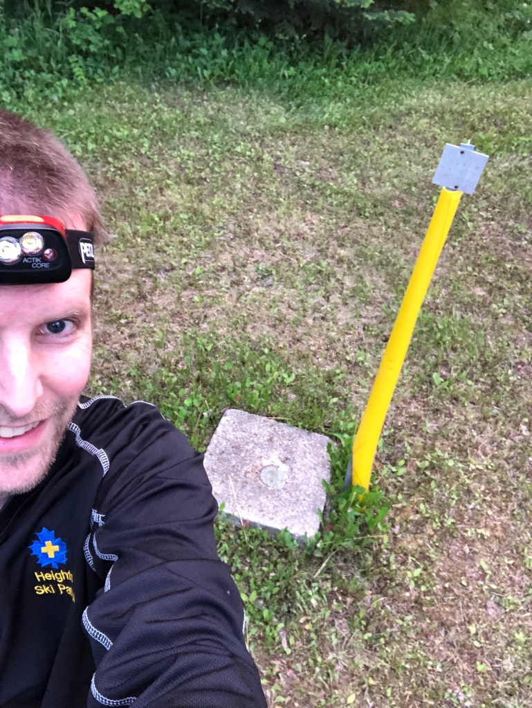
Baldy is a drive up summit at 832m above sea level, and I decided to park by the sign indicating the side road leading to the summit, and hike 10 mins on the gravel road. It was a very grueling, intense hike (kidding of course) and the bugs were relentless! Glad to nab my fifth Canadian provincial high point. Baldy is effectively a “mountain on a mountain”, as it sits on the massive Duck Mountain, which is a part of the larger Manitoba Escarpment.
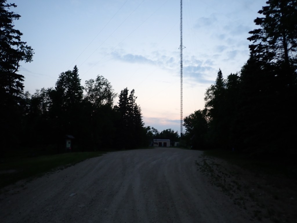
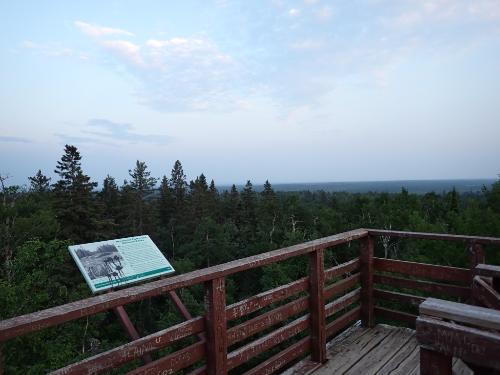
I climbed the viewing tower and saw a bit of the sunset, though the trees blocked a good chunk of it. There were also quite a few informative plaques on and near the tower, describing the geology of the mountain, wildlife, and human activity over the years. I cooked a camp meal on the tower, which was lentils, macaroni pasta, as well as spinach (left over from my wraps), still holding together despite being out of the fridge all day. The bugs weren’t too bad on the tower thankfully, and enjoyed having the tower to myself.

I eventually descended and made double time back to the car while eating the rest of my meal and swatting away the bugs. I got back to camp at around 11pm, a bit uncharacteristic of me as I’m usually in bed by 7pm when camping! After quickly setting up my bivy, it was off to bed. The mosquitoes were swarming the bivy for several hours; they were very loud! Thankfully not many got inside.
Childs Lake Trail GPS Track
Spray Lake Trail GPS Track
Day 3
Day 3 saw me up at around 7am and on the road by 7:20am or so. I decided to forgo eating breakfast at my site or doing more hikes since the bugs were horrendous, and was quickly on my way back to Saskatchewan. I stopped in Kamsack for gas and coffee, and enjoyed the drive by listening to music and audiobooks.

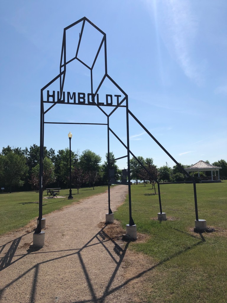
My route had me passing through many small Saskatchewan towns, including Humboldt, where I stopped for lunch at the JCI Spray Park (cooking a camp meal in the shade of a tree). I made sure to call my dad for Father’s Day! Humboldt is well known for their hockey team, which unfortunately was involved in a horrendous accident between their bus and a long haul truck a few years back. There was a another horrific accident just south of where I was staying in Manitoba, where a semi collided with a bus full of seniors. The thing about the roads (such as the Trans Canada Highway) in rural Saskatchewan and Manitoba (and probably also Alberta and northern Ontario) is that they have really high speed limits (100-110km/h) and have “at-grade” crossings where you get on the main road/highway via a four way intersection with stop signs for the side roads only, as opposed to on ramps. It’s quite scary trying to get through these intersections with traffic moving so fast!
I made great time to my next stop in Saskatoon, where I planned to stay at an AirBNB, as well as pick up a few items including hiking shorts from Cabela’s, hand sanitizer, dried veggies from Bulk Barn, as well as a toothbrush and toothpaste which I had left in my Regina AirBNB. Luckily my host in Regina, Olivia, was very nice and offered to hold on to it for me until I got back to Regina at the end of my trip. They were in a toiletry bag which my late grandma made for me, so I was really happy to hear from her.
Unfortunately, the Day 3 bad news (Day 1 was missing flight, Day 2 was almost losing my camera) was that I found three ticks on my legs when I showered at the AirBNB. I managed to get them off, and discussed with my parents. They weren’t attached that long (less than 24 hours) but it was a huge wake up call to check for them frequently. Lyme disease is brutal! I even grabbed some Off! bug spray which works on ticks at Walmart that evening.
Pretty relaxing evening otherwise, made the last couple bookings for the trip (including my Night 4 accommodations!) and was off to bed at around 11pm.

2 thoughts on “Saskatchewan 2023 Part 1: Duck Mountain Provincial Park (Manitoba) & Saskatoon”