Here’s the third and final installment from my June 2023 trip out west to (primarily) Saskatchewan! Part 3 covers my visit to the gorgeous Grasslands National Park and Big Muddy.
You can check out Part 1 and Part 2 here.
Day 7
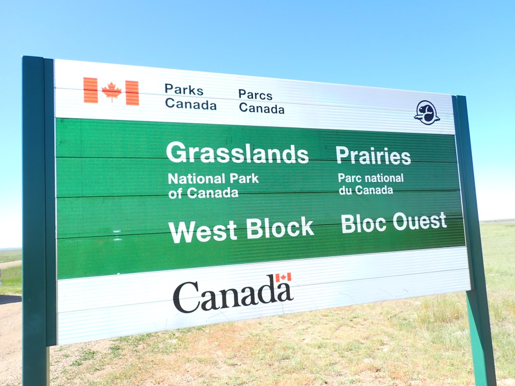
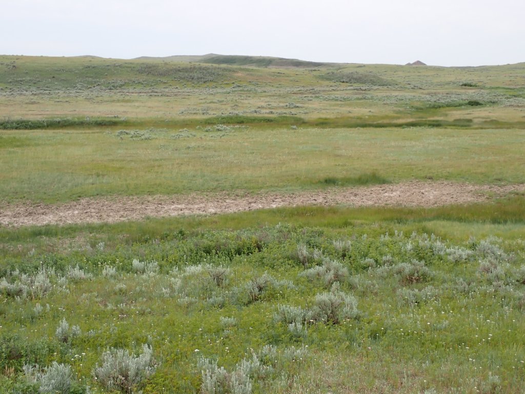
I was up pretty early, around 6am, and it was super bright out already. I quickly packed up and hit the road, heading south to my next destination, Grasslands National Park! This park is the only one of its kind in Canada that consists of prairie grasslands, an ecosystem that has largely been depleted over the years. It contains a wide range of unique flora and fauna, many of which are not found anywhere else in Canada. There are also a number of historical and archeological features that can be viewed at the park, giving a glimpse into the lives of the people that made this area their home in the past.
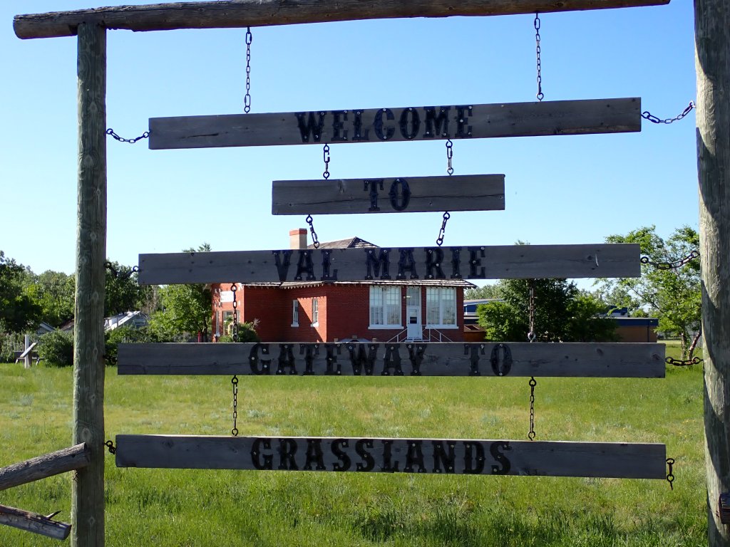
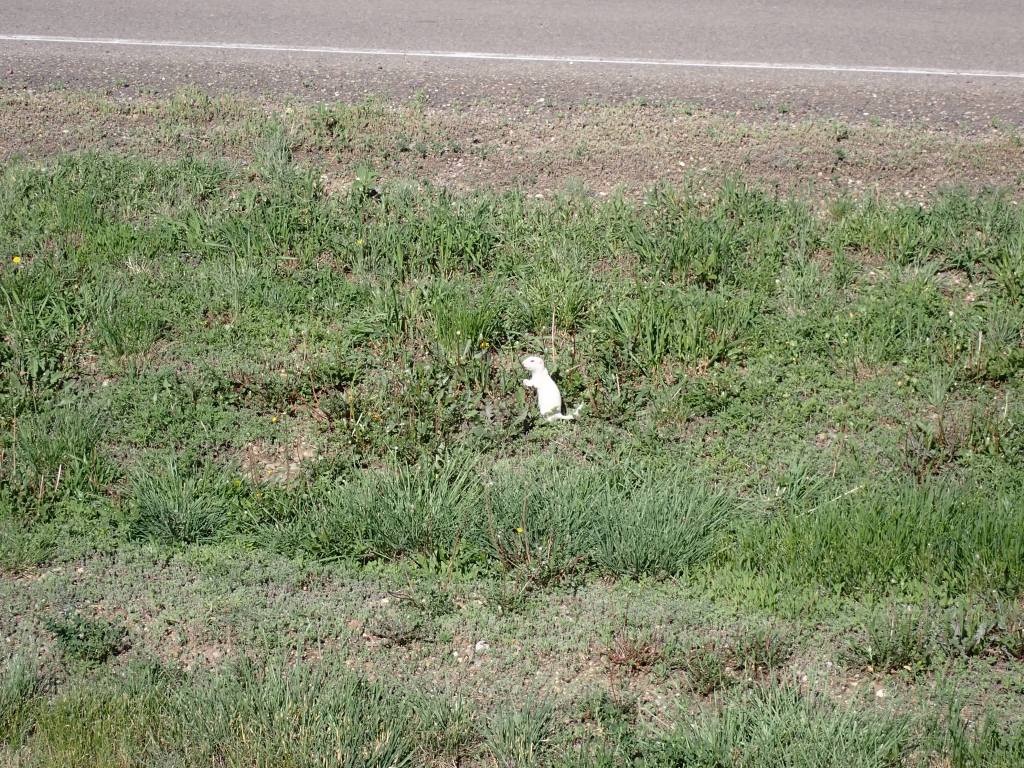
The first part of the drive was very foggy, so I had to lower my speed and put on the four way flashers for a bit. Luckily, there weren’t too many cars on the road and no wildlife (other than the odd Richardson’s Ground Squirrel or gopher) jumped out on the road. I will say the gophers were quite amusing – when they’re in a hurry they hop quickly on their hind legs like kangaroos! The route also had me travelling on quite a few gravel roads, which was par for the course at this point on my trip. I arrived at the Grasslands National Park visitor center in Val Marie at 8:30am, about 30 mins before it opened. I filled up the truck and had an interesting time using a more rural style station, with a large tank visible outside. Just outside the office, I saw an albino gopher, and ended up seeing it a few more times while I was in Val Marie.
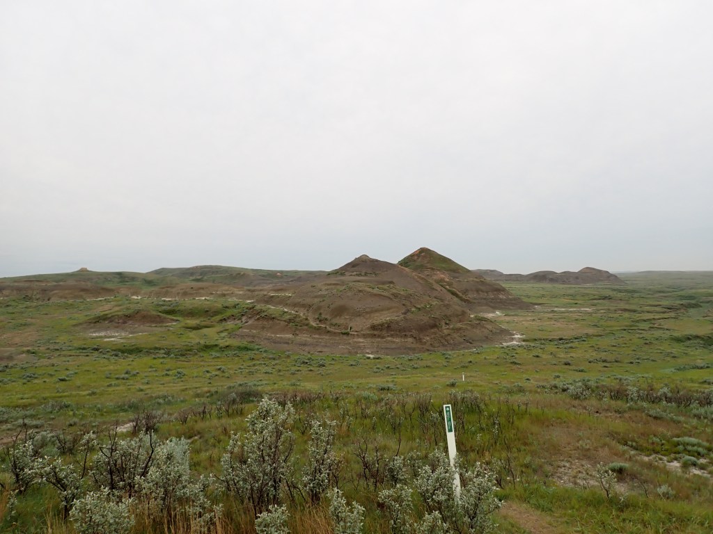
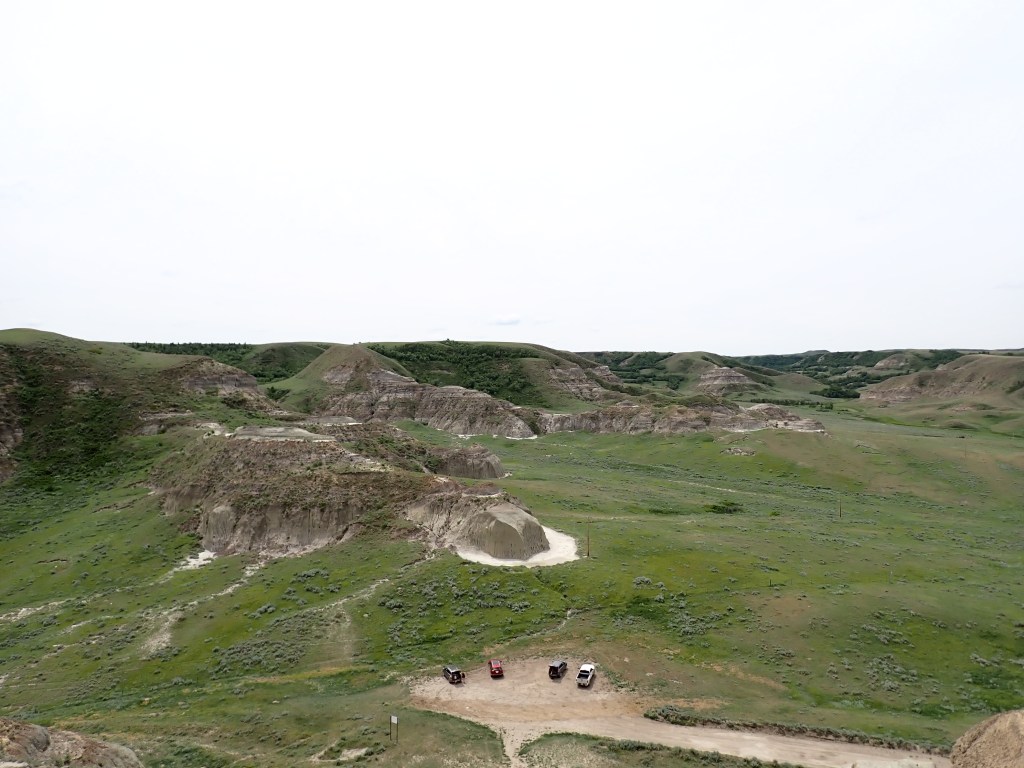
I stopped in and the friendly park staff member suggested I do the Ecotour Scenic Drive while at the park, which is about an 80km roundtrip and features a number of pull off spots along the main road through the west block. One hike I had planned for the day, the Timbergulch Trail, was near the 3rd stop, so I decided to combine the hike with the drive, completing the last few stops after hiking.
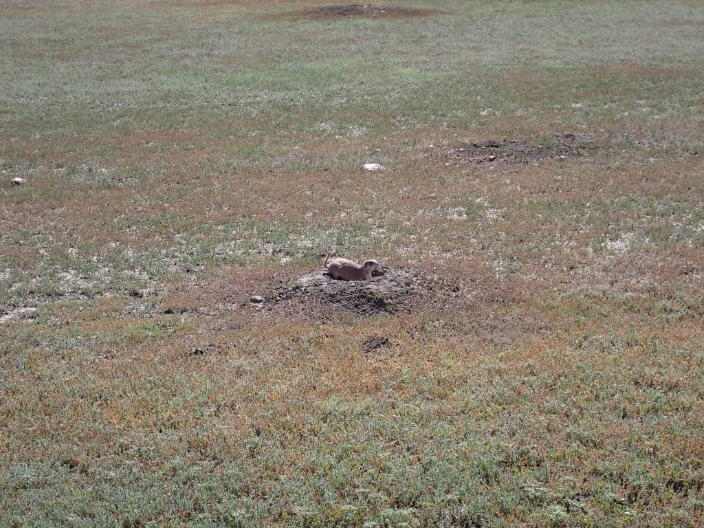
Really interesting learning about the wildlife in the park, and saw tons of prairie dogs and a burrowing owl. The prairie dogs live in fairly large communities known as “dog towns”, of which there are several along the EcoTour. Grasslands National Park and the surrounding area are the only places in Canada that prairie dogs live in their natural habitat! Prairie dogs also serve a very important role in the ecosystem – species like Prairie Rattlesnakes and burrowing owls use abandoned prairie dog burrows for shelter, and a number of predators like coyotes, hawks and rattlesnakes are provided with an ample food supply.
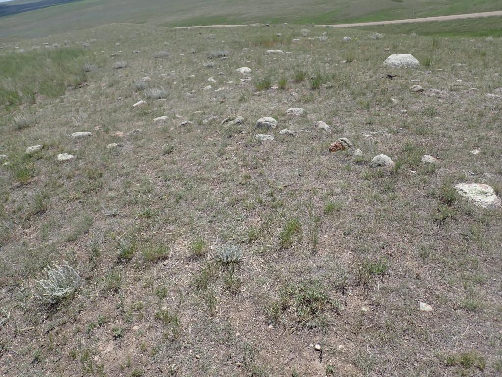
A number of interesting stone alignment features dating back to the Indigenous era could also be seen on the tour, including bison drive lanes and tipi rings. The latter were used to hold down tipi structures (temporary homes) to prevent them from blowing away. Drive lanes were used to funnel bison towards cliffs during hunts, where they were forced to run off the cliffs, rendering them immobile and easier to subdue.
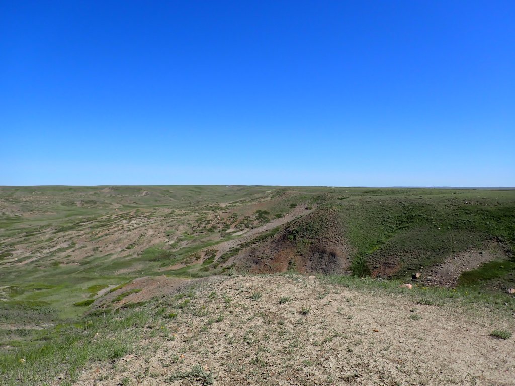
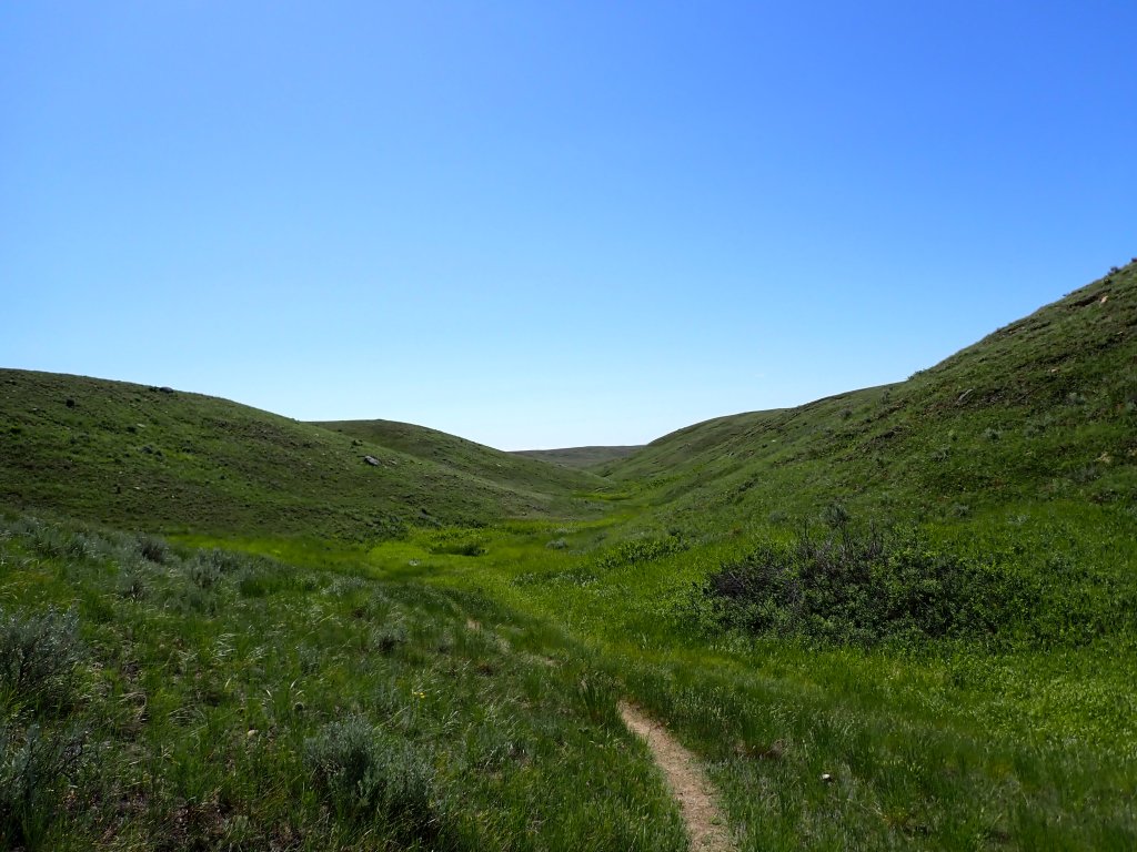
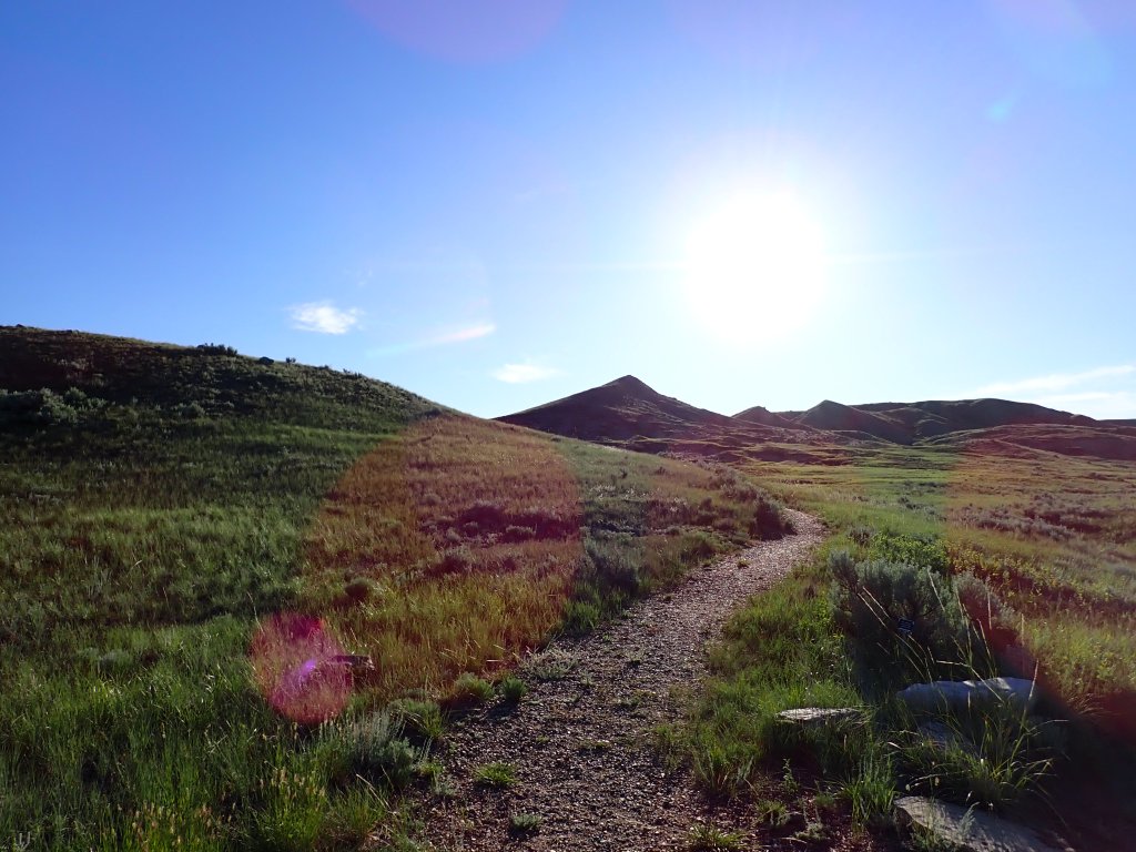
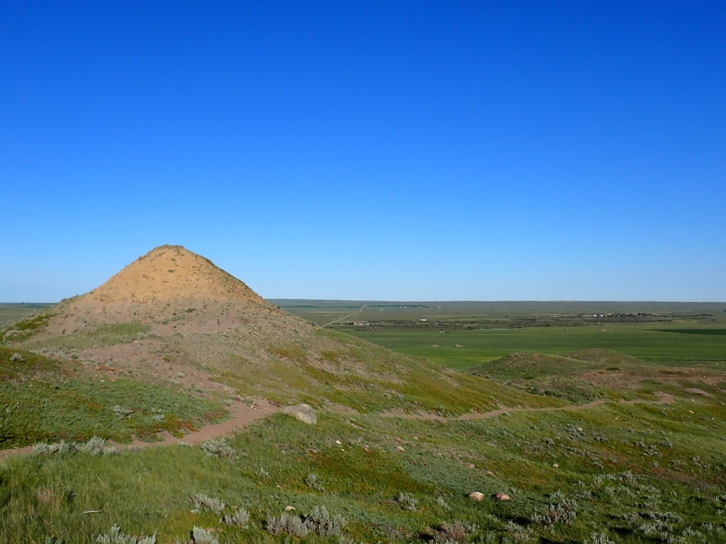
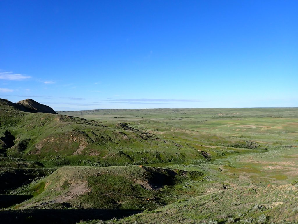
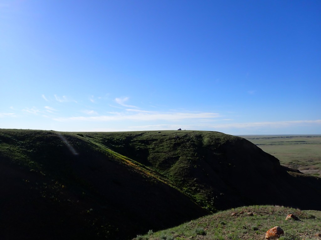
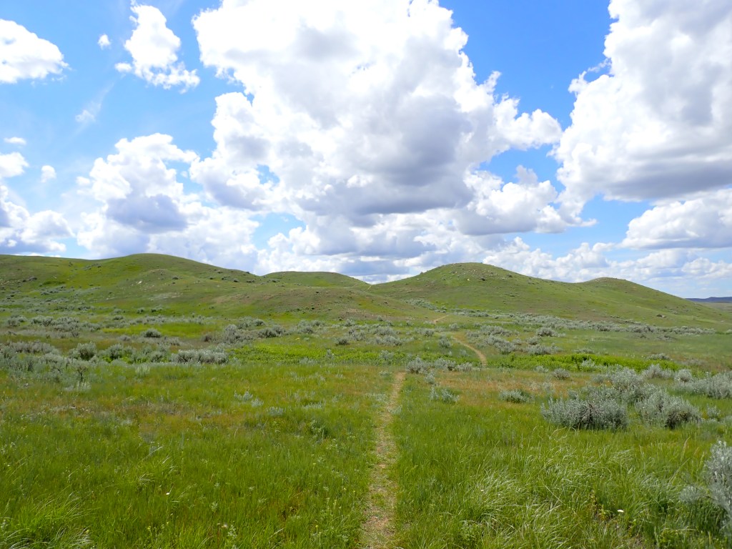
The Timbergulch trail is roughly 15km long and winds its way through the buttes and valleys which make up the terrain in the west block. I opted to go counterclockwise, which is the opposite direction the trail markers are facing. It was a beautiful hike with amazing views, though it was very hot and sunny. I appreciated the clouds that passed in front of the sun every so often!
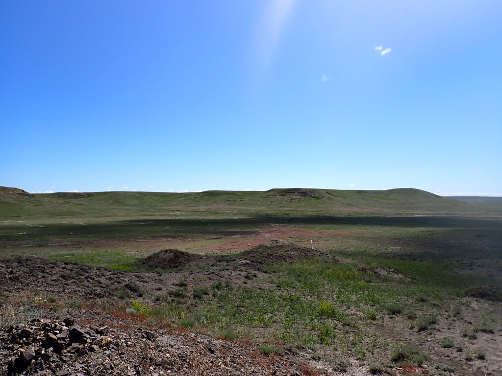
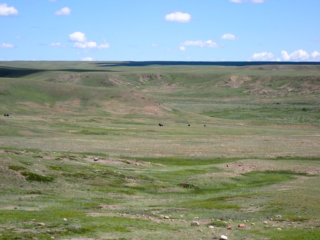
This trail is also great for seeing bison – I did see a few of them from about a kilometer away. Millions of bison used to roam the area until the 1800s, but were quickly wiped out when the Europeans arrived on the prairies. They have since been reintroduced in the last 20 years or so to several areas in Canada, including Grasslands and Banff National Parks. Currently there are around 600 bison in Grasslands! It is advised to stay at least 100m away, as they can get quite aggressive, especially during the time I was there, which is at the tail end of the calving season.
About 10km into the hike, I stopped to make a meal on my stove, a classic go-to on my hikes at this point. I made sure to place my stove on the rocks to cook – the fire danger is fairly high in the West Block so I took all precautions. It was immensely satisfying to get some fuel in me on a hot day! The remainder of the hike was smooth going and quick – the area is so immense, it really felt small being there!
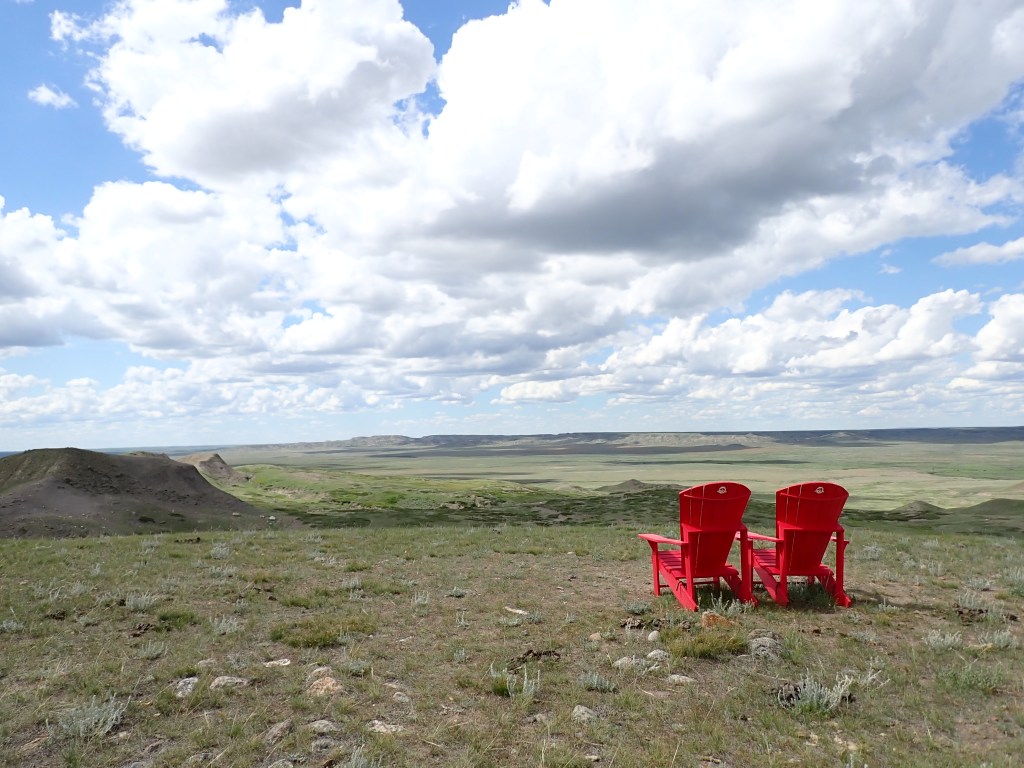
I concluded my hike after just over four hours, and met a couple of senior couples from New Brunswick who were on their way back home after a cross country van tour. Super friendly folks, had some great chats with them at a couple of the subsequent EcoTour stops. The fifth stop featured the remains of an old ranch corral which once belonged to the 76 Ranch, and was set up some time in the late 1800s.
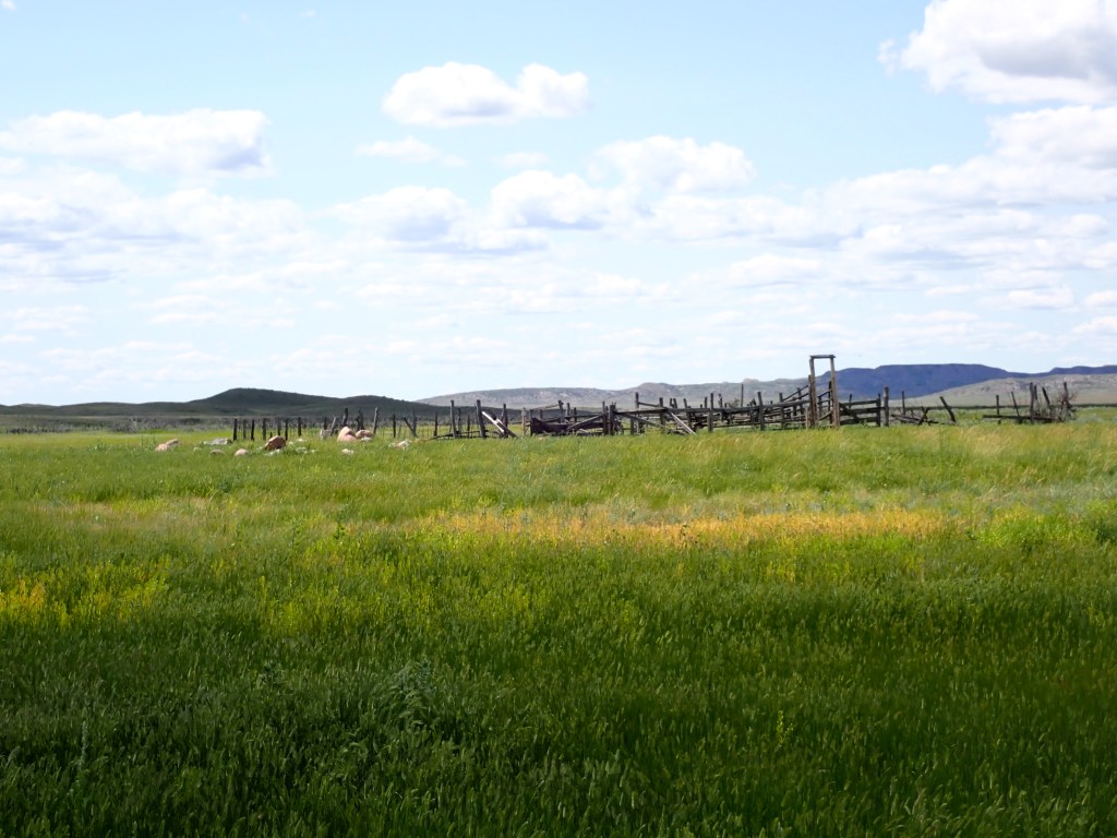
Ranching was replaced by homesteading around 1908 due to a large loss of cattle in the years prior along with the amendment to the Dominion Lands Act. The sixth stop featured the homestead of Walt Larson, who formerly worked for the 76 Ranch. It is quite remarkable how one could set up and thrive in a homestead in these parts – with no trees available for constructor lodging and barns, sod structures with thatched roofs were the norm. Food and water were scarce and the soil was quite poor for farming – it’s no surprise that many homesteaders departed the area after only a short time.
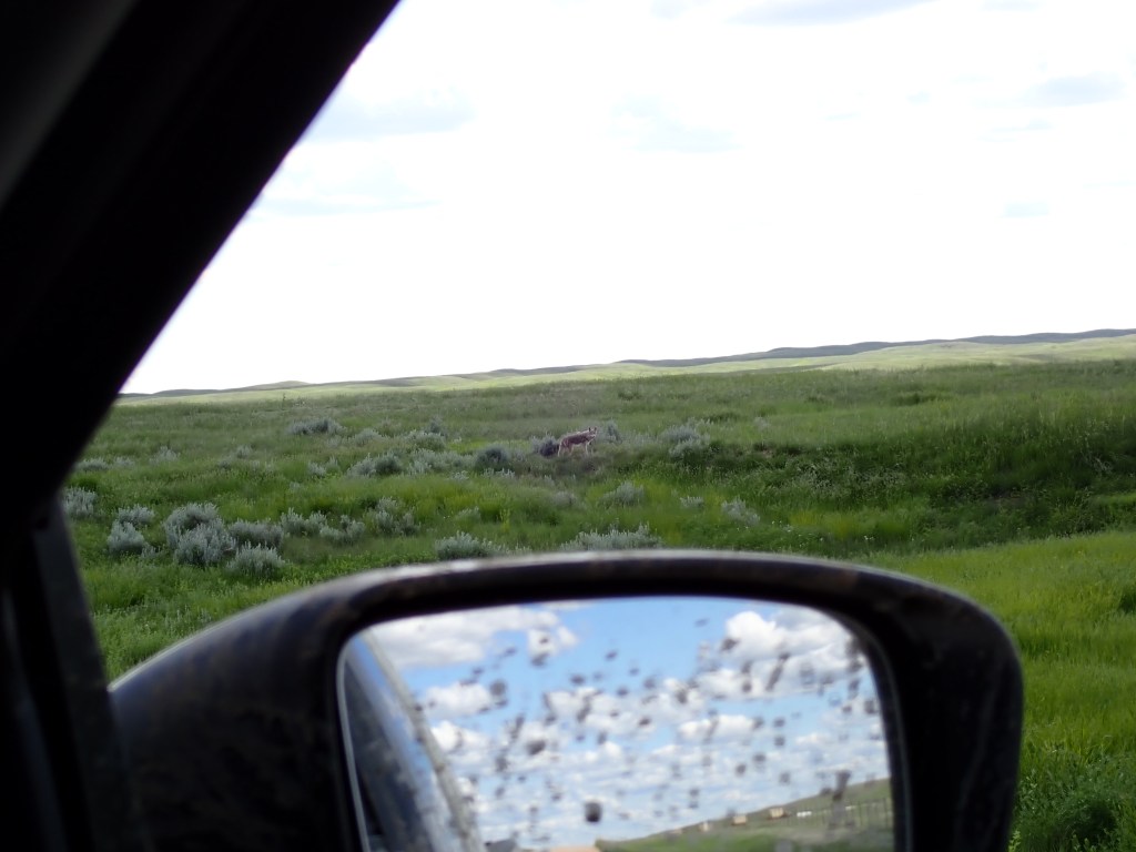
The return drive I saw a pair of coyotes crossing the road and traversing the grasslands – really cool to see. After returning to Val Marie, I realized I was horrendously sunburned – I was hiking in shorts and a long sleeve shirt, and while my face and back of neck were okay as I had applied sunscreen, my collarbone area as well as my calves were pretty burned. Unfortunately the local grocery store, Whitemud Grocery, did not have any aloe, but I did enjoy a Blizzard-esque ice cream treat. I then checked in to my accommodations for the night – Don’s Place. Don is an older gentleman from BC who runs accommodations in Val Marie during the spring to autumn season (it gets brutally cold in the winter!). Very friendly guy, and he gave me some gel for my sunburns. I checked in to my unit and spent the rest of the day hunkered indoors, out of the sun. I did emerge around sunset to make dinner, and went to bed shortly thereafter.
Day 8
My plan for my second day at Grasslands changed quite a bit leading up to my visit. I initially planned to do a night of backcountry camping my second night at the east block of the park (about a 2h 15min drive from Val Marie) but after suffering through the heat and sun the day before, I opted instead to stay at the Rock Creek campground. My plan was to do two more hikes at the west block before heading over, and do a hike at the east block the next day as my last hike of the trip.
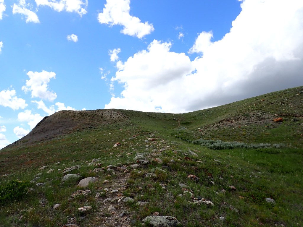
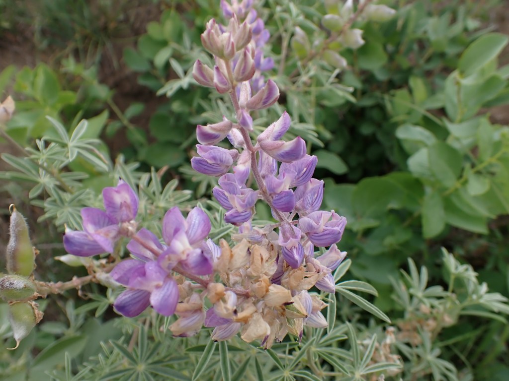
My first hike of the day was bright and early and saw me hiking the 70 Mile Butte / Eagle Butte loop, a shorter but scenic trail close to Val Marie. I got started at 7:30am and it the temperatures were excellent for hiking. I opted to wear long sleeves for the rest of my hikes to cover my sunburns, but it was fairly chilly for most of the morning so it was very pleasant. The trail had a number of interpretive panels along the way with interesting information about the flora and fauna of the area.
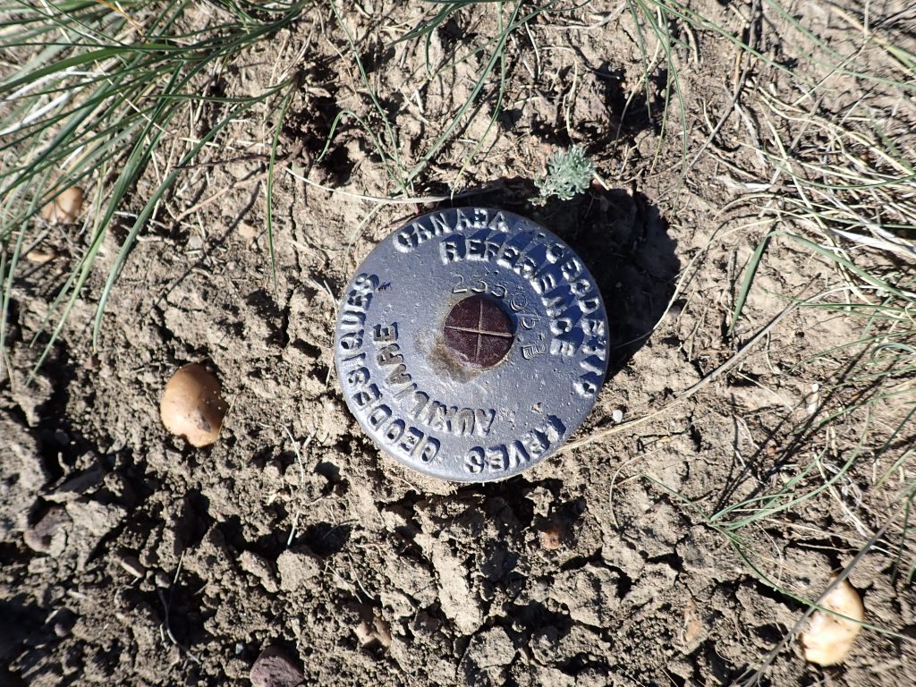
Apparently bobcats live in the coulées in this area but as expected for felines, they stayed very well hidden. Coulées are areas where drainage occurs, and generally have a lot more vegetation and moisture, which makes them an ideal home for a wide range of creatures. The trail wound its way up to the top of 70 Mile Butte, where I fired up the camp stove for an oatmeal breakfast. There were a series of survey markers in a triangle marking the summit, and great views of the surrounding area.
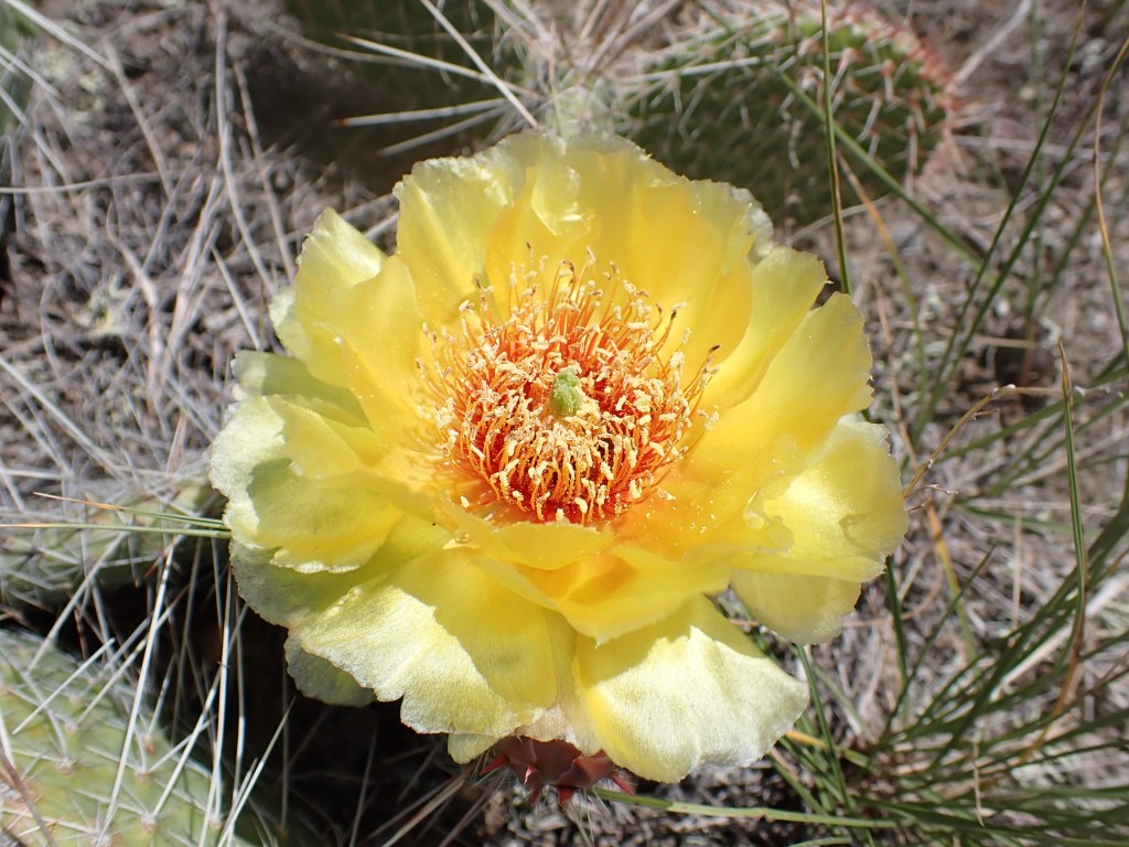
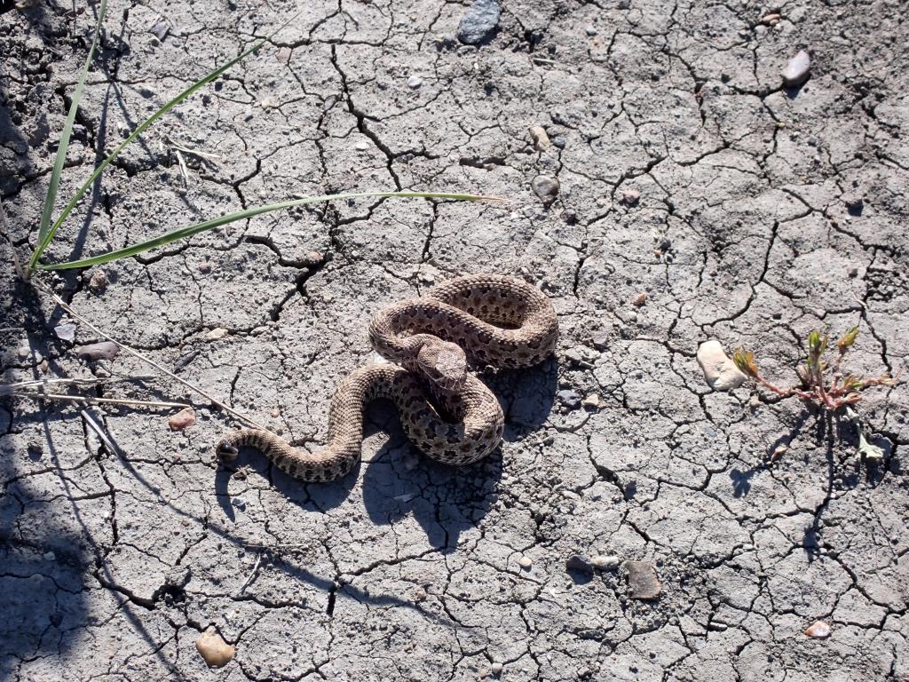
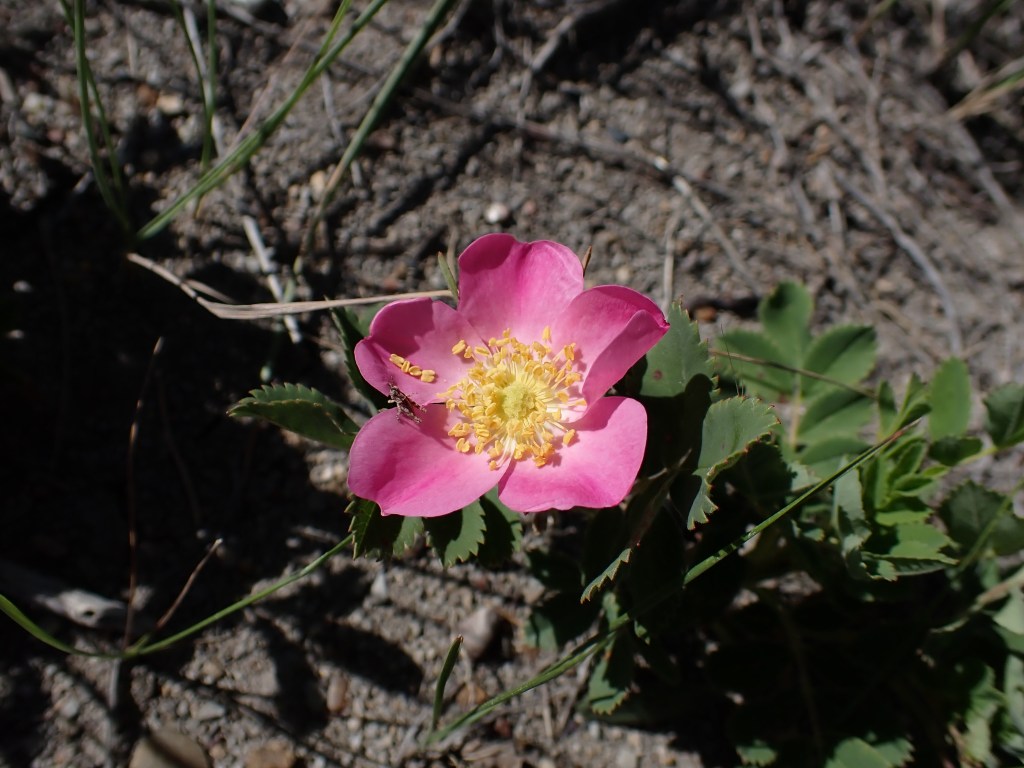
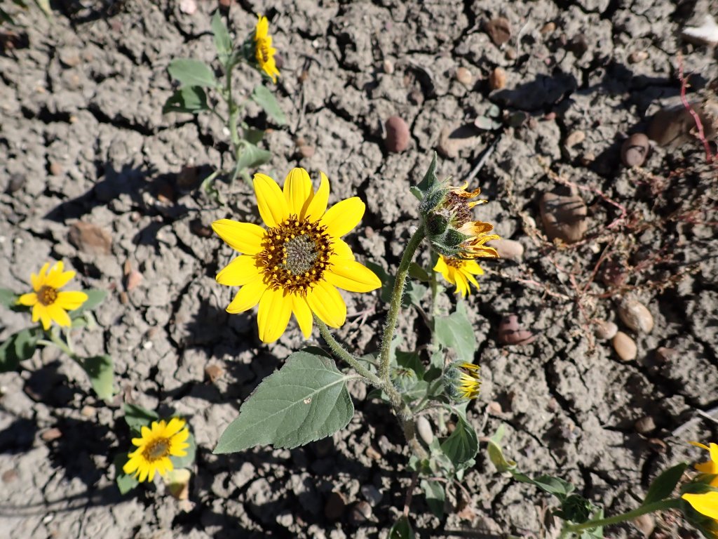
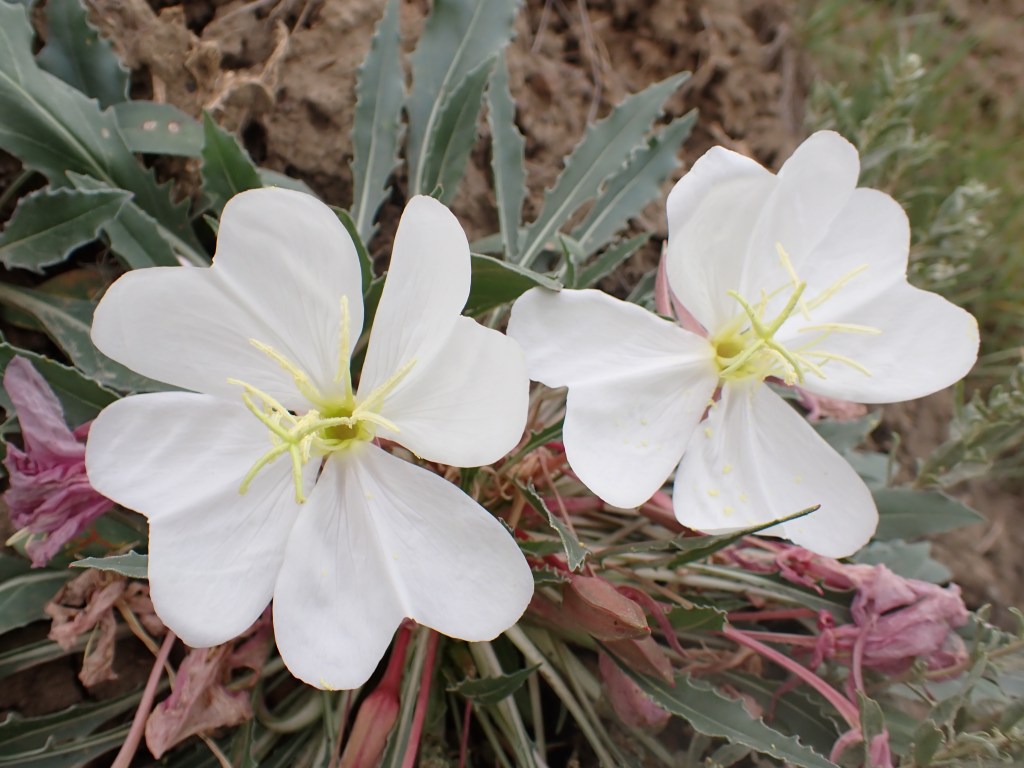
On the hike back to the car I saw a little snake on the trail and got some photos of it. No rattle, but comparing its markings to those of known species to live in Grasslands, it appears to have been a juvenile Prairie Rattlesnake. Apparently they’re born with no rattle but packing the full arsenal of fangs and venom. This little guy was more afraid than anything, and never acted defensively, quickly slithering into the grass at the side of the trail. I’m very glad I played it safe and didn’t get too close! There were a number of flowers visible on the trail as well, including Gumbo Evening Primrose and that of the Prickly-Pear Cactus.
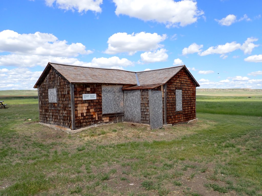
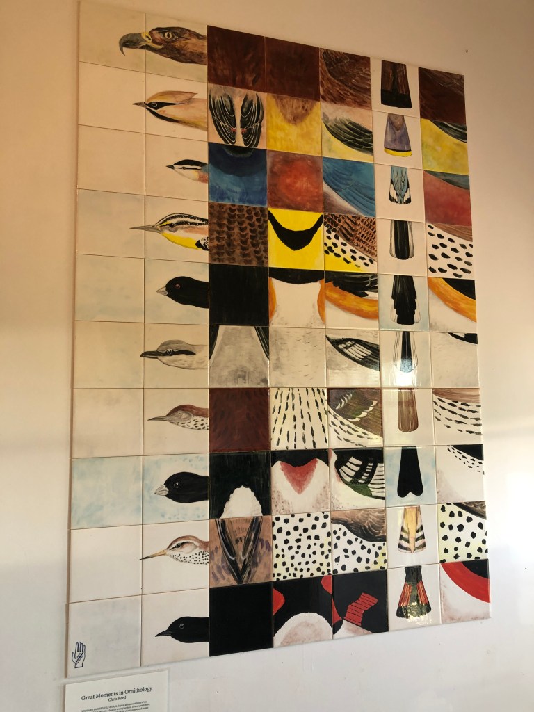
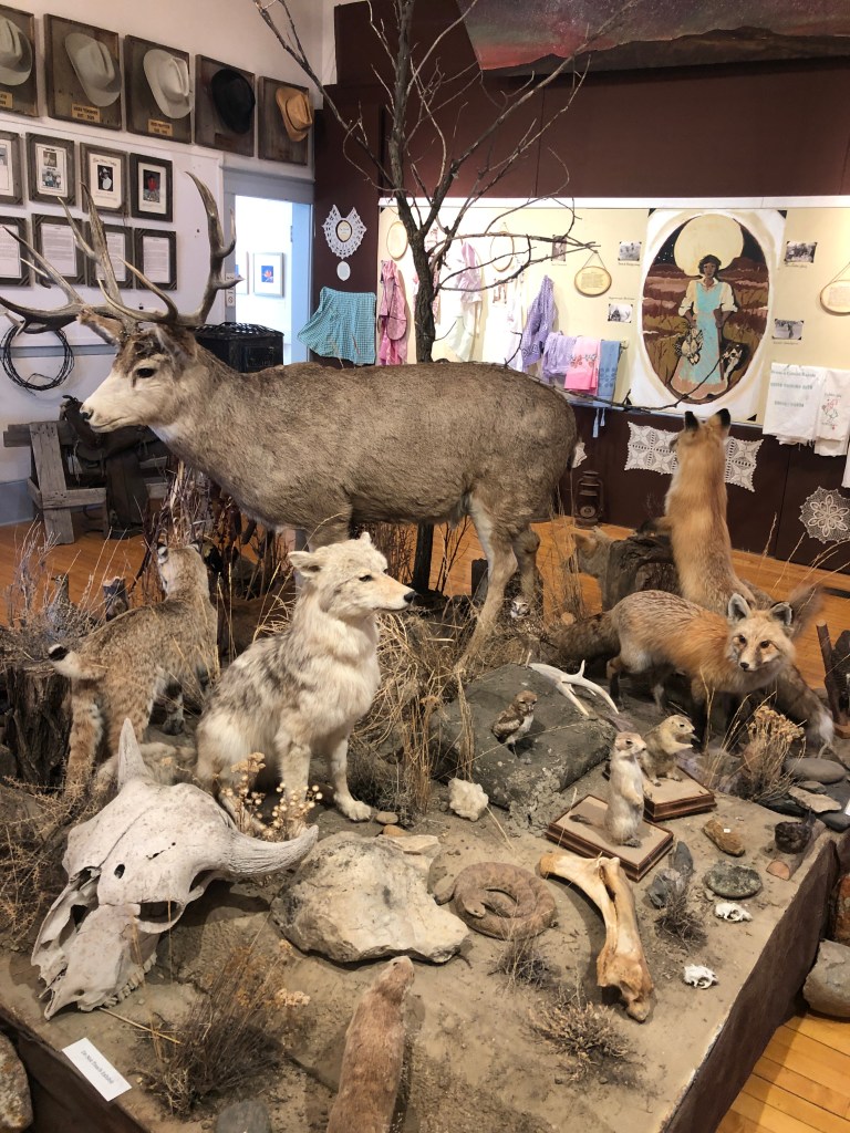
After booking a site (staff member recommended) at the East Block, I visited the local museum, Prairie Wind & Silver Sage. It is located within the Little Brick Schoolhouse and contains a lot of interesting exhibits relating to the history of the school, artifacts from the ranching and homesteading eras of the surrounding area, and a small art gallery featuring art from local artists. I enjoyed a coffee and butter tart at the café and bought a clay plate (made using materials from the area) for my parents.
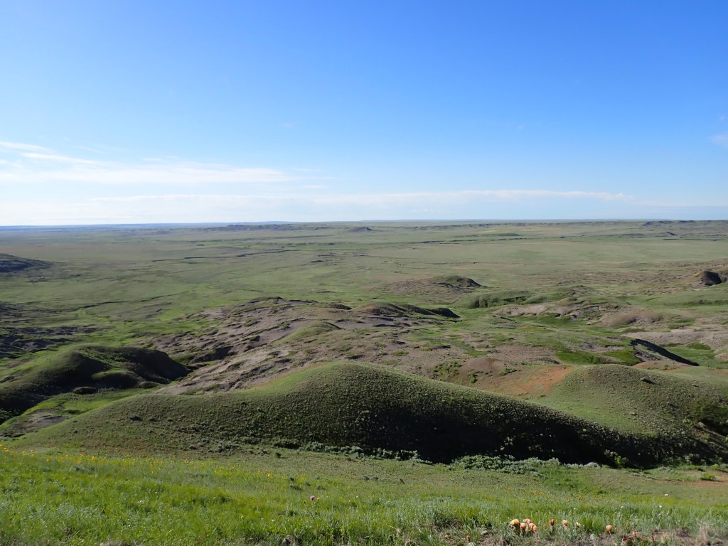
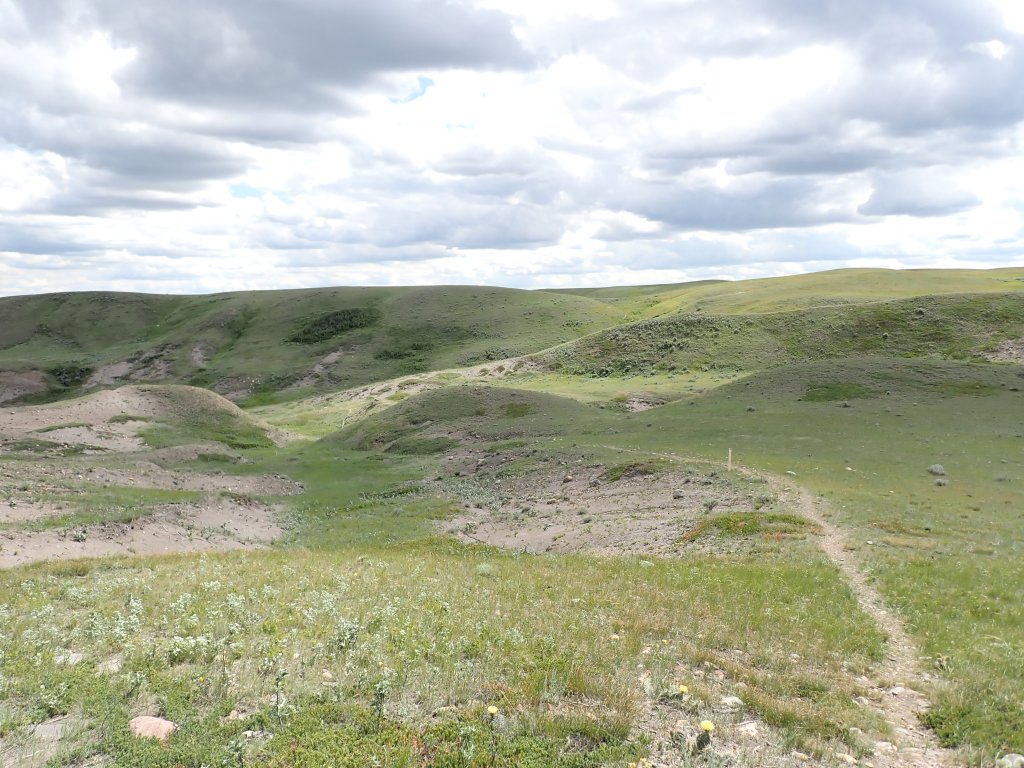
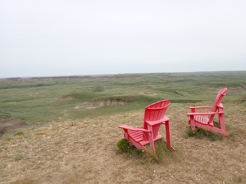
After heading back to Don’s Place and relaxing for a bit, I packed up my stuff and headed back onto the main road of the West Block to do my second hike of the day – the Broken Hills Loop. This hike was quite a bit warmer as I started around 2pm, and went over a variety of terrain, starting in the grass and into the “badlands” type terrain, before ascending several buttes and spending long stretches in the grassy terrain at higher elevation. Great panoramic views of the Frenchman Valley area! It was cloudy and windy for most of the last half of the 11km hike which was very much welcome. My feet were definitely quite sore by the end.
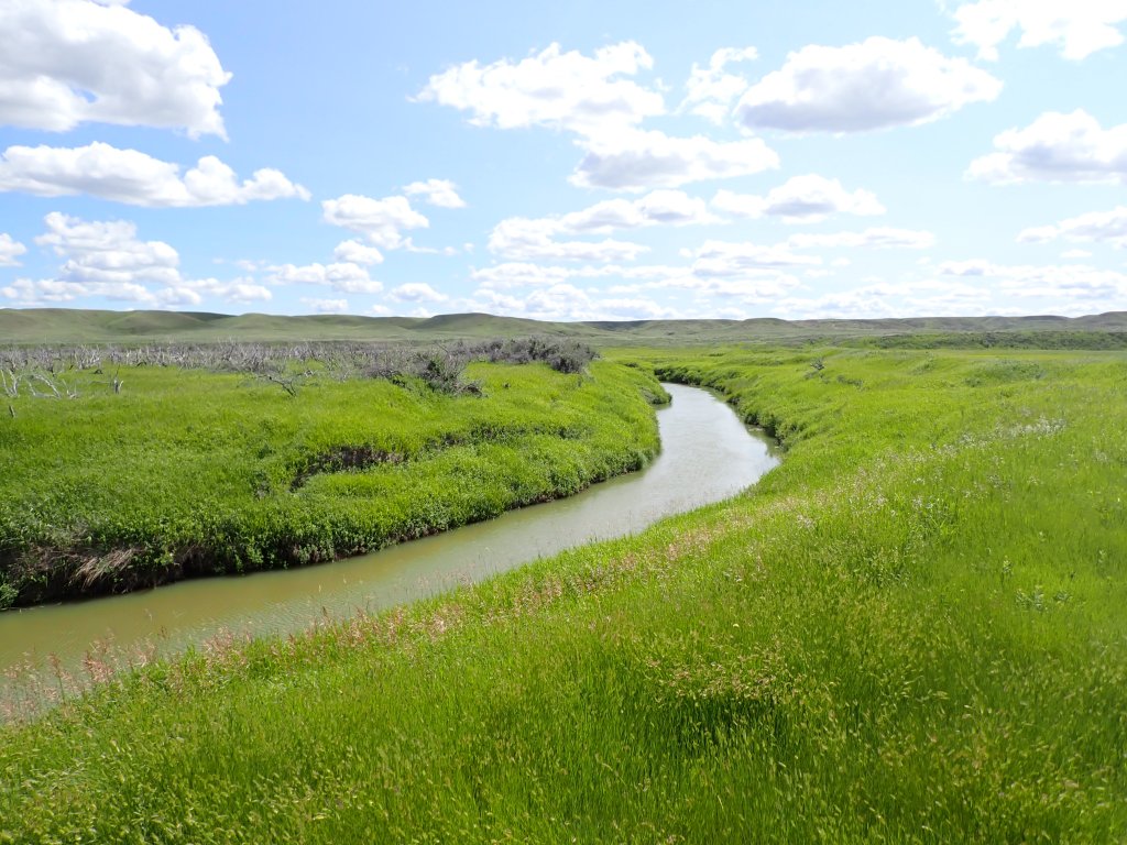
I then drove over to the East Block – it was only a 2h 15min drive but it felt a lot longer given how tired I was! I arrived at the park at about 8:30pm and set up camp at the Rock Creek Campground. The campground is located on a former homestead, an optimal location to avoid further developing the prairie. The campground was initially designed to be wider, but it was narrowed to limit encroachment on the creek, where the endangered Greater Sage Grouse makes its home.
Eagle Butte / 70 Mile Butte GPS Track
Broken Hills GPS Track
Day 9
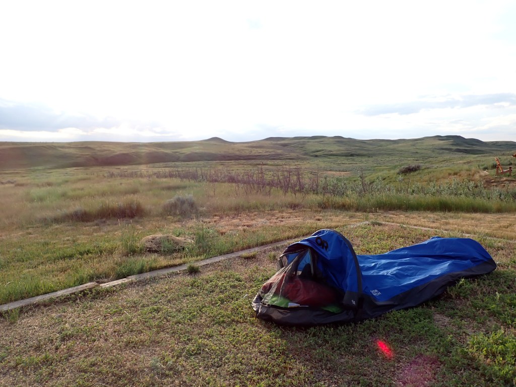
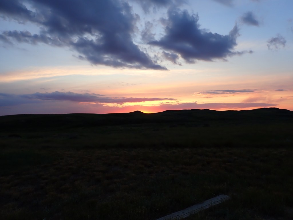
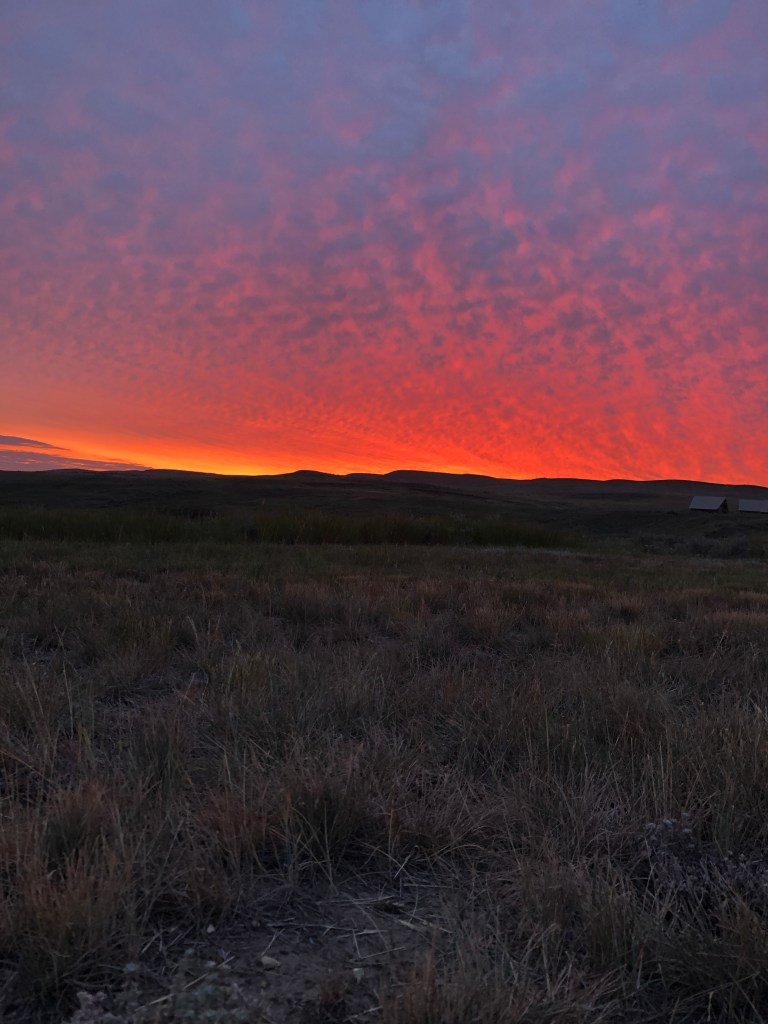
Sleep was not the greatest – my inflatable sleeping pad deflated (the camping surface was gravel mixed with some grass, not really great for tents/bivys) and it was quite warm and sticky. I think I’ll try and stick with a tent from now on in the summer! I woke up just before 4am and on the bright side, was able to see the sunrise!
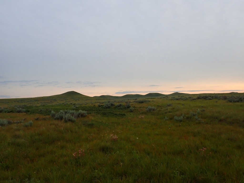
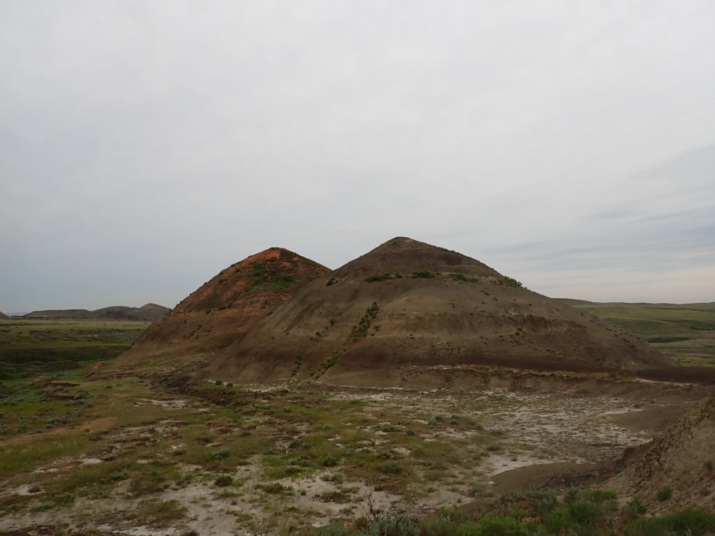
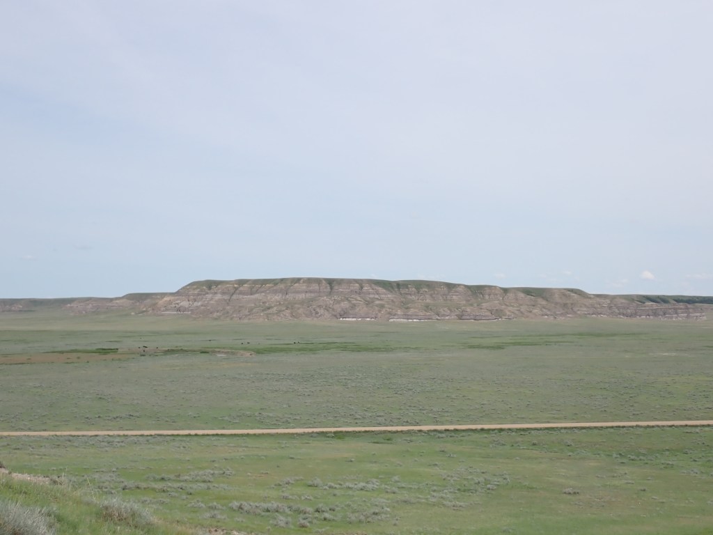
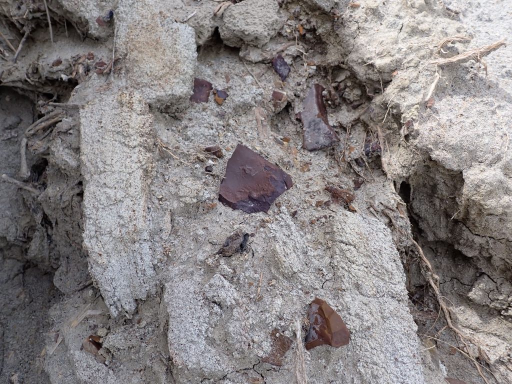
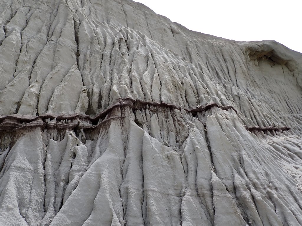
I quickly packed up my bivy (it was quite damp with condensation) and drove a short ways away to the trailhead for the Valley of 1000 Devils, probably the most popular trail in the East Block, known for its fantastic views of the badlands, including buttes, hoodoos and unique geological formations. This area is known for its paleontology, with many dinosaur fossils having been found here over the years.
I started hiking at 5:30am and there was a decent amount of cloud, so it was a bit chilly. Still great views! After about 4km I exited the grasslands over a butte and entered the badlands section of the hike, which can be 10 degrees hotter than the surrounding area. Luckily it was so early in the morning that it was still fairly cool.
I stopped at the viewpoint about halfway through the hike for breakfast and to rest my feet, then continued onwards. I think I saw a deer or two in the distance while eating. At the furthest point in the hike you can venture further for backcountry camping (this was my original plan for the previous night). Parks Canada requires you to hike 1km off trail to camp which seems pretty far compared to other places I’ve hiked, such as the Adirondacks. All in all, a great hike – I was the only person on the entire trail (at least that I could see) and the solitude was peaceful.
I got back to the campground after about 2.5 hours of hiking (8am meant there still wasn’t a lot of activity at the campground!). Man I was exhausted, having hiked almost 70 kilometers over the previous 4 days! After a quick snack, I decided to check out the Badlands Parkway, which is a bit similar to the EcoTour that was in the western block. This is a single lane, paved road about 11km long which has stops and short hikes to educational plaques along the way ranging from topics like the dinosaurs that used to roam the area millions of years ago, the indigenous people who made the most of the limited resources, the challenges of homesteading on the dry, harsh terrain, and the various wildlife and plants that make the badlands their home. The Parkway is a great spot for a scenic bike ride. Pretty interesting drive! I unfortunately triggered US roaming charges as the Canadian coverage was non-existent and Montana is less than 10km away.
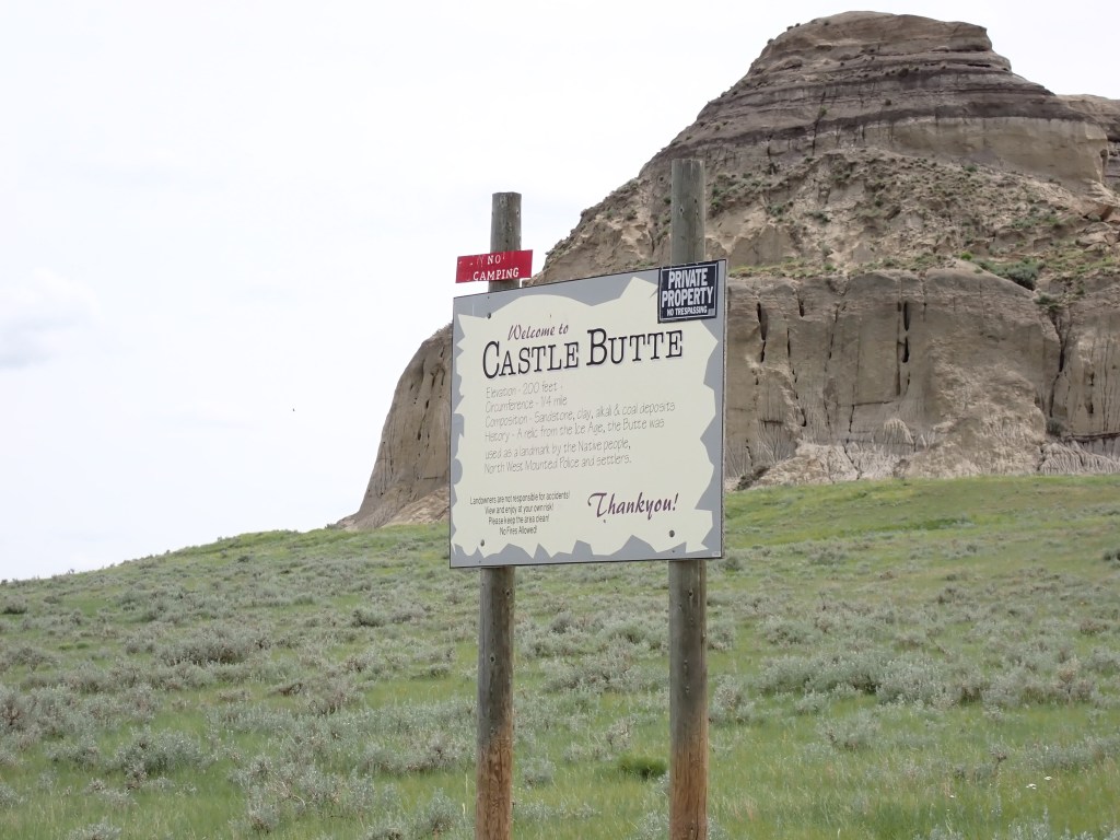
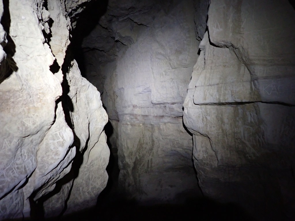
My plan was then to spend some time in the Big Muddy Badlands, but unfortunately many of the sights are on private property and thus you typically need to access them via a tour. I was a bit late to the party in booking a tour slot, but I did plan to check out Castle Butte in Big Muddy Valley, a large area about 175 square kilometers in area that was formed at the tail end of the last ice age. Castle Butte, which is free for the public to access, is a pretty remarkable structure composed of sandstone and clay, and served as a landmark for First Nations and settlers!
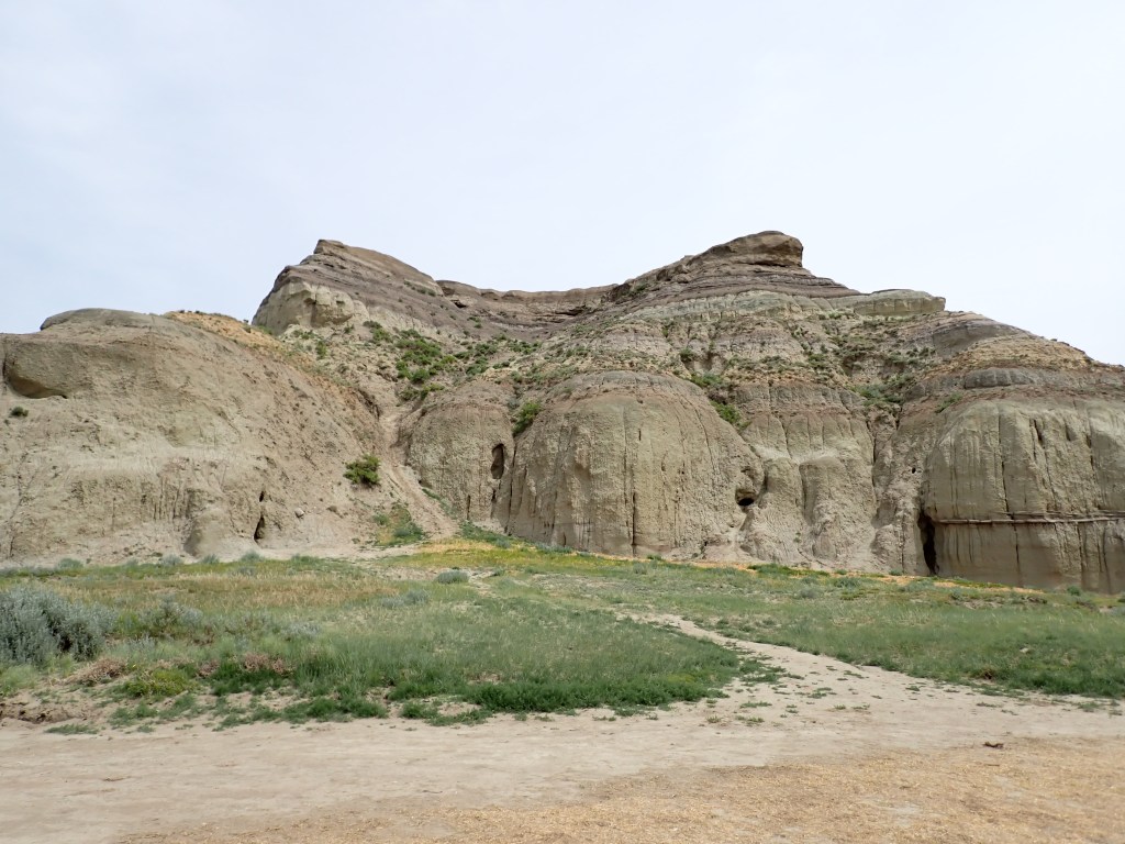
I spent quite a lot of time checking out the geology of the butte, exploring the caves (it was very cold inside, very relieving from the outdoor heat!) and even climbing to the top of the butte (it’s about 70m high). It was a bit of a scramble getting up and down but I took my time and it was quite fun!
Afterwards, I cooked a meal by the car, trying to stay in the shade of the truck. It was then back on the road, and I headed for my AirBNB in Regina. Once there I took a long-awaited shower, did some laundry, and depleted the fuel from my canister since I needed to recycle it before leaving. Unfortunately, all the viable places to recycle/dispose of the canister were closed or would be closed Sunday, so I decided that I would turn it in at the airport. For dinner I went to Taco Time and had a quesadilla, and also confirmed with National Car Rental that it would be advisable to take the truck to a car wash to wash off the mud and avoid a cleaning charge.
Valley of 1000 Devils GPS Track
Day 10
Pretty standard last day. I got a good nights sleep at the AirBNB, and checked out around 9:30am. I had a bit of time before I had to be at the airport, so I went to a local coffee shop (Brewtopia) for a coffee and to do some catchup on my blog!
I had mapped out a route which had me stop to fill the truck and get a car wash, grab lunch at A&W, swing by Olivia’s (my first AirBNB host in Regina) to pick up my bag with toothbrush, and finally return the truck at the airport. Everything went smoothly and I made it to the airport very early (much unlike my outbound flight and more in line with what I usually do!).
Getting through security was a breeze – I love travelling through smaller airports – and I made it to my gate over two hours before boarding. There were nice little tables set up by the gates with power and USB sockets to plug in (very much unlike YYZ, which has sporadic power sockets in the floor which don’t work half the time – get it together Toronto!) so I set up and relaxed.
The flight was delayed over an hour due to a technical issue (classic Air Canada), which was quite irritating, but otherwise, things went smoothly. This time I made sure to put my sleeping bag liner in my carry-on bag so that I could be super comfy during the flight. For whatever reason my tolerance to the cold is pretty high except while on the plane!
Final Thoughts
Overall, a pretty successful trip! Had a few hiccups and there were a few things I would have liked to have done differently (such as proactively planning to attend a tour at Big Muddy, or camping in Elkwater when I was in Cypress Hills) but can’t complain. Definitely enjoyed being out in rural Saskatchewan and in areas that don’t feel like Canada at all! Saskatchewan is known for being a very flat province, but after spending time in Grasslands and Cypress Hills, I’d say that honor belongs to Ontario or Manitoba.
With respect to my Canadian High Points mission, this effectively ends Phase 1, with all the relatively easy high points completed. The remaining six are all exceptionally difficult, expensive and time consuming endeavors, with a lot more risk involved. I will likely complete Columbia (Alberta) or D’Iberville/Caubvick (NFLD) as my next two as they are probably the most feasible, with the goal of doing them in 2025 and 2026. I’ll spend the next 24 months or so honing my skills on rock and ice so I’m adequately prepared for these challenges! Also banking my vacation time! 😉

2 thoughts on “Saskatchewan 2023 Part 3: Grasslands National Park”