Only a week after returning from a very successful, productive trip to Saskatchewan, I was back on the road over the Canada Day 2023 long weekend in search of more high points – this time in the US! This trip, which was with my brother Alain, was initially planned to be a trip to New Hampshire to complete the Presidential Traverse in the White Mountains. Alain, who had accompanied me in Killarney last year, has since really gotten the backpacking/backcountry bug. He’s doing an incredible thru hike in Nunavut in August, the 97km Akshayuk Pass in Auyuittuq National Park on Baffin Island. So this would be part of his training for that!
Unfortunately, we scuttled the Presi Traverse plans 36 hours before departure due to the volatile weather forecast in the Whites as well as the smoke from the Canadian wildfires. On the phone, Alain casually mentioned West Virginia (The Mountain State) might be a good backup option as it’s much further south than New Hampshire and is about the same driving time. The US state highpoints are a lower priority project for me currently but I figured this would be a good opportunity to bag one of them (I had only done Mount Marcy in New York so far), and was delighted to see that the Pennsylvania (Mount Davis) and Maryland (Hoye-Crest) highpoints were on the way to West Virginia’s (Spruce Knob), and all three were separated by only 3 hours of driving. So, I quickly got to work planning a route down from Ontario, and examined the three highpoints to see what would be required.
All three are very straightforward. Two of them (Davis and Spruce Knob) are effectively drive ups, and Hoye-Crest only requires a short 1 mile hike. I’m not a fan of drive ups and I try to hike up as much as possible, so I selected routes for the other two which involved parking some ways away then hiking to the high point. Spruce Knob was planned to be an overnight, since we wanted to get some camping in on the trip. Aside from the hiking, the trip was to be very much done on the fly – we didn’t make any accommodation bookings or hold ourselves to a strict itinerary. Very different than my usual approach!
Day 1
Saturday, which was Canada Day, we began our trip. I had been delinquent in packing for the trip (clearly had not learned my lesson from last time) and got out the door a bit later than expected, at 7am. Initially Alain was to drive from his place in Kitchener to Toronto and we would then carpool from there to New Hampshire, but since the fastest route to Mount Davis required us to enter the US at Niagara Falls or Buffalo, it was actually about the same driving time to leave from Toronto or Kitchener. So we planned for me to drive to Kitchener and carpool from there.
It took about 90 mins to make the drive and after a brief pit stop at Alain’s place (saying hello to his curious cat Reid) we loaded everything into Alain’s car and I left mine at his place. The drive was pretty smooth sailing until we made the fateful decision to cross at the Rainbow Bridge in Niagara Falls. Did I mention that it was Canada Day?! Probably the worst traffic I’ve ever experienced. We literally moved at 1km/h as we approached the bridge, and were trapped in the car for well over two hours. We saw so many people break the traffic laws to skip the logjam, including many instances of driving the wrong way in an opposing lane. We vowed to go through Buffalo on the return!
After a miserable couple hours (including, just our luck, being in the slowest US customs line), we were finally free on the other side of the border. After a bit of confusion trying to figure out how the heck the I-90 toll system worked, we decided to take the toll free route and things went pretty smoothly from there. We stopped at a gas station for some sorely needed hydration (Gatorade) and encountered quite a lot of rain on the drive down to Pennsylvania. I had brought a couple avocados with me for wraps/burritos and we tried (fruitlessly, no pun intended) to ripen them by leaving them on the dash. We did get quite a bit of amusement watching them roll back and forth when the car turned. I was sure to remind Alain of how he used to pronounce “Pennsylvania” when we played Monopoly as kids – “Penny-sclavia”. Couldn’t resist!

Our original plan was to get both the Pennsylvania and Maryland highpoints on Saturday, but our late departure combined with the fiasco in Niagara Falls meant we couldn’t reasonably hike even Mount Davis, so we decided to try and grab a campsite close to Mount Davis and hike it in the morning.
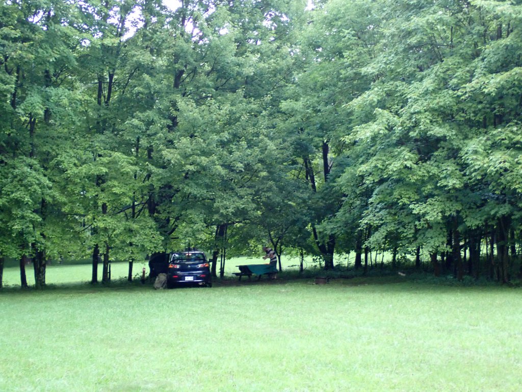
There are some sites close to Mount Davis but they were all booked up, and we settled on trying for a walk-in at Kooser State Park. Eventually we came to a true final decision to grab a site at Donegal Campground, a local camping area. After calling the owner, we learned that all the tent sites were available, so I paid for a site over the phone and we made our way there.
We arrived and caught the manager, Dan, just as he was leaving. He showed us to the tent camping area and we settled on site 6. The map that was provided was hand drawn and was very interesting! A lot of campers there in trailers, some for long term! We set up camp then had dinner – wraps with beans (I brought my can opener), spinach, and the ripest of the two avocados (still extremely tough). We also ate a few of the bananas I brought.
After dinner I took a shower – got very sweaty sitting in the car all day – and collected water. The bathroom was very open concept – no stall for the toilet! Shower was nice though. There were a lot of other campers shooting fireworks at the campground – kinda odd since US Independence Day (July 4) was several days away! I guess they were celebrating Canada Day? Eventually we were able to get to sleep once they stopped.

Day 2
I woke up initially at 5am, but was actually quite comfortable (huge difference being in a tent vs the bivy) so I went back to sleep and got up at 6:45am. Almost immediately after getting out of my tent, the downpour began, so I frantically packed away my tent and we broke camp. Unfortunately my less than waterproof tent was completely soaked but luckily Alain had gotten up earlier and his tent was already packed away before the rain started.
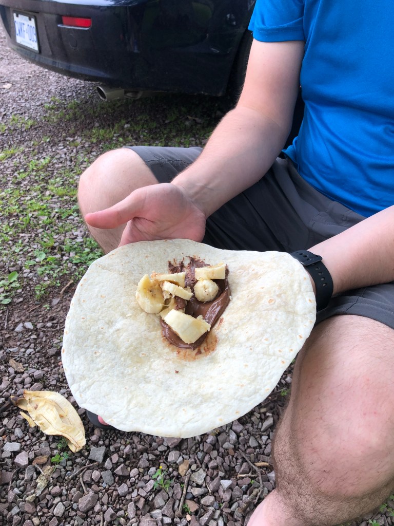
We stopped for breakfast at McDonald’s in Donegal and I was dismayed that they didn’t have the BELT bagel (more like ELT as I don’t eat meat), they only had plain bagels and it was the folded egg rather than fresh egg. The hash browns were hot and crispy though! We also made a quick stop at the local convenience store to grab some jugs of water for drinking as well as a jar of Nutella for the remaining tortillas (we finished all the spinach and beans the night before, and the second avocado was still nowhere near ripe). Finally, we were en route to our first high point of the trip!
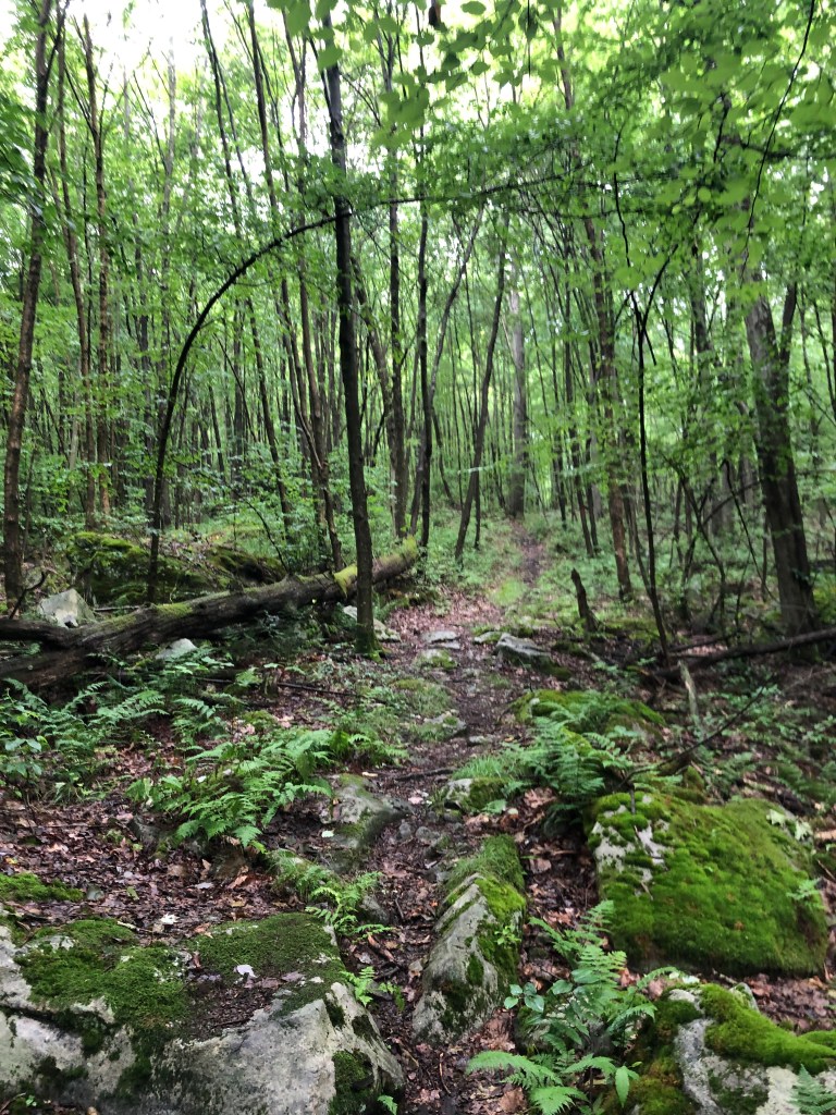
Mount Davis is located in Forbes State Forest in south Pennsylvania, and is named after John Nelson Davis, a Civil War veteran and surveyor of the surrounding area. Access is pretty easy with a road leading almost exactly to the summit, though there are a few hiking trails. Initially we looked at parking near the bottom of the Tub Mill Run Trail (the lowest point in the system of trails leading to Mount Davis) but the access to the trailhead was a bit iffy in Alain’s car. We instead parked at the picnic area, where the High Point Trail begins.

This trail is just under a mile to the summit, but we opted to make a more intense hike out of it, starting on the High Point Trail but making a left to head down the Tub Mill Run Trail, then up the Timberslide Trail to the summit. Pretty enjoyable hike with cooperative weather, though the humidity was pretty intense even early in the morning.
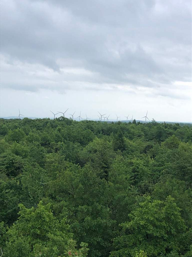
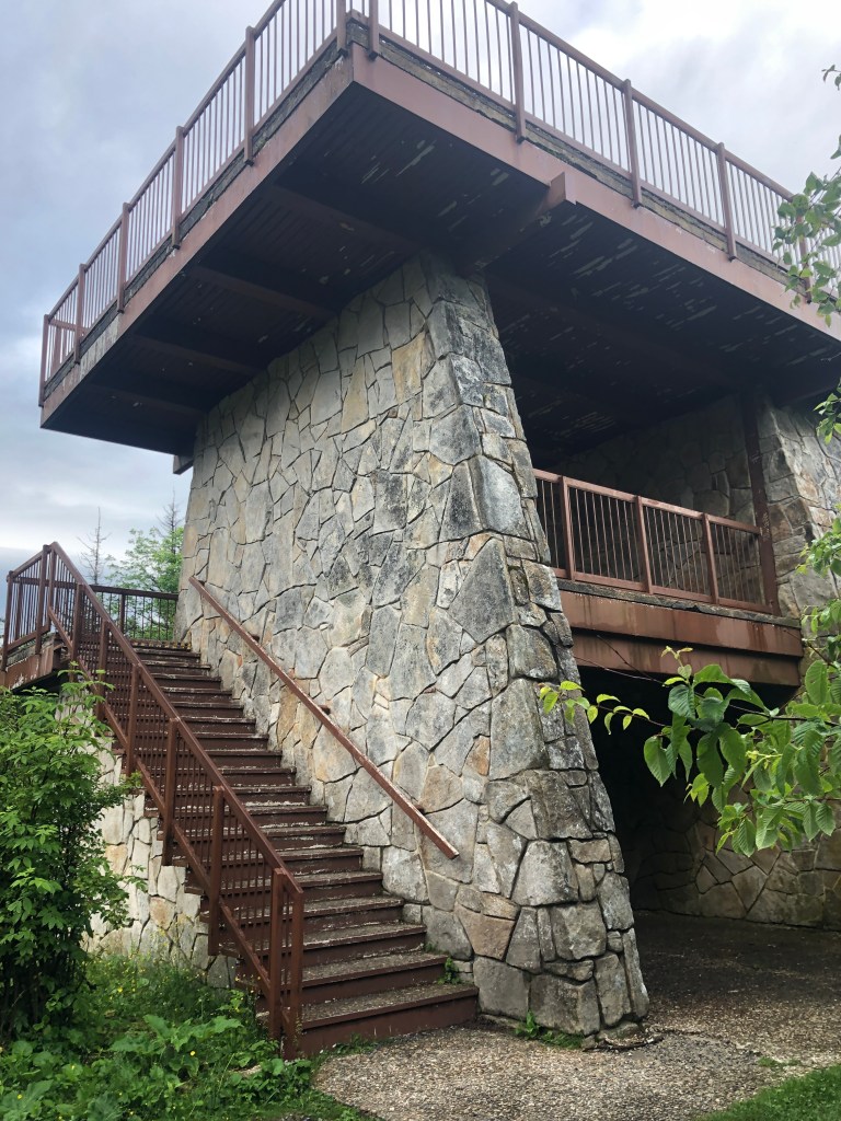
The summit is marked with a lookout tower as well as a number of interpretive plaques, talking about the geology as well as flora and fauna of the area. We ascended the tower and took some photos, marking my second US state high point and Alain’s first!


We returned to the car and had some delicious Nutella and banana wraps, before hitting the road again, heading south to our next high point!
Hoye-Crest, an obscure little spot on Backbone Mountain in Maryland, is less than 75 mins away from Mount Davis, and is actually accessed via a trail beginning in West Virginia, with the final couple hundred meters crossing the state border. The drive was very scenic as the area is quite mountainous. We parked on the side of the road (US Route 219) and made short work of the one mile trail to the summit, #3 US state highpoint for me, and Alain’s 2nd. It was here I finally used my new Leki trekking poles for the first time, having brought them all the way to Saskatchewan but never using them!


We took some photos and also checked out the Marker No. 3 on the WV/MD border. Does anyone know the significance of this marker? I was thinking it could be the highest point on the border, but could be wrong.


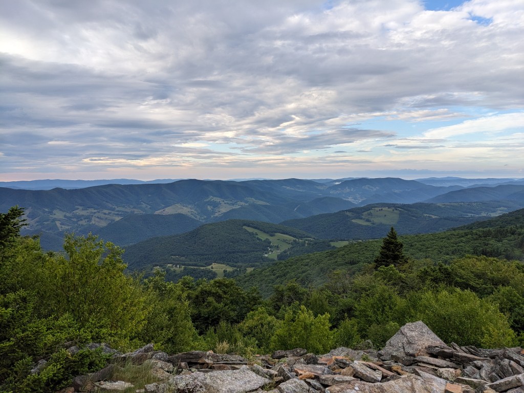
After descending back to the car, we were back on the road, en route to our final high point of the trip, Spruce Knob in West Virginia. This, like Mount Davis, is essentially a drive-up summit, but we opted to make it a bit more hardcore and overnight along the Huckleberry Trail. Our drive to the trailhead was extremely scenic, as we passed by the Seneca Rocks, located in Pendleton County. Seneca Rocks is probably the best known rock climbing location in the eastern United States. This area was super gorgeous, with plenty of rugged mountains and small rural towns.

Our planned route to Spruce Knob was an approximately 17km out and back trail starting at a trailhead located off FR 112 (which leads to the parking lot near the summit), and follows an old logging road for a short distance before connecting with the Huckleberry Trail, which spans the entire ridge of Spruce Mountain to the Knob. We parked just after 5pm after less than 2 hours of driving, loaded up our overnight packs, and began hiking at around 5:40pm, with the goal to hike as far as possible until 7pm, and grab one of the many campsites along the trail. Alain had brought along some Leukotape which, based on extensive research, one of the best methods for blister prevention while hiking. I applied a long strip to the back of both of my heels before setting out. The trail started off fairly overgrown along the logging road but was still easy to follow. There was a bit of mud and a river crossing to navigate but not too challenging.

Before long, we were in the deciduous forest of spruce along the Huckleberry Trail. I love these types of forests! We ran into a couple of friendly guys from Washington DC who had just stopped at a campsite having hiked over from the summit parking lot, and got a good laugh when they said “congratulations” when we told them it was Canada Day the day prior. After about 30 more minutes of hiking, where the trail got a bit more rocky and rugged, with more of an alpine feel, we found a great campsite. Perfect timing – 7pm.

This area is pretty high in elevation, well over 4000 feet, which is higher than some of the Adirondacks! It was still fairly warm (we hiked in shorts, and definitely used bug spray!) but we were equipped for it to cool down in the evening. While Alain started a campfire, I started drying out my soaking wet tent and then fired up the camp stove for dinner (André’s Special – red lentils, pasta, and dehydrated veggies – yes, the exact same thing I ate for half of my meals in SK!). I ended up making an insane amount of food, and we barely finished it all. Solid meal to finish off a day with tons of hiking.

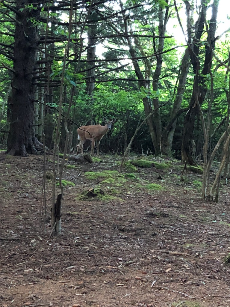
We even saw a curious white-tailed deer approach our site. The weather was very cooperative for our entire time on trail and until bedtime, and we went to bed at around 8pm, with the goal to be up very early to hike to the summit of Spruce Knob!
Mount Davis GPS Track
Hoye-Crest GPS Track
Spruce Mountain Car to Site GPS Track
Day 3
Overnight we were hit with quite a lot of rain, starting at about 10:30pm and going all the way to 4am or so. I guess this was the optimal time since we were in our tents which are (at least in Alain’s case) fully waterproof. My tent is 14 years old so it’s seen better days, and did a fairly decent job, but it was still really sad packing up a soaking wet tent. Our plan was to hike to Spruce Knob, return to our site for breakfast, then pack up and hike down to the car.
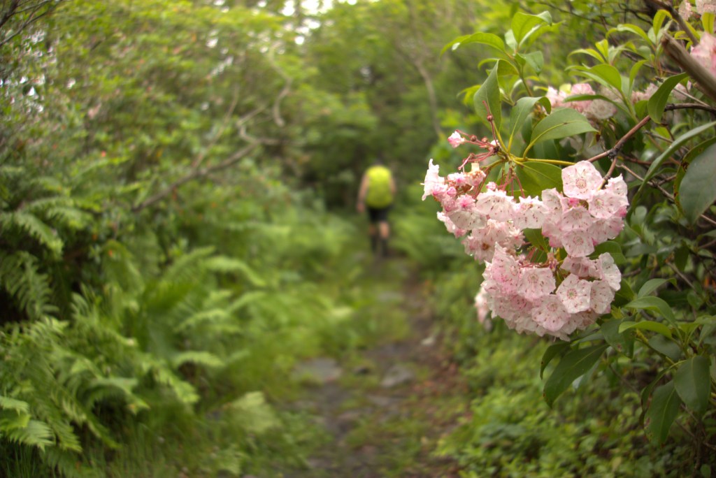
We were up at around 5:40am and on the trail at 6:10am. The hike was fairly easy (we were already nearly at the same elevation as the summit) and we made short work of it. The trail really had an alpine feel, with plenty of spruce trees (surprise surprise), though these aren’t original forests and are second or third growth forests. Some of the trees are so bombarded by wind they become stunted in the direction of the wind, and are known as Krummholz.
As we approached the parking lot, we saw a ton of other campsites with campers who were just getting up. We knew we were close when the trail suddenly turned to gravel! After crossing the parking area, we hopped on the flat-ish Whispering Spruce loop trail and stopped by the lookout tower for photos, and reading some of the interpretive plaques.

Our return trip was pretty smooth; we even saw a blue crayfish on the trail! Really bizarre seeing it this high up far away from water, but appears to be the burrowing type. Breakfast back at camp was oatmeal – I threw a tablespoon of Nutella into my bowl so as not to bring up the jar for nothing. After attempting to dry out our tents, we packed up and were back on the trail at 10am, and made short work of the mostly downhill hike back to the car.

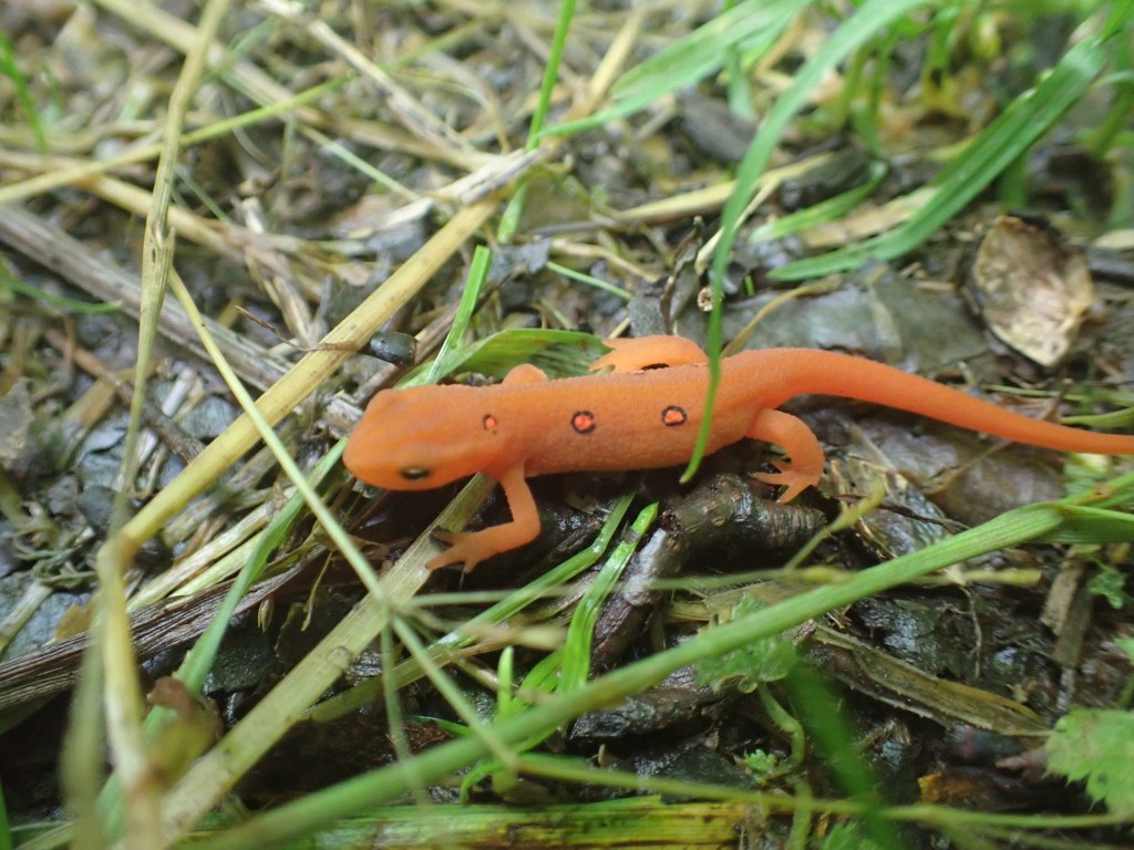
We came across the guys from DC right before we turned back onto the old logging road and helped them find their way to the Huckleberry trail loop. Nearly at the end of the trail, I found a little red-spotted newt on the trail – very neat!
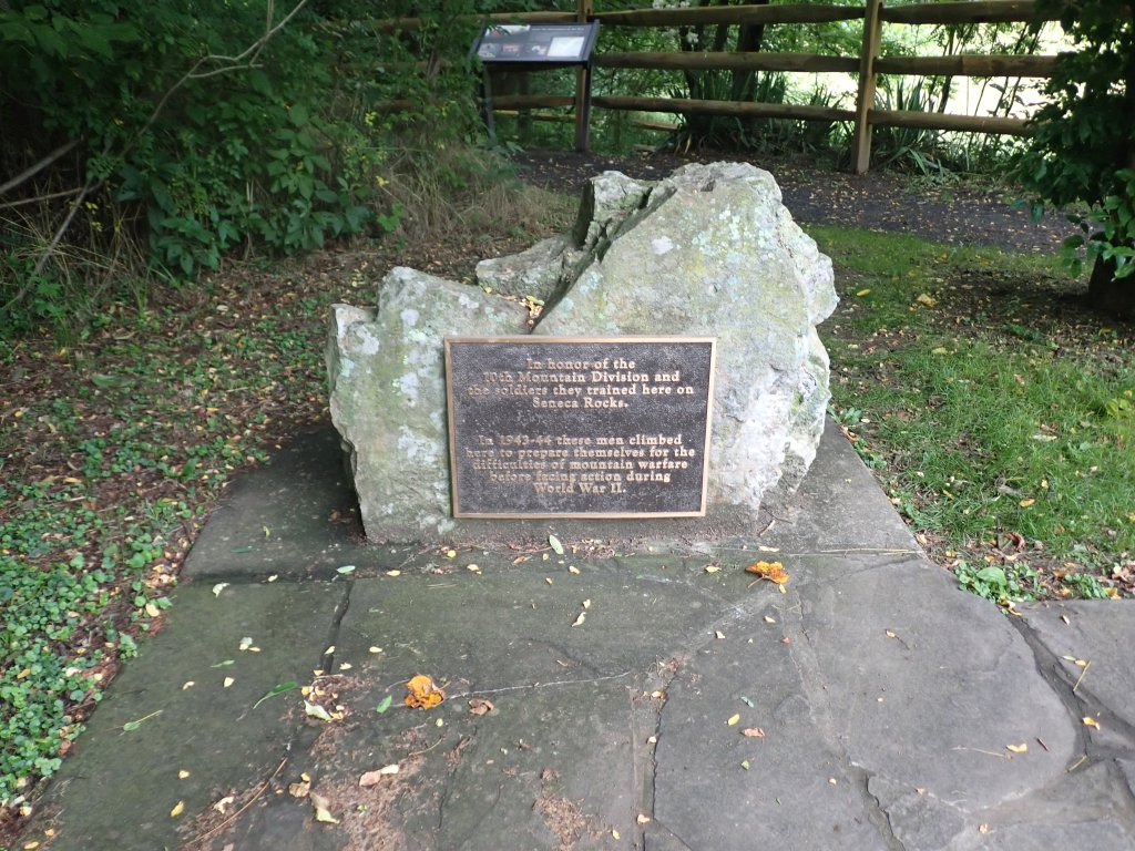
We were planning to do another 3-ish hour hike after finishing up our Spruce Knob hike, but as we had modified our schedule (effectively we had hiked an average of 1km/h across our three high points, including driving, eating and sleeping!) we were pretty tired and decided to go a bit easier, and drive partway back to Toronto, staying overnight in Pittsburgh. Before that though, we made sure to drop by the Seneca Rocks and check out the visitor center. Really interesting learning about the rocks and their climbing history – apparently the 10th Mountain Division of the US Army trained here in assault climbing before fighting in World War II in the Apennines in Italy! We even saw a couple climbers on the top of the rocks – hopefully they didn’t get sidetracked too badly from the rain which fell shortly afterward. There are over 375 mapped routes up the rocks and I’d love to climb here someday.

The drive to Pittsburgh was pretty smooth sailing and after booking an AirBNB, we stopped by Danny’s Diner for some extremely greasy American food – I had fish wraps and fries and we shared nachos which we’re pretty sure used Cheez Whiz. The AirBNB was really nice – a fully equipped upstairs unit in a house. We did laundry and I was able to dry out my tent on the patio, being sure to sweep up the spruce needles and twigs that had attached themselves to my tent. The Leukotape (which held overnight easily) unfortunately left quite a rash on my ankles which, as I write this post 4 days later, still hasn’t abated. A bit of a shame since that stuff functionally is amazing!

Spruce Knob GPS Track
Spruce Mountain Site to Car GPS Track
Day 4
Our final day was a travel day, so not a whole lot of excitement. We stopped by Koala Coffee & Tea House for a morning brew – a habit I picked up from my friend Karly who always visits coffee shops in new cities. I also picked up a bag of coffee beans to bring home. We grabbed breakfast at McDs, and somehow I ended up with Alain’s McMuffin (standard Egg McMuffin) and he with mine (same sandwich minus the meat and with lettuce and tomato), despite him ordering from the console and me at the front counter! The drive back to the border was smooth and we enjoyed listening to music, particularly when Alain put on the Rumours album by Fleetwood Mac.

The border crossing was much better this time as we took the Peace Bridge in Buffalo. Much rather bay the $8 USD toll than be stuck in traffic for several hours! Before long, we were back in Kitchener and Reid was very happy to see us (I mean, Alain, he was pretty apprehensive about me!). We said our goodbyes, I loaded up my car with all my gear, and headed home.
Final Thoughts
Overall, a pretty solid trip! Definitely a bit out of my comfort zone in terms of how we executed the trip, but we got to see a lot of cool places on the drive and banged out some great hikes. These three US high points are definitely some of the easiest in the list, so it was good to get three of them done within 24 hours, as well as nearly 26km of hiking in that time frame. Really excited to work on more of the US high points…gonna definitely bang out the Presi Traverse later this year.
Of course, it was also great to spend time with my brother. Thank you for driving the ENTIRE trip, Alain! (I did offer to take over for a bit, but he’s a unit). I look forward to more adventures with him in the future.