After a pretty lengthy hiatus from the Adirondacks (last trip was way back in May where I completed a slog through the Seward range), I finally returned in September for my fourth-last visit to finish the 46 High Peaks. I had been avoiding the ADK for the last few months, due to a pretty rainy summer, bug season, and large crowds which make the experience less fun. Fall and winter hiking are far more enjoyable and that’s how I want to experience the last 16 peaks on the list. The weather looked really good for the weekend as well (mild conditions, no rain until late afternoon on Sunday).
My plan for splitting up the last 16 peaks is roughly as follows:
– Allen, Cliff, Redfield [3 peaks]
– Dix range (Dix, South Dix, Grace, Macomb, Hough) [5 peaks]
– Colvin range (Colvin, Blake, Nippletop, Dial) + Sawteeth [5 peaks]
– Wright, Algonquin, Iroquois [3 peaks]
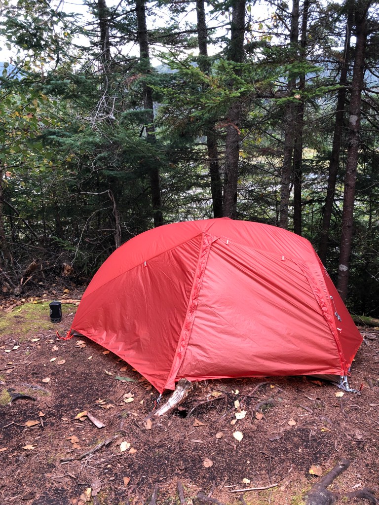
It was a toss-up between the Dix range and Allen/Cliff/Redfield for my first of these trips, but I decided on the latter since it’s still pretty busy in the ADK so I wanted to ensure I could get parking, and Upper Works has a much bigger parking area than Dix. Prior to this trip I finally pulled the trigger on a new 3-season tent (Big Agnes Copper Spur 1 person) so I was looking forward to trying it out.
This hiking trip was a bit ambitious as it features over 50km of hiking. Allen is the most remote ADK High Peak and is almost always done on its own as a day trip, the same could be said about Cliff/Redfield, which are done together. The three peaks are close enough that doing a weekend trip (two full day hikes) is manageable, and making a base camp partway in would cut down on the total hike time. I was also not fond of doing two separate trips from Toronto to do Allen separately from the other two. My tentative plan was as follows:
Friday: Leave work just after noon, arrive at Upper Works at 6pm, hike to Flowed Lands, camp (7km of hiking, full pack)
Saturday: Allen Mountain (22km of hiking, day pack)
Sunday: Cliff & Redfield (17km of hiking, day pack), pack up camp and hike out (7km of hiking, full pack), drive home
Pretty ambitious itinerary, but I’ve been putting in a lot of work on my fitness the last few months (ramped up my running both on the road and trails) and felt that this was totally within my capability. In addition, I planned for a “light and fast” approach for the peak hikes, bringing a smaller day pack as well as wearing trail shoes. I always wear boots when carrying a full overnight pack as they’re more sturdy, and planned to do so for the hikes between the car and Flowed Lands, but the trail shoes allow a bit more mobility. Not to mention there is tons of mud and water crossings on these trails, so it would be nice to have dry boots to change into if need be.
Day 1
After working the morning and ensuring the cat was fully fed and watered, I took off on the Friday and made good time down to Upper Works, with a brief stop at the Mallorytown ON Route (last one before the Ogsdenburg border crossing). I made it to Upper Works just after 6pm and was on the trail by 6:20pm. With sunset at 7:30pm and the hike to my site being just under two hours, I had my headlamp ready to go. The hike went pretty smoothly, though I developed blisters on both my heels within 30 mins, fantastic! Lots of mud on the trail but was able to dodge all of it. After about 5km it got sufficiently dark that I needed the headlamp, and realized pretty soon that it was low on battery, though it never ran out on me during the trip and I had a backup battery in my pack.
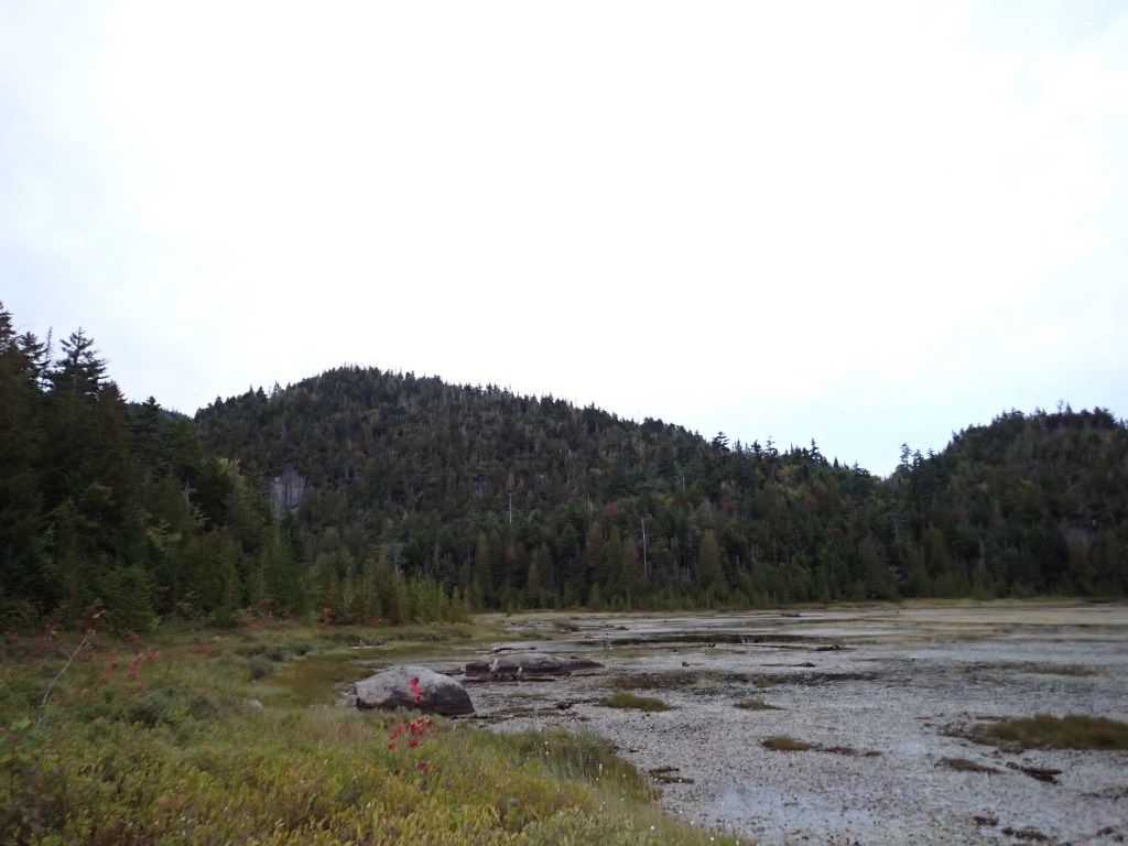
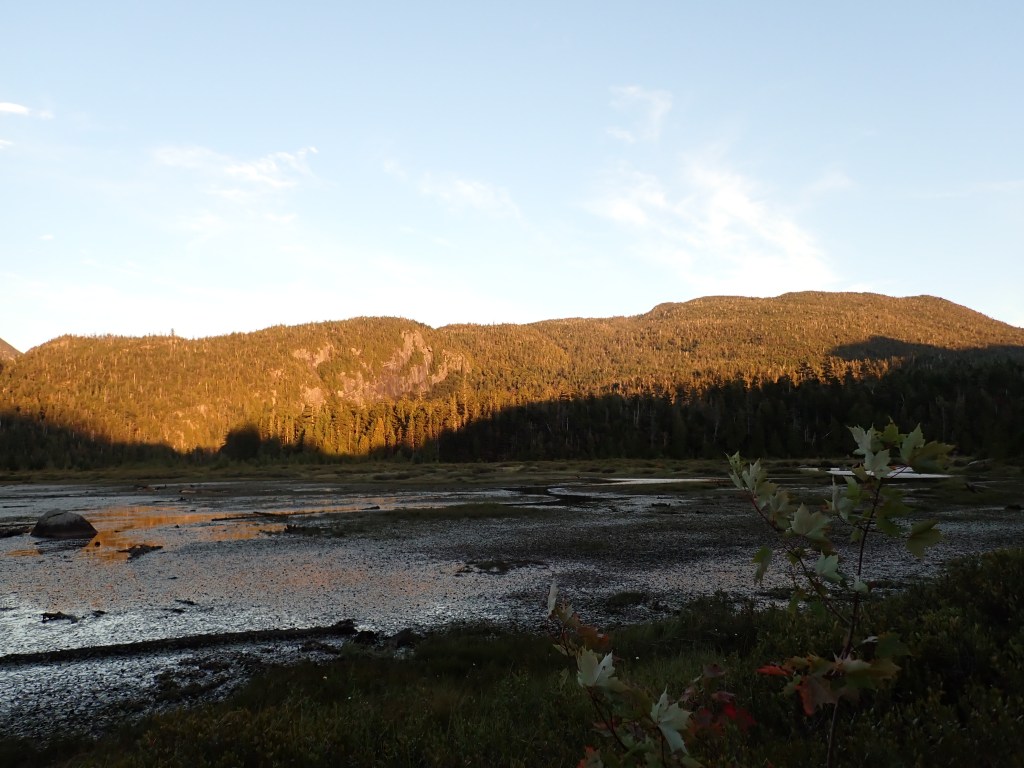
I arrived at my planned campsite, just north of the Flowed Lands lean-to, just after 8pm, where, as expected, it was pretty busy! I did find one site with just the one tent, but its occupant, Cydney, was very friendly and was on board with me setting up on the one other flat area on the site. This also marked the second tent I have set up for the first time in the dark in the Adirondacks (third if you count my bivy)! Cydney let me know there weren’t too many great water supplies nearby, but I did stroll down to the Flowed Lands Lean-to (about 600m) and collected some water from the lake, successfully half falling in in the process. No matter, my feet would be wet for most of the rest of the trip! By the time I was all set up, it was close to 10pm and at this point when in the backcountry, I’m normally in bed! Thus, I opted to skip cooking dinner and just had some trail mix and an energy bar before bed.

Day 2
Since Saturday’s hike would be likely under ten hours and I wasn’t hiking out, I opted to take my time hitting the trail. I woke up at 6:15am and made breakfast, and was on the trail by 8am. For the day’s hike, which involved tackling Allen Mountain, I donned my trail runners and packed my small backpack (which is collapsible, so I was able to stow it in my overnight pack on the approach hike) only with the essentials for the day – my trail mix, a few energy/protein bars, my Katadyn BeFree filter + bottle, my puffy jacket (it was forecasted to feel below 0C on the summit), a soft shell, hard shell, first aid kit, microspikes, power bank, camera, and InReach. I also brought my 3L Hydrapak Seeker bottle so I could collect water on the way back for dinner that evening.
My route would take me south and east down the East River trail, where I would hit Opalescent Road, an abandoned logging road, which would link me up with the Allen Mountain trail, which starts a bit south of the Upper Works parking lot. The East River trail was quite pleasant, but it started with a decent down grade (made for a bit of uphill hiking at the end of the day) and featured a ton of mud. Luckily, plenty of places to fill water! My approach this weekend would be to stop briefly at every flowing water source and drink about 1.5 cups of water, and refill, in order to stay reasonably hydrated. Opalescent Road was flatter, but was a very short stretch, including crossing a stream, and before long I was on the actual Allen Mountain trail.


The trail was generally pretty flat until the last 1.5-2 kilometers from the summit. I encountered one group of teens who had turned around due to the slippery rocks, and as I started the climb up the rocky slab sections (which were indeed quite slippery) I ran into a guy trail running down and he suggested to just keep on the dry parts, and that spikes weren’t super needed (roughly half of folks I saw on Allen had them on). The climb up the rocks was slow but methodical, and after a few spicy sections, as well as dealing with a ton more mud (did I mention my feet were super muddy and drenched?) I was off the slabs and traversing the last section of trail up to the summit of Allen Mountain, my 31st ADK High Peak.

I hit the summit after about 4 hours of hiking. I ran into a lot of nice people up top, including a fellow Canadian, Elise, who, if I recall correctly, was at about #42 or so in ADK High Peaks. I spent about 30 mins at the summit, getting a great view of many other High Peaks, and tried to dry out my socks and shoes, before making my way down.


The hike down was also quite slow – the slippery rock was definitely a cause for concern, and I did take a small spill and slid a few feet on my butt, only slightly banging my wrist in the process. It hurt a bit but wasn’t too bad. I hiked with Elise the whole way down to Opalescent Road and we had some great conversations. The hike back was pretty good, made great time and continued to refuel with water when I could. On the last water crossing before camp, I filled my Seeker and carried a bit of extra weight for the last 1.5km or so. I rolled into camp just a hair under 9 hours, having covered 23.6 kilometers. Great day! I noticed that Cydney had packed up and left; she had mentioned that she was going to move camp closer to Upper Works. So I had the site to myself for the evening. I had plenty of time to cook dinner and relax, and was in my tent by 7pm.

Garmin GPS Track (Flowed Lands to Allen Mountain There & Back)
Day 3
My final day was going to be a long one, as the plan was to hike Cliff and Redfield, then hike back to the car and drive home. Thus, I set my alarm for 4:45am and grudgingly got out of my cozy sleeping bag. I quickly made breakfast and got most of my camp gear packed up (save my tent), and cringed as I put on my damp socks and trail shoes before setting out under the light of my headlamp at 5:50am.
It was quite a peaceful hike north along the Calamity Brook Trail, past the Lake Colden camping area. I was the only one on the trail and made quick work, heading down the Mount Marcy trail (effectively following almost the same path as I took for my first ADK hike). Quite rocky and muddy terrain but overall felt really strong. It took 1h 20 mins to reach the Uphill Lean-to camping area, where the trail splits, with one trail heading to Cliff and Redfield; the other heading toward Gray and Skylight, as well as Lake Arnold.
I opted to do Cliff first, which was probably the better decision as it was now daylight and this peak was a bit more technical. I figured being more fatigued on Redfield (which is a very standard nontechnical hike) was optimal. Cliff started off with the largest, most annoying swamp I’ve ever seen in the ADK, yes even worse than the mud on Donaldson or before Couchsachraga! I managed to avoid the worst of it by skirting around on the outside, and eventually got to the actual trail. Before long I was at the cliffs.

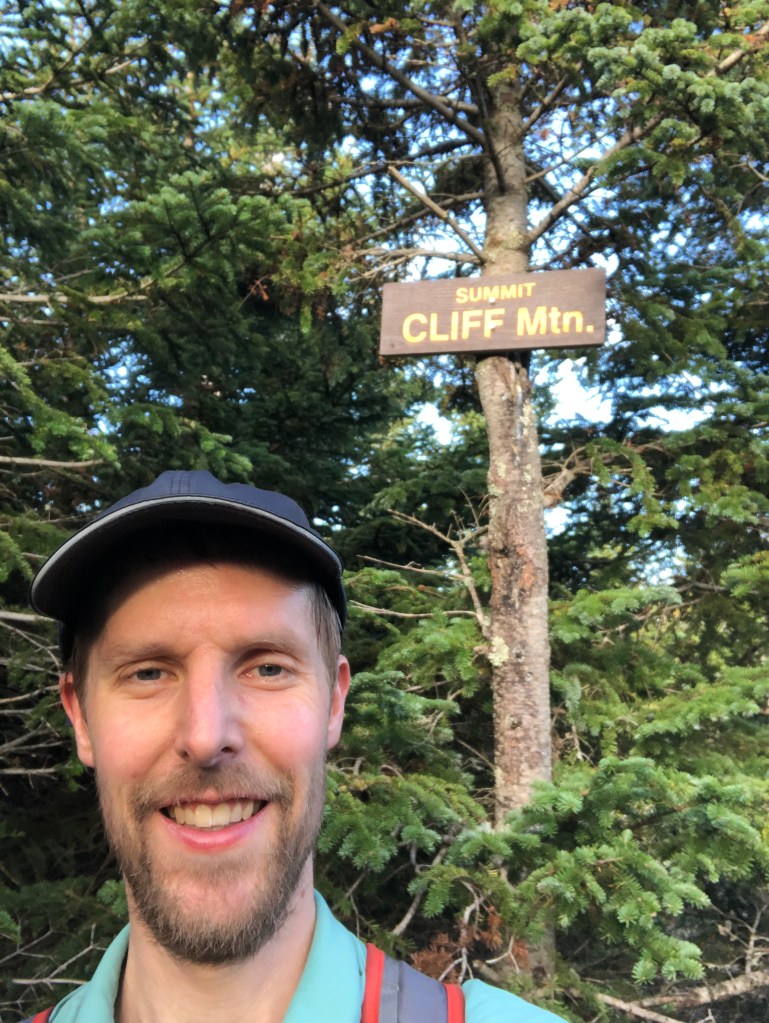
These cliffs are known for being a bit scary, but having done some alpine rock out west earlier in August (spoiler – another blog post coming soon that’s been on the back burner!) it wasn’t too bad. The rock was granite, which offered good grip for both my feet as well as my hands, though it was a lot more weathered than the rock out west! There were sections that were slick so I took special care there. Once clearing the cliffs, it was about a ten minute flat-ish hike past a false summit and along the summit ridge to the proper summit (reaching about an hour after starting through the swamp), marking my 32nd ADK High Peak! It really shouldn’t be on the 46 list (it’s lower than 4000 feet, but was recorded as being higher when the list was first established) – otherwise it was a fun hike!
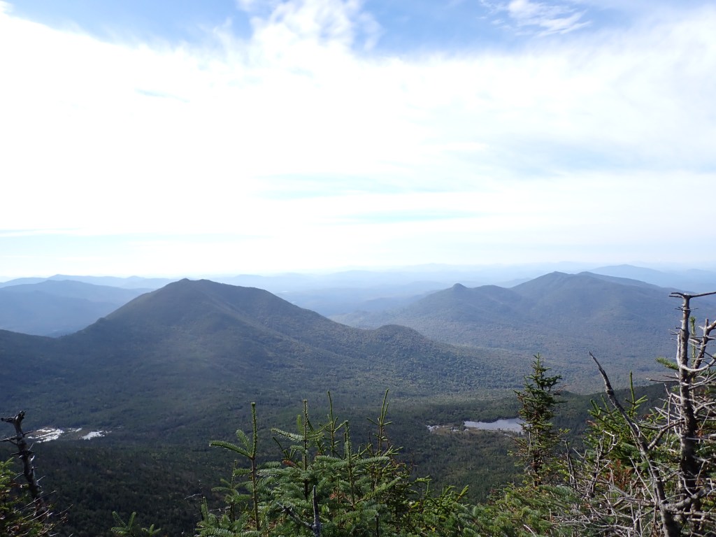
It took about an hour to descend Cliff and start up Redfield, named after William C. Redfield, a meteorologist who was the first to predict that Mount Marcy was the highest peak in New York. The hike, at first, followed Uphill Brook, offering some great creek scenery and plenty of water sources. It then peeled to the right, away from the brook, and followed a smaller creek for a bit. The trail then was largely dirt with some roots and rocks to contend with. I really enjoyed the grind here, I just switched my brain off and pushed through. It took about an hour to get up Redfield, where I enjoyed a great view of Allen Mountain in the background. After a short 15 min break, I headed down and encountered a couple other parties on their way up. It took about an hour to get back to the junction with Cliff, and I removed my shirt as it was quite warm.


It then took about 75 minutes to get back to my site, I was trying to move quickly as I still had a heavy pack hike out as well as the drive home. It took about 40 minutes to pack up and I was back on the trail. I was planning to wear my boots for the hike out initially, but since my feet were so drenched and blistered from the boots on the hike in, I realized that bandages/moleskin would not stick to my heels and thus it would be quite painful. So I opted to keep my wet trail shoes on and as a result, suffered quite a bit on the hike out. My feet felt great during the Cliff/Redfield hike, but the heavy pack made my soles pretty uncomfortable, so I was moving pretty slowly at first, especially since my ankles felt pretty vulnerable. However, the hike quickly became less rocky and I was flying through the last half, making it back to the car in under two hours. On the road just before 4pm and made it home by 10:15pm.
Garmin GPS Track (Flowed Lands to Cliff/Redfield There & Back)
Garmin GPS Track (Flowed Lands to Upper Works)
Final Thoughts
Overall, pretty efficient, yet tough trip! I was away for 59 hours, of which 20 hours I was hiking 55 kilometers. Pretty wild that well over half my time on this trip, I was either hiking or driving! Would definitely recommend this approach for people looking to complete the 46 yet live far away – don’t do Allen as its own trip! If you have the time, might even be better to stay a third night after Cliff/Redfield – that hike out was brutal!
I got a lot of mileage in trail runners on this trip (including a stretch with a fully loaded pack that was unintended) and can absolutely attest to their utility! I felt super light and mobile on my peak hikes, and never really felt like I was compromising on safety in terms of ankle injury chances. I do however, stand firm against wearing trail runners with a fully loaded pack. I felt super vulnerable on the hike back to the car, and maybe that was because of the previous 45km of hiking adding up, but would still stick with boots on approach hikes with a heavy pack.
With that, just 13 Adirondack High Peaks to go! As indicated earlier, these will be done in 3 trips. I will be in Montréal (just 2.5 hours from the ADK High Peaks area) for work next Monday, so the plan is to get in a weekend of hiking more High Peaks. Stay tuned for the next trip report!
