The end is near! With only 8 peaks to go in my ADK 46er journey, I was excited to get back out there at the beginning of November. This weekend marked exactly one year since I had hiked sans shirt on Giant, but the weather looked to be significantly colder this year. In addition, the day I drove out to the ADK (November 3rd) marked the exact one year anniversary I got unexpectedly laid off from my previous job – I was feeling super fortunate a year later having rebounded and finding an even better job so quickly.
At my job, we get a day off during our birthday month, and since my birthday is in November, and the end of the month is much more hit and miss weather wise, I elected to take the first Friday off (3rd) to give myself a 3 day weekend in order to knock off five more High Peaks – the Colvin Range (Nippletop, Dial, Colvin and Blake) as well as Sawteeth. In addition, the Colvin Range is notable for being best accessed through the Adirondack Mountain Reserve (AMR), which is private club land that is still open to hikers year round, but reservations are required to park and hike from May to October. During the reservation period, there are 70 spots per day at the AMR parking area (includes people driving and walking in) and each day opens up 2 weeks in advance. I had heard plenty of horror stories of people logging on at midnight and seeing everything immediately booked up. Sounds like bots at work! Or anti-hiking club members? Therefore, I opted to wait to hike these peaks in November, when conditions were still pretty solid and no reservations required. Sawteeth is a part of the Great Range, being situated on a ridge branching off of Gothics, so I probably should have bagged this when I did my Great Range traverse a year ago, but it is easily accessible from the AMR, so it made sense to add this on to my trip.
The plan was to drive down on Friday, park at AMR, hike up Lake Road (a gravel road leading westward) and make camp by Gill Brook, just off of AMR land (no camping allowed on AMR property), before hiking Sawteeth and returning to camp for the night. Saturday would involve hiking the Colvin Range, which unfortunately technically does six peaks (Nippletop and Colvin twice each) as Elk Pass separates two pairs of peaks (Nippletop/Dial and Colvin/Blake). It is possible to avoid the extra ascent/descent, but you’d need to do the entire hike as a loop from AMR, which necessitates camping elsewhere. Sunday’s plan was simply to pack up camp and do the easy hike down the road back to the car.
For gear, I mostly went with my 3 season setup, with my 0C bag replacing my 10C bag as it looked to get close to freezing overnight. I once again opted to wear boots for the heavy pack hikes between the car and camp, and brought my trail shoes for the peak hikes, along with a lighter day pack. In addition, I brought my microspikes as I would definitely be encountering some snow and ice up high.
Day 1
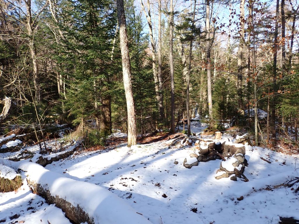
I woke up at 4am and was on the road by 4:15am. With a quick stop at the last ON Route before the border (Mallorytown), I was at the AMR parking lot exactly six hours after departing Toronto, by far my fastest drive to the ADK! Lots of space left in the lot. It was a pretty chilly morning, but solid conditions otherwise. After eating a quick early lunch (sweet potato lentil soup) I was on the trail at 11am. The hike up Lake Road was super quick and I made it to the turn off to the Gill Brook trail after only an hour. There was a small amount of snow on the ground as I made my way up the trail and quite a bit at my campsite. I cleared an area to pitch my tent, and quickly set up. I had a bit of a scare when I couldn’t find my tent footprint, but luckily it had been stowed in a pouch in my pack.
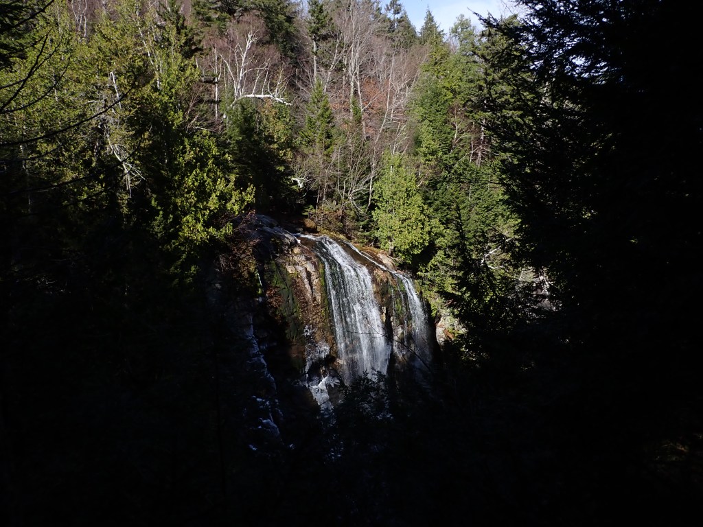
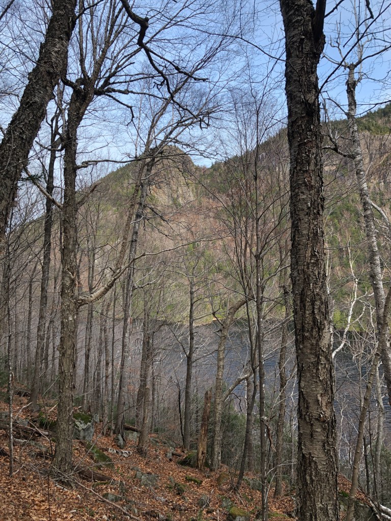
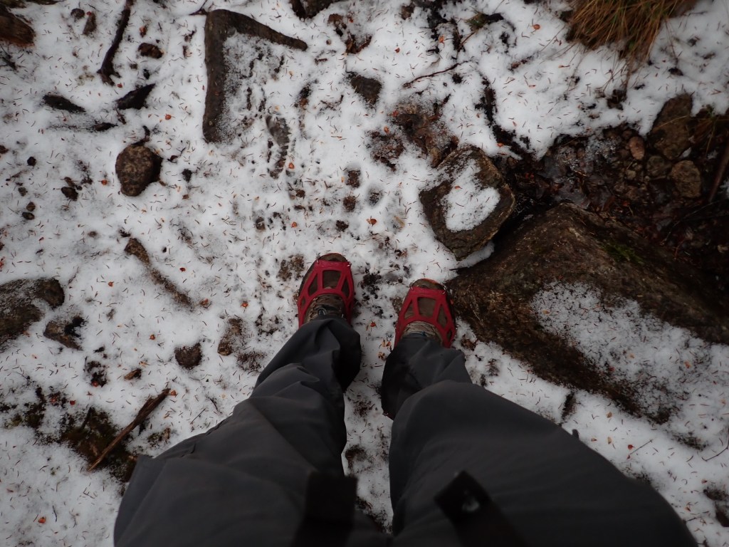
My plan for Sawteeth was to trial using my trail shoes instead of boots, and I had brought my day pack as well. It was going to be a pretty icy weekend on the trails, so this hike would be a good dry run for the trail shoes. I started my hike at 1pm, backtracking to the Lake Road and then continuing further southwest to the end of the road and across a large bridge over the Ausable River. Sawteeth offers two routes to the summit from this point – the A.W. Weld Trail, which passes by Rainbow Falls, a scenic waterfall in the area, or the Sawteeth Scenic Trail, which, as you might guess, is a bit more scenic, but longer. I opted to ascend on the steeper Weld trail and come down the Scenic trail.


The hike up the Weld trail was largely uneventful, though there was snow and ice for most of the trail, and I did put on my microspikes once the going became a bit tougher without them. After reaching the junction which connects to Pyramid Peak and Gothics, it was a quick jaunt over to the summit, which had no sign or survey marker that I could find. I did get a good view at the lookout point just south of the summit, though, and the mud/puddles weren’t fully frozen over, so my foot went through at one point. Luckily, I was moving quickly and staying warm, so I had no issues with cold feet.
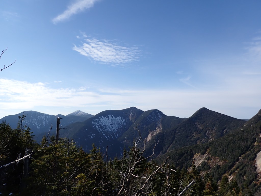
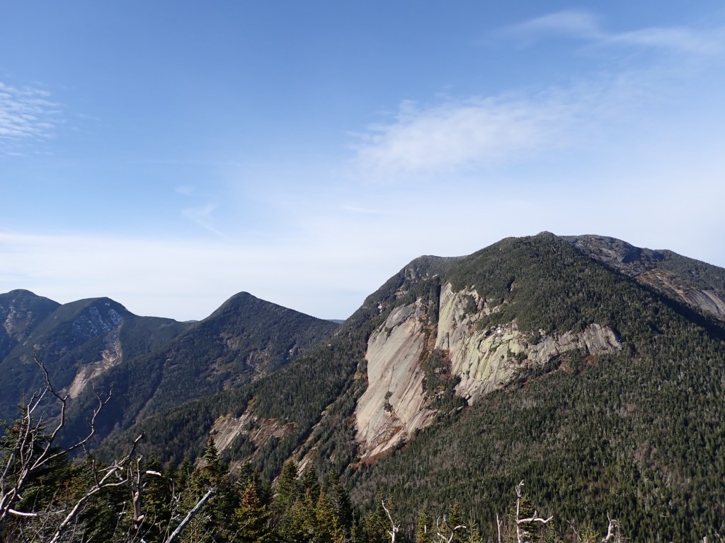
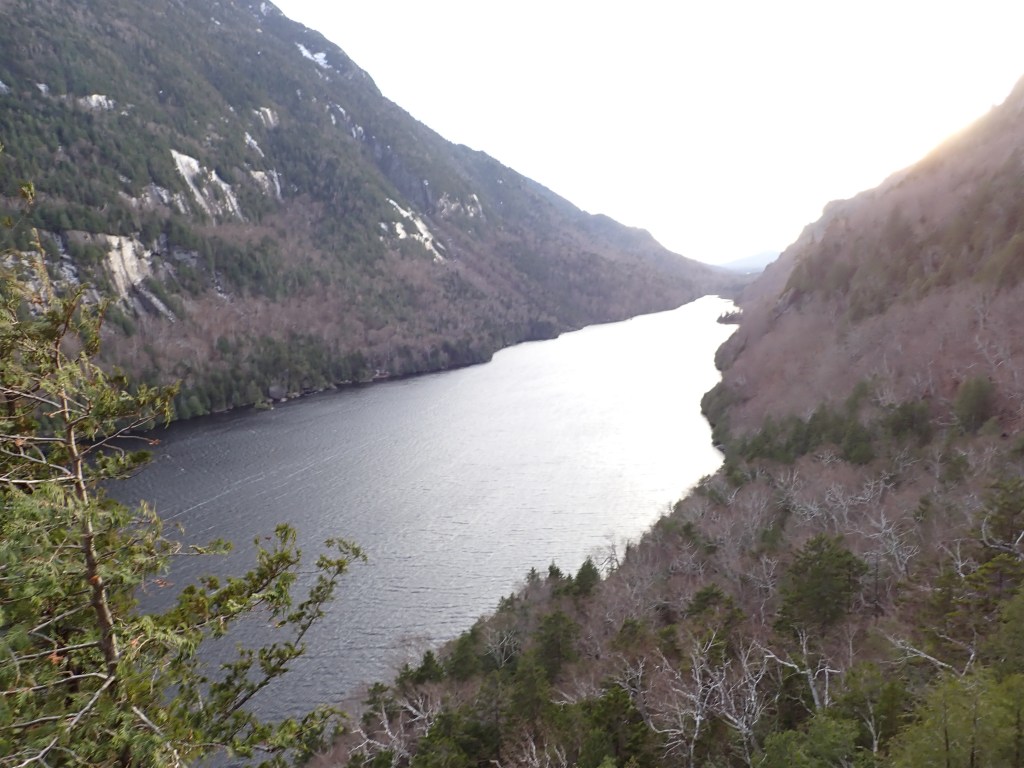
Descending the Scenic Trail was a bit gnarly, I did slip and fall several times on the leaves, but there were a lot of great places to get a good view of the scenery and nearby peaks, including Mount Colvin and Lower Ausable Lake below. I made it back to my campsite at around 5:30pm, where all the snow had melted, and had plenty of time to fire up the stove for a meal before the sun went down. I was in my tent at around 7pm.

Garmin GPS Track (Car to Camp)
Garmin GPS Track (Sawteeth)
Day 2
I was up at 6am and got my day started with oatmeal and coffee. Instant coffee is such a great way to get your caffeine fix in the backcountry – simply add hot water! It also tastes incredibly good to boot – I’ve shifted away from using my French press at home. It had rained the night before so things were a bit wet at camp, but the tent did its job so couldn’t complain.
I was on the trail later than planned at 8am. I was expecting a roughly 10 hour hike, which would get me back to camp exactly at sunset. I wasted quite a bit of time hunting for my glove, but when I checked the last possible place (the trail – I had to go back to camp briefly) I ran into a couple ladies who had found the glove and placed it on the cairn marking the campsite! Super appreciate the kindness on the trail. The start of the hike was a bit damp but fairly easy going to Elk Pass, where the trail splits between Nippletop/Dial and Colvin/Blake. Nippletop is the tallest of the four peaks, so I opted to get the greater elevation gain out of the way first.

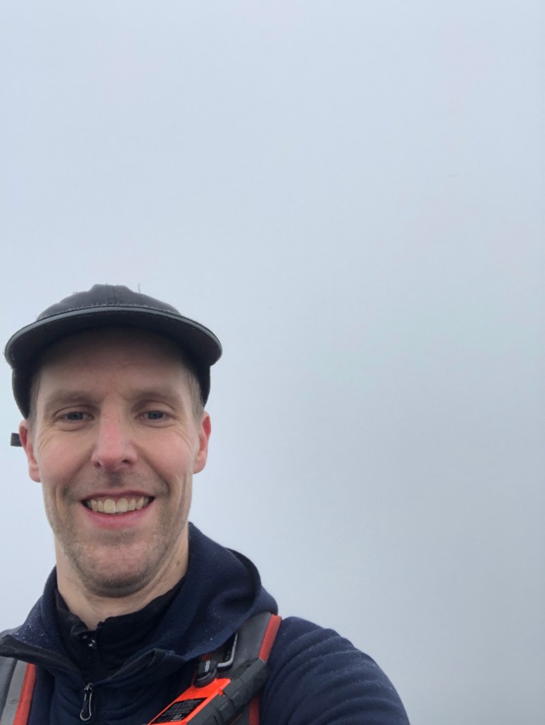
As I ascended, the trail gradually became icy and I eventually donned my microspikes at about 1250m of elevation. While spikes aren’t perfect traction, it helped a ton. I came across a dad and son who were descending and we had a great chat – the son marveled how I was able to get that far sans spikes! I eventually reached the summit of Nippletop roughly 2h 15 min after leaving camp, my big 4-0 in High Peaks! The peak was completely socked in with fog and cloud and the views, which are normally excellent of the High Peaks Wilderness, were completely non-existent. I couldn’t find any information on the origin of the name of Nippletop, but its name should be fairly self-explanatory.
I met quite a few people on my way down to Dial Mountain, which barely clocks in as a 4000 footer at precisely 4000 feet in elevation. I ran into Evan, an American expat living in Ottawa, who I came across later in the day, and was hiking all four peaks in the range with a full overnight pack! Reminded me of my first ADK hike. At the summit of Dial Mountain, my 41st High Peak, similarly with no views, I had a great chat with Chuck and Chris, a married couple. The summit was not marked, but according to my GPS the large boulder I observed (later found out this was the northernmost of two similarly tall summits).

After a short rest at Dial, it was time to backtrack more or less back up Nippletop to descend to Elk Pass. The spikes were on and off at this point as the ice was not consistent. This part of the hike was pretty tiring and I almost considered bailing on Colvin and Blake as the weather was not the greatest and both of my sets of gloves were damp. I ultimately decided to press on as I still felt very strong. Partway up Colvin I ran into Evan and we hiked all the way to Blake together. Evan works for the US Department of State and has had many interesting postings all around the world. It was great chatting with him and it definitely made the hike a lot more bearable. We did get off trail slightly heading up Blake and had to bushwhack a bit, but no issues otherwise.
When we reached the summit of Colvin (#42), it was already starting to get dark. Another peak with no summit marker and no views, but that’s ok! The peak is named after Verplanck Colvin, who was one of the earlier explorers and survey leader of the area. After a brief rest, we headed over to Blake Peak, which is notorious for all its elevation gains and losses along the way. I didn’t mind that so much, I could name several other peaks I disliked more (cough, Couchsachraga!). We reached the summit, my 43rd High Peak, which was marked by someone scratching “BLAKE” into a boulder, just over eight hours after I left camp. Blake Peak is named after Mills Blake, the assistant to Verplanck Colvin. Blake is one of the four ADK High Peaks that fail to top 4000 feet, and is undoubtedly only visited by people looking to finish the 46.


I opted to hustle down the mountain at this point, so I said goodbye to Evan and took off after a quick rest. It was almost certainly going to be a long descent, partially in the dark. I moved fairly quickly and donned my headlamp at about 5:45pm, just above the junction at Elk Pass. The last stretch of trail back to camp was long and seemed to last forever, and I was relieved when the light of my headlamp illuminated the small cairn marking my campsite. All it, it was 10 hours and 45 minutes on the trail, with just over a half marathons distance (21.46km) travelled, with nearly 2000 meters of elevation gain. Definitely the most grueling ADK day hike I’ve done!
I was pretty soaked and getting cold at this point, so I added all my damp layers and quickly got to work making dinner, which was some dehydrated lentil squash soup with the remainder of my pasta thrown in. I quickly washed up and got into my tent at around 7:45pm, removing all my wet clothing in the process, leaving most of it outside the tent body but under the rain fly.
Garmin GPS Track (Colvin Range)
Day 3 & Final Thoughts
I had all day to get home, but I still got up fairly early to make breakfast and coffee, before packing up and heading out. Luckily, the weather was really good and I had plenty of dry clothes to hike out in. I also opted to wear my hiking boots for the hike out since my hiking shoes were incredibly wet and muddy. It was a quick 75 minute hike back to the car – I saw plenty of hikers and even some wildlife heading up the road. Drive home wasn’t too bad either!

I definitely could have done a lot of things better on this hike, like bringing a dry sack to keep my layers dry (my day pack doesn’t do well in damp conditions), as well as my sit pad to make sitting down on damp surfaces a bit more bearable. Also bringing an extra set of gloves would have worked wonders. Luckily, the conditions weren’t quite cold enough for this to be serious, so I got away with one there.
Aside from these things, a very successful trip, which means I only have one more trip left to finish the 46 High Peaks. I’d like to do this in the winter, as the MacIntyres are largely above treeline and they look spectacular in winter. But, I may consider going a bit before the official winter season (which starts December 21st) if the weather is looking perfect.
