Quite a bit late getting this one out, but better late than never. So many photos to go through! As a follow up to my Intro to Mountaineering course from June 2022, I was back on another course in August 2023 with Yamnuska Mountain Adventures, this time with a focus on alpine rock in Bugaboo Provincial Park. This course was particularly important for my development as a mountaineer as many mountains consist of mixed terrain (snow/ice and rock), and several of the peaks remaining on my Canadian high points list (Thunder Mountain, NWT as well as Caubvick/D’Iberville, NFLD/QC) are purely alpine rock objectives. It was also recommended by a member of the Alpine Club of Canada (ACC) Toronto section that I get some exposure to all types of terrain prior to joining any serious expeditions.
This trip had been in the plans for quite some time – earlier this year my friend Karly (who I had met during the Intro to Mountaineering course and climbed Mount Temple with in Sep 2022) messaged me about signing up for this course and it was a no brainer. That being said, I was a bit nervous given my outdoor rock climbing experience was pretty much zero going in, but I was confident in being able to rise to the challenge.
For this course I acquired quite a bit of standard alpine gear, including hybrid mountaineering/hiking boots (La Sportiva Trango), an ice axe, crampons (Petzl Vasak) as well as various pieces of climbing gear (carabiners, sling, prussik cords). I had used the boots on an ADK trip in the winter and really liked them, so I was looking forward to seeing how they performed on true alpine rock.
Day 1: Meeting the group, Hike to Kain Hut
I had carpooled with Karly from Edmonton, and we had stayed in Cochrane the night before. Unlike last year, where I arrived a bit late to the Yamnuska office, we made it with plenty of time to spare, and stopped at Beamer’s for coffee.
We met our fellow course participants as well as our two guides. There were four of us on the course in total. The other two guys were Tyler, a lawyer from Toronto (who coincidentally lives less than 10 mins away from me) as well as Tony, from New Jersey, who currently works in the film industry. Pretty cool guys! Our guides were Nick (originally from northern England) and Paul (from Alberta), and as expected, both came equipped with great sense of humor. After a quick gear check (Nick had Tyler swap out a bunch of his gear, I also realized that a grigri was not the correct belaying device), packing our personal snacks as well as a portion of the group meals (thankfully no ropes, as Nick had brought them up to the hut earlier in the week), going through the hike up to the hut, reviewing weather, and signing waivers, we packed up and were on the road.
For this course, unlike the Intro to Mountaineering, we piled into personal vehicles for the trip to the trailhead in the Bugaboos. Karly and I were quite relieved that Tony and Tyler were driving trucks, which were ideal for the uneven former logging road that would form a good portion of the drive, which meant we would not need to take Karly’s Chevy Cruze rental. Tony was in the midst of a massive cross-continent road trip – he had a lot of time off as he was affected by the (then) ongoing labour dispute, and had a super cool setup on the back of his truck.
The trip from Canmore to the Bugaboos had us driving through Banff and Kootenay National Parks, as well as a brief stop at Radium for fuel and snacks. I remembered that I had been to the hot springs about 6 years ago when I was in the area visiting a friend. After entering Brisco, the road transitioned into an old logging road, which wasn’t too bad compared to some of the roads I’ve driven on in my little hatchback (such as the road to Cheticamp Flowage on Cape Breton Island!). We learned about an infamous rock just before the trailhead which Paul had bumped into on his way out from another recent excursion in the Bugs, which resulted in a Yamnuska vehicle suffering significant wheel/tire damage, and having him and Paul stuck in the backcountry for several hours.
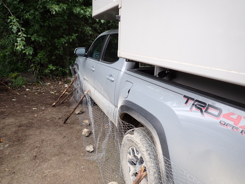
Eventually, we made it to the trailhead, and were greeted by the site of hundreds of meters of chicken wire that had been left behind. It is highly recommended in the Bugaboos to protect your vehicle by wrapping it with chicken wire to keep the critters away from the undercarriage. Apparently the porcupines there love chewing on brake cables! This meant that the guys didn’t need to use the brand new sets of chicken wire they brought along!
After some time ensuring the fences around the vehicles were sound, we were off on the hike up to Kain Hut! This hike would take us close to 5km in distance but around 700m in ascent (up to around 2250m in elevation), making it a pretty steep hike in sections! The hike did start off pretty flat in the forest but soon took on quite an incline. In addition, it started raining pretty hard about halfway up, making certain sections a bit trickier to navigate. On a creek crossing, it was quite slippery and Tyler took a spill and cut the bridge of his nose, luckily not serious at all. We were treated to some great views of the Bugaboo Glacier as well as a few of the peaks such as Hounds Tooth, and eventually made it to the hut in roughly 2.5 hours (including a break about halfway up).

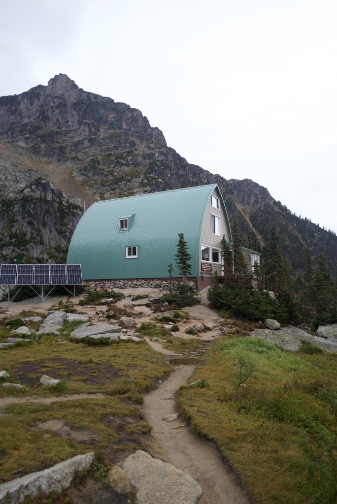
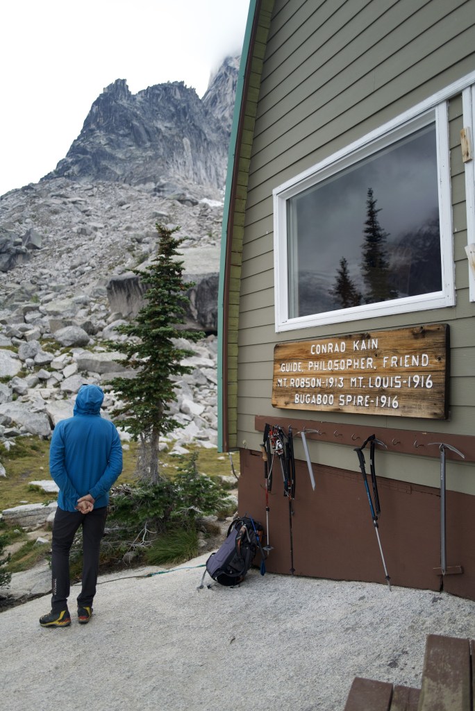
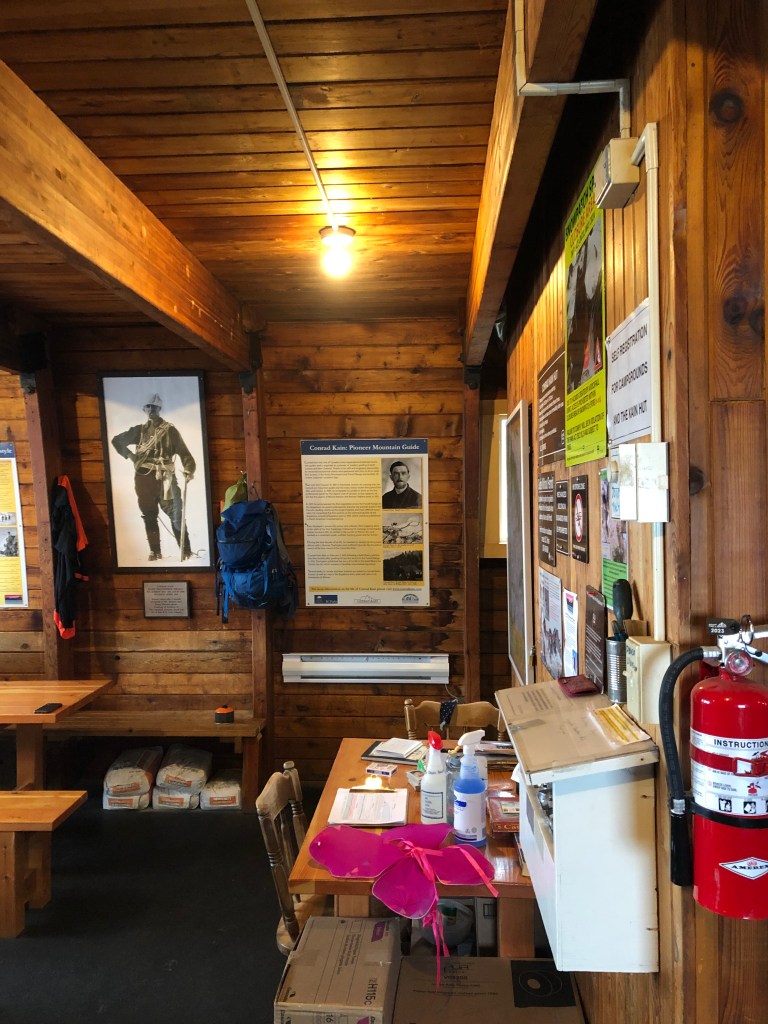
The Kain Hut is named after Conrad Kain, an Austrian mountaineering guide who had emigrated to Canada in 1909 and was instrumental in spearheading exploration of the Purcell Mountains (of which the Bugaboos are a subset) and is credited with many first ascents in the area, including Mount Robson, the highest point in the Canadian Rockies (3954m). It is quite wild thinking about how he and his companions accomplished what they did with fairly primitive mountaineering equipment! The Hut was constructed in 1972 and is currently maintained by the Alpine Club of Canada. It features a kitchen area with methane-powered stoves, a seating area with plenty of games and books, and two levels of sleeping areas which can comfortably sleep 40 people. The first level was comparable to the Bow Hut (with a walkway in the middle), but the second level’s floor was entirely covered in mattresses. I grabbed a spot at the far end of the top floor by the window, before realizing that it could get awkward if the floor were to fill up and one needed to get up to use the bathroom in the middle of the night!


The rest of the day was pretty relaxed. We had a great dinner, which was prepared by Nick and Paul, and played cards (Asshole/President). I wish I remembered how to play euchre!
Garmin GPS Track (Hike from Parking Lot to Kain Hut)
Day 2: Exploring the Area
We were up at 6:30am and had breakfast at 7am, which was scrambled eggs, hash browns, and bacon, including veggie bacon for the vegetarians, which actually outnumbered the meat eaters in our group who weren’t guides (only Tyler ate meat). The day began by reviewing the technical gear we would use on the trip – crampons, harnesses, rope (including rope management and knots). We then headed up to the Crescent Glacier for some practice. It was here I successfully managed to lose track of practically every single piece of gear I had (namely dropping a glove when I went to pee, then misplacing the other one). As someone who is generally quite organized in the backcountry, this was pretty embarrassing!

Unfortunately, the weather turned foul pretty soon after we got to the glacier and got our crampons on, with a thunderstorm complete with snow/sleet in place of rain. We quickly retreated back to the hut after only a couple hours on the mountain.


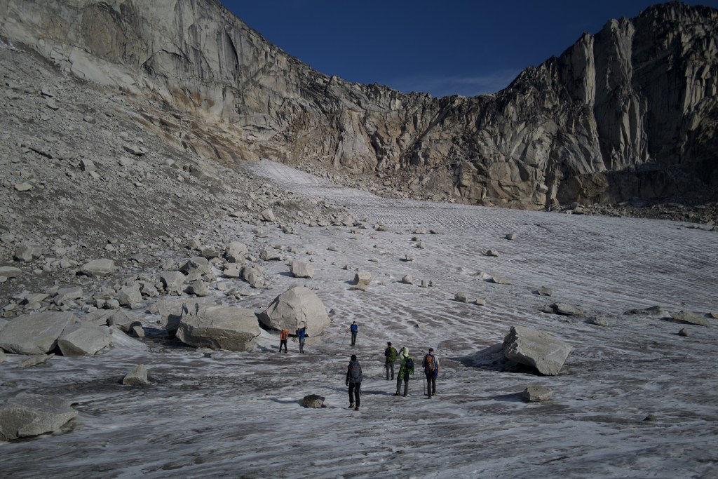
After lunch, we reviewed crevasse rescue in the hut (using very scaled down demos on the table!) and the weather turned around afterwards, so we went back out for a quick 90 min hike up to Applebee campground, one of two tent camping areas in the Bugaboos. This was a pretty sweet little camping area with great views of some of the peaks like Eastpost Spire and Snowpatch Spire. It was interesting learning about the evolution of the area and getting an understanding of how detrimental the retreat of the glaciers has been for alpine rock climbing routes. We even saw a daring pika interested in Karly’s dropped pack.


The evening’s game was Monopoly Deal, and dinner was lentil chili and rice with a butter tart for dessert. Today’s meals were probably the only ones I wrote down in my journal, but I do promise they were all very good!
Garmin GPS Track (Crescent Glacier Hike)
Garmin GPS Track (Applebee Dome Hike)
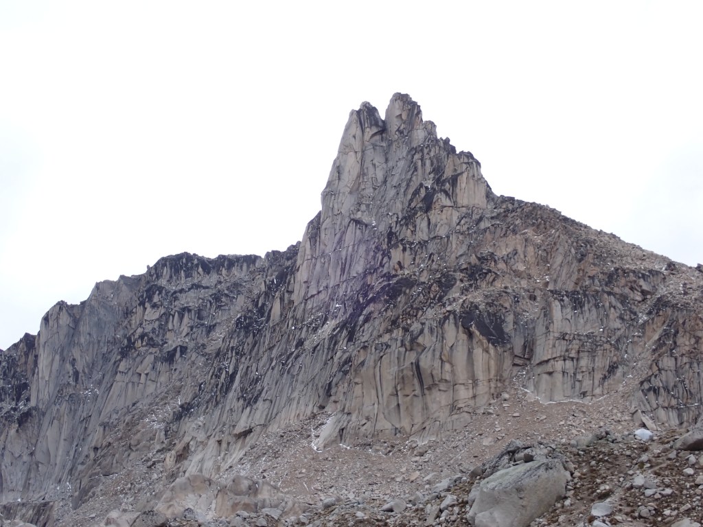
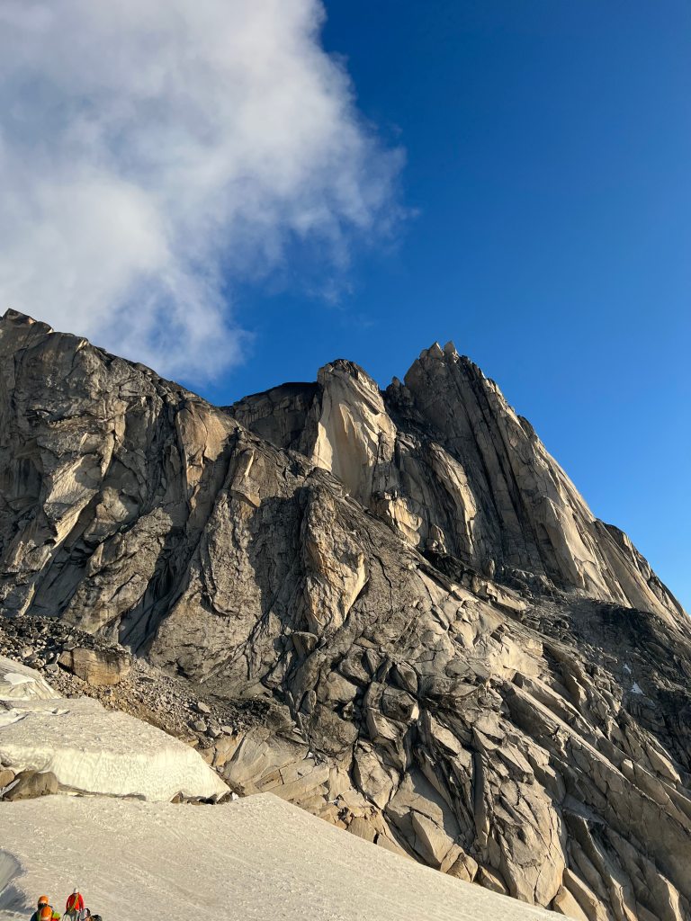
Day 3: Eastpost Spire
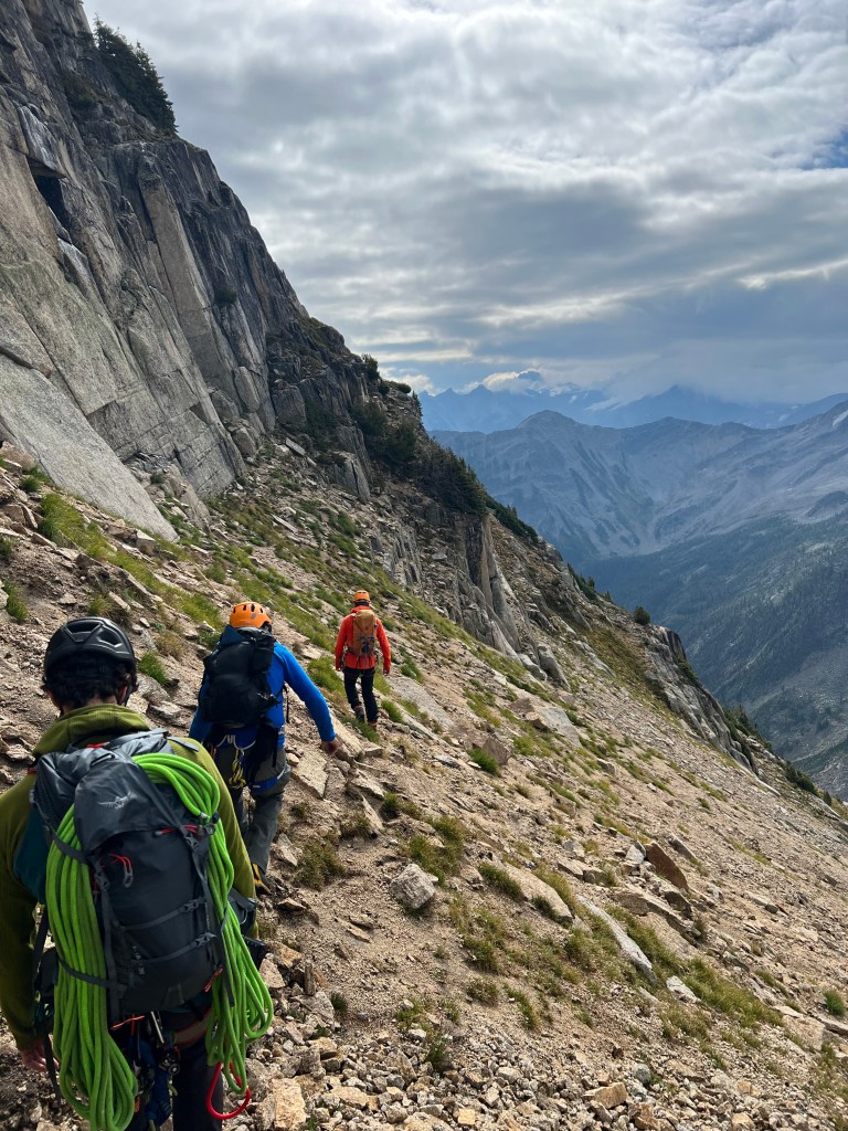
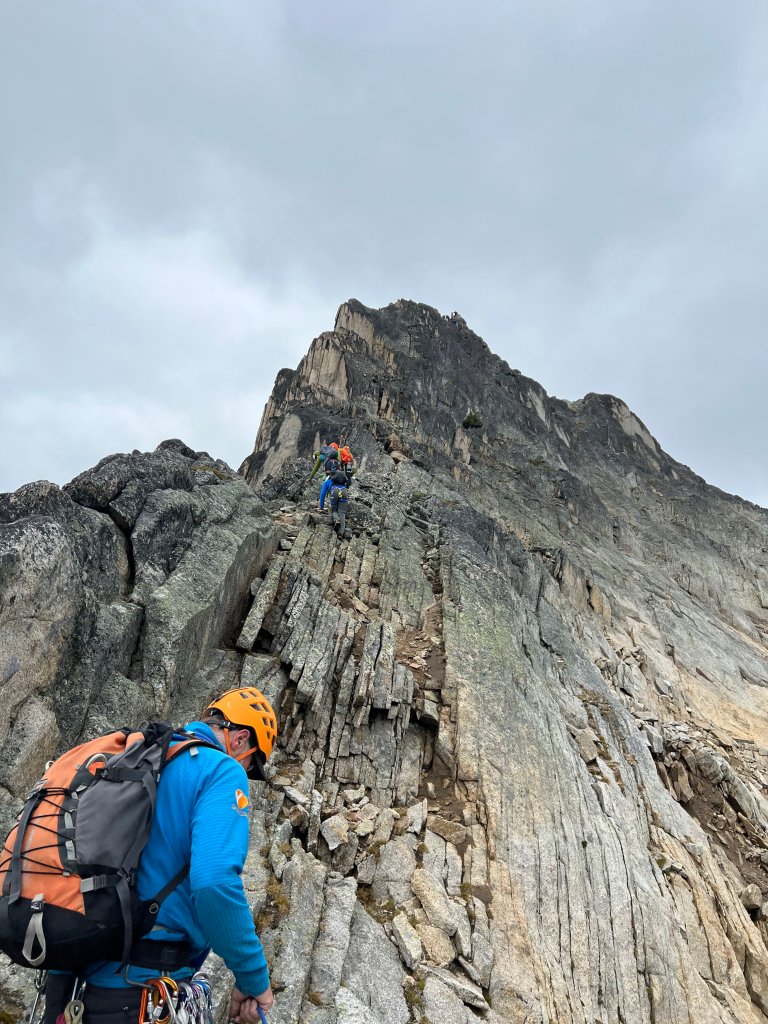
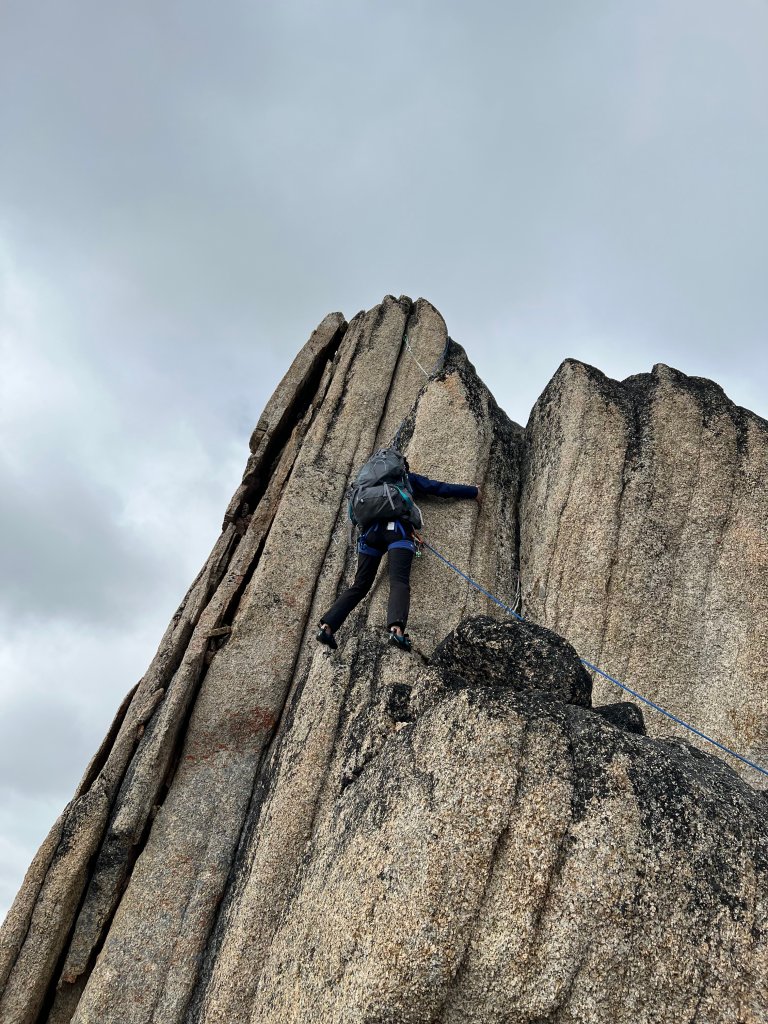
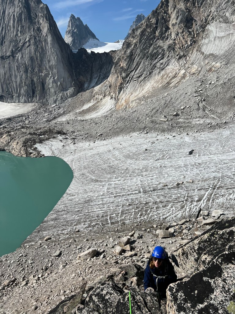
The next three days each featured an alpine rock objective. The first was Eastpost Spire, a fairly straightforward peak close to Appleby Dome. Eastpost, like many of the peaks/spires in the area, has multiple routes up; we elected to scramble across the south side, which would lead us to several pitches of climbing up the southeast ridge (5.6), and descend the Class 4 terrain down the northwest ridge, effectively traversing the peak. The hike up was pretty fun and involved navigating some scree along the south face.
This was certainly a crash course in rock climbing – while I had some experience being roped up this was far more technical than the glacier travel I had done on the last Yamnuska course I had attended. We split into two teams of three and kept these teams for the remainder of the trip – Tyler and Tony were led by Nick, while Paul led Karly and I. It was really great learning about setting up gear and removing it as we climbed, as well as the various belay methods (I was pretty much only exposed to top rope at the gym) as well as protection. For Eastpost Spire, I was at the back of the group and removed the gear (cams) as I climbed up. The climbing wasn’t too difficult but definitely felt harder than a 5.6!


The granite was very grippy and also quite sharp in places, which meant that although I got good purchase with my holds, my hands did take quite a beating over the course of these three days. We did about half the pitches in our boots, which were actually really solid climbing shoes for “easier” terrain, and then switched to climbing shoes for the last few pitches, something that we generally did for all of our climbs on the trip.
After reaching the summit we rappelled down using conveniently placed rappel stations. Took a bit of getting used to but it was fun descending that way. All in, about an 8 hour day!

Garmin GPS Track (Eastpost Spire)
Day 4: Crescent Towers
The following day’s objective would be the Lion’s Way route on Crescent Towers. We were up fairly early for breakfast at 6:30am and were on our way by 7:30am. It was a pretty warm day as we hiked up to Applebee campground and started our way up a large boulder pile at the base of the Towers. We had to be mindful of where we were placing our feet, as many of the boulders were loose and not secure.


We remained in the same teams as the previous day, and made our way through six pitches of varying difficulty. This was probably the most technical day of climbing, with lots of challenging moves, as well as several sections involving crack climbing and hand jamming. My hands took quite a beating on this climb, and got pretty bloodied. Unfortunately, Karly, who was behind me on the rope, had to not only contend with the terrain, but also dodge the blood from my hands and fingers. 😦
We started in boots, with the first two pitches reasonable, but switched out to rock shoes for the remaining four pitches. It was truly exhilarating and terrifying to stand on a small ledge the size of a doormat to change shoes, with a solid 20 meter drop below (we were clipped in, of course!). The last bit of the climb involved some short rope scrambling, and after donning boots, we rappelled down some of the descent back to the boulder pile, taking it very slowly. All in, just over ten hour day!

Back at the hut, we met Nicole, who was there with her guide Jean, and it was great meeting more people. It was a pretty long, tiring day, and I was feeling pretty wiped that evening. Nick mentioned that the conditions were looking great the next day, and that we would be getting up at 3am the next morning to tackle Pigeon Spire, which seemed very daunting yet exciting at the same time. I made sure to get properly hydrated and also take it easy that evening to be as prepared as possible.
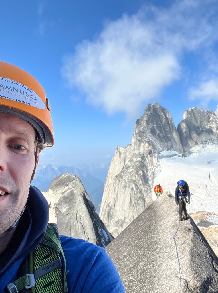
Day 5: Pigeon Spire
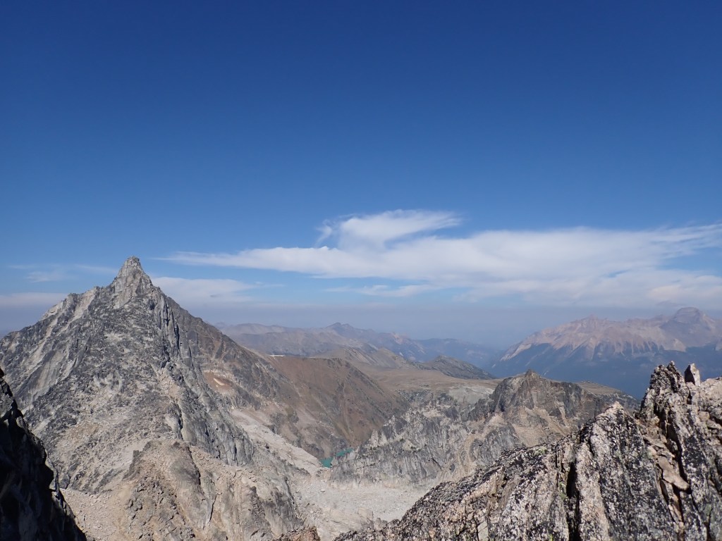
Our final full day in the Bugaboos was a full day hiking up to the base of Pigeon Spire followed by some exciting scrambling up the three summits of the mountain, along with a bit of climbing at the end. In terms of technical work, this would be some of the easier climbing of the trip, but still very strenuous with a lot of mileage to get to the peak (including some glacier travel) along with some fairly exposed class 3 and 4 scrambling.
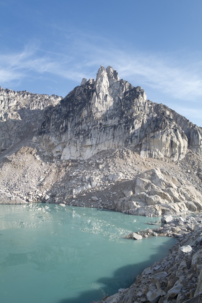
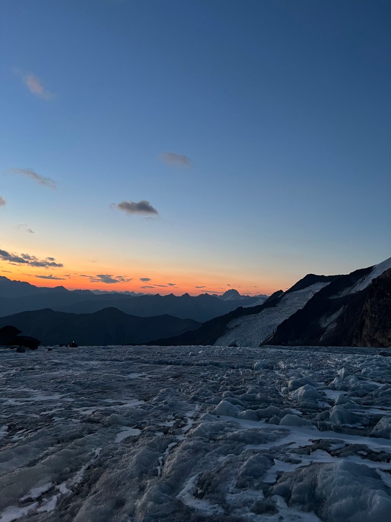
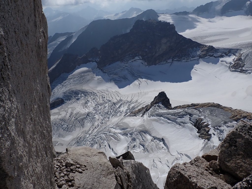
We were up at 3am and groggily had breakfast, and were out on the trail at around 4am, under the light of the moon and our headlamps. Nicole and Jean joined us for this adventure, though we largely stayed in our smaller groups when on the mountain. The hike up to the Vowell glacier was pretty fun in the dark, with a couple spots which required cables to get up over some tricky terrain, and a massive boulder field we had to work through to get to the base of the receding glacier. Nick mentioned that this climb used to require far more glacier travel as the Crescent Glacier extended further south, and this boulder field at one point was covered in glacial ice. It was probably also accessible via the Bugaboo glacier close to the hut, but that terrain is virtually impassable now due to the fragility of the glacier and the deep crevasses that were easily visible from the hut. I even had a pack rat venture close while hiking, it was probably interested in the light from my headlamp!
After about 2.5 hours, we reached the start of the glacier, so it was time to get our crampons and harnesses on, ice axes out, and get roped up. It was around this point that the sun finally started to rise, providing some incredible views of the surrounding terrain.

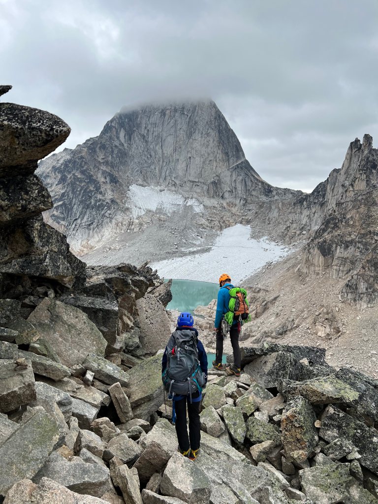
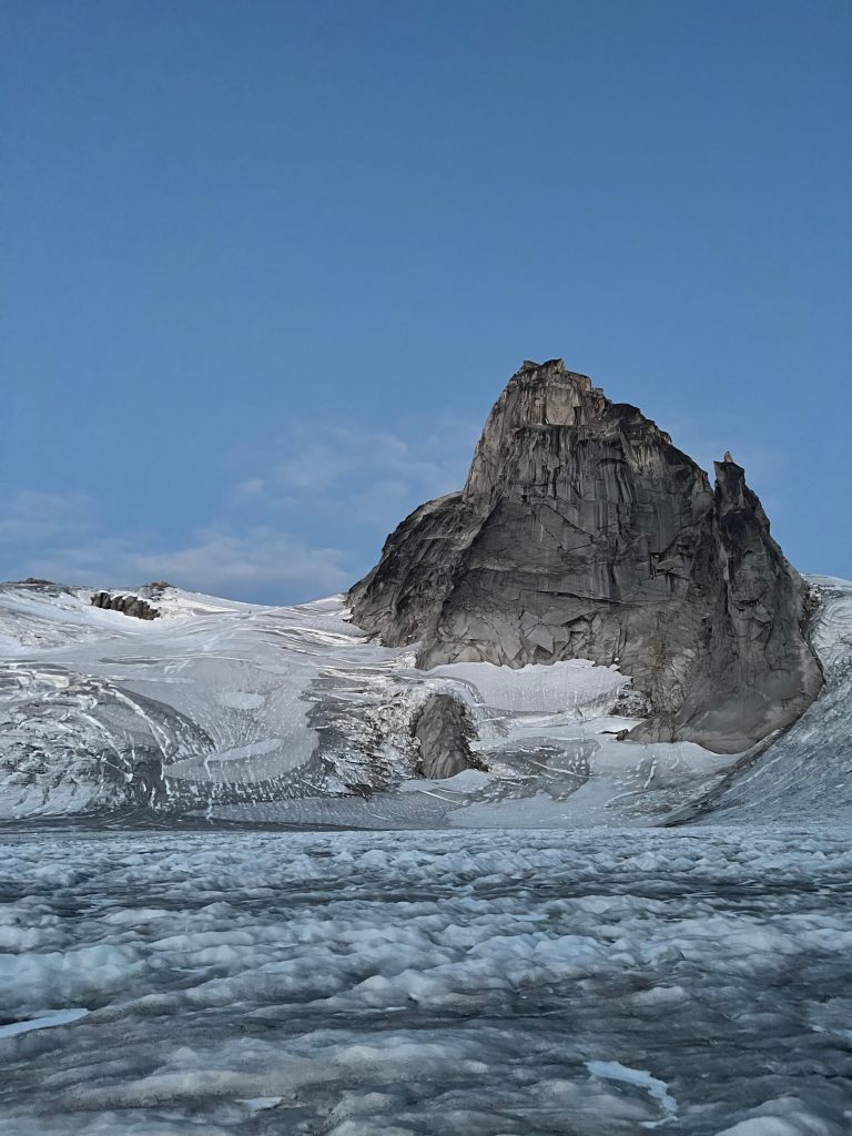
The hike up the glacier was certainly interesting! As we were at the end of the season, there wasn’t too much snow cover left, meaning the crevasses were very easy to see. The problem was that there were so many of them, and they were so wide, we had to take a torturous path in order to skirt around them – they looked incredibly deep. One spot had us crossing a snow bridge close to the side of Pigeon Spire, but it wasn’t too bad and we got to the base of Pigeon in no time. Plenty of great views of the Howser Towers nearby!


Once we got to the base of the scrambling/climbing section, we stowed our crampons and ice axes, and got ready for the ascent. There was a convenient alpine toilet situated here, which was great to see since human waste does quite a number on the environment. Must be a pain to empty though! Pigeon Spire features two false summits en route to the true summit, and the climbing wasn’t incredibly technical, which I enjoyed. Still, it was quite exposed, so Paul did a great job leading us and providing protection. It also could not have been a better day for climbing in the Rockies!
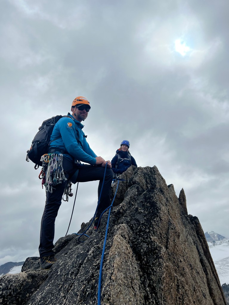
There were three interesting sections of the climb I want to highlight here. The first involved descending a large slab from the first summit. Fairly grippy rock, and it was also quite a quad-burner when we had to go back up on our way back! The second was probably the most exposed part of the climb and involved a bit of “au cheval” movement to traverse a fairly sharp ridge prior to the second false summit. This was definitely super uncomfortable! There was also a bit of technical class 5.4 climbing heading up to the true summit, but compared with the other climbs on this trip, it wasn’t too difficult. Before long, we were at the true summit, which had a rappelling station and a large boulder just above.


Heading down was quite interesting – we descended quite a bit of the terrain via rappelling which was a lot of fun, though it was very cold! We did have to traverse the “au cheval” section again, which was not so much fun. One more rappel down after the first false summit and we were soon back where we stashed our glacier travel gear.


We were pretty exhausted at this point, and the descent down the now quite soft glacier was a bit tricky as even with crampons it was a bit slippery. It was quite a relief to get to the base of the glacier and start the bareboot hike back to the hut. Unfortunately, my GPS watch had died descending Pigeon Spire, but I estimated it to be a roughly fourteen hour day. Fairly relaxing evening as we were all super exhausted, but it was a solid day overall!

Day 6-7: Departure
A bit of a slower morning on our last day in the Bugs – after breakfast we took our time gathering our gear and packing up. I did have to turn back a few minutes after we left as I had forgotten my phone in the hut but all good. It was a very pleasant hike down compared to the hike up, and we were back to the cars in good time.
The drive back was quite eventful – Tyler’s truck was behaving quite oddly. It wasn’t able to reach high speeds and was having a lot of trouble accelerating, seemed to be a transmission issue. After passing through Radium, it was not looking good for the long drive through Jasper and Banff, an area with very poor cell service. We decided to return to Radium and find a garage to look at the truck. We found one, and while Tyler was figuring out logistics for getting it fixed (he, like me, had an early morning flight back to Toronto the next day), we hung out and each took a turn riding Tony’s snazzy mountain bike around the block. Super cool ride!
It was decided that Paul and myself would jump into Tony’s truck and the five of us would return to Canmore while Tyler got things figured out. He luckily had family in Alberta to help with the truck, and he was able to get his flight out the next day. The drive was a bit cramped but went smoothly – Tony kept us entertained by having episodes of “The Office” playing on the screen. We got back to Canmore and parted ways, with Karly and I hopping in the rental and driving back to Edmonton. We got back to Karly’s apartment fairly late but still got a good nights sleep before a very early Uber ride to the airport.
Closing Thoughts
Overall, this was a fantastic trip. Lots of good and challenging times, met a lot of great people, and picked up a lot of valuable experiences along the way. I’m really looking forward to carrying this momentum forward into next year where I have a ton of ideas on trips/excursions to build upon what I learned on this course.
A huge thank you to our guides Nick and Paul for their guidance, in particular Paul as he had worked with Karly and I on the climbs, and was incredibly enthusiastic, helpful and patient throughout. Also it was great to meet with both Tyler and Tony, super friendly, chill guys who I hope to cross paths with again in the future! Finally, it was great hanging out with Karly again, both on the road between Edmonton to Canmore, as well as during the course and on the climbs. Thank you for putting up with all the blood, again I’m so sorry!! Also, I want to make clear that a lot of the photos in this post were taken by my tripmates – I cannot recall who took what, but thank you all for sharing your shots!
I’ve got quite a few plans to return to Alberta in 2024, both to acquire new alpine/climbing skills as well as gain more technical experience in the mountains. Bring on the new year! Until then, back to the Adirondacks to finish the 46!

Amazing adventure! Thank you for sharing!
LikeLike