Back in February, I made plans to apply for the permit lottery to climb Mount Whitney. Whitney, standing at 4421 meters above sea level, is the highest point in California and in the contiguous (lower 48) states, as well as the 25th highest mountain in North America. Although Whitney is a very tall peak, its most popular route is actually a pretty straightforward Class 1 hike (in perfect conditions), though it is extremely long and gains a ton of elevation. I luckily remembered to apply for a permit at the very last minute on March 1st when applications closed (weirdly enough, the application window is from Feb 1 to March 1 inclusive, and didn’t end on February 29th which I had feared).

I found out on March 15th when I was away in Alberta that I won a permit for Saturday, June 1st, which was pretty exciting, so I quickly made plans to travel down there. Since Whitney would mark the highest elevation I would ever be at (highest I’d been coming in was Mount Temple at 3544m), I planned to incorporate a small period of acclimatization into my training (this is also highly recommended for anyone attempting the climb). I planned to arrive in the Sierra Nevada a couple days before my attempt to gradually work up to higher altitudes, including spending nights up high. In addition, I started following a more consistent and structured training program by Uphill Athlete, however I injured my foot after about ten days on the program, so I needed to take two full weeks off of training, resuming running/hiking about five weeks out from my trip, and subsequently not having the fitness I was hoping for. However my athletic base is solid and I was confident I would be fine, the key was to train smartly, stay hydrated and ensure I had proper nutrition and sleep in the weeks leading to my trip. The day before my trip, I saw my doctor and he prescribed diamox, which is the most common (and effective) medication to minimize the effects of altitude sickness. I planned to take it starting the evening of my arrival in California. I also went down to the Adirondacks on the May long weekend to get some elevation gain in, despite the overall altitude being much lower than in the Sierra Nevada. Gotta make do with what’s available…
Another thing that was interesting about early June was that historically there has been snow on the main route, so I would need to bring my mountaineering boots, crampons and ice axe. The plan was still to attempt the normal route and not the shorter but steeper Mountaineer’s Route which is optimal when there is good snow coverage (April or earlier), though there would be the possibility of taking a slightly different line up a snow slope if the switchbacks were impassable.

Day 1: YYZ –> LAX –> Sierra Nevada
My flight to California was 3 days prior to the date of my permit, in order to get some acclimatization in. My flight was at 10:30am, so I made sure to get to the airport super early in the day. Leaving at 7am and using my carless sequence of transportation (bicycle –> subway –> UP Express) I got to my gate with plenty of time to spare. The flight was pretty uneventful, though we got some great views of the Colorado Rockies in the air. The flight attendant at the back of the plane was an interesting guy – he was around 50 years old and had just become a flight attendant after working a corporate job his whole career. Quite the change and a great way to travel!

After landing in Los Angeles, I hopped on the shuttle bus to the car rental (Hertz) and picked up my car, a mid-size SUV (Mazda CX-5). I opted for a bigger vehicle in case I ran into troubles getting around in the mountains, though it was forecasted to be just above freezing on the summit of Mount Whitney so I suspected at that point I could have probably gone with a sedan. I made a quick stop at an REI in LA to pick up some camp fuel as well as some more matches. The only matches they sold were fireproof and stormproof, so a bit much for this trip. After getting back on the road again I braved some of the infamous LA traffic (which honestly wasn’t really that bad, being a Toronto resident) on my way north, stopping at a McDonalds for a large fries and iced coffee on the way. The drive was pretty scenic, as there were quite a few mountain ranges along the way. I never realized there were decently sized peaks only forty miles away from downtown LA. Really unfortunate the same can’t be said about Toronto (which sits at the same elevation). As I headed north into Lone Pine (elevation 1281m), the Sierra Nevada range gradually came into view on the left side, with some very big peaks visible. Truly a beautiful view, even from the road.

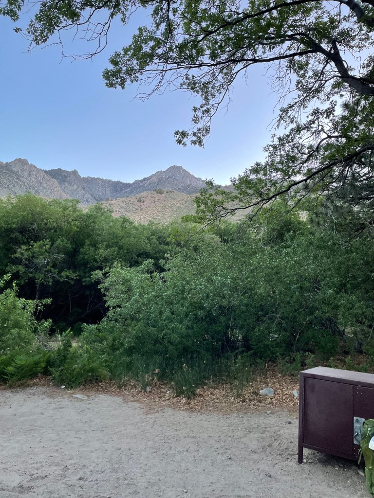
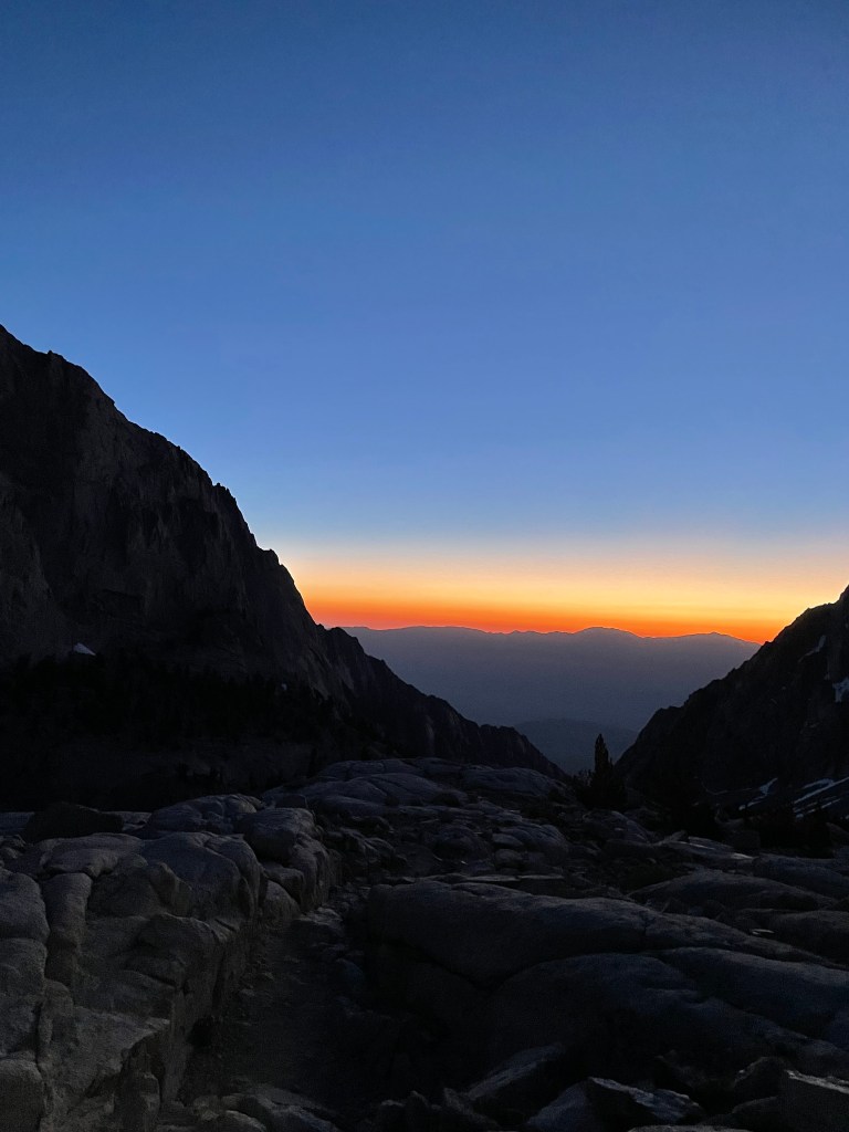
Upon entering Lone Pine, I made a quick stop at the grocery store to pick up a few items (jug of water, trail mix, instant oatmeal) before heading further north to my first stop – Grays Meadow Campground. Situated at around 1800 meters, this is a nice little campground which would serve as the first stage of my acclimatization schedule. I stayed in the upper campground (Site 13) and arrived shortly before sunset. I quickly pitched my tent, heated up some water for soup, and stowed my extra belongings in the bear locker before heading to bed.
Day 2: Climb High…
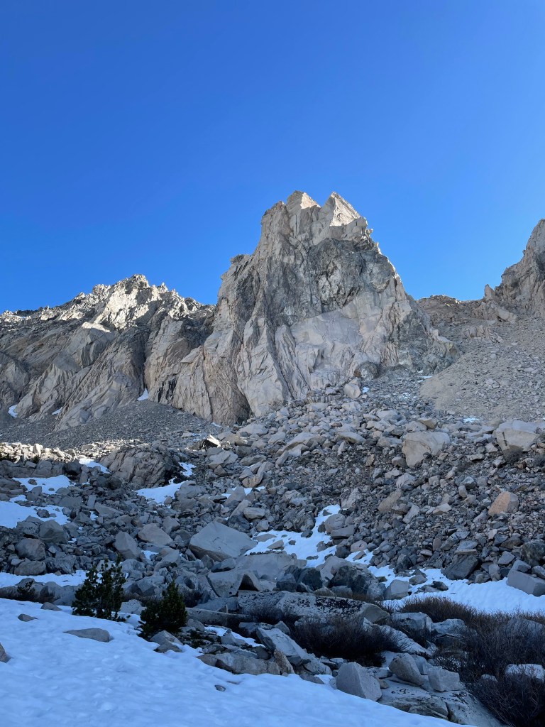
Sleep was pretty uncomfortable as I needed to get up and use the bathroom a handful of times, likely the result of the elevation combined with the diamox (also trying to stay hydrated in general). I ended up waking up once the sun rose at 6am and cooked up some delicious instant oatmeal (the variety pack I bought was “X” and cream and there were four different flavours) as well as instant coffee, then strolled north to an open area to enjoy the view. Kearsarge Peak was the highlight of the view, and is a peak I’d like to try sometime as it’s not too technical and the route looks interesting.

I also started monitoring my blood oxygen saturation using a finger meter that my parents got me. Ideally your O2 saturation should be 97% or higher, and this naturally decreases as you gain altitude. With time spent at altitude (without gaining too fast) you can gradually recover your O2 saturation to some extent. At Grays Meadows my O2 saturation was around 92% when I arrived but by morning it had risen to about 96%. However the elevation of the camp is not considered an elevation where the body experiences a significant physiological response to altitude.

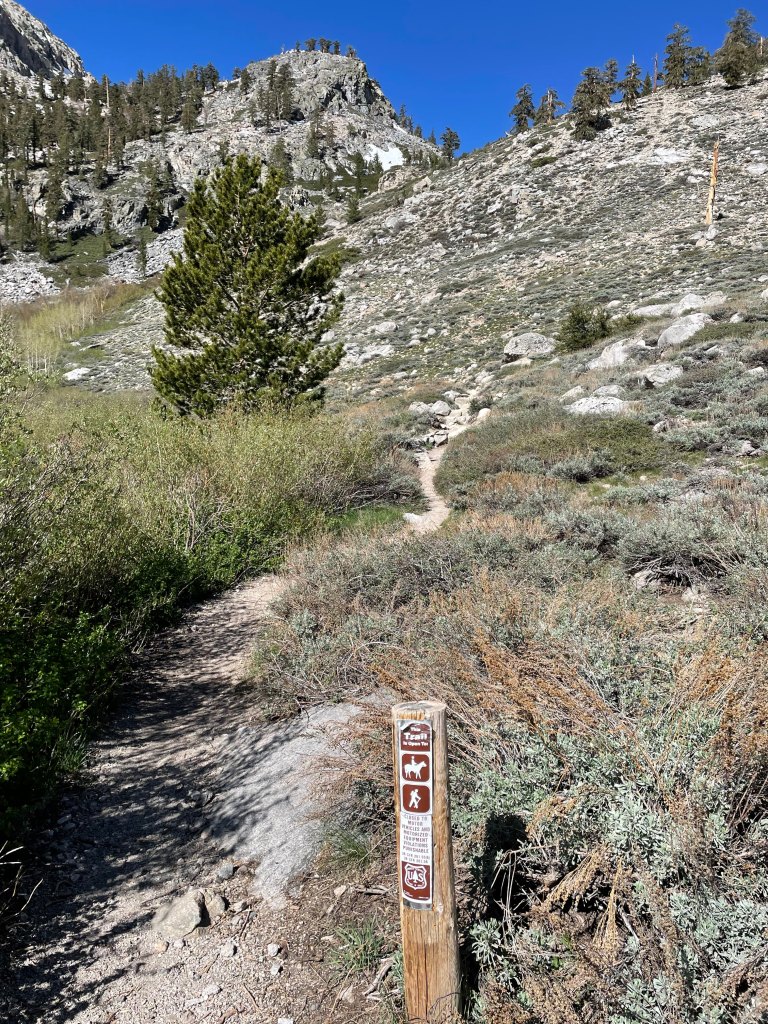
I returned to camp, broke things down and packed my 50L pack for my planned overnight backcountry camp that evening. I then hopped in the car and drove up to Onion Valley, a bit further up the road but substantially higher in elevation at 2800m. After walking around a bit, I started my hike up the Golden Trout Lakes trail. This trail, which is between 3 and 4 kilometres from the trailhead, rises about 700m to the furthest of three lakes. At each lake there are backcountry camping options with access to several 3500+ meter peaks. The goal of this overnight was to keep things simple and take it easy on the hike up, and relax at camp until the hike down. I would also be monitoring my O2 saturation periodically and staying hydrated.


The hike started off fairly straightforward, with the trail easy to follow, and I tried to keep my heart rate reasonable to not burn out. After crisscrossing a series of switchbacks and a few water crossings, the trail enters a valley which is followed up to the Golden Trout Lakes. Here the snowfields began and I got off track quite a few times as I lost the trail and not many people had evidently been up this way in some time. The snow was pretty consolidated and firm, though I had to be careful on the edges of the snow as well as avoiding rocks and trees to prevent myself from punching through.

Eventually, the trail hit an alpine meadow at around 3325 meters, where it actually splits off and you can head right to the westernmost of the Golden Trout Lakes. I had planned to detour this way on my way down, but was thinking given the difficulty I was having that I might skip that. This area was really beautiful and was a great water source.
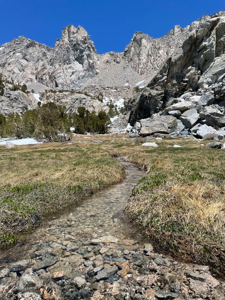
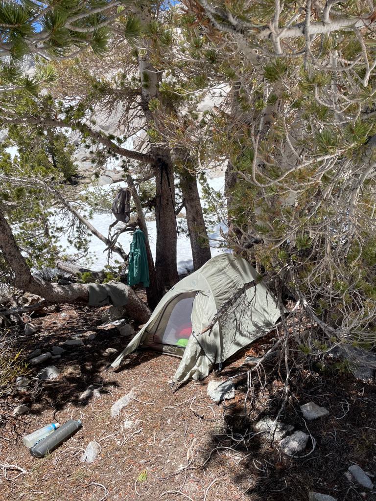
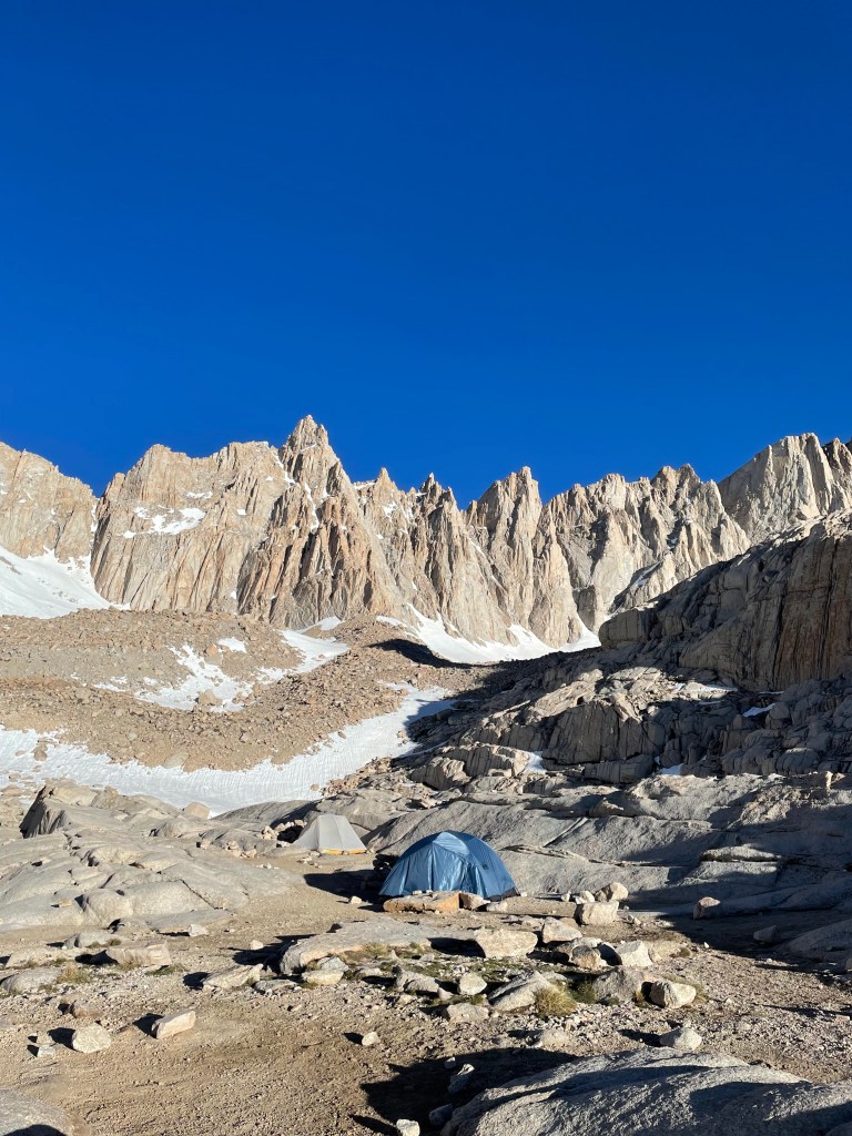
From here, the trail continued up and I got off track a couple times, including unnecessarily climbing a small ridge rather than staying in the valley. Eventually I reached the first of the two lakes and it was here I decided that I would camp here (at 3430 meters) rather than press on to the next lake. Remember, my goal was to acclimatize, not get a workout, and the second lake was only about 25 meters higher than the first. The lake was partially frozen and there were great views of several neighbouring peaks like Kearsarge Peak, Dragon Peak, and Mount Gould.
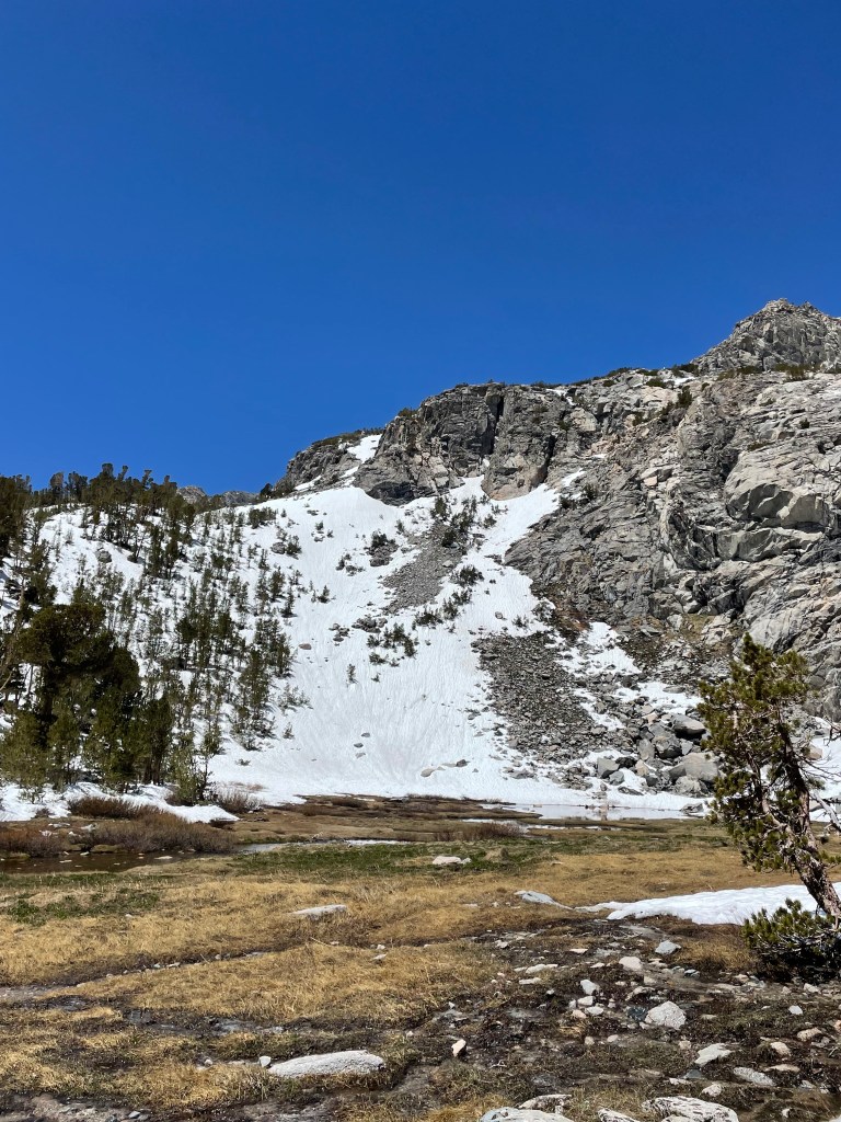
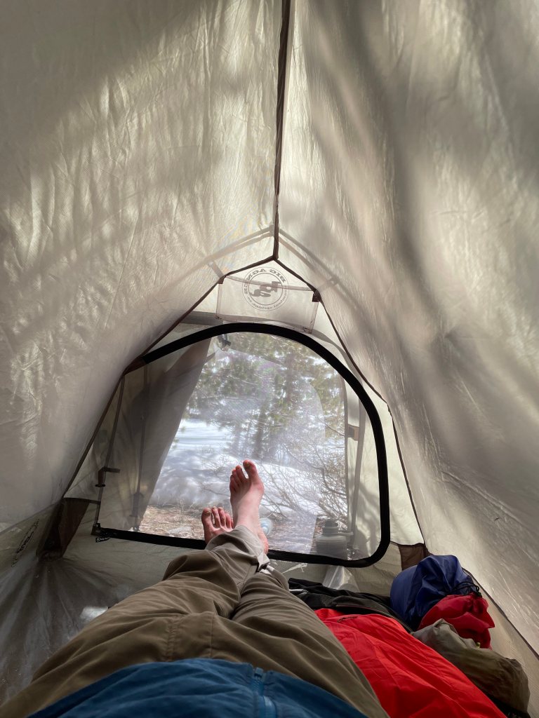
The camping area was completely covered in snow, but I found a neat little spot a bit further down that was bare and sheltered by trees, so I opted to set up camp here. It was definitely challenging unpacking and getting set up as the altitude was noticeable. It felt good to finish and fire up the stove for some hot soup and a snack. The weather was absolutely gorgeous and the views from camp were incredible.

By the time I finished lunch it was around 1pm, and I spent the next four hours chilling at camp in my tent (with the vestibule open to get more airflow). I tried to stay out of the sun as much as possible (you’re more susceptible to sunburn when taking diamox) and read my book on avalanche safety, as well as listened to some alpinism podcast episodes.
I kept a close eye on my body’s reaction to the altitude when I was here, especially watching out for any symptoms of altitude sickness. I had a mild headache for a bit and even some very minor nausea, but that passed relatively quickly as I was mostly staying put, reducing my activity and staying hydrated. I checked my O2 saturation periodically throughout the afternoon, and it was fairly low, around 79%. My heart rate was also quite high even at rest at first, in the high 60s to low 70s, which is much higher than at sea level (low 50s to mid 50s), though it did gradually settle to a level only slightly higher than my sea level resting HR.
At around 6pm I cooked up dinner which was the usual camp meal (pasta, red lentils, dehydrated veggies) with some chocolate afterwards. I tried some of the matches I had purchased at REI and they were surprisingly awful to light. I wore out the strike pad on one side of one of the matchboxes just trying to light one match. And once they’re lit, they stay lit (hence the “stormproof” aspect) so I had to extinguish them by “butting” them out like cigarettes in the snow. After washing up and collecting more water (there was some very thin ice to break through to access it) I settled back into my tent for the night. Was feeling pretty good at this point now that my body had started adjusting!
Training Peaks Activity – Onion Valley to Golden Trout Lakes
Day 3: …Sleep Low
Sleep was surprisingly good compared to my night at Grays Meadows, possibly because I had taken melatonin, though I still woke up several times to use the bathroom as well as because of being uncomfortable. I really should try hammocks…
I checked my O2 saturation first thing in the morning and it had risen to 84% overnight which was really good to see. Not quite into the 90s which would be ideal (I’m sure another night at Golden Trout would have gotten it partway there) but I was feeling really good and strong. I fired up my camp stove for a coffee and some oatmeal – the lake had frozen even more overnight and I had to break the ice with rocks to get at the water. While waiting for my oatmeal to cool down I started to break down my camp and was on the trail just before 8am.

The hike down was really pleasant and enjoyable. It was a pretty crisp morning and there was a significant crust that had formed on the snow, which made things a bit dicey as I did not have any traction with me (was regretting not bringing my microspikes). However my trail runners (La Sportiva Bushido II) did a really good job on their own. I love these shoes! I made it down to the meadow and was able to fill up my water, and did not make any weird detours this time.
On the way down to Onion Valley, I ran into a party of three who were hiking up the trail. Their goal was to climb Dragon Peak which looked kind of daunting from my vantage point at my campsite. But they seemed prepared so I’m sure they had no difficulty. It got pretty warm once I got out of the forest and hit the final stretch of switchbacks down to the parking lot. It really was an excellent day and felt really good to be in the mountains. I made it back to my car about 2 hours after leaving camp.
I headed back down into Lone Pine and enjoyed a delicious shrimp alfredo lunch at Totem Café. I then hopped back in the car and headed up to Whitney Portal, where the trailhead to the Mount Whitney trail is located. In addition, there is a nice day use area as well as well as the Portal Store, where you can buy delicious pancakes after your hike as well as purchase souvenirs. I walked around for a bit getting the lay of the land, including figuring out where to park in the morning as well as where the trailhead was. I had some time to kill before my AirBNB check-in at 3pm, so I spent some time relaxing in the day use area reading my book and continuing to get some exposure to the altitude (2550m).

My AirBNB, a cabin at the back of the Lone Pine Mobile Oasis, was a cute little spot. As soon as I arrived I cranked up the AC as it was well over 25C inside (my ideal indoor temperature is around 20C) and got my stuff inside and got settled. The evening was pretty relaxing – I cooked a camp meal outside and watched “You Only Live Twice” on the DVD player, which, now I think about it, was an interesting choice. After watching a YouTube video on how to glissade properly (this ended up being relevant) I was off to bed at around 8pm, not incredibly excited about a midnight alarm.

Training Peaks Activity – Golden Trout Lakes to Onion Valley
Day 4: Summit Day
After only about 4 hours of sleep, my alarm went off at midnight which would mark the “earliest” I had ever woken up for a hike/climb. Interestingly, the keys I was given could not lock the sliding patio door which I had been using to access the unit, so I made sure to bring my passport with me in case someone broke in. I arrived at the portal just before 1am and after struggling to park straight and ensuring there was no food or anything attractive to bears in the car, I was off on the trail just after 1:20am.
The Mount Whitney trail is approximately 27km to 30km out and back, and gains nearly 2km in elevation gain. Starting out at about 2600m at Whitney Portal, it follows a relatively mild grade for the first 7km as it follows a series of switchbacks and passes by the first of two camps, Outpost Camp (3160m). From here it gets a bit steeper before reaching Trail Camp (3650m), the main camping area for those doing overnight climbs. At this point, the route diverts depending on the season. In the summer, you would take a series (99 to be precise) of switchbacks up to Trail Crest (4100m), where the Mount Whitney trail links up with the John Muir trail. As mentioned earlier, in winter or when there is still snow on the switchbacks, one would take a snow slope to climber’s right of the switchbacks. While this cuts down on the distance travelled, this slope can get very steep (over 30 degree grade) and appropriate mountaineering gear (boots, axe, crampons, helmet) is highly recommended. From Trail Crest, it’s about 3.2km (350m ascent) to the summit of Whitney along a fairly narrow ridge which, though not being steep, is difficult due to the elevation and the lower oxygen in the air. This nifty chart by Hypoxico indicates that there is about 12% of oxygen in the air around the summit of Mount Whitney, which is about 60% of the oxygen at sea level.
Although I was moderately acclimatized, I was still mindful to start slowly. I heard stories of people charging up the trail to start before getting burned out and needing to abort their summit attempt. My goal was to keep my heart rate below 130 bpm (Zone 1) to Outpost Camp at least, and take lots of breaks for water and snacks along the way. Despite making a wrong turn and heading up the trail that leads to the Mountaineer’s Route briefly, it was smooth sailing through the first 7km or so, though my body was not responding well to being forced to hike at such an ungodly hour.
Eventually the sun started to rise as I passed by Trailside Meadow and Consultation Lake (~3500m) and I started feeling much better at this point. The views were absolutely stunning with views of some neighbouring peaks such as Mount Irvine (Mount Mallory is actually a neighbour and was out of view). I opted to ascend via a snowfield just above Trailside Meadow, which is otherwise where a river is and is not an option in the summer. My trail shoes had no issues gripping the snow slope – no need for additional traction.


At around 6am, I arrived at Trail Camp and took a pretty lengthy break in order to collect water, have some food, and switch out my footwear in preparation for the snow slope. I had worn my Bushidos up to this point but as crampons would be needed for the slope, I switched into my mountaineering boots (La Sportiva Cubes) and also switched my socks.
After about 30 mins, I continued onwards and ascended a fairly steep rocky section to the point just below the main snow slope to put on my crampons and get one last refill of my water. I also donned my helmet and gaiters (the latter mainly to protect my pants and legs from being nicked by my crampons) and swapped out one of my trekking poles for my ice axe. Still feeling really strong and energized for the snow slope.

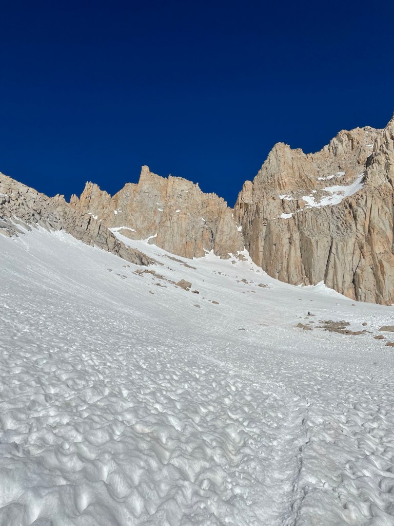
The slope started off with a bit of a horizontal traverse and was then a relentless 30 to 40 degree grade for about a kilometer, gaining around 400 meters of elevation. The snow was starting to soften but still had really good purchase with my crampons. I never felt unsafe in this section but it certainly was the most tiring thing I had ever done to that point. It was definitely a situation where you took a couple steps then stopped to catch your breath, I was also trying to practice the rest step here. I took several longer breaks here as well at some of the rocks that were poking through the snow.
At one point a bottle fell out of someone’s pack above me and hurtled down the slope. It came to rest and I ended up picking it up, adding a couple pounds to my pack. Also at one point I heard a mix of a scream and a whoop and looked up to see a girl hurtling down the slope in a pretty uncontrolled glissade. She eventually was able to come to a stop but was using her trekking pole as a brake which was crazy. She also had no helmet and gloves and her hands got pretty bloodied. Fortunately she was okay, though her hat had fallen off and lay on the slope above. I told her I would grab it and to have a safe descent before taking off. It’s crazy how many people don’t take Whitney seriously.

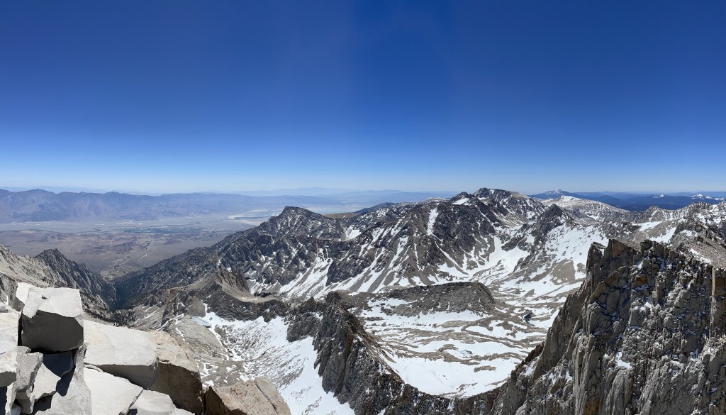
About 50 meters below Trail Crest, I caught up with another hiker and we climbed the last (probably steepest) bit together and chatted on the many rests. Eventually we made it to Trail Crest and I was relieved that the last of the steep climbing was done. I removed my crampons and gaiters and pondered switching back to my Bushidos but opted not to. The views of the west side of the ridge were phenomenal, with great views of the valley below, which featured several frozen alpine lakes (Guitar Lake, Upper and Lower Hitchcock Lakes) as well as some of the other peaks across the way.

Just before setting off, the girl who had lost her hat suddenly arrived – she had apparently lost her phone on that awkward glissade as well. Unfortunately, none of us saw it, but I returned her hat and told her I would keep an eye out for the phone on the descent. The hike along the ridge was not very steep, and the terrain was fairly easy, though the elevation (>4000m) made things challenging. I took my time along this section, stopping a few times to rehydrate. About a kilometer in, I dropped off the water bottle I had picked up and made a note to talk to everyone I met from here on to find out who dropped it. I also switched back to my Bushidos at this spot and was instantly relieved to have lighter feet. It was here that my choice to go easy to start the hike was starting to pay off, as I passed several parties along the way. I eventually ran into the couple who had dropped the water bottle, Bobby and Millie (from Arizona), the former of whom I knew from the Mount Whitney group on Facebook. It was great to finally meet them in person and we hiked the rest of the way to the summit together. Bobby was recovering from a head cold so they were moving a bit slower, which I didn’t mind.

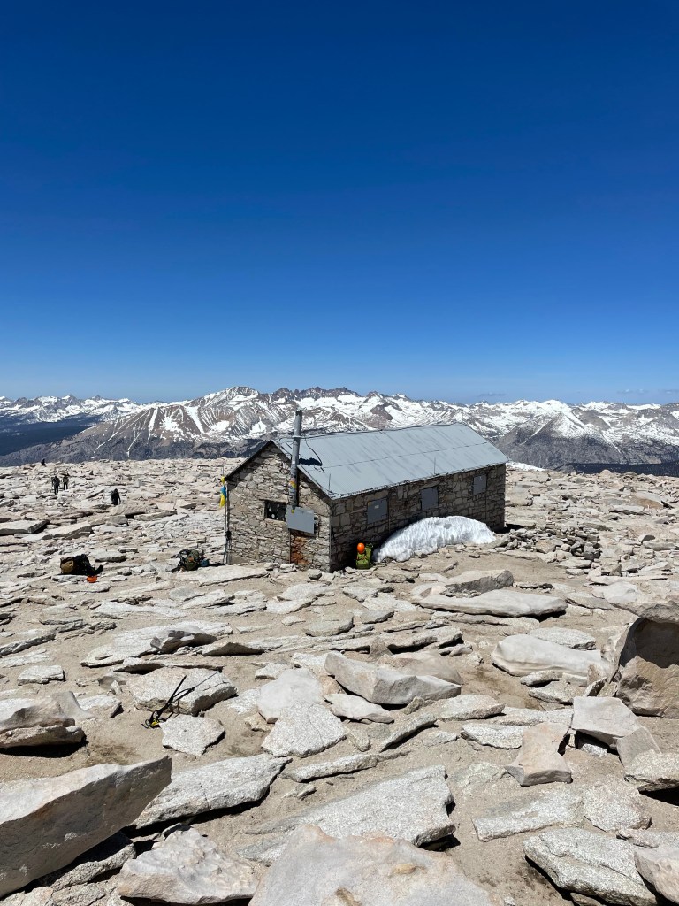
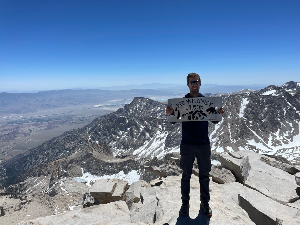
We saw a group opting to take a shortcut up a boulder field in lieu of following the trail as it looped around, and decided to join them. Scrambling at 4300m was quite something. The group (Austin, Janet, Raj, and Janet’s dad), which was from the Las Vegas area, were a good bunch of folks and I ended up hiking a good chunk of the descent with them. Eventually, we were on the final stretch up a fairly modest incline towards the shelter on the summit, and finally, after a little over 10 hours on the trail and 5 hours after leaving Trail Camp, I arrived at the highest point in California at about 11:30am, about an hour before my hard turn around time of 12:30pm. The shelter, the Smithsonian Institution Shelter, is not recommended as a refuge from storms as there is no protection from lightning. There was still a huge pile of snow inside from the winter!
What an incredible feeling to finally make it! It was an unbelievably beautiful day, not a cloud in the sky, and the views were breathtaking. After getting some summit photos with the summit sign, I sat down and boiled some water for a summit coffee. I was thinking of making oatmeal as well but my water supply was low, so I opted not to. I also had a mild headache at this point, likely from the altitude (though my helmet is very tight so it was actually giving me a headache on the snow slope!) so I took an ibuprofen before beginning the descent just after noon with Bobby and Millie.
The hike down to Trail Crest was pretty enjoyable – we took the “correct” route off the summit and it felt good to lose some elevation. We eventually reached the spot where I had left Millie’s water bottle and thankfully it was still there – Bobby and Millie were running pretty low on water at this point so it was definitely a relief for them. We eventually got back to Trail Crest after double checking the route a few times – I definitely did not remember good chunks of that ascent!

At Trail Crest, we prepared for the glissade down the snow slope. Despite the warm temperatures, I put on my waterproof layers including gaiters, helmet, and gloves, as well as putting away both of my poles in favour of my ice axe. I also made sure that there was nothing loose attached to my person that could become dislodged. Before long, the Nevada group joined us and we explained the correct glissade technique including being properly dressed. It took a while, but eventually Raj was the first to start sliding down. He was pretty cautious and I made sure to give him lots of space before starting to follow.
Now, again this was my first time glissading and though I knew proper technique, it was definitely challenging to control my speed. I probably didn’t lean back nearly as much (to get more drag from my pack) but there were two occasions where I picked up far more speed than I’d have liked. The first time I was able to come to a stop via the usual braking with the axe. The second time I got so fast that I tried flipping over to self-arrest, and actually lost hold of my axe! I continued hurtling down the slope (fortunately the rocks to my left weren’t in the way), and actually crashed into Raj. After bouncing off him, I kept sliding and eventually hit a bump of snow which brought me to a stop. It was here I had to make a decision. My axe was about fifty meters away up the steep slope, I had my trail runners on, and still had a decent amount of slope to descend. Because the group above me was not glissading down, I decided to climb up and get my axe. Problem – I did not have my mountaineering boots on and thus could not put on my crampons. So I ended up putting on my microspikes for this short climb, and also left my bag where I had come to a stop (I had stomped out a small platform for it). The climb up was a bit tiring and a bit spicy due to the soft snow, but it wasn’t too difficult to get to my axe and begin coming down. Instead of glissading (which would have been awkward since I had both of my trekking poles with me), I elected to traverse over to the rocks and walk down as far as possible there, then climb backward down the remaining slope to my pack. I then glissaded down the rest of the slope with no issues – fortunately the grade lessened sufficiently such that it was easy to control my speed. My conclusion is my struggles on the glissade was a combination of being inexperienced, the slope being very steep, and the snow quality being poor and difficult to get purchase with the axe. Janet also ended up finding a phone on the snow slope which likely belonged to the girl who had the glissading misadventure. Hopefully she was able to return it to her.

The rest of the descent to the Portal was pretty uneventful, but also quite speedy! After a quick break at Trail Camp to collect water, say goodbye to Bobby and Millie (who needed to pack up their camp) as well as remove a ton of layers, I joined the Nevada group for the rest of the hike – it was great getting to know them, especially Austin, who is really into splitboarding, the snowboard equivalent of backcountry skiing. Hopefully I’ll be able to reconnect with him in the future, either if I visit Nevada or he comes up to Canada (I shamelessly plugged Alberta as it is definitely a top skiing location in North America). It was also great seeing a lot of the terrain and surroundings that I had not been able to see in the morning when it was dark outside.

After getting to the Portal (we took the Old Whitney Trail, a steeper, shorter route for the last stretch in which I rolled my ankle 3 times!) I said goodbye to the Nevada group and drove back down to Lone Pine. After dropping my gear off at my AirBNB (nothing was stolen), hanging up some stuff to dry/air out outside, and taking a shower, I headed back to Totem Café for dinner, where I surprisingly had a pretty low appetite after an epic day. I ended up having an appetizer on top of the pasta dish, and had barely any room for the latter, so I took a take out box for breakfast the next day.
The evening was pretty relaxing, I organized my stuff a bit but planned to pack the next morning before driving back to Los Angeles. I ended up going to bed fairly early, definitely needed it. All in all, Mount Whitney was by far the biggest day I had ever done in the mountains, both in distance, time, and elevation gain. What a long, tiring, and rewarding day!
Training Peaks Activity – Mount Whitney
Day 5: Lone Pine –> LAX –> YYZ
I was up at 6am the next morning to pack, scarf down pasta leftovers for breakfast (definitely not as good tasting as the night before) and check out of the AirBNB. I took off around 7am after going back and forth on which set of footwear I would pack in my checked bag. I opted to bring my mountaineering boots in my carry on since my trail runners were still damp from Whitney, and I wanted to try and get as much stuff in my 65L pack as possible.
The drive back was pretty scenic and enjoyable, and got through the “traffic” in Los Angeles without any difficulty. I can say with confidence that Toronto traffic is far worse than LA traffic – Toronto at this time would have been much slower moving. I got back to the car rental place with plenty of time to spare and had no difficulty getting to my gate nice and early, despite being given a hard time by the airport workers (not Porter reps) at check-in for having a bag that was literally an inch longer than the max carry-on size. Pretty ridiculous considering my bag had hardly anything in it besides my laptop, boots, and book, and weighed a fraction of many of the carry-on bags I see. Thankfully, I was still able to proceed but it was something to keep in mind for the future.
I kept myself nourished by having a bunch of tortillas with Nutella (I had to polish off my jar I had bought in Lone Pine) and the flight didn’t have cookies which I was a bit disappointed about, but no big deal. The turbulence on the plane was absolutely insane though, probably the worst I have ever experienced flying. Otherwise, the flight went smoothly and I was able to collect my bag in Toronto with no difficulty. Opted for an Uber for the trip home and will save my UP Express ticket for the next trip!
So how did that trip go? I think it was a huge success. I was able to experience higher altitudes and learn how my body reacts to it as well as (attempt to) acclimatize by gradually building up to it. Not to mention I was able to summit Whitney, which honestly wasn’t even my main goal of the trip, especially given all the injuries I had been dealing with. Met lots of great people on the trail and had some very interesting experiences, including glissading for the first time. Definitely need to get more practice with that on some shallower grades… Overall, super happy with how things went and also to bag my sixth US state high point (I am now up to 6 for both Canada and the USA!). I am sure my next US state high point will be significantly less taxing!
I have a really action packed summer lined up, so I’m super excited to rest up a bit then get back to training (while also trying to remember my mobility work and also avoiding overtraining). Thanks for reading and I hope you’ll check out whatever I post next!
