In November 2024, I embarked on perhaps my boldest and most ambitious adventure yet. I’ll leave it as a surprise for now, but here I’ll share some adventures from immediately prior, in the beautiful state of Arizona. I had been eyeing Flagstaff and the San Francisco Peaks which lie just north of the city for some time, and spending some time here would allow for some pre-acclimatization for my main November objective. My main goal of my Arizona pit-stop would be to hike to the summit of Humphreys Peak, the highest of the San Francisco Peaks and the highest peak in Arizona, at 3851m.
I considered visiting Nevada instead and climbing Boundary Peak (4007m), however a couple factors caused me to select Humphreys. Firstly, the time of year. November is an awkward time of year as conditions vary wildly, with snow very likely. Secondly, the difficulty of both routes. Humphreys is a class 1 hike in the best conditions, whereas Boundary is a class 2 scramble. So given the uncertainty of the weather and trail conditions, Humphreys seemed like a safer bet. In addition, Flagstaff itself is around 2000m in elevation which in itself would be great for acclimatization.
My plan was to fly to Phoenix and drive up to Flagstaff on Friday (working remotely), and hike Humphreys either Saturday or Sunday. The day I would not be hiking I would do a less strenuous hike. After taking an easy day to recover and work remotely on Monday, I planned to return to Phoenix on Tuesday and fly on to my next destination.
Day 1: Travel to Flagstaff
I stayed the previous night at my parents’ place. I had to drop off my cat, and was concerned about having to deal with additional traffic in Toronto due to the Taylor Swift shows, so it made a bit more sense (despite costing more) to leave my car at my parents’ and take an Uber to the airport from there. I was up pretty early (5:30am). After quickly getting dressed and ensuring I had everything, I was out the door 5 mins early and my Uber was pulling up. My driver was actually a cargo pilot living in Markham, who was on his way to work (he had a flight to Minneapolis the same morning as my flight).
After getting my bag checked (I forgot that flying with Porter to the US meant I could NOT check my bag at the Porter check-in area (which only allows domestic bag drops – the same thing happened when I went to California earlier in the year) and through security, I grabbed overpriced breakfast and got to my gate with plenty of time to spare. The flight itself was interesting – on approach to Phoenix the pilot had to go around as he missed the approach. We were still pretty high in the air so my guess was that he either was coming in too fast, wasn’t descending quickly enough, or a sudden gust of wind was enough to change the landing calculus.
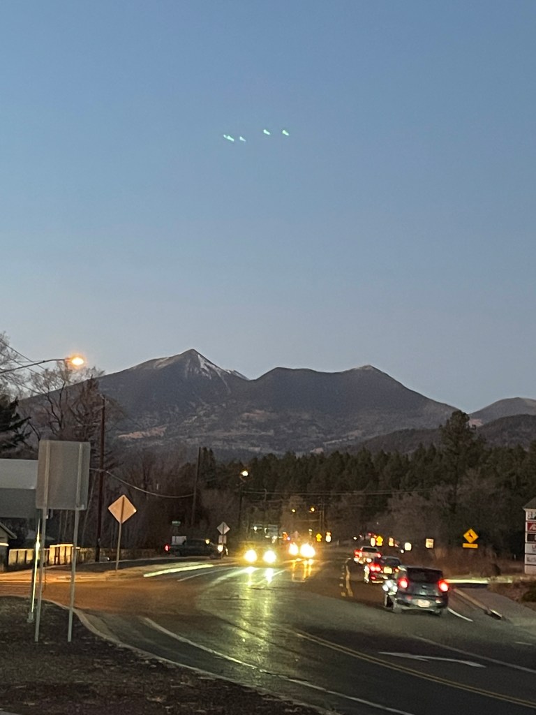
On my way to the bathroom after arriving in Phoenix, I took a hard fall in the terminal as I had not laced my boots and my two boots caught on each other. I hurt my wrist a bit but it ended up feeling better in a couple days. I was wearing my mountaineering boots on the plane as they are a pain to pack and my checked bag (75L pack inside my 90L duffel) was stuffed to capacity. I grabbed my rental vehicle, a Ford Edge SUV (to be safe, I made sure to rent a car with AWD in case of tricky road conditions in the mountains) and was on my way. The drive to Flagstaff, taking about 2 1/2 hours, involved about 1650m of elevation gain, a lot of it on fairly steep roads where trucks and larger vehicles had to slow down significantly. Quite a lot of fuel was burned on this drive, though it was very scenic and I got a great view of the San Francisco Peaks (namely Agassiz Peak) on the way in.
Upon arrival I went to the local burger joint (Mama B’s Burger) for dinner then went to the grocery store to pick up some food and snacks for my stay. I ended up buying a ton of food including a single avocado which was not ripe yet. I was hoping it would ripen before I left the US…
Day 2: Elden Mountain
My first full day in Flagstaff had a bit of a late start while I settled in. After breakfast (I had bought a pack of 18 instant oatmeal packets and ate four of them) I went for a walk around town. First I stopped at the local backcountry outfitter to pick up a couple extra items (warm wool socks, extra mineral sunscreen as I didn’t have much left, and a compact 22L pack which packed down as small as a tube of toothpaste). I inquired about the trail conditions for Humphreys Peak and was told that there would be a fair amount of snow up high, but microspikes would be sufficient. This was a relief as I didn’t think I’d have space to carry my crampons in my daypack. On the way back I stopped by the ski outfitter and inquired about good brands for climbing skins. I had been recommended a brand over the summer and forgot which one. I need to order a set when I get home as ski season is near!
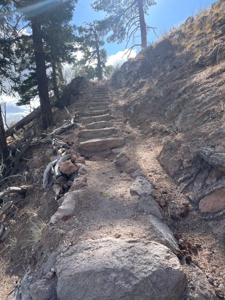
After lunch, I drove over to the east of town to climb a smaller peak, Mount Elden. A pretty popular day hike close to Flagstaff, this peak rises sharply about 700m to 2835m and looked like a great half day hike. The peak, a dormant volcano, used to be heavily wooded but a fire in 1977 burned a large portion of the trees on the peak. For this hike, I opted to wear my trail runners.
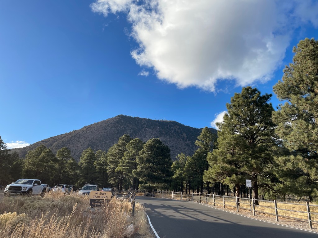
The hike up took just under 90 mins and was pretty easy going, with lots of switchbacks and a moderately rugged trail. I encountered a fair amount of ice close to the summit, but for the most part the trail was dry. After stopping at the summit for a 20 min break where I grabbed a snack and rested my feet, I snapped a few pictures of the San Francisco Peaks and the city below before beginning my descent.
The descent was a bit slower than the climb, as I wanted to be a bit careful with my ankle. About 500m from the trailhead, I picked up a discarded bag of dog poop to toss in a trash can. I can never understand why people go through the trouble of bagging the poop but leaving the bag on the trail! As it turned out, there was no bin at the trailhead so I reluctantly placed the bag in the trunk of the car, and threw it in a bin on the way home.
My ankle was pretty stiff after the hike (it didn’t help that I lay down for a couple hours) so I debated whether I would attempt Humphreys the next day. I decided to get a good nights rest and decide in the morning, after doing a bit of stretching before bed.
Day 3: Humphreys Peak
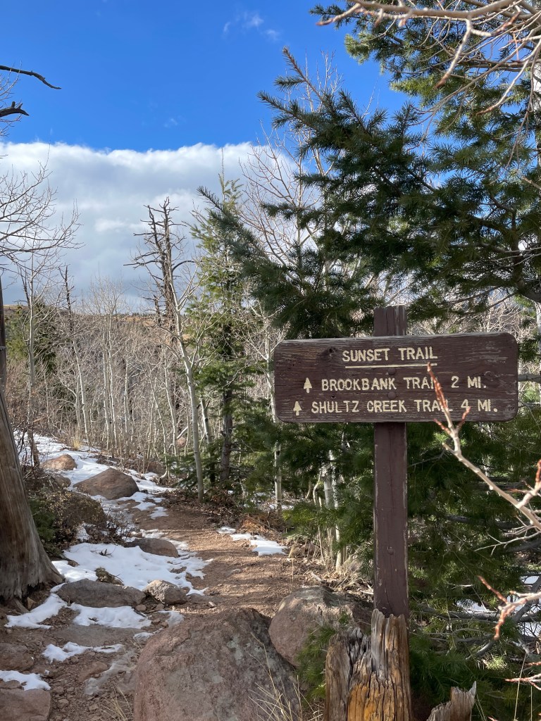
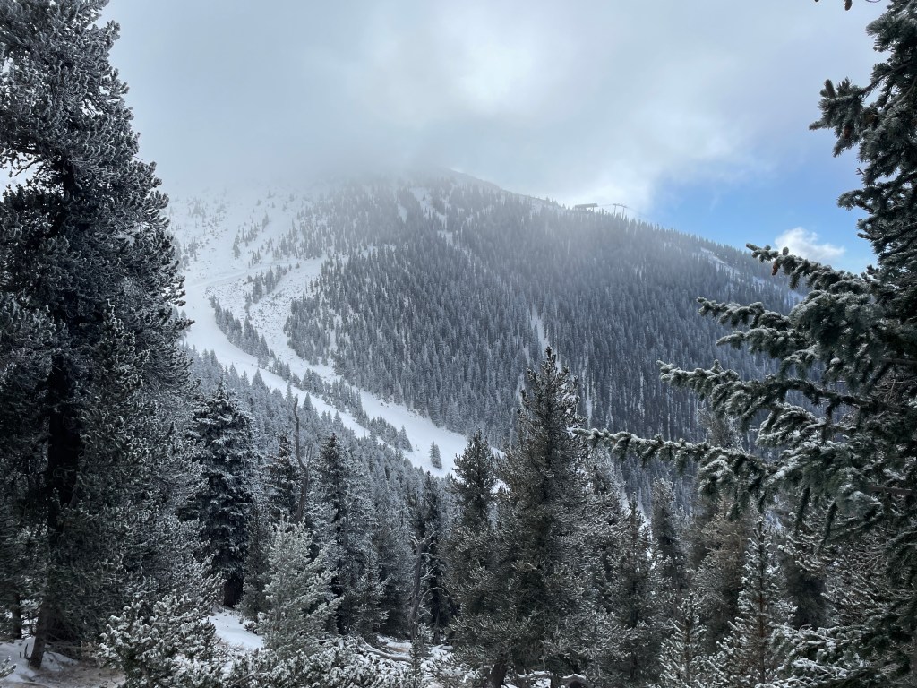
I got up at 7am on Sunday and after having breakfast and assembling my pack, I was out the door and off to the trailhead for Humphreys Peak. The drive was about 25 minutes and gained 800 meters in elevation. The trailhead is located close to the Arizona Snowbowl, the highest ski resort in Arizona, with lifts and runs on the slopes of Agassiz Peak, the second highest peak in Arizona. The weather for the day looked really promising. While it was forecasted to be cold (around -10C at the summit), it looked like the winds would be light, which is definitely optimal.
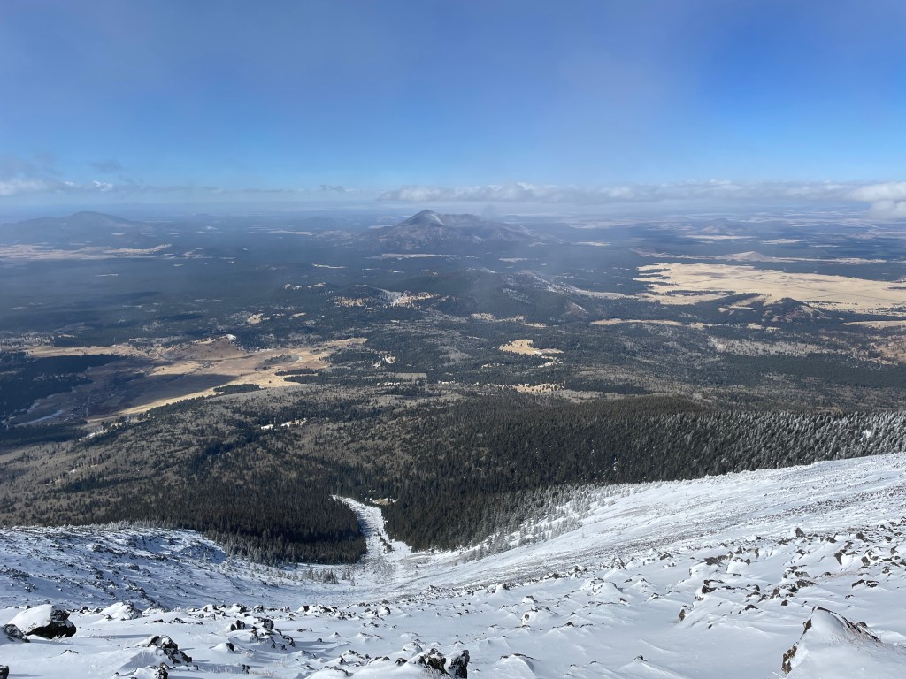
A little bit of history on the San Francisco Peaks. The Peaks, which consist of the six highest mountains in Arizona along with several smaller peaks, are the remnants of a massive stratovolcano which was estimated to be around 4900m at one point before a lateral eruption (similar to the one at Mount St. Helens in 1980) approximately 200,000 years ago followed by glacial erosion caused it to collapse. This resulted in a hollowed out caldera lined with the Peaks (including Humphreys). It’s crazy to think about what the peak might have looked like prior to the eruption – from Flagstaff, it would appear about 58% taller! The caldera contains an aquifer which supplies a large portion of Flagstaff’s drinking water. The area is largely dormant, with the most recent volcanic eruption occurring approximately 1000 years ago at Sunset Crater, situated northeast of the San Francisco Peaks. Humphreys Peak was named after Andrew Atkinson Humphreys, who participated in the exploration and surveying of the area in the late 1800s.
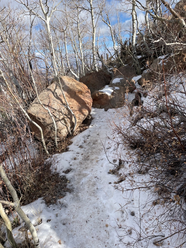
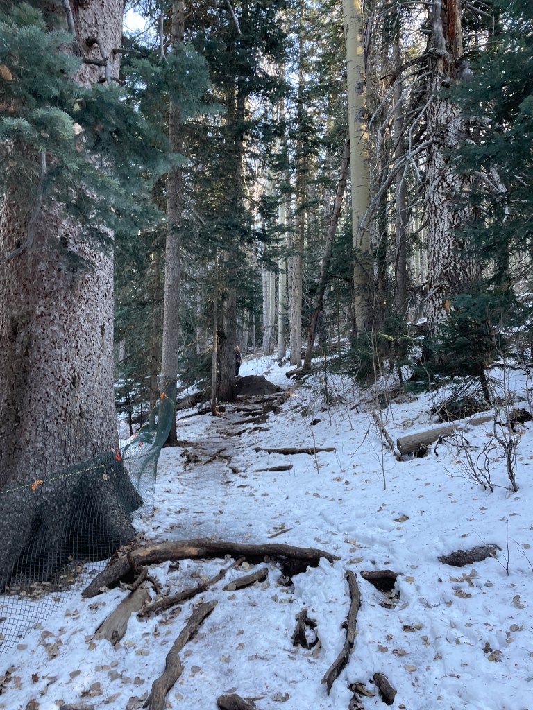
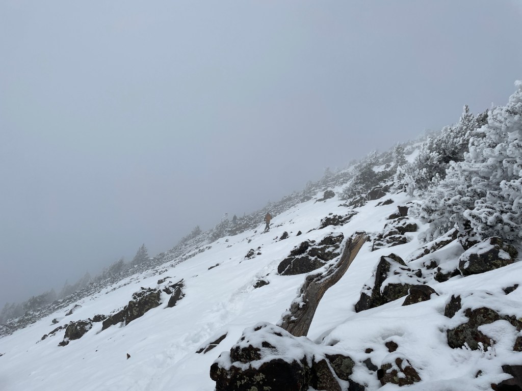
The hike started off crossing a meadow which passed just underneath the Snowbowl, before entering a mixed conifer forest consisting of a number of fir, spruce, and pine trees. The trail began almost immediately with a covering of snow and ice, which made the going a little bit easier as the route is known for being chock full of roots and rocks.
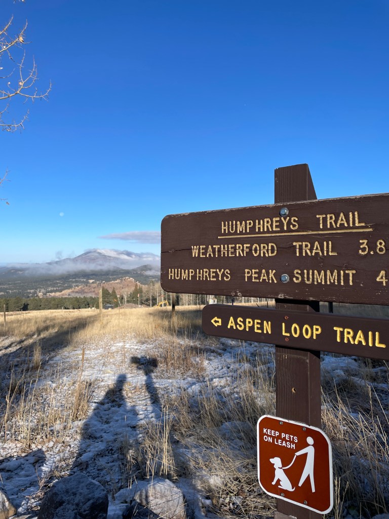
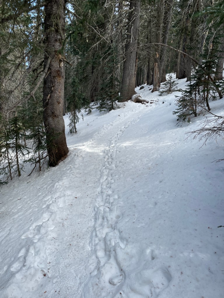
The first 6.5km of the trail followed several large switchbacks up the slopes towards the saddle/col between Agassiz and Humphreys. As I ascended, the trail became much more slick with ice and at approximately 3100m, I donned my microspikes. Around this point, the flora transitioned into a sub-alpine conifer forest, with different species of fir and spruce. I encountered a few other groups of hikers in the switchbacks, most of whom looked terribly unprepared. All the groups I passed on the switchbacks I did not see again that day – thankfully they turned around. I did encounter a couple of trail runners with their dog who had been to the summit, and said it was cold and snowy.
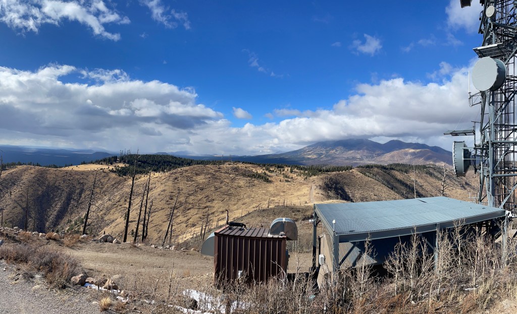
Around 3400m or so I was able to get a great view of the ski runs at Snowbowl as well as a view of Agassiz Peak, and it was quite a busy day at the resort. Shortly before the saddle, I stopped to don additional layers in preparation for hiking above the treeline. At that point I had made do with just my hiking pants and a couple layers for my upper body, as well as light gloves, but donned my insulated pants and hard shell pants as well as my hard shell jacket and a thicker pair of gloves. I kept my toque, balaclava, and mitts at the ready just in case.
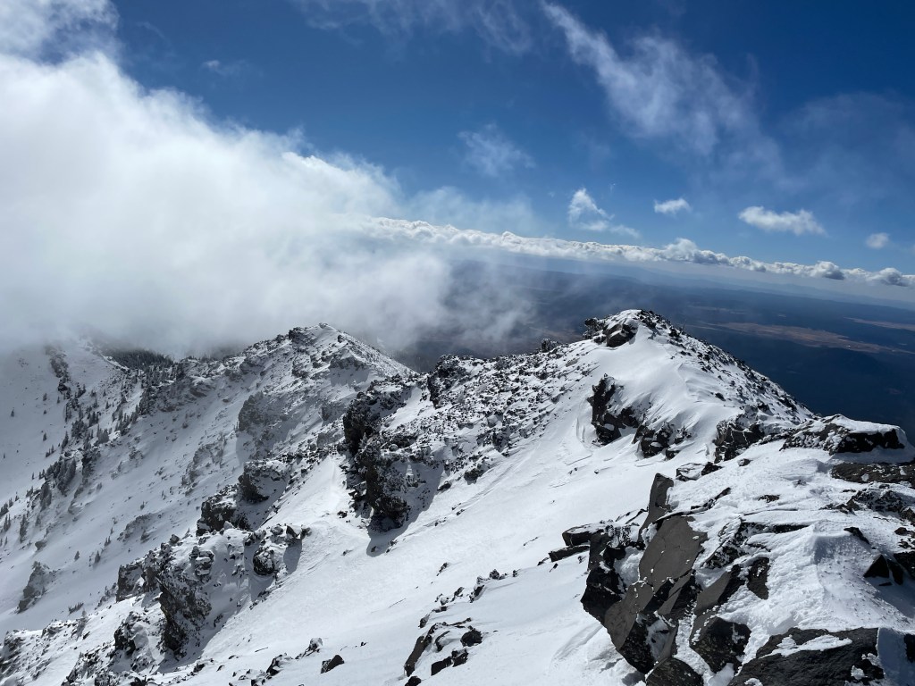
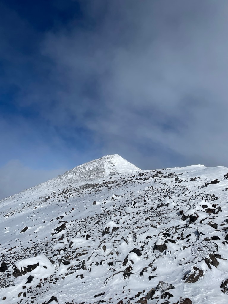
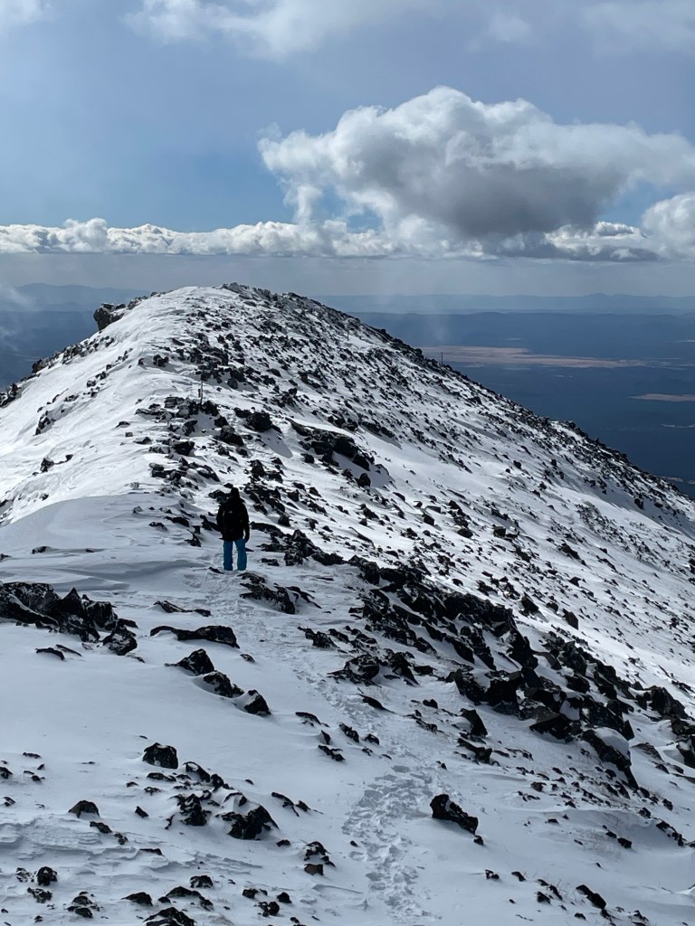
At the saddle, it certainly was cold, though the winds were light as advertised. In addition, the trail appeared to follow the outside of the ridge leading up to Humphreys, so it was a bit sheltered here. The views weren’t great as clouds had rolled in, but overall I was feeling pretty good with the altitude (I had taken a couple 200mg ibuprofen tablets over the course of my hike thus far). I began working my way up the ridge and the snow was fairly deep in spots, but nothing too crazy. This area is known as the alpine tundra zone, with very little vegetation. The San Francisco Peaks groundsel is an endemic species to this region, and the threat to its existence from human recreation is the primary reason why the summit of Agassiz Peak is off limits other than during the winter. I didn’t see any of these plants when up on the ridge, likely they were buried in snow!
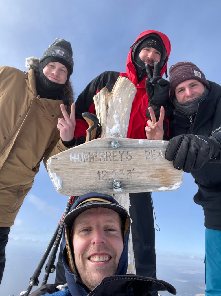
At about 3600 meters, just below the first of several false summits, I caught up with a group of guys from Phoenix who were taking a break – Trevor, Matt, and Kyle, and sat with them to shoot the shit. Really friendly dudes. They had started about an hour and a half before me and suggested I go on ahead of them, but I offered to join them for the push to the summit – it’s more enjoyable suffering with others, and I also wanted to go at a bit of a slower pace at these altitudes.
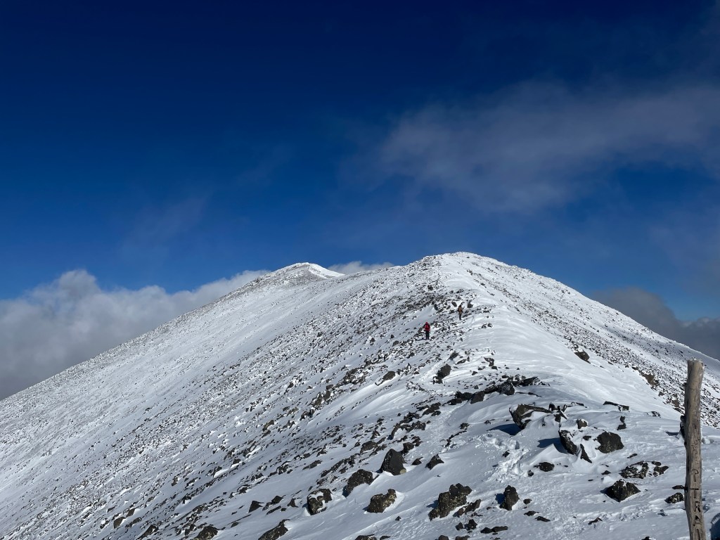
The trail was fairly easy to follow, with wooden posts and faint tracks from the trail runners, though there were a few places we had to improvise a bit as the wind had filled in some of the tracks. The snow was fairly deep in places but well packed down on the trail, so the going was fairly steady. The clouds broke a few times and we were able to get some excellent views of the caldera and surrounding peaks, as well as great views to the north including the Grand Canyon.
After traversing past far too many false peaks (I was pretty sure it was the last one several times) we finally made it to the final snow slope up to the summit of Humphreys Peak. The air was pretty thin but I was feeling pretty good other than a light headache which didn’t really get much worse as I ascended. Taking lots of deep breaths along with pounding Sour Patch Kids for a sugar boost really helped.
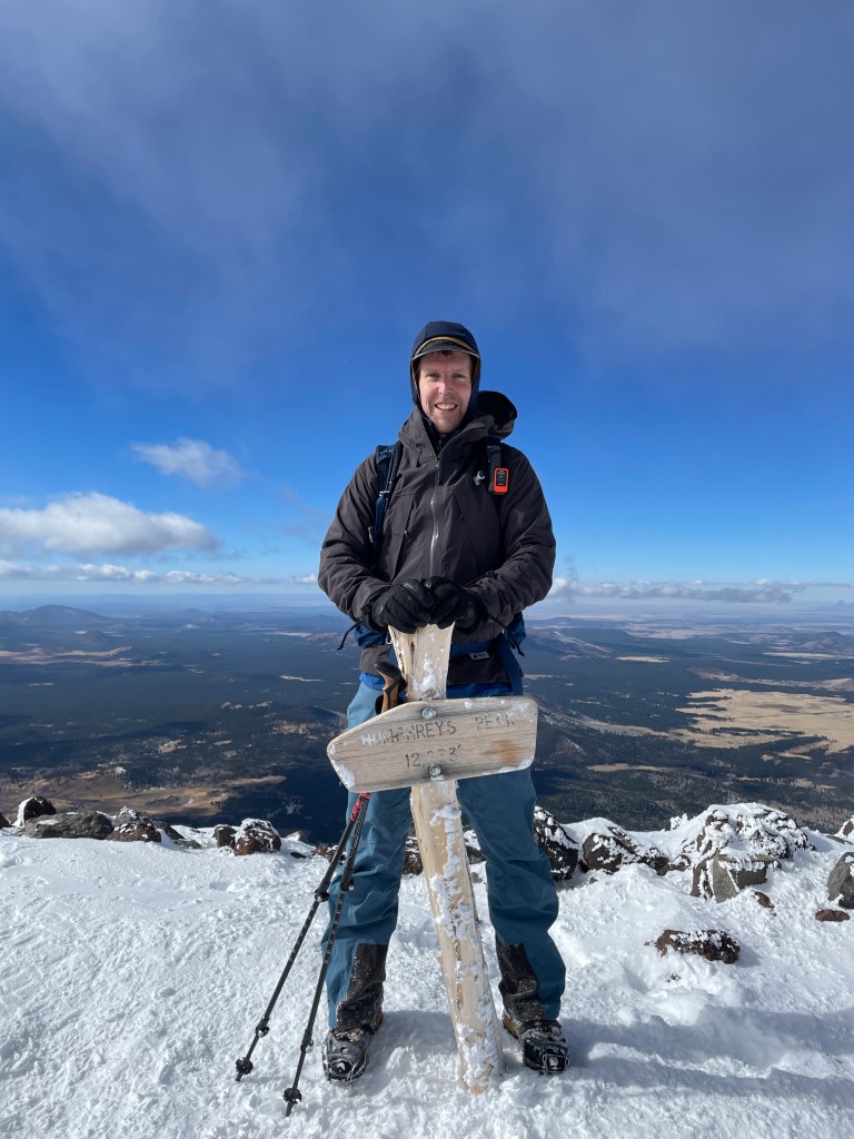
The final slope was a breeze and we were finally at the top. The guys joked that I was a game changer in getting them to the top, though I’m sure they would have made it without me. We spent about 10 mins at the summit, taking pictures at the summit sign along with enjoying the majestic views, before starting back down.
The descent was, as descents go, not as enjoyable other than the fact the air was getting thicker the lower we went. I was bit more cautious given my ankle (which, considering I haven’t mentioned it yet in the account of this hike, held up extremely well!). We stopped a few times on the ridge for a break before getting to the saddle. Just above the saddle, it was quite warm and I removed most of the layers on my upper body other than my sun shirt. A lot of the snow and ice on the trail had thawed and there was a lot more dirt and rock than on the way up.
The switchbacks were a long, painful grind – the soles of my feet were pretty sore due to my boots and spikes, but at least a lot of the trail still had snow and ice to soften my footfalls. About halfway down I took a break to rest (my headache had gotten a bit worse at this point, likely due to being hungry and a bit dehydrated) and ran into Trevor a minute after resuming, who was waiting for Kyle and Matt. We hiked the remainder of the descent together – Trevor was able to text the others and determined they were in good shape to head down on their own. After taking a slightly different path back to the cars (a fence had been set up which indicated that the last switchback was closed, despite me ascending that way) which involved walking down the ski run, we made it back about half an hour before sunset, with my car-to-car time of just over 8 hours and a FASTER descent than ascent (a rarity for me). After exchanging contact information and sharing the photos I took at the summit with Trevor, I headed back into Flagstaff while he waited for Kyle and Matt. Shoutouts to these three for being awesome company on the trail and for getting to the summit!
After getting back to Flagstaff, I took a shower and washed my microspikes (they were pretty muddy by the end of the hike), before returning to Mama B’s for a burger and tater tots. I was originally planning to have wraps for dinner, but I was craving greasy food! This definitely helped with my headache. I was off to bed by 9:30pm – super exhausted but overall very stoked about the day. The conditions in the alpine tundra zone above treeline were incredible and super fun to hike in. I’m so glad I did this hike in (almost) winter! I’d have to say Humphreys is my favourite US state highpoint thus far.
The following day, I worked remotely in Flagstaff. A lot of the time was spent in my AirBNB, but I also checked out a local cafe (Kickstand Kafe) for a coffee in the afternoon. Flagstaff is on Mountain time which is 2 hours behind Eastern time, so I had to be up pretty early (7am MST) in order to be “on time” for work. In addition, I had to work pretty hard to eat the rest of the food I had purchased at the grocery store in Flagstaff – not difficult given the caloric deficit I was experiencing after Humphreys! I also went through the painstaking task of repacking all my gear and clothing for my flight the next morning. It was somehow more difficult than the first time despite packing my trekking and tent poles more efficiently!
Stay tuned for the second part of my November trip, featuring even bigger peaks!
