Recently, I relocated from Toronto to eastern Massachusetts for work, and was excited to take on a lot of objectives which would have otherwise been a much further drive away. In particular, there are three U.S. state highpoints which are all within a couple hours of my new residence, and a further two which are about six hours away. My first mission since arriving in the US would be to take on the highpoints in Rhode Island and Connecticut, on the way to a fundraising event in Ottawa for the Mount Logan expedition.
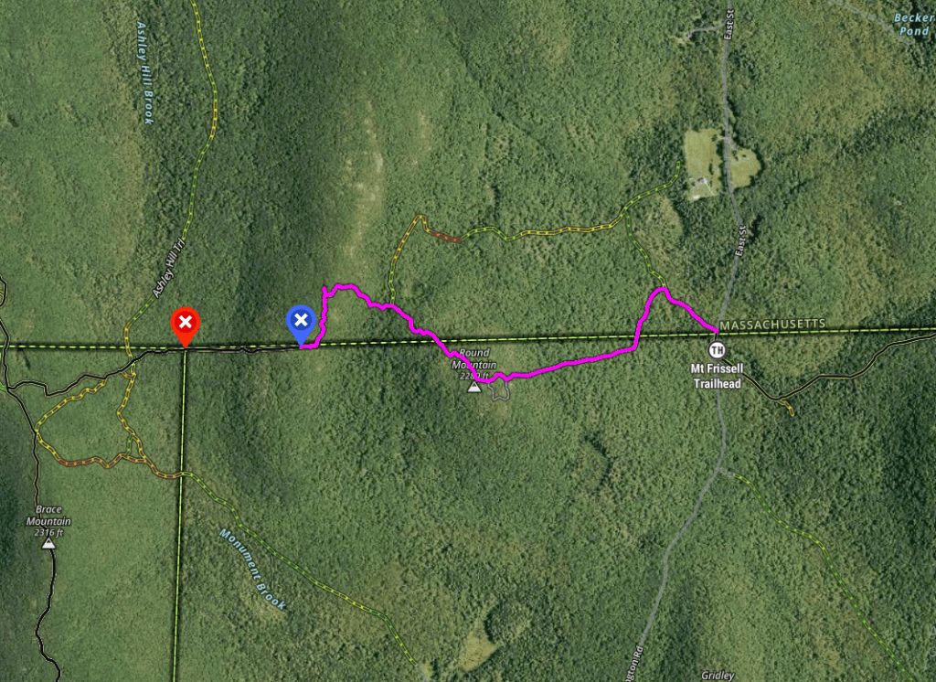
Both highpoints are fairly low (ranked 36th and 46th in the list) and are not exceptionally challenging. Jerimoth Hill (247m) in Rhode Island is about a 10 minute roundtrip with only a few meters of elevation gain. This one used to be one of the most difficult to access as it is situated on private property and the previous owners were particularly stingy about highpointers trespassing on his property. The summit of Mount Frissell (748m) actually lies in Massachusetts, but its southern slopes cross the border with Connecticut, where the highpoint of the latter state (727m) is located. Bear Mountain, about 19 meters lower, is the highest mountain entirely situated in Connecticut and is about 2 kilometres away. Frissell can be accessed via a number of trails; the shortest is about 2 kilometres long and gains about 230 meters of elevation from the trailhead.
I decided to tackle both high points on the way home after driving up for a fundraising event for the Mount Logan expedition, taking place near Ottawa. A very long drive for a short trip back home (I grew up in the Ottawa area), which was quite interesting as I drove through three states (New Hampshire, Vermont, as well as a brief 20 mins in New York) and one province (Quebec) along with by starting and ending points. It was great to meet a member of the expedition, Dan, who I had previously only chatted with on video call. Dan’s retired and spends most of his time away from home, including half the year in the Rockies skiing and climbing. Hopefully I’ll be able to get out west and ski with him this coming winter/spring! Dan was gracious enough to host myself as well as another team member (Rob) as well as another member of the Alpine Club for the Saturday night. The fundraising event was fun (1920s themed) and it was great catching up with most of the Logan team including the expedition leader Bryan, who I had last seen during our Mount Rainier trip in July.
The following day, I departed Dan’s place at about 8:45am and made the long drive south to southwestern Massachusetts to first tackle Mount Frissell. Crossing the border went well (first time re-crossing since getting my US work status) and it was a very long drive including the approach to the Frissell trailhead being on a windy, rugged mountain road. I pulled into the lot just before 2pm and was off and going shortly afterwards.

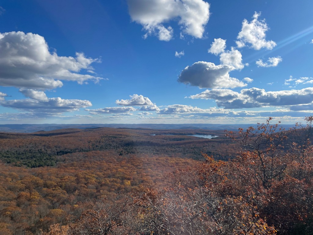
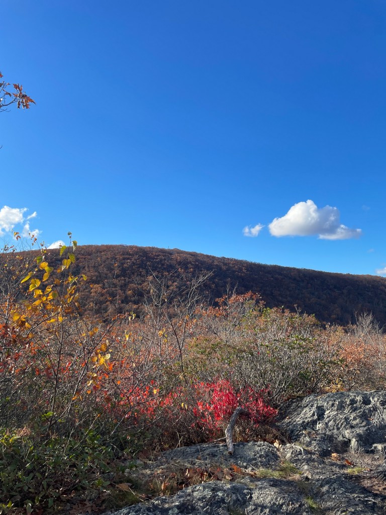
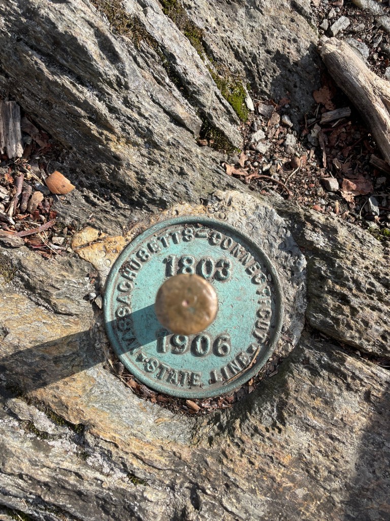
Frissell was a super fun hike! It’s also interesting in that the route starts in Massachusetts, quickly enters Connecticut (there’s a state border marker right near the trailhead), re-enters Massachusetts after the false summit on Round Mountain (where the proper summit of Frissell is located). The trail continues to the southwest back into Connecticut and eventually into New York as it passes the New York-Connecticut-Massachusetts triple point.
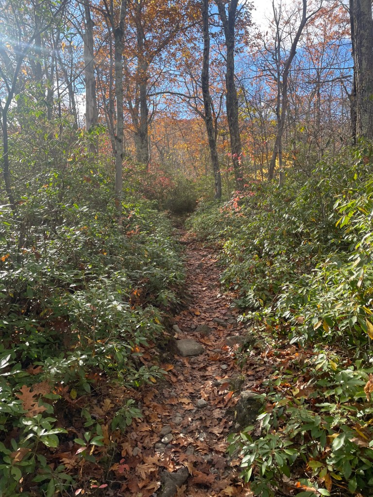
The trail started off pretty flat but got steep quick, with pretty rugged terrain and a false summit to traverse. Not quite scrambling but pretty close. After all the driving I had done, it was great to finally stretch the legs out a bit and I blasted up the trail, reaching the summit of Mount Frissell in 27 minutes flat.


After tagging the true summit, I continued on to the south slope, but for some reason I thought that the highpoint of Connecticut was just across the border, so I actually didn’t reach it! I stopped for a break at what I thought was the highpoint then immediately turned around. Later on, when I realized my error (the trail continues on from where I stopped and gains a couple meters of elevation), I was a bit annoyed at myself as the south slope has a cairn and sign, so if only I had double checked the route! Oh well, gives me an excuse to go back and try and beat my time (keep reading to the end of this post)! Car to car, including my break, was just under 75 minutes. Probably a 50/50 split between hiking and trail running overall.
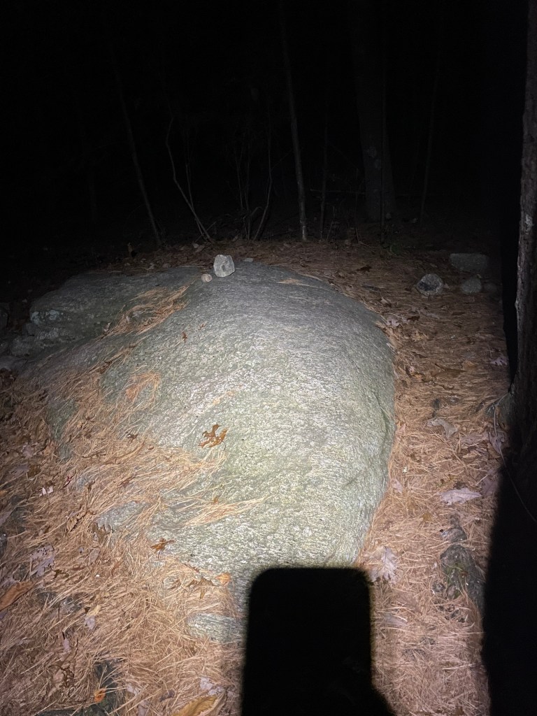
The drive to Jerimoth Hill in Rhode Island, just across the border with Connecticut, was about three hours away, which meant that I would be getting to it well past nightfall. Despite being not that far away, all the driving was starting to wear on me and the drive never seemed to end. Jerimoth Hill was by far the easiest “summit” I had ever done, just a simple 3 minute jog on a very obvious path (I was using my headlamp) and I was able to locate the giant rock which marks the summit easily. After signing my name in the register and trying to take some pictures in the darkness, I ran back to my car in about a minute and set off for home in Worcester, only about 45 minutes away. On the way back, I passed by a point (Durfee Hill) which was once thought to be the highest point in Rhode Island, but is 3 meters lower.

The following weekend, at the end of my trip to the Catskills to climb the two 4000 foot peaks there (Slide and Hunter Mountains), I made a quick detour on the way home to properly tag the high point of Connecticut (and also cheekily try an beat my previous time up to the summit from the trailhead). Was great to be back – it’s a shame that Frissell is 3+ hours from home otherwise I’d definitely hike here more often. Fun fact – the drive from the Catskills to Frissell is either 90 mins with a $2.15 bridge toll (only charged travelling eastbound across the Hudson River over the Rip Van Winkel bridge) or an hour longer (and more than double the mileage with the detour taking one north all the way to Albany!) without the toll. I figured the gas consumption would be more than $2.15, and always want to avoid sitting in my car as much as reasonably possible, so it was a no-brainer to fork over the toll!
This time, knowing the route, and running the flats to start off, I managed to make it to the main summit of Frissell in just under 23 minutes, about 4 minutes faster than the previous weekend. I was a bit tired after my Catskills mission the previous day, so I definitely could have gone a bit faster if I was fresh (or a fitter athlete!). If anyone knows what the FKT (fastest known time) for this hike, let me know! After catching my breath, I sauntered down back into Connecticut and made sure to actually visit the high point! That makes 11 of 50 for the US states for me.

I decided to make a loop down the west side of Frissell after speaking with a lady in the parking lot. Terrible idea! I did get to see the New York-Connecticut-Massachussetts triple point which was cool, but my map app sent me on a trail which quickly disappeared into the brush, so I was bushwhacking for a good ten minutes trying to get back to the main trail. Once on that trail, I discovered that a stream ran down it, so I had to be careful on the slippery rocks. I ended up jogging a lot of this trail once it got a bit dryer, and eventually made it back to the main road – over a mile south of the parking lot!
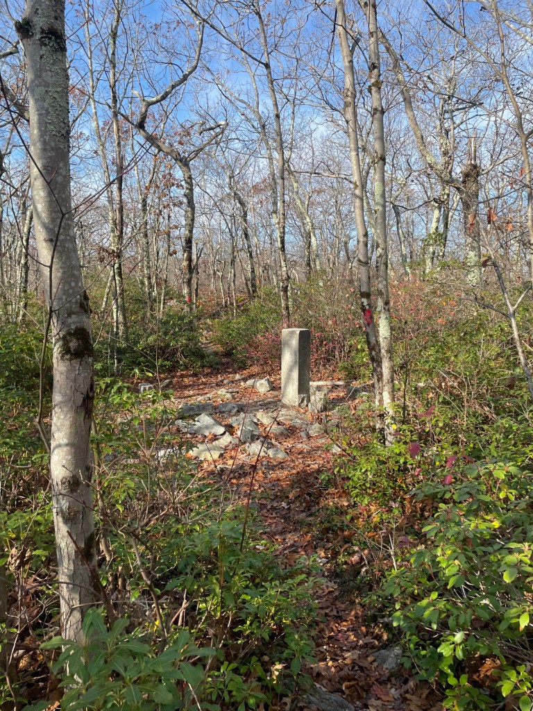
I jogged back to the car, with a bit of a walking break due to my sore calf (which flared up in the Catskills the previous day). Definitely do not recommend this route! There is an interesting route coming in from the NY side in the west which is about twice as long as the out and back from the main parking lot and traverses Brace Mountain (a peak in NY near the state tripoint) and part of the South Taconic Trail. I might try that if I’m in the area again.
This is a bit of a weird post in that in encompasses two separate trips, but glad I could complete both highpoints eventually. I also didn’t even discuss my objectives in the Catskill Mountains done between my two visits to Frissell – that will be a separate trip report/post. Stay tuned!
