The logical first stop on my quest to summit all the provincial/territorial high points was the one in my home province – Ishpatina Ridge in Ontario!
Ishpatina Ridge is located deep in the Temagami wilderness, about 150 kilometers northwest of North Bay (as the crow flies). The ridge itself is in Lady Evelyn-Smoothwater Provincial Park, a relatively barebones member of Ontario Provincial Parks. And by barebones, I mean no car camping, no site bookings, no amenities (other than thunderboxes). It’s really only viable for backcountry camping. That, in addition to its proximity from any major cities (such as Toronto), ensures that it is not overrun by inexperienced campers like you see in places like Sandbanks (I love the tranquility of the backcountry!).
Lady-Evelyn, along with the other parks in the Temagami cluster, are well known for the extensive network of lakes, rivers and portage trails, making it a popular area for backcountry canoeing. Maple Mountain (once believed to be the highest point in Ontario – it’s actually 51m lower) is another, more popular destination. Maybe another trip? As for Ishpatina, there are two routes to access the summit:
- Canoe route – from the north, down the Montreal river through to Scarecrow Lake, followed by a short 1 hour hike to the summit
- Overland route – from the south, northeast to the Scarecrow Lake trailhead, same hike to the summit
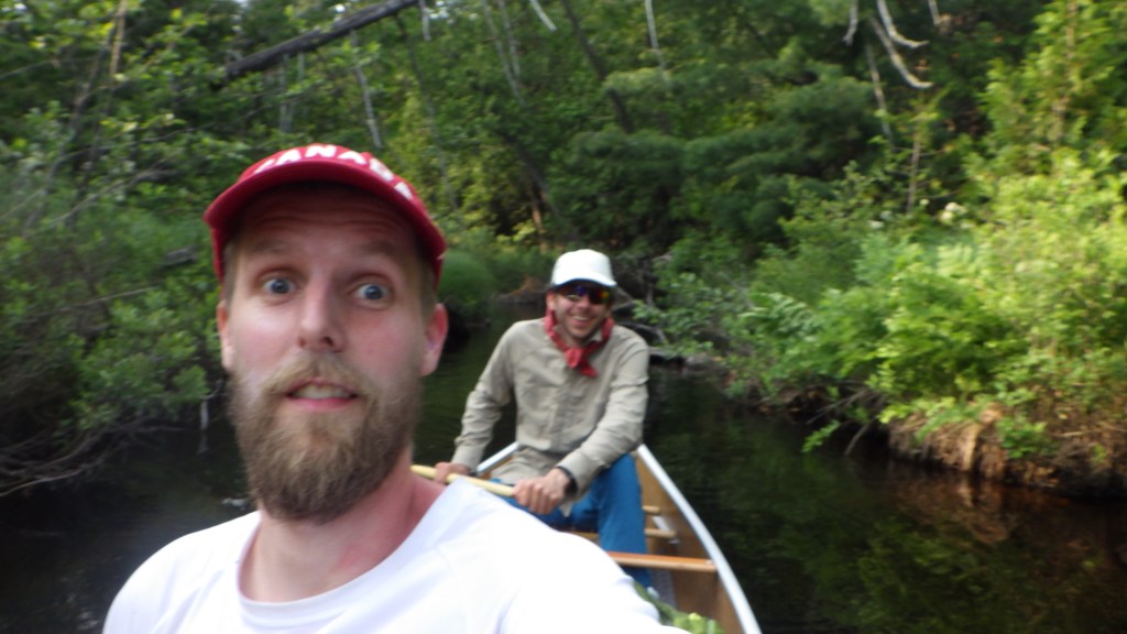
The overland route is technically shorter and can be done in one day as a round trip (plus a day on either side for travel), but it’s not terribly exciting and is less travelled. The canoe route is longer and far more interesting, so that’s the one I opted for. I based my itinerary on a trip log posted by Markus Wandel, which showed the canoe route as well as possible campsites along the way. For this trip I enlisted my good friend Nikola, who is a keen outdoorsman and paddler himself, to join me.
Day 1 – July 1st, 2021
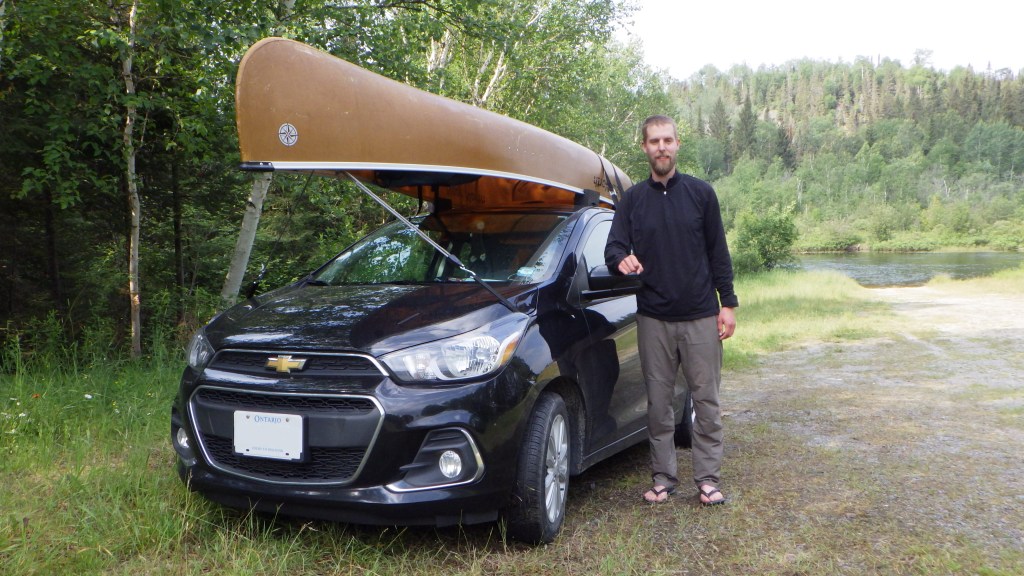
Canada Day, what a fitting time to start this epic highpoint journey! I met Nikola at my parents’ place in Musselman’s Lake, an hour north of Toronto, and we drove up in my car. I live alone with my cat Pepper, so my parents generously look after her while I go on my adventures. Thank you!! We left fairly early, around 6am. The goal was to drive to the canoe outfitter, Smoothwater Outfitters (highly recommend!), pick up our canoe, drive the rest of the way to the launch point on the Montreal River, paddle for a couple hours, and make our first camp just north of Smoothwater Lake, all before it got dark.
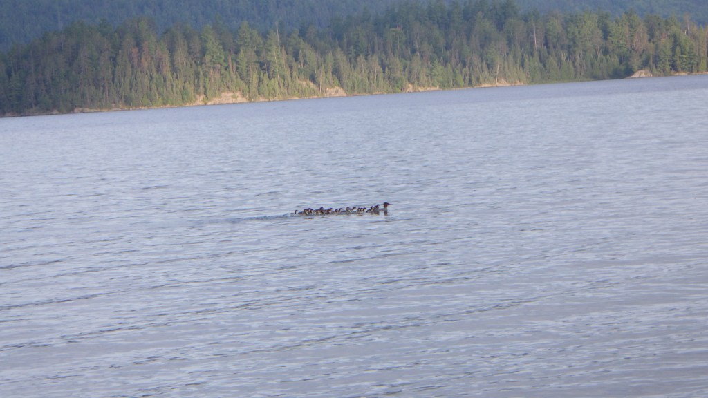
My car does not have a roof rack, so Nikola bought a tie down kit with foam blocks which nestle in the gunwhales of the canoe and rest on the roof of the car. The attachment points were under the hood as well as on the tow hook on the back. After further driving, including a long stretch on an old bumpy logging road (Nikola very appropriately played “Mud on the Tires” by Brad Paisley on his iPhone at this point) we arrived at the launch area (still on Crown land) and set off. At this point it was raining so we got decked out in our rain gear, which thankfully we never used after this day. The paddle down the river instantly was exciting as we saw a female moose on Lady Dufferin Lake and paddled in for a closer look. The first of several wildlife encounters! We soon entered the boundaries of Lady-Evelyn Smoothwater Park. After setting up camp at a really great spot right at the opening of Smoothwater and enjoying a delicious dehydrated meal, it was off to bed.


Day 2 – July 2nd, 2021
After having breakfast and breaking camp (as well as taking some pictures of weird bee-like insects on flowers, we were back in the canoe to take on Smoothwater Lake, which, as advertised, was anything but smooth! Even though we left fairly early, it was quite choppy and despite knowing the canoe was quite stable, I was a bit nervous about flipping in the middle of the lake with all our gear. After a roughly 6km paddle across the lake (thankfully with a tailwind) we arrived at our first portage of the trip!
If anyone has done portaging in Killarney or Algonquin, these portage trails were next level. Decent elevation changes, and lots of roots and stones scattered across the path. The first couple portages we did in particular pretty much involved stepping from stone to stone, prime ankle rolling territory. In terms of carrying the canoe, I took this task on for the first portage (also wearing my pack), while Nik carried the paddles. Really challenging. First portage (0.76 km) brought us to the first of a series of small lakes connected by portages – Apex Lake. After a quick paddle, Nik took over with the canoe for the worst of the portages – a 1.1 km monster up and down and across rough terrain. After a break at the end, we went for a swim, then quickly made short work of three small unnamed lakes with short portages connecting them. It was around this time I won a bet with Nikola when I claimed I could wear both his and my packs (one on front, one on back) and carry the paddles, while he took just the canoe (which was a strategy my HS friends and I did in Algonquin years ago). This made the portages MUCH easier!

After crossing McCulloch Lake, it was another short portage to Mihell Lake, which featured a number of interesting features like straits and islands. On our right loomed our objective, a long 9km wide forested mound of land, Ishpatina Ridge. We could just make out the fire tower marking the highest point. It was here we made probably the worst (or best, if you’re into Type 2 fun) decisions of the trip. Rather than take a very long portage down to Scarecrow Lake, we opted to paddle our way through Scarecrow Creek, a winding narrow passage featuring a ton of beaver dams (where we had to both get out of the canoe and push/pull it over, before quickly checking for leeches), fallen trees to duck under, as well as a lot of drawing strokes to quickly turn the canoe. This stretch was aptly described in Jack Bennett’s log of his Ishpatina trip in his book Not Won in a Day: Climbing Canada’s Highpoints:
The creek meandered back and forth, and seemed to last forever.
Jack Bennett
Couldn’t have put it better, Jack! After some quick sanity checks on our phones (for whatever reason the coordinates on my map did not agree with those on Nikola’s InReach) we determined that we were on the right track and it was just a super long creek. We finally made it out into Scarecrow Lake after spending 2 hours and 5.31 km in Scarecrow Creek. What a relief to see open water!

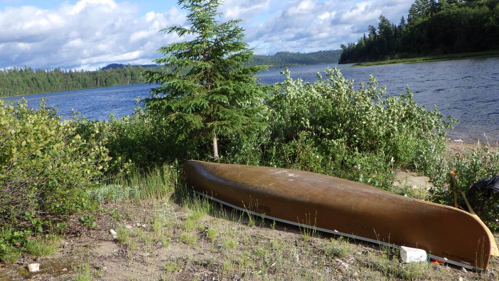
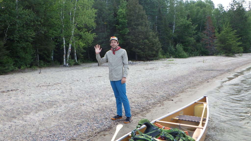
With our goal in sight ahead (campsite on a small island about a mile away) we pushed on with fresh vigor and finally arrived at our home for the next two nights. After circling the island just to make sure there wasn’t someone there already (I could have sworn I saw someone sitting, turned out to be a fallen tree), we hit the shore, unloaded and set up camp. Good places for tents were hard to come by – I ended up pitching my tent underneath the branch of a fallen tree, which is appropriately called a “widowmaker” in a backpacking book I had recently picked up, The Backpacker’s Field Manual. We got set up, had a great dinner and bonfire (in the fire pit of course) and it was off to bed after a long day.

Day 3 – July 3rd, 2021
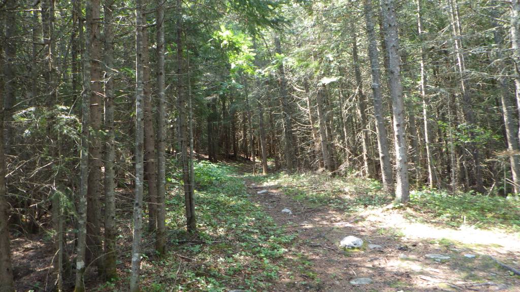
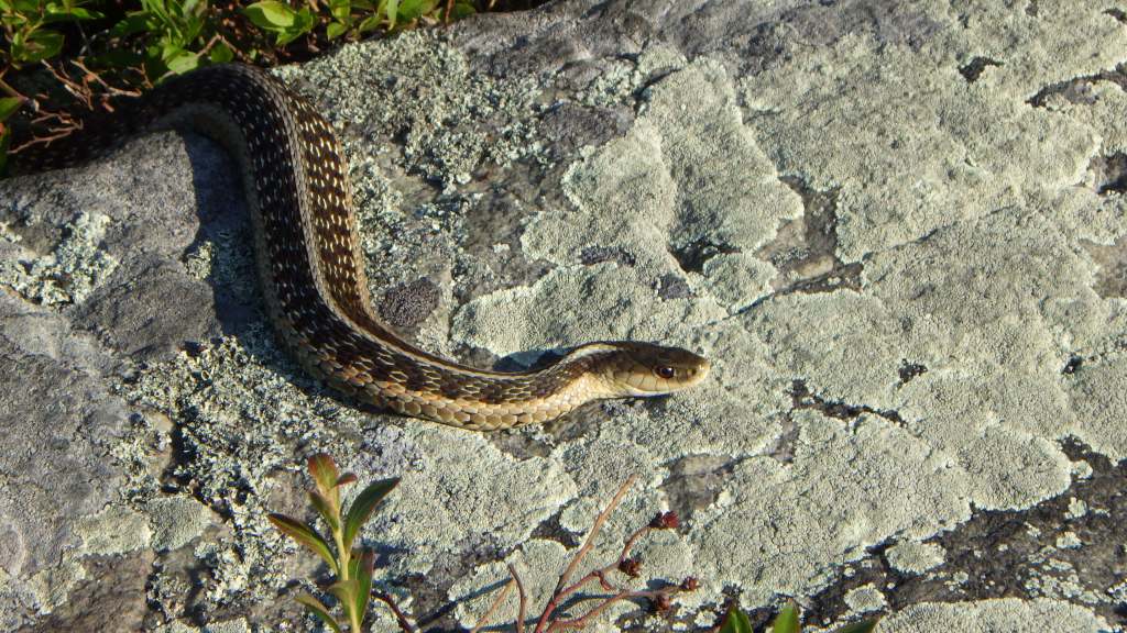
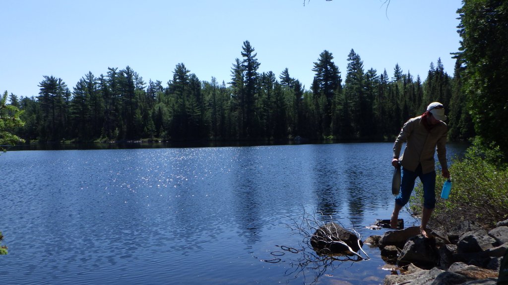
After a long day the previous day and another planned long day for Day 4, thankfully the hike to the top of Ontario wasn’t going to be super grueling of a day. After waking up and getting some epic shots of a garter snake suntanning in the morning sun, it was time to hop back in the canoe and backtrack to the northwestern end of Scarecrow Lake and the trailhead for Ishpatina Ridge. After a quick one mile paddle, we arrived at a campsite which was right beside the trailhead. Fortunately no one was there, so we moved our canoe out of the way a bit in case anyone wanted to camp, and started up the overgrown trail. The paddle and hike were made significantly easier as we only needed to carry what we needed for a half day hike, including water, food and the camp stove.

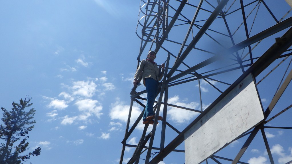
It was on this day the temperature got a fair bit warmer, however luckily most of the hike was in the shade. Nik was an absolute madlad and did the entire hike barefoot! He says he likes the feel of the earth under his bare feet. I would tend to agree, but I’ve had far too many ankle injuries so I was more than happy in my trusty hiking boots. Our 80 minute hike passed by a few small lakes and rose about 290 meters from the shore of Scarecrow Lake up to the 693m summit. Interestingly, Ishpatina does not have the highest prominence in Ontario, that honor belongs to the more well known Maple Mountain (also in Lady-Evelyn Smoothwater) which rises about 345 meters above the surrounding area. Upon arrival, we took a few photos (could only get a decent view by partially climbing the fire tower – we later learned that it was possible to climb to the top but we were discouraged slightly by the gaps in the ladder), then found a shady area with some comfy moss to sit on and Nikola fired up the stove for a nice hot lunch. Was nice to not have energy and protein bars for lunch for once!


As we were leaving we met a nice couple who had hiked in via the overland trail, neat to see that that option was viable. The hike down made me very glad I had forgotten my trail runners (I planned to not even bring my boots as we mainly would be canoeing) – the downhill was decently steep so it felt good to have some stability (Nikola donned his trail shoes for the descent here). After about 45 minutes we arrived back at the canoe and paddled back to camp. It was a relaxing afternoon, we went for a swim and were absolutely harassed by deer/horseflies (a theme that would continue the next day). Pretty chill afternoon otherwise, after dinner and a bonfire it was off to bed around 8:15pm to get lots of rest for the long day ahead!

Day 4 – July 4th, 2021
We set our alarms for 6am (I usually wake up at this time anyway since it got pretty light at this time) and we quickly packed up and had breakfast before setting off on the return trip to Smoothwater Lake. Rather than suffer through Scarecrow Creek again (which would have been even more difficult as the return trip was upriver) we opted to take the long portage that runs from Scarecrow Lake to Mihell Lake. Since this was a long portage, we tried a different method by doing two trips. The first trip would have us both carrying the canoe together (switching the canoe ocasionally onto each shoulder), and the second trip we would take the packs and paddles. Oh and because “why not,” we ran back on the return to grab the packs.
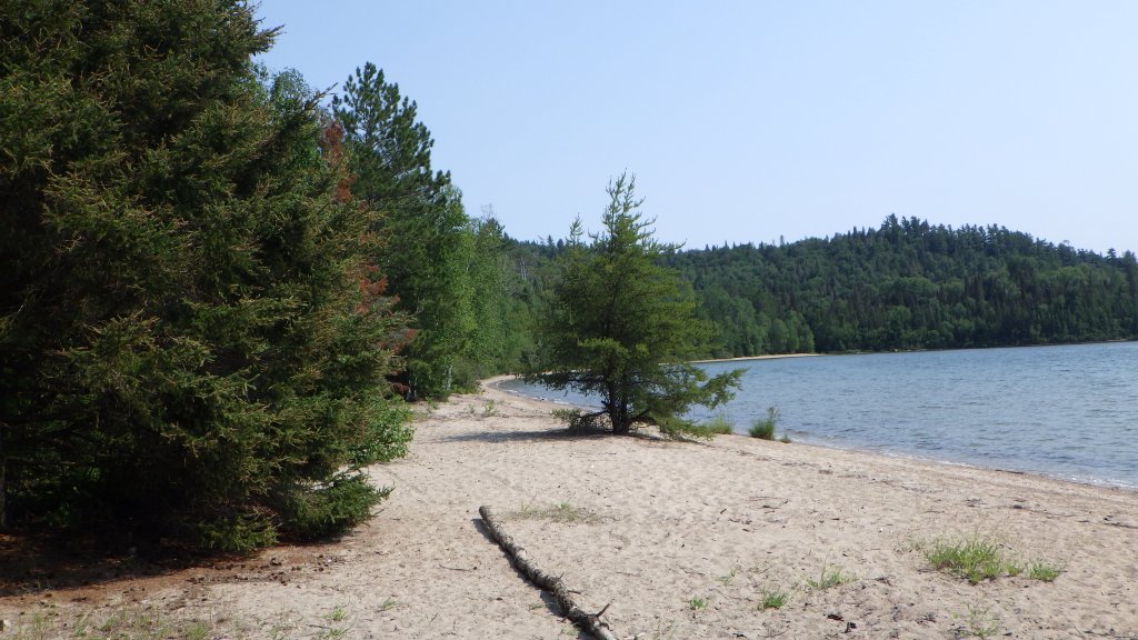
Overall, it wasn’t a terrible idea. Despite it taking longer than a single trip, it was significantly easier. Oh and also, Day 4 meant the arrival of a horde of vicious bugs which mauled us the entire day. Mosquitoes, horseflies, deerflies, you name it. There was one fly whose sole mission was to land on the back of my head in the gap on my cap. It was quite a long day – after the long portage to Mihell Lake, we retraced our steps from Day 2, which involved doing all the portages again. Suffice to say the previous three days caught up to us, and we were pretty worn down by the time we reached Smoothwater Lake, which once again was pretty rough. Our goal was a campsite along the east shore near Marina Lake. Optimally, we would have followed the east shore all the way up, but owing to the turbulent waters which would have been constantly hitting the port side of the canoe, we had to zigzag our way over to avoid a capsize. After a long, arduous paddle, we finally arrived at the campsite, and boy was it a great one! Beautiful beach made it look like a deserted island.

We set up camp, went for a swim and made dinner. It was quite a warm day so I initially planned to sleep without my tent fly, but Nik’s mom messaged him through the InReach that there might be a big storm coming, so on went the fly and off to bed, with the plan to get a very early start the next day.
Day 5 – July 5th, 2021
Day 5 was largely uneventful. We woke up at 5am just prior to sunrise, had breakfast, and packed up camp. Luckily, Smoothwater had calmed sufficiently overnight such that we could take a relatively straight line up to re-enter the Montréal River, more or less the same route that we took coming in. The bugs tended to leave us alone as we were on the water the entire time. With the comforts of home beckoning, we made short work of the 14.15 km paddle back to the launch site. After packing everything up, we drove back to the outfitter to return the canoe, and headed home.

We had some issues with the canoe getting to the outfitter, as it kept sliding to the left while we were driving. We stopped a half dozen times to adjust and tighten, but it refused to stay put. We carefully covered the last few kilometers going a bit slower than we’d have liked, and were relieved to finally unload the canoe. At this point I was pretty exhausted, so Nikola took over driving until we got to North Bay – it was great that he knows how to drive stick shift! In North Bay we gorged on delicious, not nutritious goodness at A&W (two Beyond Meat burgers and two order of fries each) to fuel us for the drive home. Just north of Stouffville, we got hammered by a gigantic thunderstorm which made driving a bit sketchy, but we eventually made it to my parents’ place where we parted ways.
All in all, we had covered nearly 85 kilometers over the course of the last five days. What an epic trip and a great start to my Canadian high point mission. Thanks for joining me, Nik!

Great post. Enjoyed all the details. Not sure about all the bugs though. I guess it’s expected for these kinds of hikes. I wish you luck with all of your subsequent hikes.
LikeLike
Thanks! June to August is definitely the worst time of the year for bugs, unfortunately…
LikeLike