For my second high point, I decided to visit New Brunswick, a province I had only ever been to in transit (have family in Nova Scotia, so we would drive through New Brunswick), and climb Mount Carleton over the 2021 Labor Day long weekend.
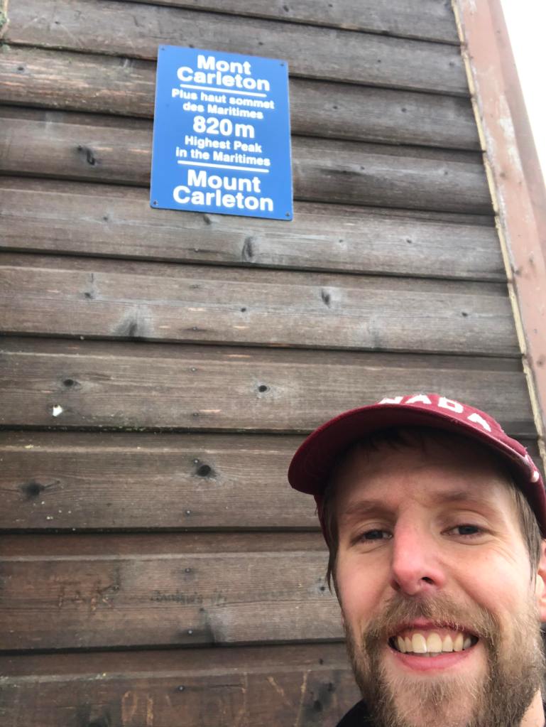
Based on my research, Carleton, standing at 821m in elevation, presented one of the more straightforward summits to reach among the Canadian high points. It is located in an easily accessible provincial park, you can drive directly to the trailhead, no camping is required, and the round trip hike to the top can be done in half a day.
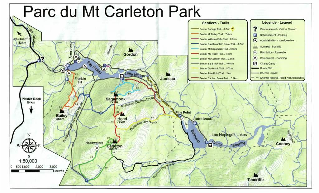
I opted to make things a bit more challenging for myself, by parking at a trailhead far from the summit, doing a full day hike to the summit, camp overnight, then complete several other summits nearby over the next few days. All this without needing to resupply or access my car. My plan was a bit ambitious and if I were to have done things over, I may have followed a slightly different route. I’ll get to that below!
Day 1: Travel from ON to NB
Mount Carleton is roughly 1100km from Toronto, and according to Google, takes roughly 12 hours to drive to depending on when you leave. In particular my departure time revolved around avoiding morning rush hour traffic in both Toronto and Montreal, while arriving at a time when I could get settled at my first campsite before dark. I did briefly look into flying into Fredericton and renting a car, but that would have cost more money, not saved too much time owing to airport logistics, and most importantly prevented me from bringing fuel for my camp stove, even in a checked bag.
After consultation with my dad, who has driven to Nova Scotia many times, the best play is to leave the GTA around midnight, drive through the night and get past Montreal before rush hour starts (and take a nap then!). So I went to bed around 7:30pm, took a quick 4 hour nap, and left in the dead of night. The drive was very tough – I needed to play music and sing along to stay awake, as well as roll down the window periodically to get a blast of fresh air. After getting through Montreal I stopped at a Timmies for a quick 15 min nap, as well as grab a bagel and coffee. Then it was back on the road. Stopped for fuel and lunch in Rivière-du-Loup, about 50km from the border with NB, then hit the road again, arriving at the park at around 3pm local time.
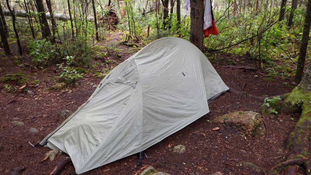
At this point it had started raining so I knew I was in for a damp night. After getting my camping permits and familiarizing myself with the maps, I set off for my campsite which was #1 in the Franklin camping area, on the southwest shore of Nictau Lake. After setting up camp and making dinner, it was off to bed!
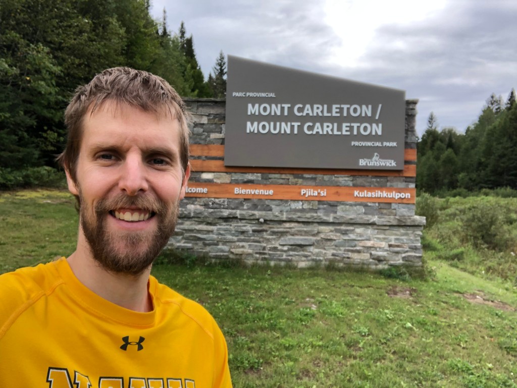
Day 2: The day I wished I brought my rain pants
After getting packed up, it was off to the Mount Bailey trailhead (at the westernmost “P” on the map above) to begin the backcountry part of my trip. Bailey stands at 564m and presented a moderate challenge to hike. It had rained quite a lot the previous night so my boots and pants quickly became damp. I had forgotten my waterproof pants at home, and also forgot to waterproof my boots, oops!
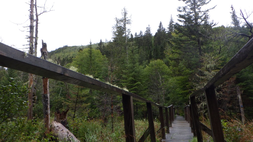
After descending Bailey (4.5 km), I made my way over to Bald Mountain Brook (dark blue) trail heading east over to the bigger peaks. Pretty steep descent to the road and then climb to the Mount Head (red) trail running north-south, which was about 4.7km. At this point I was very cold and damp but still had about 3.5km to the summit of Mount Carleton, so just focused on keeping mind over matter! The Head trail was generally flat but a bit overgrown so a lot of the rainfall dripped off, at this point my boots were completely soaked through.
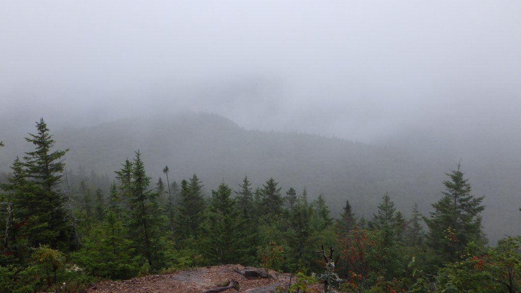
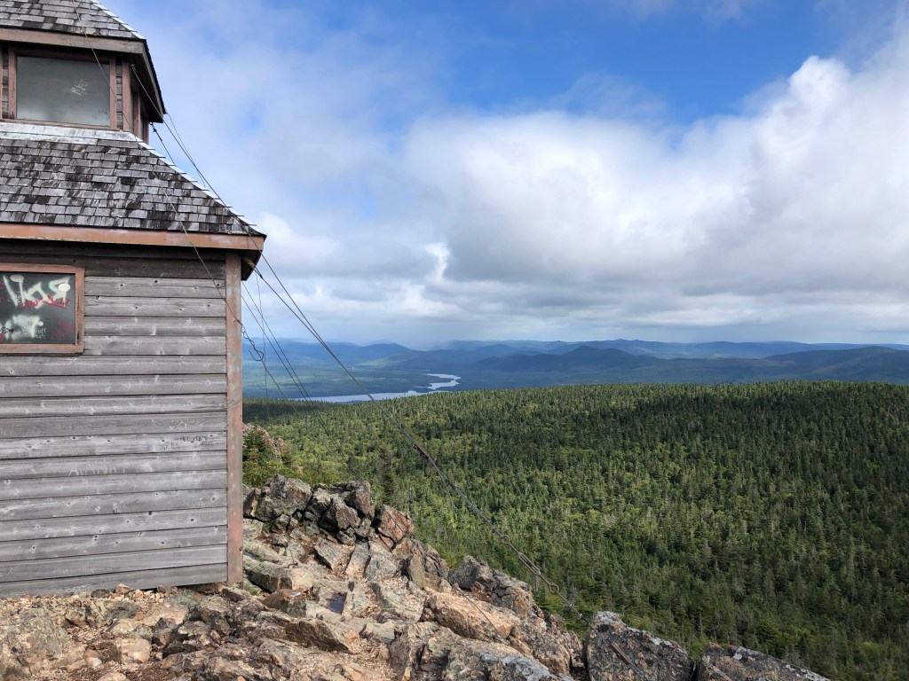
After soldiering on for a few kilometres (passing the turnoff for the Mount Head summit which i hit two days later) I finally saw the last stretch to the summit of Carleton. With renewed vigour, ignoring the discomfort from the wet and cold, I pushed onwards over the steeper, rockier trail until I finally reached the old fire cabin and the highest point in the Maritimes! One major change as I emerged from the woods was the wicked wind that was blowing which dropped the temperature significantly. In addition it was very foggy so I couldn’t see much in terms of a view.
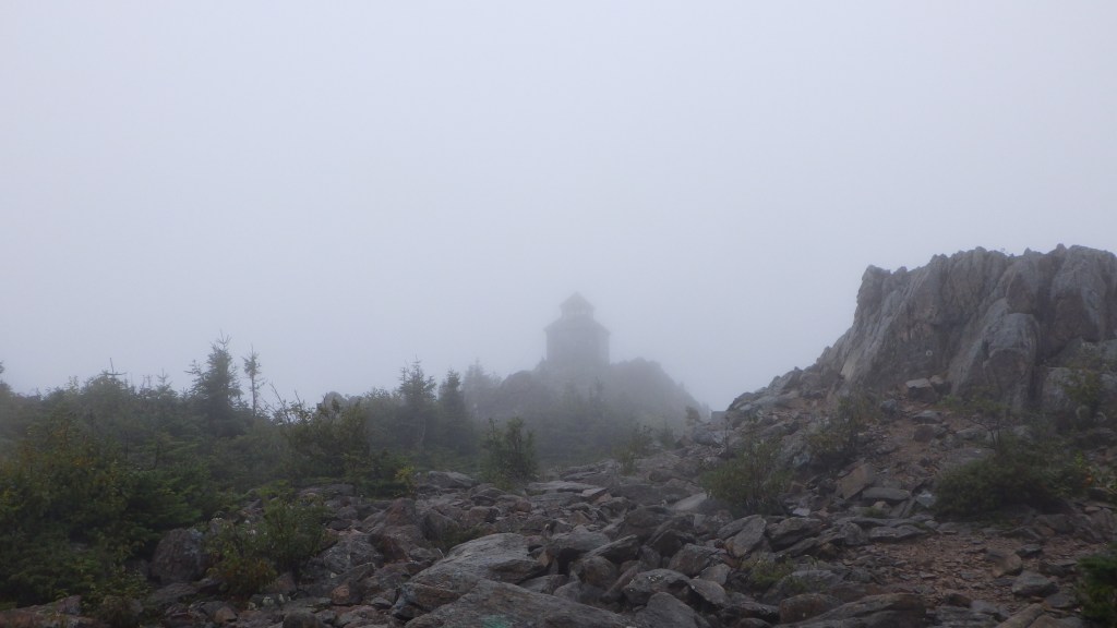
It was still about 1.5km to descend down the south side of the summit to the Headwaters campground where I had booked two nights in a backcountry site, but as soon as I entered the cabin to take a breather, I quickly came to a decision that it would be risky to make the descent in the cold, wind, wet, and failing light (got to the cabin at 4pm) so I would crash in the cabin for that one night and make camp at Headwaters (southwest of the summit) in the morning. I hung my wet clothing up to dry, put on all my dry clothes to warm up (was shivering like crazy), made dinner, then set up my sleeping pad and hunkered down for the night. Man the wind outside was loud but was very glad to be dry and sheltered from the elements!
Day 3: The weather turns for the better!
After waking up and quickly packing my stuff up lest an early bird hiker stumble upon my squatting setup in the cabin (which I’m fairly sure was not allowed, though to be fair it was a bit of a bivouac situation) it was time to make my way down to Headwaters and finally get camp set up on the site I paid for. The weather was still quite foggy with poor visibility but I still had hope on my next pass through the summit that it would improve and I’d get a great view of the surrounding area. The descent was slow owing to the many rocks I had to scramble down and the slipperiness of the rocks and tree roots. After about an hour, I made it to my site and set up, then went in search of water.
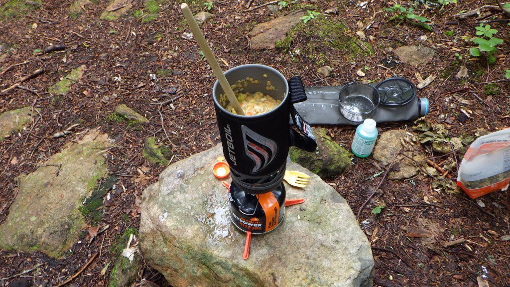
It was actually pretty dire water-wise at this point – I only had about a liter left when I arrived at Carleton summit, and needed to cook two meals and wash my cookware. This left only about a quarter cup for drinking. I found a great little flowing stream, filled up my HydraPak Seeker (3L) and made my way back to camp. With my Katadyn BeFree spout with built in filter, I quickly filtered two liters into my bottles then poured some into my pot to cook lunch.
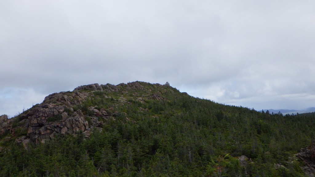
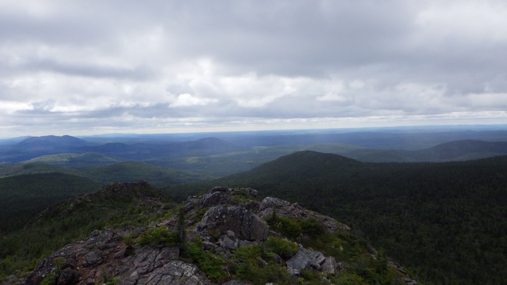
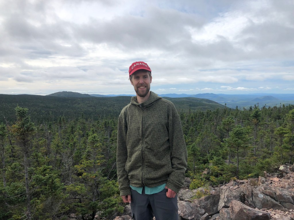
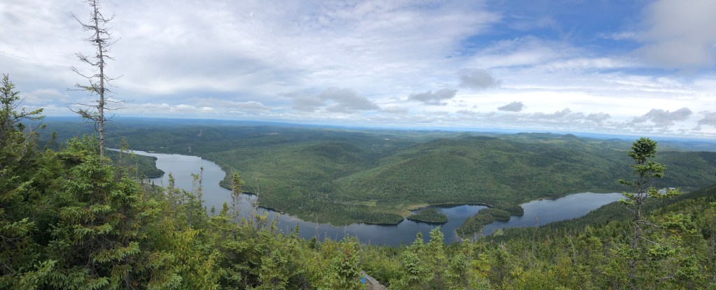
After lunch I decided it was best to keep moving around (I had warmed up quite a bit via the hike down and setting up camp) so i decided to do the entire Carleton loop – starting at my site, hike down to the trailhead then take the east trail up to the summit, and finally descend to the campsite. I figured it should be doable in three hours – I wanted to be back by 4pm to have dinner and wind down before bed. The hike was very enjoyable (lighter load and warmer weather – I finally got around to hiking in shorts after being brutally cold the past 24 hours). The east trail up was much more gradual and I was able to go at a bit of a faster pace, which I enjoyed. After a quick stop at the old cabin where the men who manned the fire cabin stayed, I once again ascended the final summit trail to see perfect conditions – hardly a cloud and gorgeous sunshine. What a great view! I stopped for some photos before descending to camp, well within my 3 hour target. After a nice dinner it was time for bed after a much better day on the trail.
Day 4: Two more peaks and an unplanned bushwhack
My last night out on the trail was pretty rough. Contrary to the previous 2 nights where I was very cold, this last night was very warm and sleep was much more interrupted. In addition, I was startled awake at around 2am to the repeated loud sounds of an animal (possibly in its death throes?). Probably the most bloodcurdling sound I had ever heard and being alone in the dark in the woods didn’t help! I was certainly glad when the sun rose.
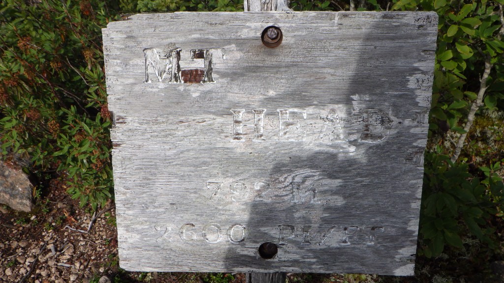
After getting my camp packed up, I was back on the trail for my last day of hiking. I went up the trail to the summit of Carleton first on my way to Head and Sagamook. Great view once again! I continued north down to the Head trail and retraced my steps north. When I arrived at the turnoff for Mount Head (2nd highest peak in New Brunswick at 793m), I set down my pack and went ultralight (just poles and InReach) and set off on the one mile return trip. It was far more than a mile! I found the summit easily, had to bushwhack a bit to the (very faded) sign. Not the best view but could still see the fire cabin on Carleton. Descending was a mess – could not find the trail (it’s not on FATMAP), and ended up going in circles trying to make my way back to my pack!
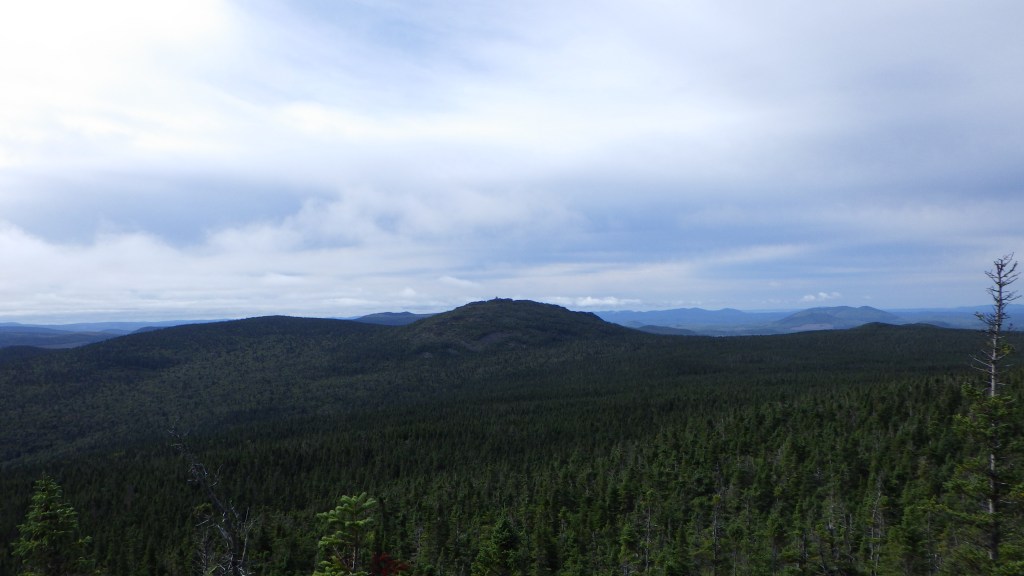
After finding my pack, I continued north on the Mount Head trail. Eventually the forest trail opened up onto a wide expanse of large rocks and boulders leading to the summit of Mount Sagamook, the fourth highest peak in New Brunswick at 777m. I stopped on the top for photos and lunch, and had some great chats with some New Brunswickers. I was told about some other great hiking spots north in the Gaspésie region in Québec. I’ll have to add those to my list!
The Sagamook trail consists of two paths (light blue trail on map above) – a steeper 2.5km trail and a gentler 3.5km trail. I opted for the steeper descent – man it was tough! After about 90 mins I finally made it to the bottom. I took a quick break and then started along the road west back to the Bailey trailhead where I had parked my car. I got roughly 3km before one of the families I had chatted with on Sagamook pulled up and offered me a ride. I graciously accepted, merçi beaucoup!
I got changed, packed up and took off into St-Quentin where I booked a comfy AirBNB to spend the night prior to the long drive back home the next day. I bought some delicious apples from a farmer, and had a satisfying pizza dinner in town. I stayed at Bed and Breakfast Du Repos, highly recommend! Went to bed (felt incredible to sleep in a bed after 3 nights on the ground) around 10pm with plans to wake up at 5am.
Day 5: Home!
Drive home was largely uneventful. First 90 mins were a bit dicey in dark in moose territory (I even saw one crossing about 100m ahead, not close to hitting it thankfully) and had smooth sailing through to the Ontario border, with breakfast/gas stop just west of Quebec City. Upon entering Ontario, a big thunderstorm hit creating slow, congested conditions on the 401. Along with numerous accidents, it was pretty slow going the rest of the way (sounds like the 401! 🙃). One last stop in Kingston for lunch and gas, and made it home around 5:30pm after a harrowing jaunt down the dreaded Don Valley Parkway during the post-holiday weekend rush.
Major Takeaways
This was a fun trip, very doable for most people. Lots of options for hikes and camping, though the backcountry options are meagre. Lessons learned for next time:
- Don’t forget my waterproof pants
- Bring extra base layers (would’ve helped when I got wet)
- Waterproof my boots
- Plan hikes a bit better. I think if I were to do this again, I would’ve parked at the Carleton trailhead and done three nights at Headwaters. Or, I would have done the Bailey summit on Day 1, then drove to Carleton trailhead and camped. I would have seen a lot less of the park, though.

Continues to be an enjoyable read. Sounds like you had a lot of fun despite the cold, rain, wind, slippery rocks, getting lost-ish, and the traffic.
LikeLiked by 1 person